

Vertical
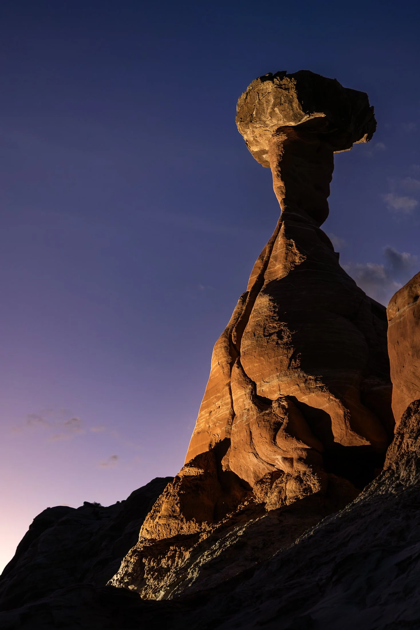
The Toadstool Hoodoos, located outside of Kanab, Utah and Page, Arizona, are part of the greater Grand Staircase-Escalante National Monument. The trail is unassuming, located at a small turnoff on Highway 89. The trail to the hoodoos meanders through the valleys of small eroded plateaus with large amounts of scree covering the area.
These unique formations find their creation from the Dakota Sandstone boulders that sit atop the Entrada Sandstone pedestals. Once the softer Entrada Sandstone erodes, the Dakota Sandstone resides leaving a cap, like a mushroom, on top.
This photo was taken after a group of friends and I decided to stop off here for sunset following a particularly exhausting 8 mile hike through Buckskin Gulch. With the setting sun providing enough darkness for me to use my off camera flash, I channeled my inner studio photographer and directed my friend where to hold the flash to best reveal its form, giving rise to magnificent colors and striations against the purple hue of the setting sun.
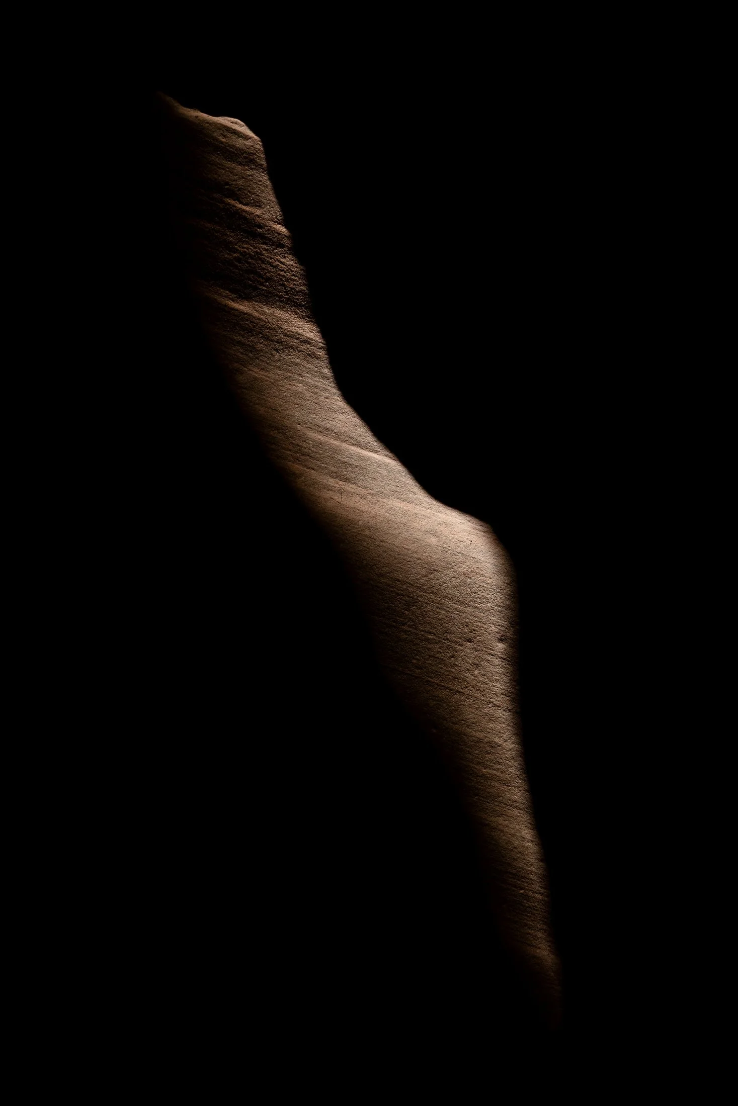
Buckskin Gulch, located in the Paria Canyon-Vermilion Cliffs Wilderness area, is the longest and deepest slot canyon in United States and possibly the world.
Marked by their sinuous carved rock, typically sandstone, slot canyons are often formed through water erosion over long periods of time. Flash floods are what make these strikingly beautiful canyons also some of the most dangerous to hike, with the runoff from a storm ten miles away potentially leading to the canyon on a day with clear skies.
These walls form their own abstract art where light reveals and conceals form, changing each minute with the path of the sun. On my third venture into this slot canyon, the light caught this particular patch of sandstone highlighting its sinuous nature allowing for an eerie contemplation of the form itself.
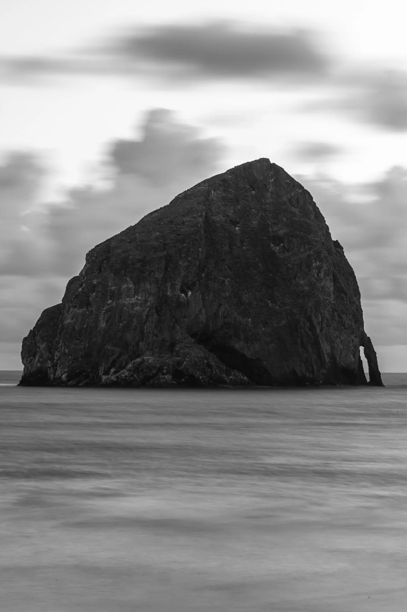
Haystack Rock near Pacific City, also known as Chief Kiwanda Rock, is an enormous sea stack located just offshore from Cape Kiwanda in Pacific City, Oregon.
Standing approximately 327 feet, it is one of the tallest sea stacks on the Oregon coast, even taller than the more famous Haystack Rock in Cannon Beach.
This was taken during a bustling evening near the Pelican Brewing Company, where patrons dined as the light broke through at golden hour, giving way to these stunning clouds behind the sea stack. After taking a sunset shot, I found the solitary nature of the rock against the ocean waves fascinating and wanted a visual that gave a sense of its unmoving nature over the past 17 million years.
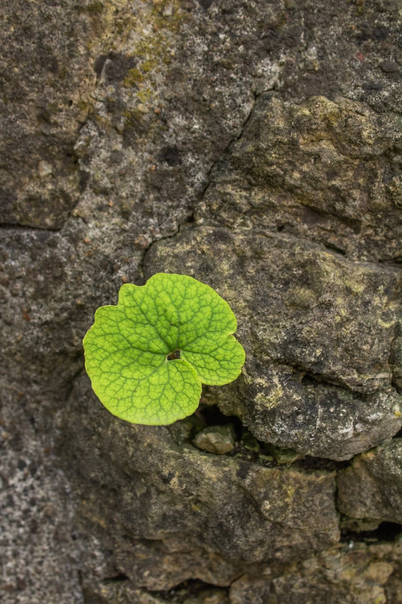
This photo was taken at the Hurstville Lime Kilns, located north of Maquoketa, Iowa.
Listed on the National Register of Historic Places, four kilns remain from the operation that supplied much of the Midwest masonry efforts during the late 1800s and early 1900s.
This one spec of green among a bed of stone immediately caught my eye, and I was fascinated with the way it somehow found its way through. Life always seems to find a way to adapt to its environment.
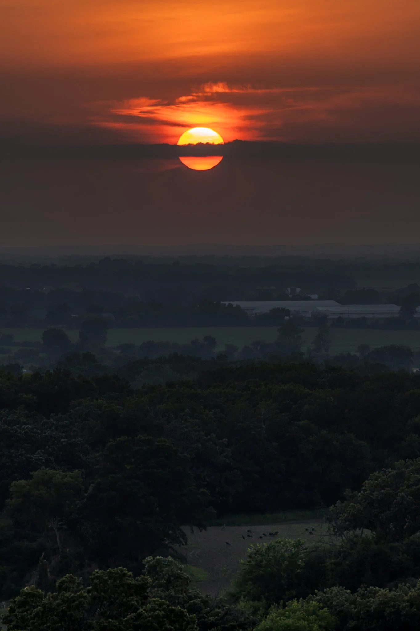
Kettle Moraine is a beautiful unique region in southeastern Wisconsin, shaped by the massive glaciers carving the landscape during the last ice age. The area features continuous rolling hills, deep valleys, and kettle lakes.
Named for the unique glacial carvings, kettles exist as depressions in the earth that fill with water over time, creating serene ponds and lakes. John Muir’s family immigrated to Wisconsin as a child, settling on a farm near the rugged terrain of the Kettle Moraine. This area played a crucial role in shaping his philosophy of conservation and his advocacy for preserving wild spaces.
Hiking through the forests of Kettle Moraine was an experience i did not expect. Each turn reveals a new region distinct from the last. This hike from my campsite to the one prominent overlook in the area ended with a stunning sunset overlooking the pastoral lands below.
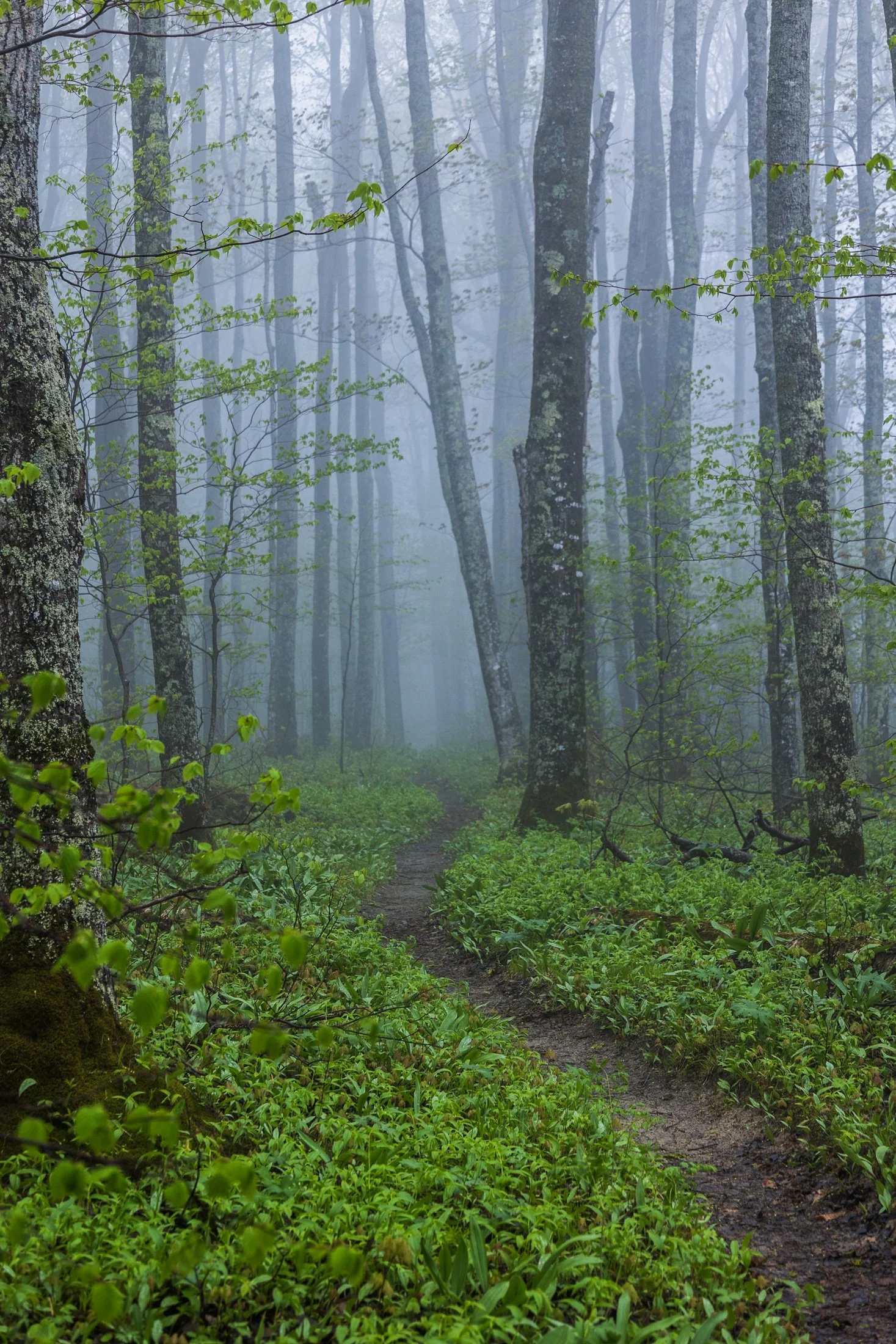
Pictured Rocks National Lakeshore, located near Munising, Michigan, already provides a stunning hiking opportunity for those willing to trek its bluffs, but in the early morning they can often take on a surreal atmosphere as the fog rolls in, transforming the area into a mystic forest.
This fog is often the result of the extremely cold waters of Lake Superior mixing with the warmer air from the land. As the fog rolls in, it muffles sound and adds depth to the already vibrant sandstone cliffs, creating a dramatic backdrop for an already stunning hike.
This particular photo occurred during an 11 mile backpacking trek along the cliffs, providing the one respite from a continuous onslaught of rain throughout the day. The experience of hiking through this atmosphere must be experienced, as this photo barely does it justice, but this winding trail disappearing into the fog serves as a glimpse into its magic.
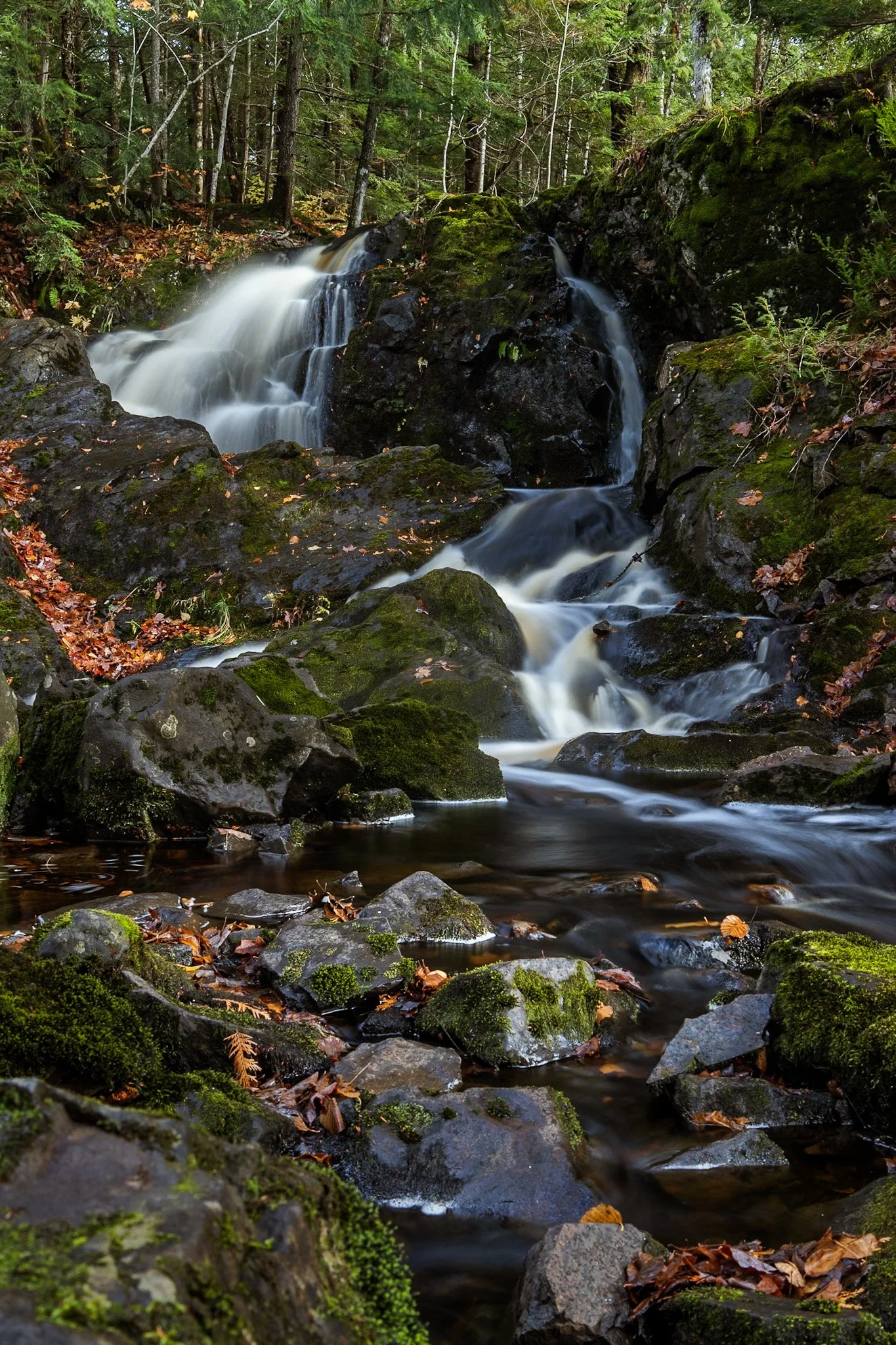
Located near Twin Lakes State Park, Wyandotte Falls finds its source from the Misery River in the Keweenaw Peninsula. The falls consist of a series of short cascades rocky ledges in a quiet, forested setting. The falls create an atmosphere that is reminiscent of a fairy tale forest.
This long exposure required the balancing of my tripod on the river rocks to get the composition that showed its varied pathways. Fall always adds something to a scene like this, and after chasing loud, roaring waterfalls all day, this was a serene end to the day.
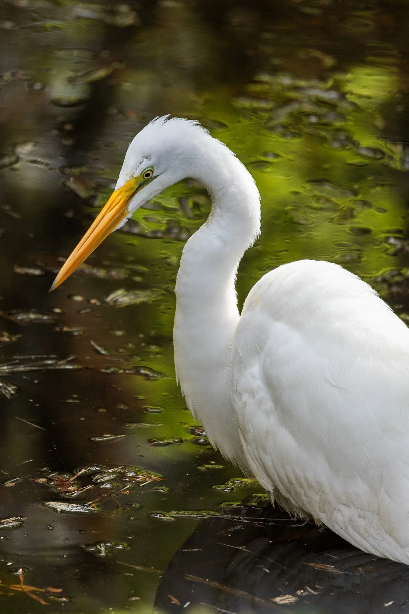
The Great Egret, often referred to as the white heron, is a majestic bird known for its all-white plumage and long, graceful neck. It is an excellent hunter, often seen standing motionless in shallow waters or slowly wading through wetlands in search of fish, amphibians, and small reptiles.
During the breeding season, egrets develop long, delicate plumes on their backs, which were once highly prized in the fashion industry, leading to significant hunting pressure in the late 19th century.
This specific individual waded slowly through in the lowlands of the Everglades as I waited to frame its graceful profile against the swampy abstraction behind it. These birds find a secluded paradise in the Everglades, an area that has been under a constant state of threat since its inception.
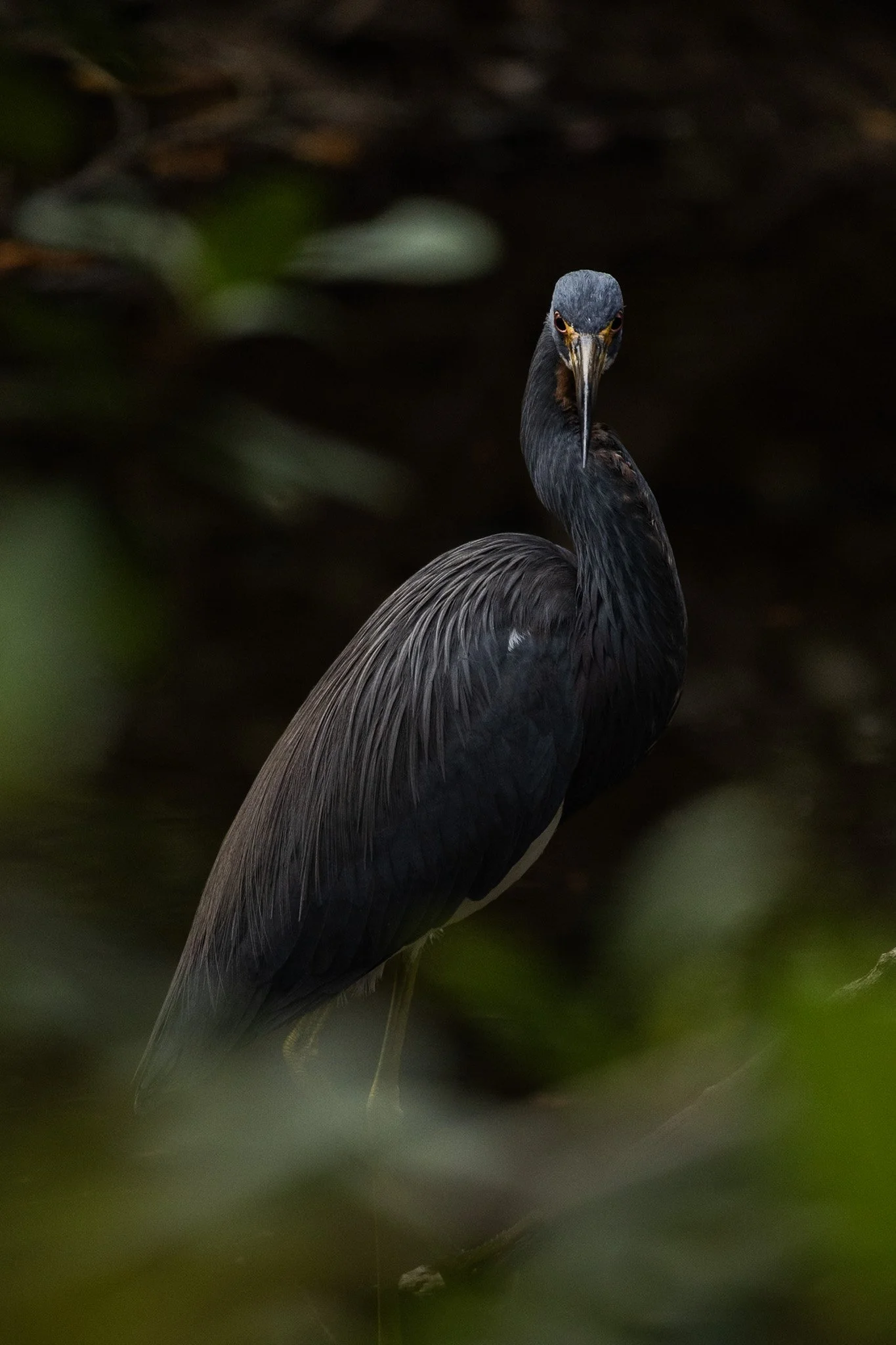
The Tricolored Heron is known for its vibrant plumage, with dark shades of blue, purple. It is an expert hunter, often employing a unique technique where it attracts prey by creating a contrast with its bright chest feathers in the water.
They are social creatures, often found hunting in groups and nesting in colonies with other wading birds. During breeding season, their plumage becomes even more colorful with long, elegant plumes on their heads and necks.
This specific heron was found on a lone dirt road surrounded by trees and swamp on each side. The birds here seem to enjoy a secluded paradise meandering among the Everglades swampy foliage. This guy noticed my lens and gave me a beautiful glare during a moment of soft light creeping through the shadowy of the swamp.

Buckskin Gulch, located in the Paria Canyon-Vermilion Cliffs Wilderness area, is the longest and deepest slot canyon in United States and possibly the world.
Marked by their sinuous carved rock, typically sandstone, slot canyons are often formed through water erosion over long periods of time. Flash floods are what make these strikingly beautiful canyons also some of the most dangerous to hike, with the runoff from a storm ten miles away potentially leading to the canyon on a day with clear skies.
These walls form their own abstract art where light reveals and conceals form, changing each minute with the path of the sun. This patch in particular caught my eye, not only for its abstract nature, but the small patch of life growing along its walls.

From above, Chicago’s famous grid system becomes a kind of urban quilt, stitched with rivers, highways, and rails. The skyline, punctuated by towers like the Willis Tower (though for Chicagoans it will forever be known as the Sears) and the St. Regis, rises like a great sculpture.
The city’s architecture seamlessly incorporates styles ranging from Gothic Revival and Art Deco to International and Postmodern, all layered along the river and gridded streets. Notable landmarks like Marina City, the Tribune Tower, and buildings by Frank Lloyd Wright create a living timeline of American design.
This photograph was taken while departing for O’Hare, heading toward New York. This was the tail-end of a storm and the cumulonimbus clouds gave a staggering scale of the sky in relation to the city, one which will forever remain my home.

The escarpment at Pictured Rocks, in this case Chapel Rock, is part of the dramatic sandstone cliff formations that define the Pictured Rocks National Lakeshore along Lake Superior in Michigan’s Upper Peninsula. Chapel Rock itself is a striking feature of this escarpment — a freestanding column of Nape sandstone, shaped by centuries of erosion from wind, water, and ice.
This section of the escarpment showcases the layered and weathered nature of the sandstone, with its rich textures and colors—ranging from golden hues to deep reds and greens—caused by the mineral content in groundwater.
After a long day of backpacking, I set up camp and filtered water from Lake Superior while setting up this shot. I found the rock against the passing storm a particularly interesting composition, showing the fascinating rock that has been a source of wonder for centuries.

Carl G. Washburne Memorial State Park may be the one of the most scenic stretches along the entire Oregon Coast. Located about 15 miles north of Florence, and only a few miles past Heceta Head Lighthouse (a trail connects the park), this area offers a portal to another world.
The China Creek Trail which weaves through coastal forests terminating on the beach, and the picturesque Hobbit Trail known for its moss-draped trees and old-growth forest.
This photograph was taken after sundown following a chaotic two hours of photographing. I used the last remaining daylight to grab this abstract before retiring to my campsite across the main road. It is a quiet place, unassuming, and it is here that shows Oregon’s true beauty.

Heceta Head is one of the most iconic and picturesque stretches along the Oregon Coast. Known for its historic lighthouse, dramatic cliffs, and panoramic views of the Pacific Ocean, it must be seen to be believed.
Located just north of Florence, Oregon, Heceta Head offers a blend of natural beauty, maritime history, and coastal ecology.
This photo came after photographing the Heceta Head lighthouse, which resides right behind this stunning view. The road curve seen in the distance is also the location of the nation’s only natural Sea Lion caves, accessible to tourists via an elevator.

The Metra rail yards near Grant Park in Chicago are integral to the city's commuter rail infrastructure, particularly for the Metra Electric District line. These yards are situated just south of Grant Park, extending from the Museum Campus area to the northern edge of the South Loop neighborhood.
The rail yards themselves are primarily used for train storage, maintenance, and operational functions.They are not typically open to the public but are visible from various vantage points around Grant Park and the Museum Campus.
This vantage point, straight east of Chinatown, is a breathtaking view of the Windy City. This scene reminded me of something out of Blade Runner, the myriad of colors and lines presenting a chaotic order that drew my eye.

Starved Rock State Park in LaSalle County, Illinois transforms into a stunning winter landscape, and its waterfalls freeze into towering columns of ice. These frozen waterfalls are a major seasonal attraction, drawing hikers, photographers, and ice climbers to the park’s deep sandstone canyons.
Formed by melting snow and natural springs, the waterfalls normally flow through narrow cliff faces, but in winter, they become massive ice formations, sometimes reaching over 80 feet tall. The contrast between the icy formations and the ancient, rust-colored rock walls creates a dramatic and otherworldly scene.
This photo required some careful maneuvering to get to the right position as well as making sure my tripod stayed stable on the ice. Taken earlier in my career, I had not come to appreciate the magic of crampons when navigating slick ice.

The Oregon Coast holds many treasures and its relationship with the Pacific leads to its dramatic cliffs. Stretching endlessly westward, the Pacific creates a boundless horizon that seems to hold no end.
Long before roads carved through these coastal towns dotting the headlands, this was a remote and mysterious frontier. Pirate ships, privateers, and explorers found their way to this region, exploring its untouched mysteries. Legends linger of hidden coves that sheltered their treasures, buried beneath shifting sands or unexplored coves.
This photograph was taken right near the lookout to Heceta Head, and while that lighthouse is as picturesque as any can be, it was this drama playing out in the clouds that drew my eye. It seemed to point me back to an unremembered time, before roads, towns, and civilization.

The Grand Staircase-Escalante National Monument region is renowned for its expansive layers of sedimentary rock, shaped over millions of years by wind, water, and tectonic activity.
Visitors to the area encounter a breathtaking variety of rock features, including narrow slot canyons, towering cliffs, slick rock domes, and natural arches. These rocks not only define the physical character of the region but also serve as a natural record of Earth’s history.
This photograph was taken due to the need to escape the intense heat of the area, finding refuge in this little pocket of rock, providing important shade. This shade was a full 30 degree cooler from that of the exposed sun. While lying on a large slab of broken rock, the view above was an abstract wonder, only needing the right framing.

Harris Beach State Park, located just north of Brookings, Oregon, is a coastal haven renowned for its dramatic scenery, diverse wildlife, and rich marine ecosystems.
The park's centerpiece is Goat Island (also known as Bird Island), the largest offshore island along the Oregon Coast. This National Wildlife Refuge is a breeding ground for over 100,000 seabirds, including tufted puffins and Leach’s storm-petrels, making it a prime spot for birdwatching.
This photo was taken during a quiet moment as the last vestiges of light revealed eerie silhouettes of the rock formations surrounding Harris Beach. It is one of my favorite places on the Oregon Coast, offering endless photographic opportunities, a great campsite, and a beach unlike any other.

The Heceta Head Lighthouse, built in 1894, is one of the most photographed lighthouses in Oregon, if not the United States, and remains operational as a navigational aid. One of the original light keepers' houses still stands nearby and now serves as a bed-and-breakfast.
The wildlife here is rife with sea lions, harbor seals, and migrating gray whales often seen from the headland, especially during the spring and winter migration seasons, as well as numerous seabirds who make the cliffs their home.
The waves that slam into the cliffs on a windy day, like the one captured here, shows the sheer force of nature at work. I took this as the mist continually covered my lens, requiring me to wipe it between each exposure as I waited for the rogue wave to strike.
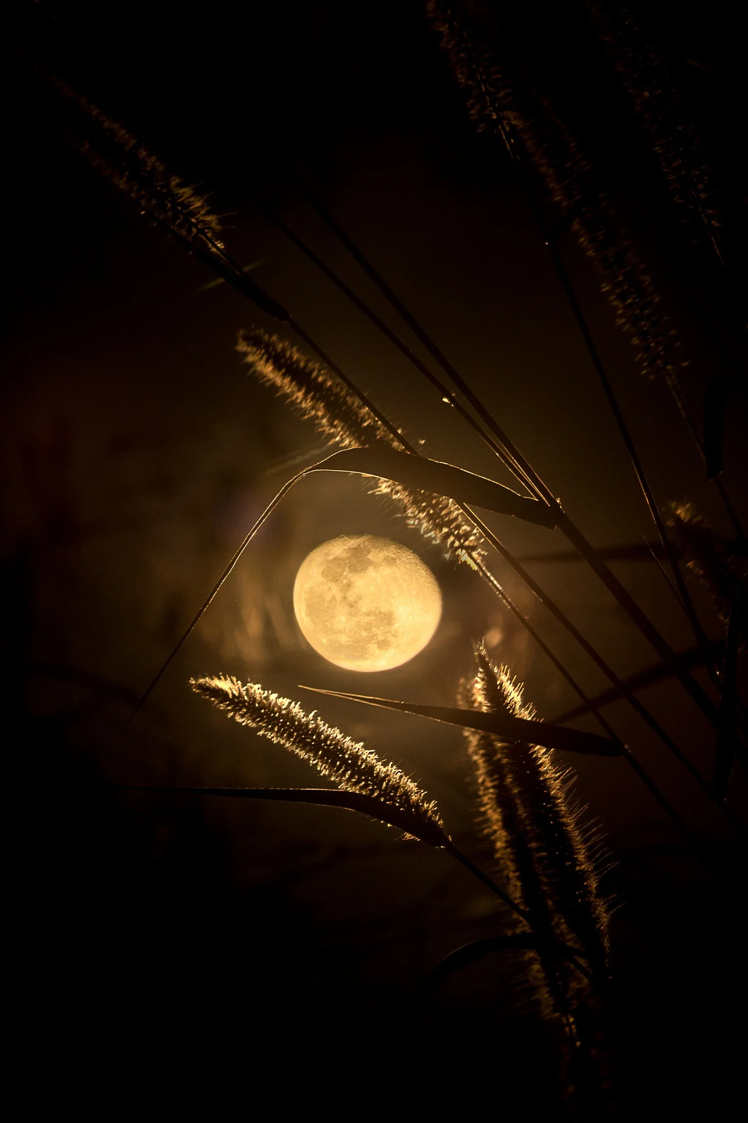
Everglades National Park is a park that reveals itself slowly, it requires those with patience and keen observation to see its true beauty.
Known colloquially at the “River of Grass”, the Everglades is one of the largest wetland ecosystems in the world. One of the only places in the world in which both alligators and crocodiles coexist, it also contains one of the largest mangrove forests systems in the world. But it’s true beauty is the sanctuary it provides for all manner of birds make it their home or migratory stopping point.
This photo was taken sitting around a fire at my campsite following a long day of kayaking through a mangrove forest strewn with alligators. Requiring the stitching of two photos, this is one of the few images I offer that was not captured in camera due to the nature of how depth of field works in a camera versus our eye, but the light and view was too good to not attempt to emulate what I saw.

“The sky is the ultimate art gallery just above us.”
-Ralph Waldo Emerson-
On my drives across the corn belt, I’ve always been enamored with the lone trees among the endless fields.
Some say they are for markers for property boundaries, others that they were once a primary source of shade for farmers from a bygone era. Whatever the case, their air of mystery sits majestic among the expansive cornfields of the Midwest.
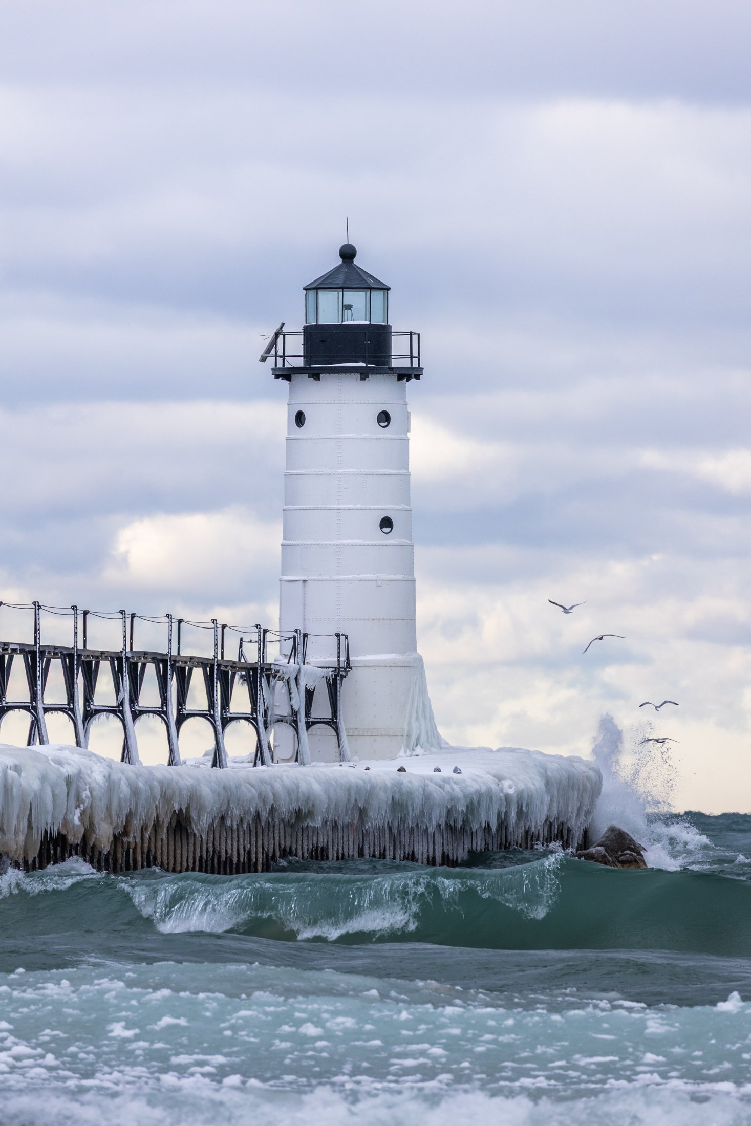
The Manistee North Pier Lighthouse, located in Manistee, Michigan, is as picturesque as any lighthouse can be.
Constructed in 1870, the wooden lighthouse was changed to steel in 1927, providing an important means of safely guiding ships in the lumber industry during the end of the 19th century.
This was my second visit to the Manistee Lighthouse, with both events being particularly cold days. This day just happened to be my birthday. The wind was fierce, and after setting up the shot, I was lucky enough to have some avian tourists enter my frame.

The South Coast Wilderness Trail is a stunning, rugged, and truly wild 17 mile one-way hike through Olympic National Park. One of the last undeveloped coastlines in the contiguous United States, Olympic’s protection status ensures native species like sea otters, bald eagles, bears, and migrating whales will continue to thrive in this pristine wilderness.
Switching between stretches of picturesque coast and dense rainforest, the trek (which is at sea level) entails 2,000 feet in elevation change, due to the use of ladders and ropes to maneuver up and down coastal embankments.
After setting up camp, I descended a very steep sand embankment via a rope wrapped around a tree to reach this secluded beach. It was a peaceful moment photographing these majestic sea stacks at sunset alone on this pristine beach.
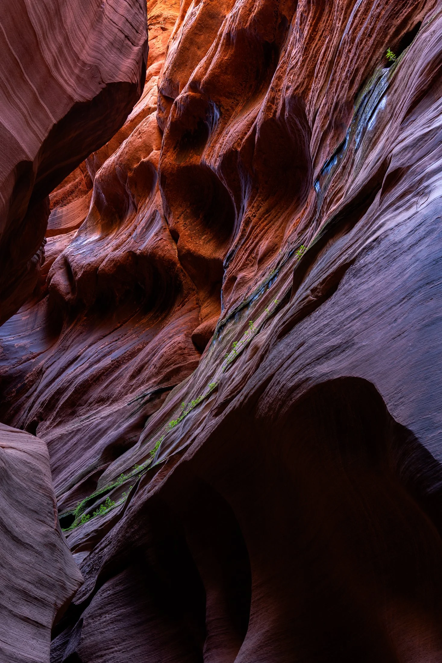
Buckskin Gulch, located in the Paria Canyon-Vermilion Cliffs Wilderness area, is the longest and deepest slot canyon in United States and possibly the world.
Marked by their sinuous carved rock, typically sandstone, slot canyons are often formed through water erosion over long periods of time, often coming from flash floods. This is what make hiking these beautiful canyons so dangerous. A storm from ten miles away can funnel into the canyon on a day with clear blue skies.
The plant growth on the side of this canyon is a unique sight. Small amounts of water and sunlight find their way to these plants allowing them to survive in this surreal environment.
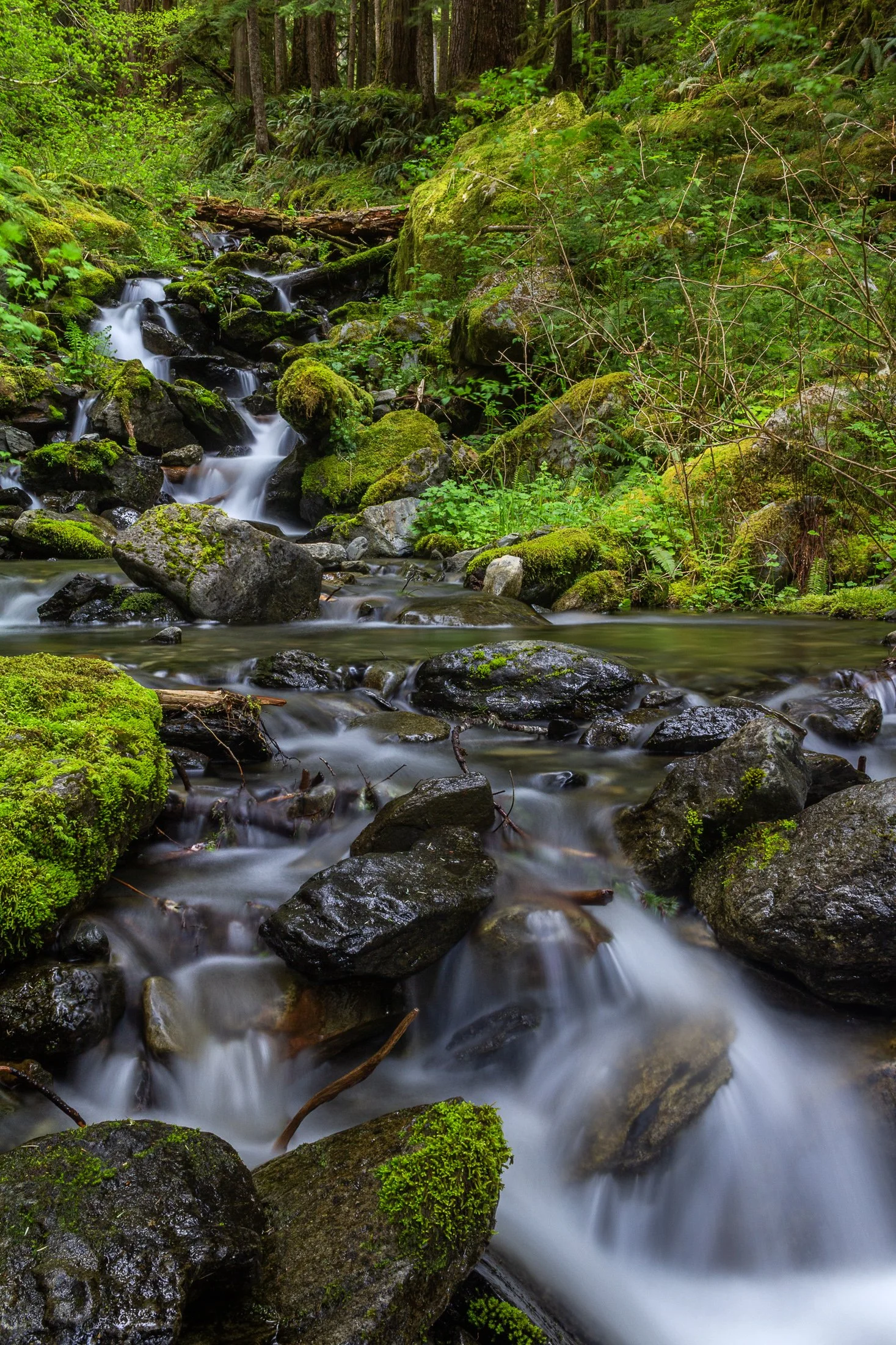
Enchanted Valley, dubbed the “Valley of 10,000 Waterfalls” requires a 15 mile hike through the Quinault Rainforest in Olympic National Park. It is one of the few rainforest in the United States, and receives 140-167 inches of rain per year. The precipitation leaves Olympic National Park with one of the most biodiverse ecosystems in the United States.
The Enchanted Valley Chalet at the end of the trail was built in 1931 and was originally meant to be a rustic lodge for hikers. Eventually it transformed into a monitoring station during WW2 to scout for potential Pacific Coast enemy threats. After the war it returned to its original purpose for backpackers and rangers.
The trail crosses many streams on the way to the chalet allowing us to forgo storing water for the hike while backpacking and instead drink the glacial melt from the streams via a LifeStraw. I have not tasted water better than that before or since.
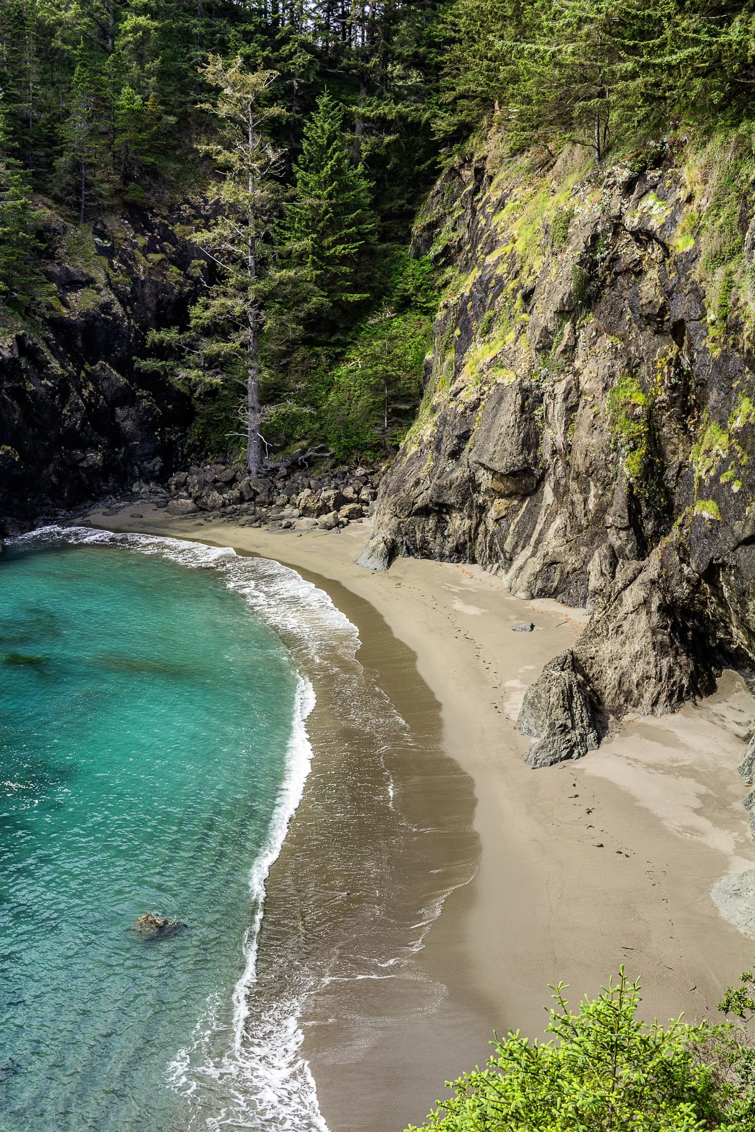
Samuel H. Boardman State Park, located along the southern Oregon coast near Brookings, Oregon, is renowned for its stunning coastal landscapes and diverse natural beauty. The park stretches for 12 miles along the coast, offering a variety of scenic views and ecosystems, from rugged cliffs to pristine beaches.
One of the park's most iconic features is its collection of sea stacks — tall, isolated rock formations that rise out of the ocean. These formations are often surrounded by crashing waves, adding to the dramatic beauty of the area.
While climbing out on to a precarious rocky perch with a 200 foot fall on either side to photograph some sea stacks, I noticed this beautiful cove to my right. It reminded me of something out of a Robert Louis Stevenson story where buried treasure might reside.

Enchanted Valley, dubbed the “Valley of 10,000 Waterfalls” requires a 15 mile hike through the Quinault Rainforest in Olympic National Park. One of the few rainforest in the United States, it receives 140-167 inches of rain per year. The precipitation leaves Olympic National Park with one of the most biodiverse ecosystems in the United States.
The Enchanted Valley Chalet at the end of the trail was built in 1931 and was originally meant to be a rustic lodge for hikers, eventually being used during WW2 to monitor potential Pacific Coast enemy threats. After the war it returned to its original purpose for backpackers and rangers.
The area is known for a surplus of black bears, and during our time there over two nights, we were mere visitors in their home. It is not the easiest thing to retire to your tent with a 400 pound black bear scrounging for berries outside it!

Congaree National Park in South Carolina is the largest intact expanse of old growth bottomland hardwood forest remaining in the southeastern United States. The Congaree River floodplain had a rich history including being a prominent area for bootleggers to hide their wares during the prohibition era. Authorities would be hard pressed to find the spirits stored in the recesses of the swamp land where the locals knew like the back of their hand.
Congaree is a mysterious land and one I would like to come back and kayak through as the boardwalks were completely flooded when I arrived. While this prevented me from exploring much of it, it was a prime example of the beauty of the area, one which cannot be tamed.
The best angle to capture this flooded boardwalk required the sacrifice of the dryness of my boots. I needed to dry them out before the next morning’s backpacking trip so I blasted the heat in my car with my shoes next to the vent while I sat in 90 degree bumper to bumper traffic. All worth it.
The Canal Street railroad bridge located north of Chinatown in Chicago, Illinois, it one of the most famous bridges in Chicago. Built for the Pennsylvania Railroad, it was finished in 1914 and designated as a national landmark in 2007.
The bridge replaced a swing bridge that was in the same location so to prevent obstructing traffic, the bridge was built in the raised position while the old bridge still operated. Upon completion, the old bridge was demolished and the railroad bridge still operates to this day.
On a trip to Chinatown with some fellow photographers at sunset, this view caught my eye as we headed north. The bridge provided a compositional pointer finger to one of Chicago’s most iconic landmark, the Willis Tower (although it will forever be known to Chicagoans as the Sears).