

Sunrises + Sunsets

Sunrises | Sunsets
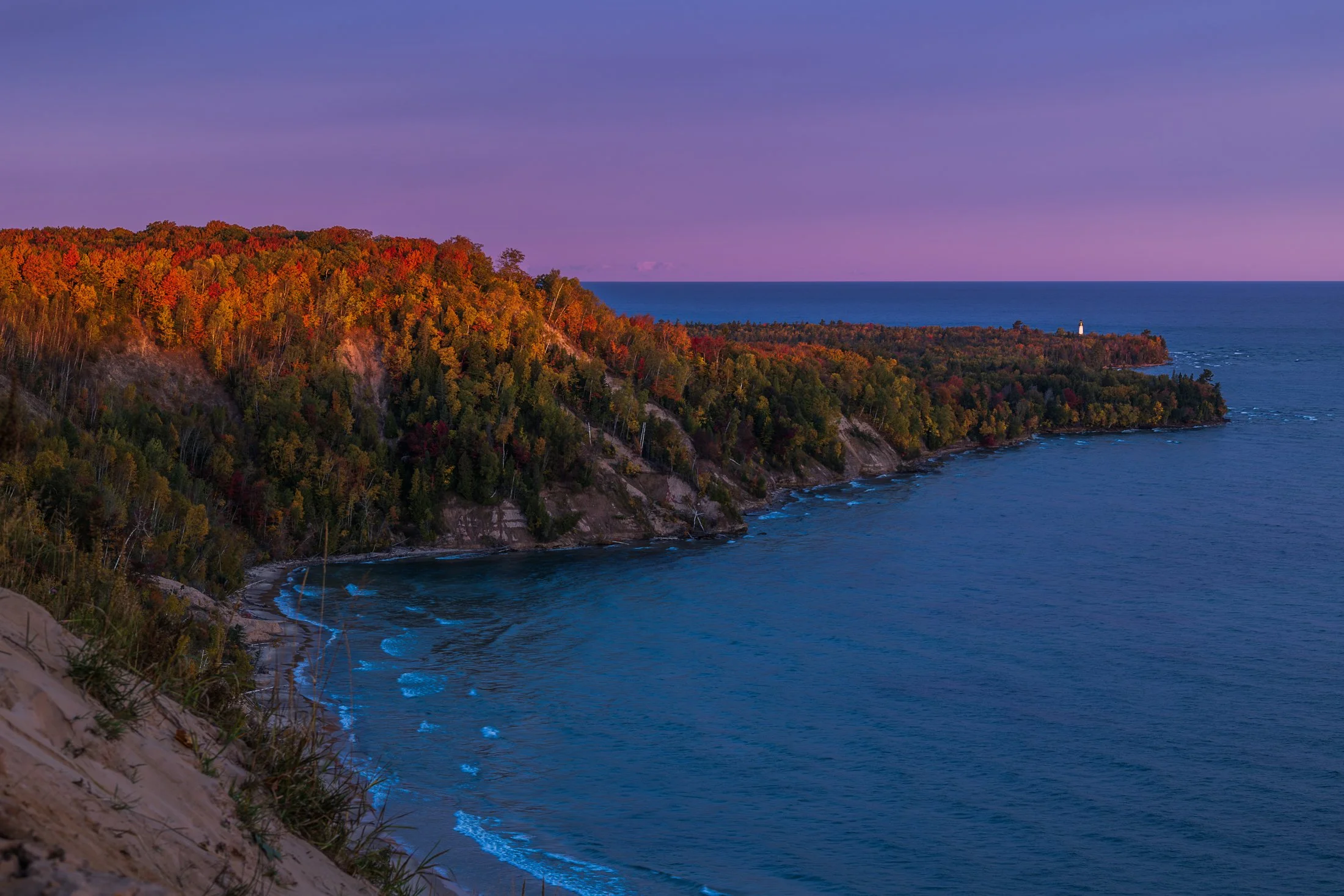
The fall colors of Pictured Rocks National Lakeshore are one of the marvels of the Upper Peninsula, especially in the early morning. Pictured here is the Au Sable Light, a lighthouse that was built in 1874 to prevent shipwrecks on Lake Superior.
The shoreline in this area is considered one of North America's most beautiful, but was once considered the most deadly areas for ships due to rocks under the shallow surface, violent storms, and frequent fog.
Requiring an early wakeup call, this photo involved positioning myself precariously on the shifting sands of the Grand Sable dunes before the sunrise. The changing color over the next hour was an amazing sight to behold as well as the moment the light broke across this stretch of coast.
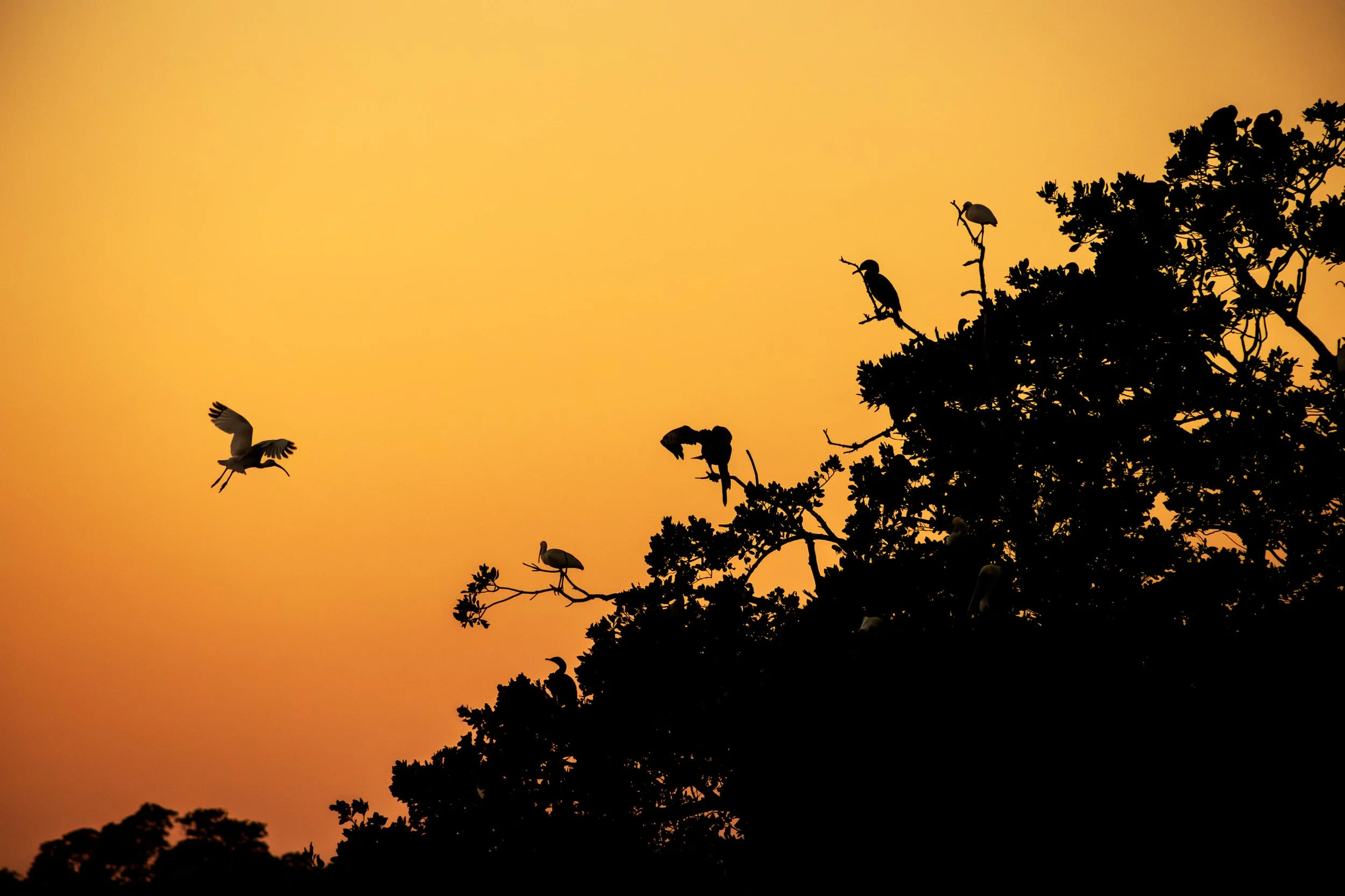
Everglades National Park is a park that doesn’t present itself as grandly as the others, it requires those with patience to see its true beauty.
Known colloquially at the “River of Grass”, the Everglades is one of the only ecosystems to house both alligators and crocodiles. It also contains one of the largest mangrove forests in the world and, due to the diverse ecosystem, all manner of birds make it their home.
I happened to be the lone passenger on as sunset Everglades boat tour and the captain was kind enough to veer off the usual course and tailor it to my photography. At the end of the tour, when he brought me to one of the mangrove rookeries these birds call home, an egret flew into frame and began its landing as I snapped the photo. It was a sunset I’ll never forget.

Standing at 867 feet tall, Devil’s Tower, located in eastern Wyoming, has been a sacred site for Native Americans for centuries as well as being featured prominently in “ Close Encounters of the Third Kind” (1977).
One narrative surrounding its formation involves two girls attempting to escape a large bear by scurrying up a rock formation. The Great Spirit, seeing their plight, rose the rock high into the air to protect the. The distinctive basalt columns were formed from the claws of this bear’s attempt to reach them.
After renting a cabin at the nearby KOA, where “Close Encounters of the Third Kind” is shown every night in front of the monolith, I drove to the southern side at sunset to capture the light slowly fading from the tower. While standing there I could only think one thought; the energy of this land is palpable.

Mount Hood is an iconic stratovolcano located just outside Portland, Oregon in the Cascade Range. Standing at 11,240 feet, it is the highest peak in Oregon and one of the most recognizable mountains in the Pacific Northwest.
Visible from miles around, the mountain is often in full view from Portland, Oregon, located about 50 miles to the west, and offers up near perfect symmetry and a towering presence.
Only visiting for a day and having the Japanese Gardens planned for the next morning, I had not planned to photograph this day as a stop in Portland requires me to make the rounds at Powell Books, Blue Moon Camera, and Music Millennium, but I after I got back, I decided to walk up the street from my Airbnb at sunset and found myself in the perfect location to capture this magnificent mountain.

Haystack Rock near Pacific City, also known as Chief Kiwanda Rock, is an enormous sea stack located just offshore from Cape Kiwanda in Pacific City, Oregon.
Standing approximately 327 feet, it is one of the tallest sea stacks on the Oregon coast, even taller than the more famous Haystack Rock in Cannon Beach.
This was taken during a bustling evening near the Pelican Brewing Company, where patrons dined as the light broke through at golden hour, giving way to these stunning clouds behind the sea stack, casting its true form in silhouette. And if you look closely you’ll see the staggering amount of birds which call it home.
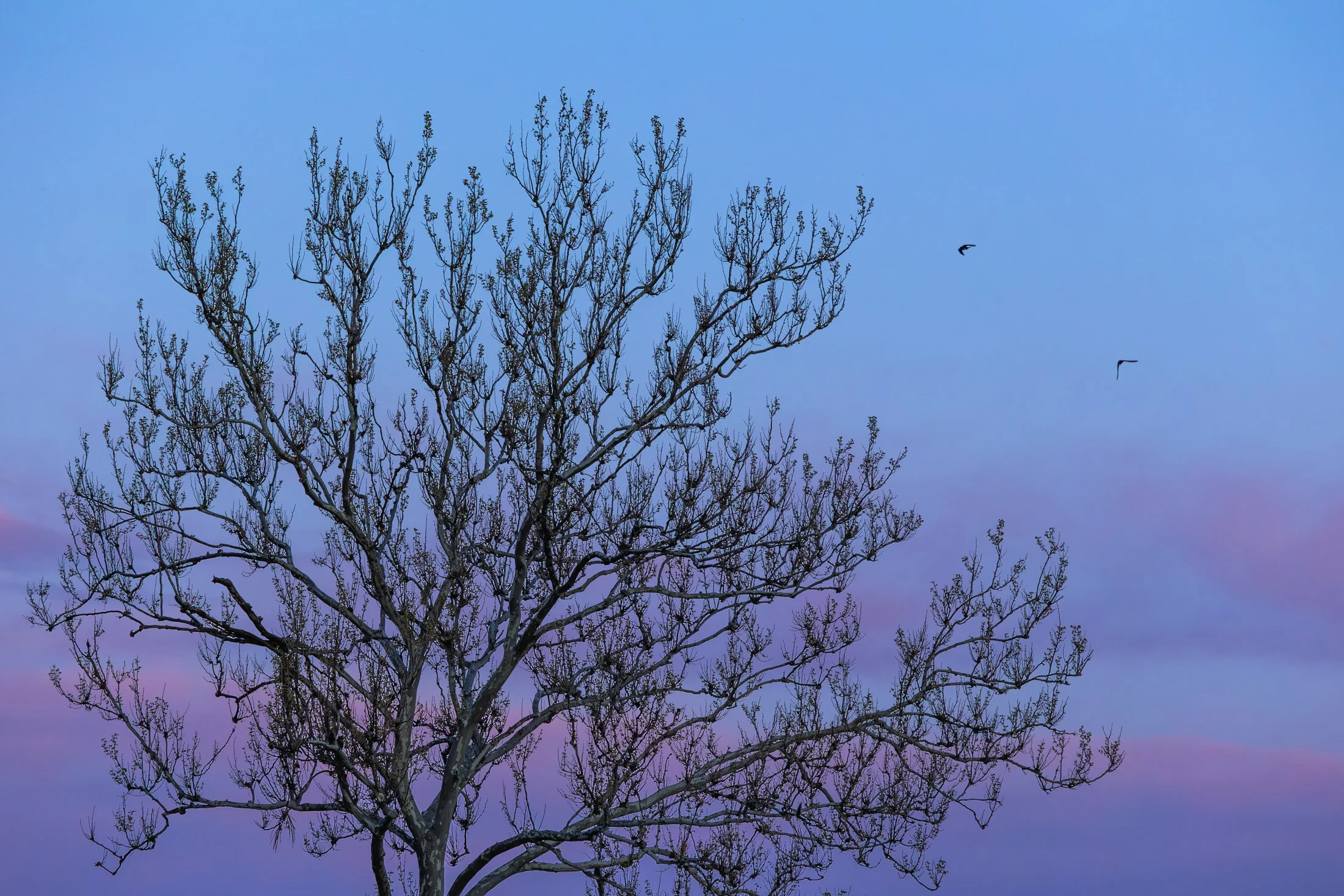
The area around Starved Rock State Park near Utica, Illinois, is one of the most scenic Illinois has to offer. The Illinois River cuts through the area and was one of the few areas in Illinois not flattened by glacial drift.
This beautiful tree on the bank of the Illinois river is a Sycamore, known as the London Plane. Often planted in the Victorian area to help quell the London pollution caused by the Industrial Revolution, this tree has been a stable of urban development. It can incur a disease known as the Witches Broom, causing the shoots to bunch up which also offers a natural nest for nearby birds.
Camping on the edge of the Illinois after a trip to Starved Rock, I set up my tripod to capture the active birds at sunset, but then this Sycamore caught my eye. The composition of the eerie branches against the beautiful purple glow of the setting sun was mad even better by the birds passing through the area.

“The sky is the ultimate art gallery just above us.”
-Ralph Waldo Emerson-
On my drives across the corn belt, I’ve always been enamored with the lone trees among the endless fields.
Some say they are for markers for property boundaries, others that they were once a primary source of shade for farmers from a bygone era. Whatever the case, their air of mystery sits majestic among the expansive cornfields of the Midwest.

In the Midwest, nuclear power plants are a vital part of the energy infrastructure, and many of them are surrounded by sprawling cornfields. This unusual pairing is more practical than it might seem. Nuclear plants require large safety buffer zones, which makes rural farmland an ideal setting.
At the same time, the actual footprint of a nuclear facility is relatively small, allowing the surrounding land to continue being used for agriculture. Illinois, in particular, stands out as the top nuclear-generating state in the country, with 11 reactors at six sites, most of them nestled in farming regions.
Having just finished photographing these monoliths from the other side, I was stunned by the scene developing in my rear view mirror as I sped down the country road. With someone tailgating me, I signaled at the next service road, parked in front of a farm, and quickly set up my tripod to grab this shot.
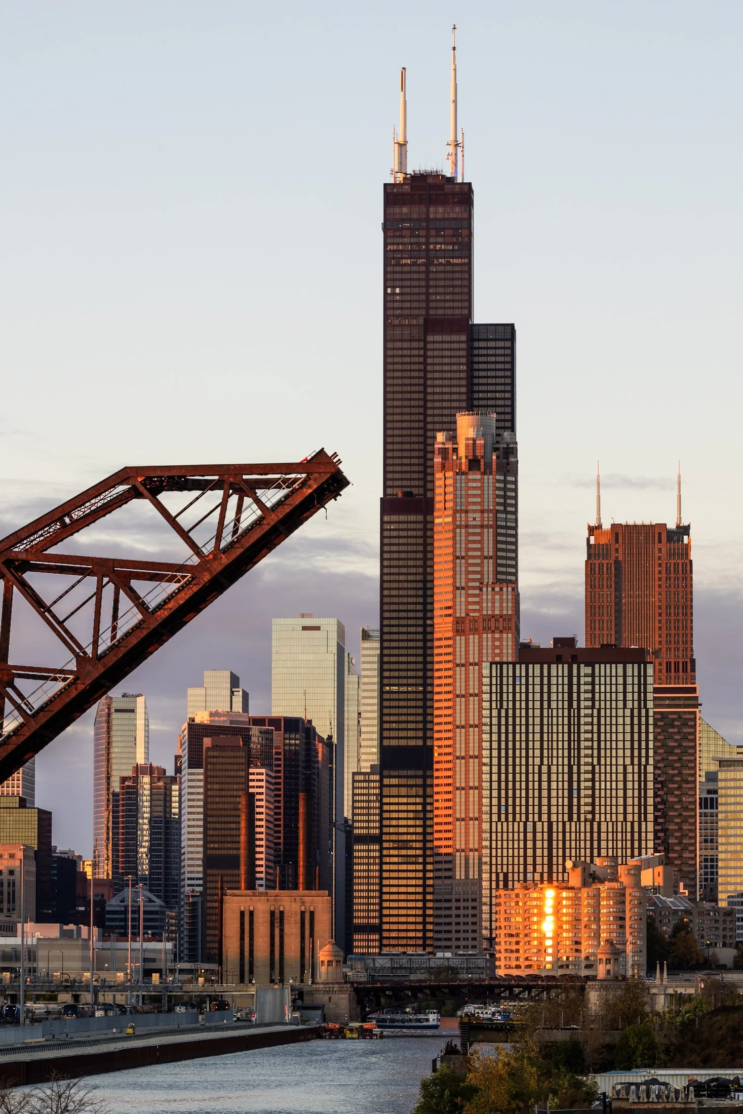
The Canal Street railroad bridge located north of Chinatown in Chicago, Illinois, it one of the most famous bridges in Chicago. Built for the Pennsylvania Railroad, it was finished in 1914 and designated as a national landmark in 2007.
The bridge replaced a swing bridge that was in the same location so to prevent obstructing traffic, the bridge was built in the raised position while the old bridge still operated. Upon completion, the old bridge was demolished and the railroad bridge still operates to this day.
On a trip to Chinatown with some fellow photographers at sunset, this view caught my eye as we headed north. The bridge provided a compositional pointer finger to one of Chicago’s most iconic landmark, the Willis Tower (although it will forever be known to Chicagoans as the Sears).
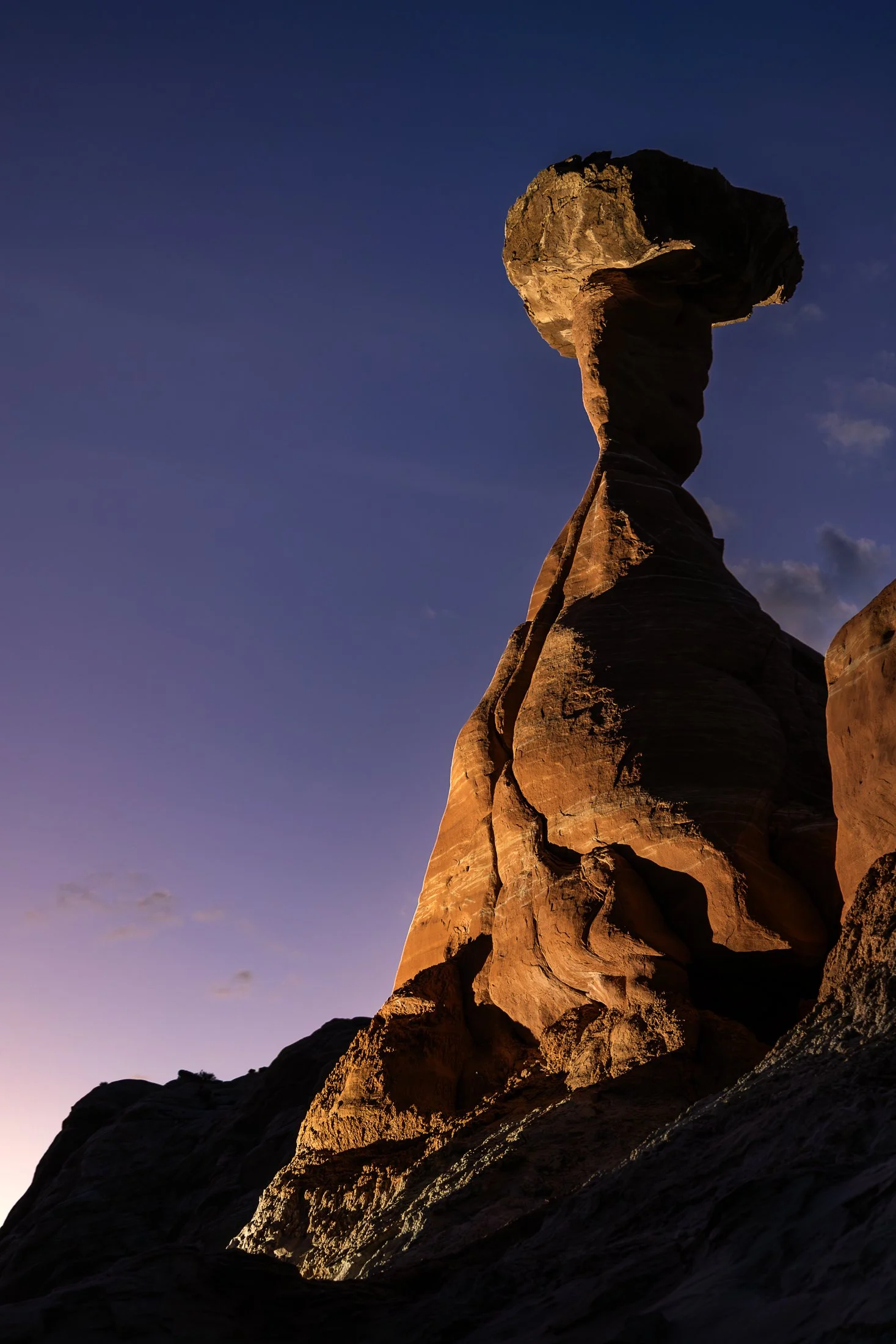
The Toadstool Hoodoos, located outside of Kanab, Utah and Page, Arizona, are part of the greater Grand Staircase-Escalante National Monument. The trail is unassuming, located at a small turnoff on Highway 89. The trail to the hoodoos meanders through the valleys of small eroded plateaus with large amounts of scree covering the area.
These unique formations find their creation from the Dakota Sandstone boulders that sit atop the Entrada Sandstone pedestals. Once the softer Entrada Sandstone erodes, the Dakota Sandstone resides leaving a cap, like a mushroom, on top.
This photo was taken after a group of friends and I decided to stop off here for sunset following a particularly exhausting 8 mile hike through Buckskin Gulch. With the setting sun providing enough darkness for me to use my off camera flash, I channeled my inner studio photographer and directed my friend where to hold the flash to best reveal its form, giving rise to magnificent colors and striations against the purple hue of the setting sun.

The dunes in and around Coral Pink Sand Dunes State Park, located on the border of Utah, are primarily shaped by wind and erosion, which picks up and transports sand particles across the valley floor. Sediment from surrounding mountains supplies the sand forming these natural features.
The area is known for frequent ATV usage, allowing visitors to traverse the dune system in style. Sandboarding is also available for purchase from the state park, but be careful, as these boards gain some speed especially on the larger dunes.
This was my third visit to the state park, and there’s a reason I keep coming back. The campsite is phenomenal, allowing access to the dune system from the campground. I grabbed this shot right before my friend’s footprints ruined the pristine, untouched dune. This was the first stop on my most recent trip to the Kanab area, with the next stop being the dangerously beautiful Buckskin Gulch.
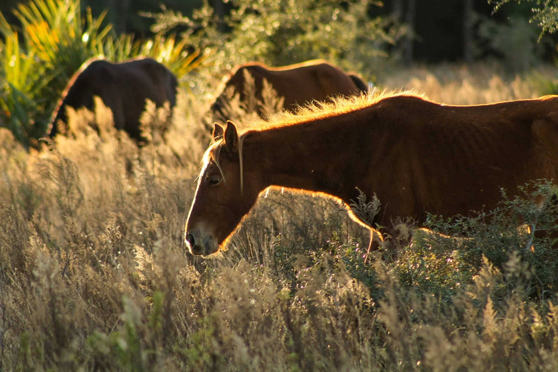
Cumberland Island National Seashore, located near St. Marys, Georgia, is a pristine 18 mile stretch of undeveloped wilderness unique to the East Coast. The island is known for its feral horses, possibly left over from the Spaniards during the 1700s.
The island has a long history, and was once owned by the Carnegie Family who then dedicated the island to the National Park Service in 1972. The island has faced various threats to its wilderness status over the years and has been defended through the continuous efforts of Carol Ruckdeschel, one of the few persons allowed to live on the island.
Heading out from my backcountry campsite to a small airplane landing strip, this area is frequented by the wild horses (technically feral) of the island. I was able to observe this group of horses grazing in golden hour light highlighting the area’s beauty as well as their complicated existence.

Cumberland Island National Seashore is a pristine 18 mile stretch of undeveloped wilderness unique to the East Coast.
The island has a long history, and was once owned by the Carnegie Family who then dedicated the island to the National Park Service in 1972. The island has faced various threats to its wilderness status and has been defended through the efforts of Carol Ruckdeschel, one of the few persons allowed to live on the island.
While wandering back to my campsite coming from the deserted airstrip strewn with feral horses, I found this scarlet sunset right across from my campsite, the clouds accentuated by the pointing fingers of the tall Loblolly Pines prevalent on the island.
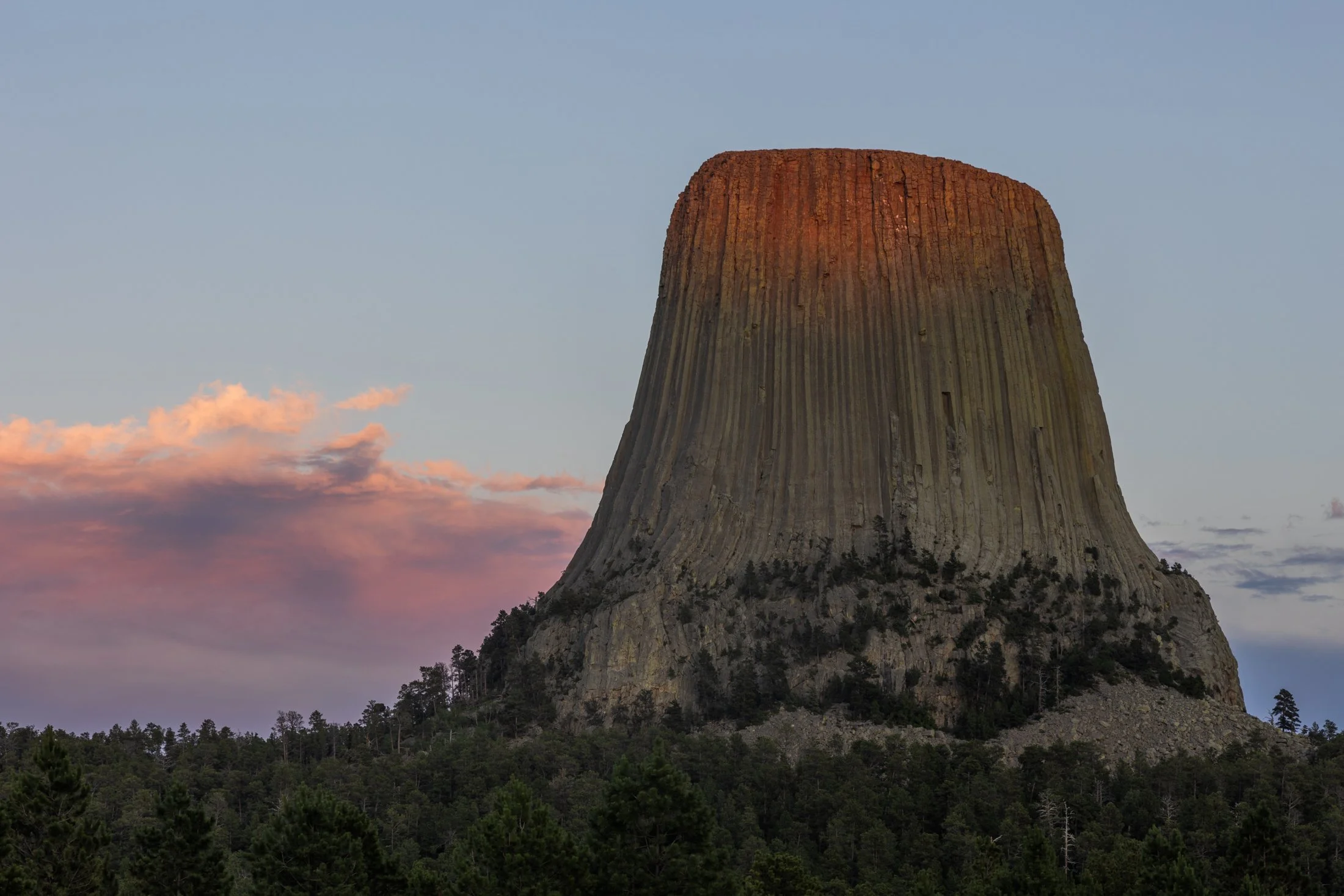
Standing at 867 feet tall, Devil’s Tower, located in eastern Wyoming, has been a sacred site for Native Americans for centuries as well as being featured prominently in “ Close Encounters of the Third Kind” (1977).
The Lakota tribe refers to it as Mato Tipila, roughly translating to “Bear Lodge”. One narrative surrounding its formation involves two girls attempting to escape a large bear by scurrying up a rock formation. The Great Spirit, seeing their plight, rose the rock high into the air to protect them. As the bear attempted to reach them, he clawed the sides of the rock, which formed the basalt columns seen today.
After renting a cabin at the nearby KOA, where “Close Encounters of the Third Kind” is shown every night in front of the monolith, I drove to the southern side at sunset to capture the light slowly fading from the tower. While standing there I could only think one thought; the energy of this land is palpable.
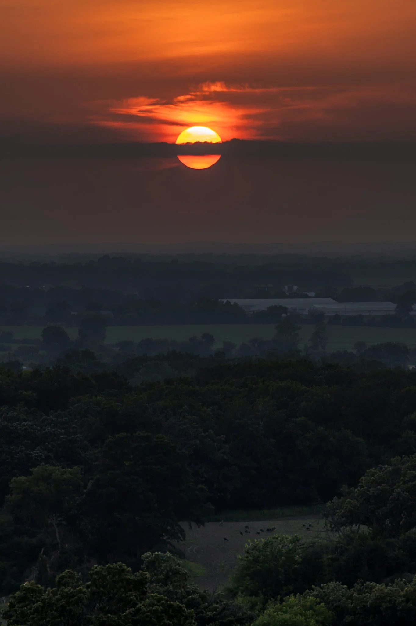
Kettle Moraine is a beautiful unique region in southeastern Wisconsin, shaped by the massive glaciers carving the landscape during the last ice age. The area features continuous rolling hills, deep valleys, and kettle lakes.
Named for the unique glacial carvings, kettles exist as depressions in the earth that fill with water over time, creating serene ponds and lakes. John Muir’s family immigrated to Wisconsin as a child, settling on a farm near the rugged terrain of the Kettle Moraine. This area played a crucial role in shaping his philosophy of conservation and his advocacy for preserving wild spaces.
Hiking through the forests of Kettle Moraine was an experience i did not expect. Each turn reveals a new region distinct from the last. This hike from my campsite to the one prominent overlook in the area ended with a stunning sunset overlooking the pastoral lands below.

Cumberland Island National Seashore is a pristine 18 mile stretch of undeveloped wilderness unique to the East Coast.
The island has a long history, and was once owned by the Carnegie Family who then dedicated the island to the National Park Service in 1972. The island has faced various threats to its wilderness status and has been defended through the continued efforts of Carol Ruckdeschel, one of the few persons allowed to live on the island.
I had visited the wild protected beaches of both the Atlantic and Pacific Ocean in the same calendar year when I took this photo, and I cannot divide my love for both. The sunrise peaked through the clouds this particular morning, while I photographed on an empty beach. It is a peaceful memory I recall often.

Harris Beach State Park, located just north of Brookings, Oregon, is a coastal haven renowned for its dramatic scenery, diverse wildlife, and rich marine ecosystems.
The park's centerpiece is Goat Island (also known as Bird Island), the largest offshore island along the Oregon Coast. This National Wildlife Refuge is a breeding ground for over 100,000 seabirds, including tufted puffins and Leach’s storm-petrels, making it a prime spot for birdwatching.
This photo was taken during a quiet moment alone on the beach as the last vestiges of light began to disappear. Harris Beach is one of my favorite places on the Oregon Coast, offering endless photographic opportunities and true tranquility.

A sunset over the Tetons is one of the most stunning views nature has to offer. One reason the Teton Range is famous is due to the dramatic prominence visible from the eastern side, which rises sharply from 4,000 to 7,000 feet above the valley floor.
Aerial debris will often obscure the Tetons during sunset leading to a fascinating ghostly form on the landscape, but when the air is clear the sunsets are incredible, accentuating the fascinating form of one of America’s greatest mountain range.
The mosquitos were in full force as I rushed to set up my tripod shortly after arriving at Grand Teton. I rented a rustic cabin (offered at the Grand Teton campsite), consisting of two unfinished cots and a fire pit. I drove down to the lake and set up this shot while providing a perfect meal for the skeeters.

Carl G. Washburne Memorial State Park may be the one of the most scenic stretches of the entire Oregon Coast. Located about 15 miles north of Florence, and only a few miles past Heceta Head Lighthouse (a trail connects the two parks), the surrounding area offers a portal to another world.
The China Creek Trail weaves through coastal forests terminating on the beach, and the picturesque Hobbit Trail, known for its moss-draped trees and old-growth forest, make the hiking here magical.
This photograph was taken moments after sundown, following a chaotic two hours of trying to photography too many areas at once. I used the last remaining daylight to grab this abstract before retiring to my campsite across the main road. The park is a quiet place, unassuming, and it is here that shows Oregon’s true beauty.

The Manistee North Pier Lighthouse, located in Manistee, Michigan, is as picturesque as any lighthouse can be.
Constructed in 1870, the wooden lighthouse was changed to steel in 1927, providing an important means of safety guiding ships during the lumber industry of the last 19th century. The lighthouse is now on the National Register of Historic Places.
This photo was taken on a particularly cold evening while heading up to Sleeping Bear Dunes. With a windchill of -4 degrees, waiting for this moment required patience, warm clothing, and slowly freezing fingers.

Springbrook Prairie Natural Preserve, located in Naperville, Illinois, is one of the few remaining natural prairies in Illinois, spanning 1,800 acres.
Known as the Prairie State, Illinois’ prairie is now .1% of what it once was, owing this to farming, industrialization, and the scrawling metropolis of Chicago. This Preserve is one of the largest in the Chicagoland area and visiting it is a step back in time.
Planning to photograph the prairie at sunset, this cloud formation became the most interesting thing in the area. The wispy cirrus clouds caught the descending light at just the right angle crystalizing this the fleeting moment.

The Palouse region, located in southeastern Washington and extending into portions of Idaho and Oregon, was originally home to the Palus people, historically known for breeding strong horses, but the U.S. government did not acknowledge them as a distinct tribe in the late 1800s as settlers arrived under the Homestead Act.
Indigenous communities were displaced, and the land was drastically reshaped by agriculture. The region’s deep loess soil and steep terrain led farmers to adopt contour plowing, giving the fields their signature flowing appearance.
I raced the descending sun following a long drive from Seattle, arriving just in time to catch the sunset atop Steptoe Butte, the one elevated area among the farmland. I set up next to a group of amateur photographers taking a class led by a knowledgeable local — which brings me to an interesting detail about the Palouse: I only encountered two types of people there — farmers and photographers. There might not be a better place to learn photography.

Harris Beach State Park, located just north of Brookings, Oregon, is a coastal haven renowned for its dramatic scenery, diverse wildlife, and rich marine ecosystems.
The park's centerpiece is Goat Island (also known as Bird Island), the largest offshore island along the Oregon Coast. This National Wildlife Refuge is a breeding ground for over 100,000 seabirds, including tufted puffins and Leach’s storm-petrels, making it a prime spot for birdwatching.
This photo was taken during a quiet moment as the last vestiges of light revealed eerie silhouettes of the rock formations surrounding Harris Beach. It is one of my favorite places on the Oregon Coast, offering endless photographic opportunities, a great campsite, and a beach unlike any other.

Carl G. Washburne Memorial State Park may be the one of the most scenic stretches along the entire Oregon Coast. Located about 15 miles north of Florence, and only a few miles past Heceta Head Lighthouse (a trail connects the park), this area offers a portal to another world.
The China Creek Trail which weaves through coastal forests terminating on the beach, and the picturesque Hobbit Trail known for its moss-draped trees and old-growth forest.
This photograph was taken after sundown following a chaotic two hours of photographing. I used the last remaining daylight to grab this abstract before retiring to my campsite across the main road. It is a quiet place, unassuming, and it is here that shows Oregon’s true beauty.

“Time is, time was, but time shall be no more.”
- James Joyce (Portrait of an Artist as a Young Man) -

The Oregon Coast holds many treasures and its relationship with the Pacific leads to its dramatic cliffs. Stretching endlessly westward, the Pacific creates a boundless horizon that seems to hold no end.
Long before roads carved through these coastal towns dotting the headlands, this was a remote and mysterious frontier. Pirate ships, privateers, and explorers found their way to this region, exploring its untouched mysteries. Legends linger of hidden coves that sheltered their treasures, buried beneath shifting sands or unexplored coves.
This photograph was taken right near the lookout to Heceta Head, and while that lighthouse is as picturesque as any can be, it was this drama playing out in the clouds that drew my eye. It seemed to point me back to an unremembered time, before roads, towns, and civilization.

The South Coast Wilderness Trail is a stunning, rugged, and truly wild 17 mile one-way hike through Olympic National Park. One of the last undeveloped coastlines in the contiguous United States, Olympic’s protection status ensures native species like sea otters, bald eagles, bears, and migrating whales will continue to thrive in this pristine wilderness.
Switching between stretches of picturesque coast and dense rainforest, the trek (which is at sea level) entails 2,000 feet in elevation change, due to the use of ladders and ropes to maneuver up and down coastal embankments.
After setting up camp, I descended a very steep sand embankment via a rope wrapped around a tree to reach this secluded beach. It was a peaceful moment photographing these majestic sea stacks at sunset alone on this pristine beach.

St. Marys is a quaint little town in southern Georgia. The town provides ferry access to Cumberland Island National Seashore, which offers 18 miles of undeveloped wilderness.
St. Marys became a point of conflict during the War of 1812, with the British raiding the town in 1815. It established itself as a port town, with shipping and trade. The town’s economy declined following the abolish of slavery and reestablished itself as tourist community in the mid-20th century.
This photograph was taken while returning from Cumberland Island on the daily ferry. The sun lined up perfectly along this strip of clouds making the bay and the surrounding boats shimmer gold.

Lone Eagle Peak is a marvel among Colorado’s already stunning collection of mountains peaks.
Named for Charles Lindbergh, the “Lone Eagle”, after his historic transcontinental flight, the mountain is tucked in the Indian Peaks Wilderness and requires at 15 mile hike to reach base where two mountain lakes sit.
This was captured at one of the most tiring moments in my life; 15 miles up the mountain with 50 lbs of camping and camera gear. I now travel lighter when climbing mountains. I arrived at camp completely spent, and struggled to make the effort to grab this shot as the light faded from the mountain.
Opened in 1937, the Golden Gate Bridge is a marvel of modern engineering. Designed by one Joseph Strauss, the bridge was painted orange to help visibility through the common San Francisco fog. The bridge runs 1.7 miles in length and extends to a height of 746 feet.
Seagulls are a familiar presence around the Golden Gate Bridge. These large, intelligent birds are often seen soaring in the updrafts, perched on railings, or scavenging along the nearby shorelines
This shot was another case of being in the right place at the right time. Arriving at my hotel an hour before sunset completely spent from a full day drive along Big Sur, I dropped my bag in my hotel and immediately started walking towards the bridge. Miscalculating the distance it would take to reach the vantage point I had planned, this shot came as a result of randomly being in the right place at the right time.