

Midwest

Midwest
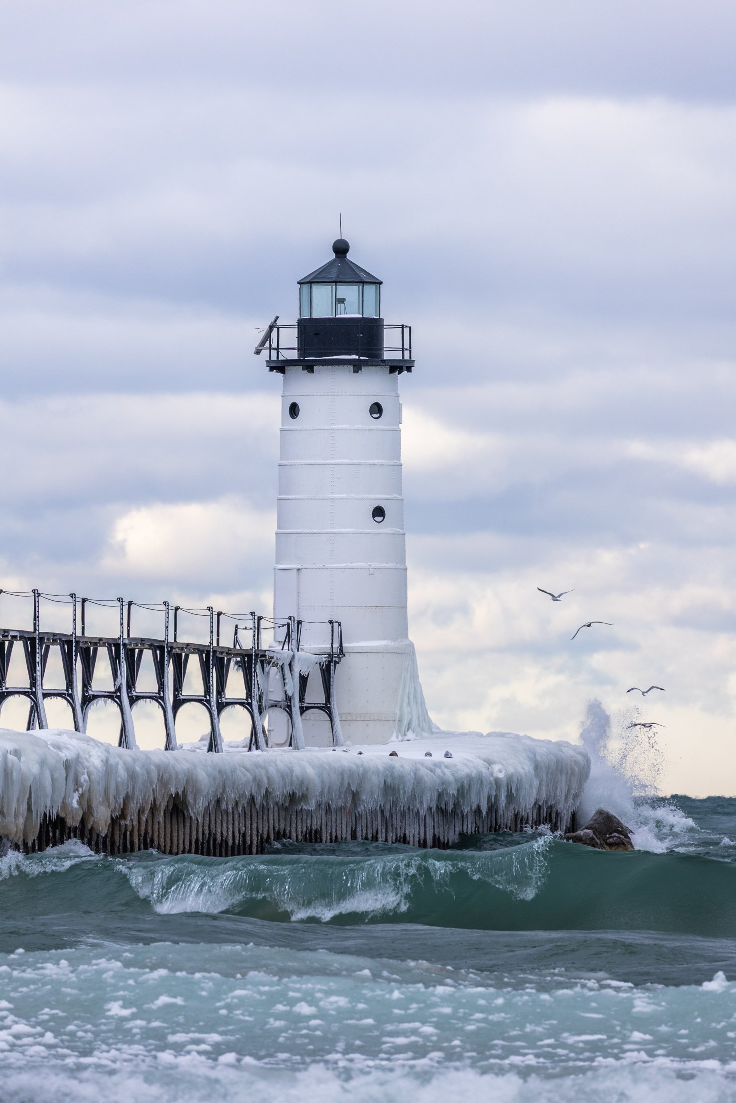
The Manistee North Pier Lighthouse, located in Manistee, Michigan, is as picturesque as any lighthouse can be.
Constructed in 1870, the wooden lighthouse was changed to steel in 1927, providing an important means of safely guiding ships in the lumber industry during the end of the 19th century.
This was my second visit to the Manistee Lighthouse, with both events being particularly cold days. This day just happened to be my birthday. The wind was fierce, and after setting up the shot, I was lucky enough to have some avian tourists enter my frame.

The Grand Island East Channel Light was constructed in 1867 by the United States Lighthouse Service to help ships navigate the dangerous waters of the East Channel of Grand Island, which has historically been a busy route for steamships and commercial vessels.
The area was notorious for shipwrecks during the 1800s due to the complexity of the navigation and the strong currents in the surrounding waters. Decommissioned in the early 1970s the Lighthouse remains as an iconic stop on Pictured Rock Cruises.
While taking the cruise, I positioned myself on the outside seats to grab this photo, requiring a quick shutter speed and precise timing to get this compositon.
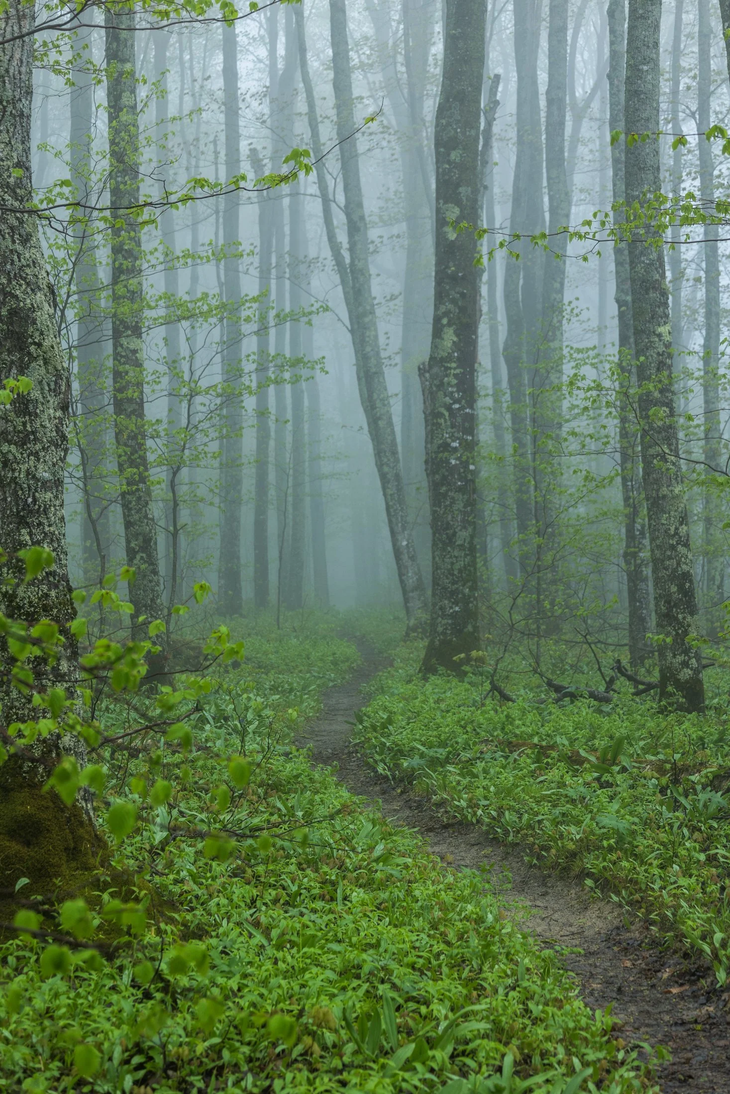
Pictured Rocks National Lakeshore, located near Munising, Michigan, already provides a stunning hiking opportunity for those willing to trek its bluffs, but in the early morning they can often take on a surreal atmosphere as the fog rolls in, transforming the area into a mystic forest.
This fog is often the result of the extremely cold waters of Lake Superior mixing with the warmer air from the land. As the fog rolls in, it muffles sound and adds depth to the already vibrant sandstone cliffs, creating a dramatic backdrop for an already stunning hike.
This particular photo occurred during an 11 mile backpacking trek along the cliffs, providing the one respite from a continuous onslaught of rain throughout the day. The experience of hiking through this atmosphere must be experienced, as this photo barely does it justice, but this winding trail disappearing into the fog serves as a glimpse into its magic.
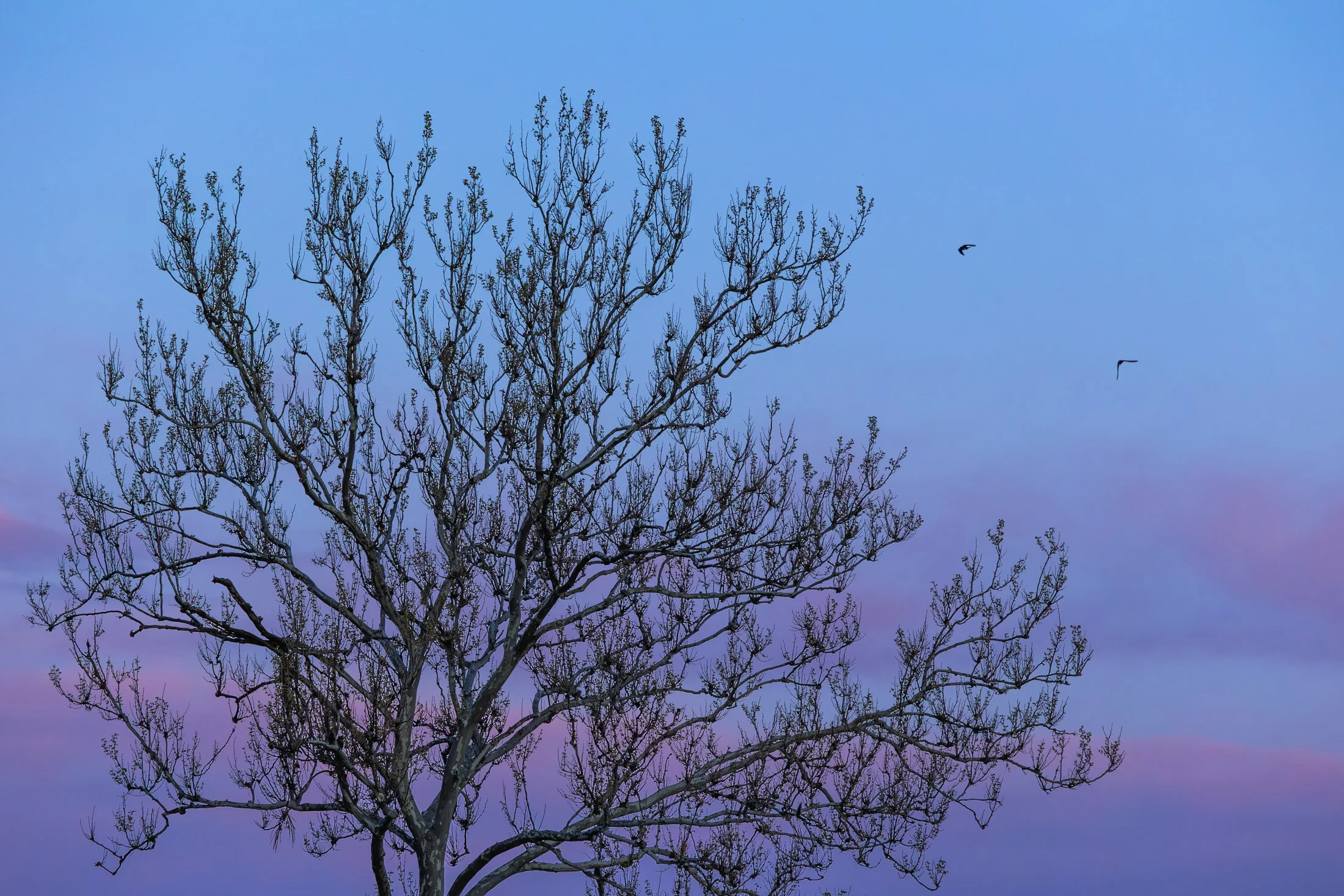
The area around Starved Rock State Park near Utica, Illinois, is one of the most scenic Illinois has to offer. The Illinois River cuts through the area and was one of the few areas in Illinois not flattened by glacial drift.
This beautiful tree on the bank of the Illinois river is a Sycamore, known as the London Plane. Often planted in the Victorian area to help quell the London pollution caused by the Industrial Revolution, this tree has been a stable of urban development. It can incur a disease known as the Witches Broom, causing the shoots to bunch up which also offers a natural nest for nearby birds.
Camping on the edge of the Illinois after a trip to Starved Rock, I set up my tripod to capture the active birds at sunset, but then this Sycamore caught my eye. The composition of the eerie branches against the beautiful purple glow of the setting sun was mad even better by the birds passing through the area.

“The sky is the ultimate art gallery just above us.”
-Ralph Waldo Emerson-
On my drives across the corn belt, I’ve always been enamored with the lone trees among the endless fields.
Some say they are for markers for property boundaries, others that they were once a primary source of shade for farmers from a bygone era. Whatever the case, their air of mystery sits majestic among the expansive cornfields of the Midwest.
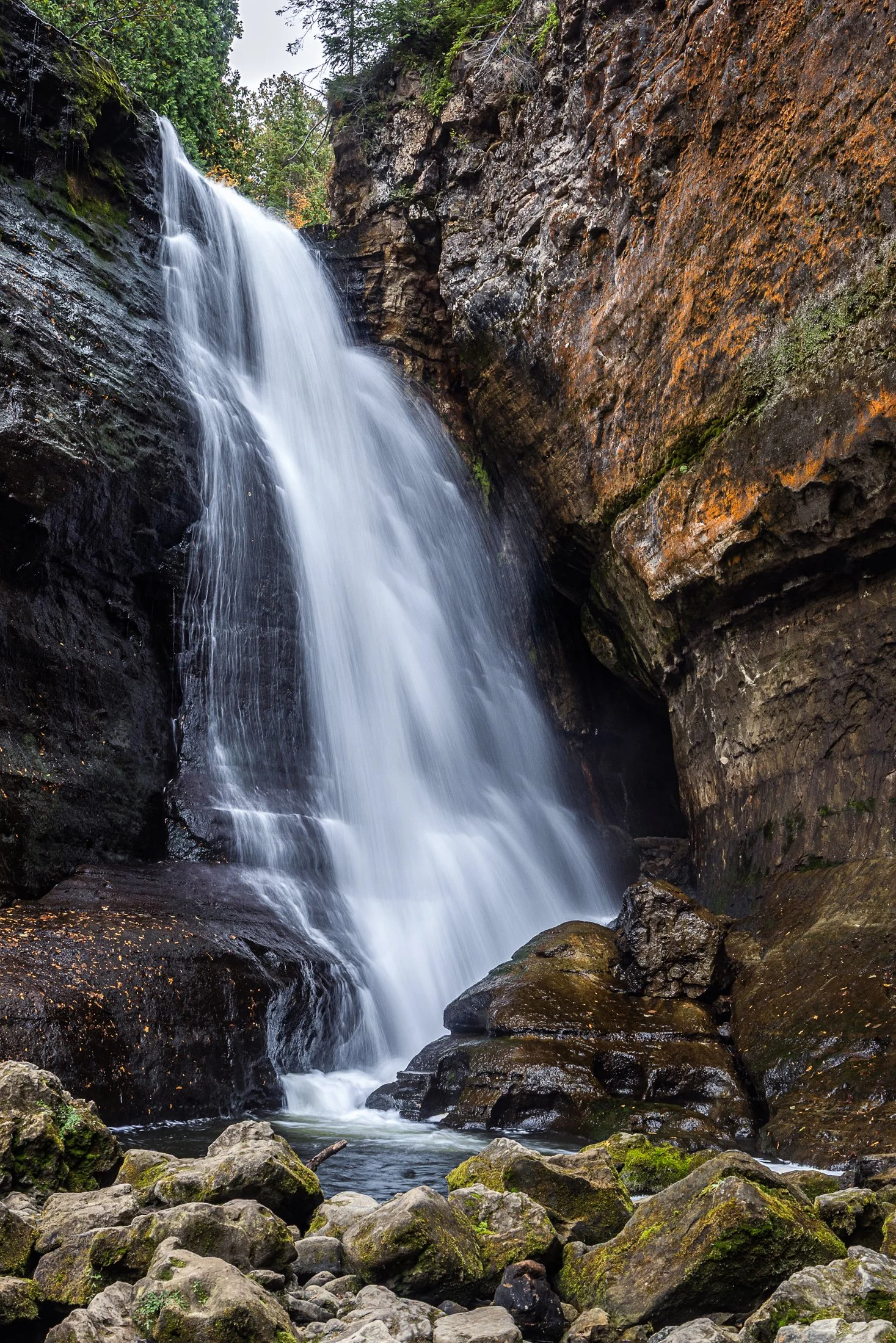
Pictured Rocks National Lakeshore, located near Munising, Michigan, offers up some of the best waterfalls in the Midwest. This, coupled with saturated colors during the dramatic fall foliage, make it a fall vacation spot for many a midwesterner.
The name Miners Falls derives from the local mining history around the area during the 19th century copper boom. The waterfall along with the nearby Pictured Rocks became a big tourist attraction following the decline of the mining industry there.
The continual downpour of this water was amazing to witness. While a fast shutter speed would have captured the pure force of this fall, I found the slower shutter speed revealed its picturesque beauty.
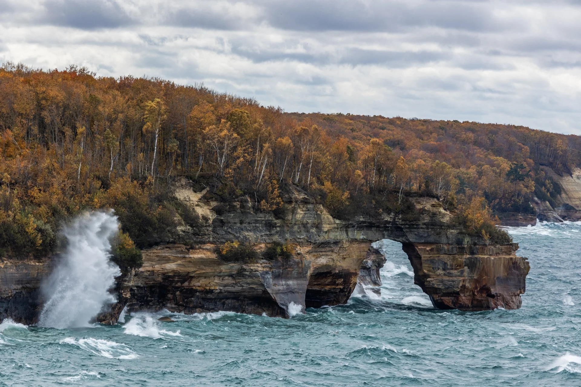
Lover’s Leap Arch, located in Pictured Rocks National Lakeshore, near Munising, Michigan, is one of the park's most iconic and photographed spots. The towering 200-foot cliffs and turquoise waters are often photographed from the local boat cruise and are rarely seen from this vantage point.
The cliffs colors, created by mineral staining, gives the area its "painted" appearance and inspiring the park’s name. According to Native American legend, Lover's Leap got its name from a heartbroken woman’s jump to her death after her lover’s failure to return from a journey.
Part of my 22-mile backpacking trip along cliff, this stormy day lead to Lake Superior’s waves continually crashing into the cliffs, often reaching their full height. These are the same storms that lead to the wreck of many ships, including the Edmund Fitzgerald.
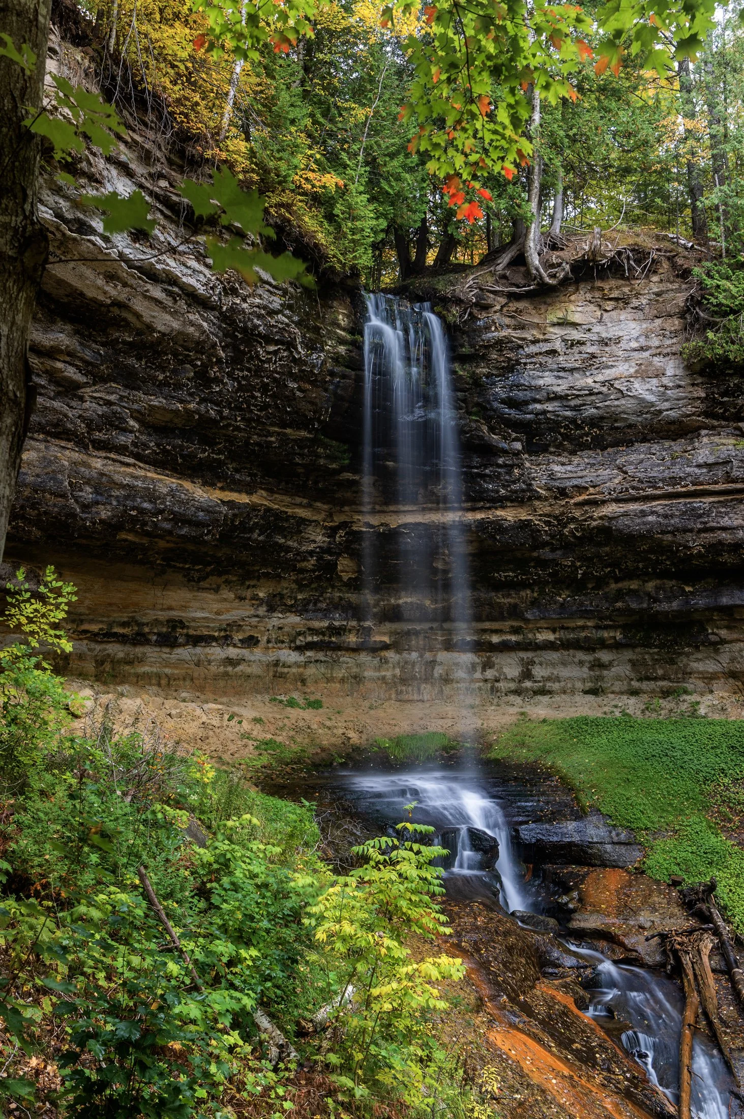
Pictured Rocks National Lakeshore, located outside of Munising, Michigan, offers up some of the best waterfalls in the Midwest. This, paired with the unbelievable colors that arise during peak fall season, make it a top travel destination.
Right near the town of Munising, the eponymous falls are easily accessible with a viewing area for all ages. A paved trail leads directly to the falls directly from the Pictured Rocks Visitors Center.
The peak foliage against these historically picturesque falls accentuated this long exposure, complimenting the beauty of the surrounding sandstone valley, formed through extensive periods of erosion.
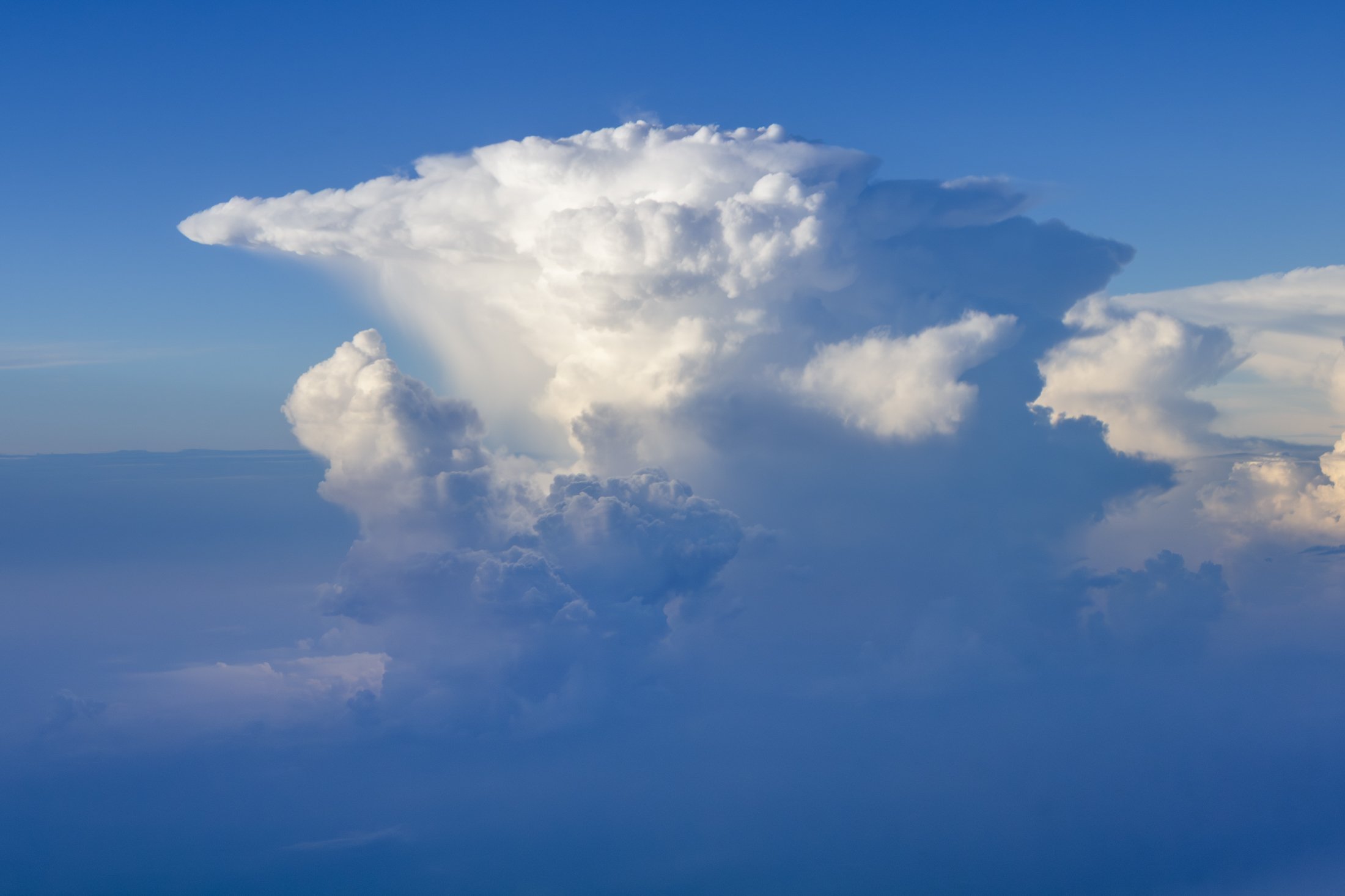
Cumulonimbus clouds are among the most powerful and visually striking clouds in the atmosphere. The only clouds that produce thunder and lightning, these towering giants can reach heights of over 12 miles.
One of the most distinctive features of a mature cumulonimbus cloud is its anvil-shaped top such as the one seen here, which forms when the cloud's upward growth is halted by the tropopause, causing the upper part to spread out horizontally.
I was lucky enough to witness this fascinating formation while taking off from Chicago at the tail end of a storm. The sheer size was daunting, and the setting sun raked against the cloud perfectly. This is an alternate to the black and white version, as I found both offered something different.

From above, Chicago’s famous grid system becomes a kind of urban quilt, stitched with rivers, highways, and rails. The skyline, punctuated by towers like the Willis Tower (though for Chicagoans it will forever be known as the Sears) and the St. Regis, rises like a great sculpture.
The city’s architecture seamlessly incorporates styles ranging from Gothic Revival and Art Deco to International and Postmodern, all layered along the river and gridded streets. Notable landmarks like Marina City, the Tribune Tower, and buildings by Frank Lloyd Wright create a living timeline of American design.
This photograph was taken while departing for O’Hare, heading toward New York. This was the tail-end of a storm and the cumulonimbus clouds gave a staggering scale of the sky in relation to the city, one which will forever remain my home.
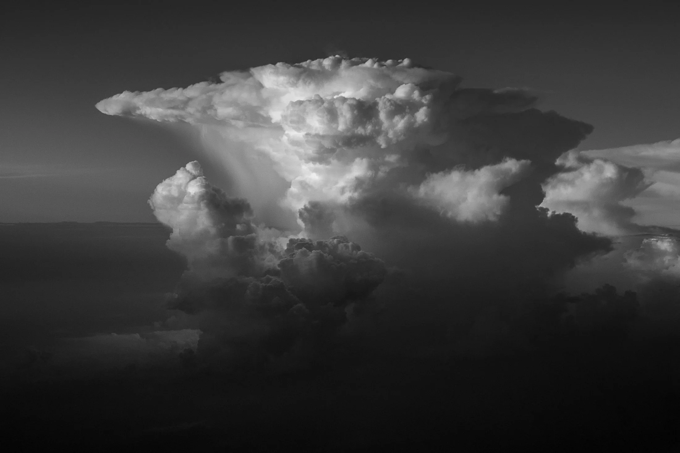
Cumulonimbus clouds are among the most powerful and visually striking clouds in the atmosphere. The only clouds that produce thunder and lightning, these towering giants can reach heights of over 12 miles.
One of the most distinctive features of a mature cumulonimbus cloud is its anvil-shaped top such as the one seen here, which forms when the cloud's upward growth is halted by the tropopause, causing the upper part to spread out horizontally.
I was lucky enough to witness this fascinating formation while taking off from Chicago at the tail end of a storm. The sheer size was daunting, and the setting sun raked against the cloud perfectly. This is an alternate to the color version, as I found both offer completely different vibes.
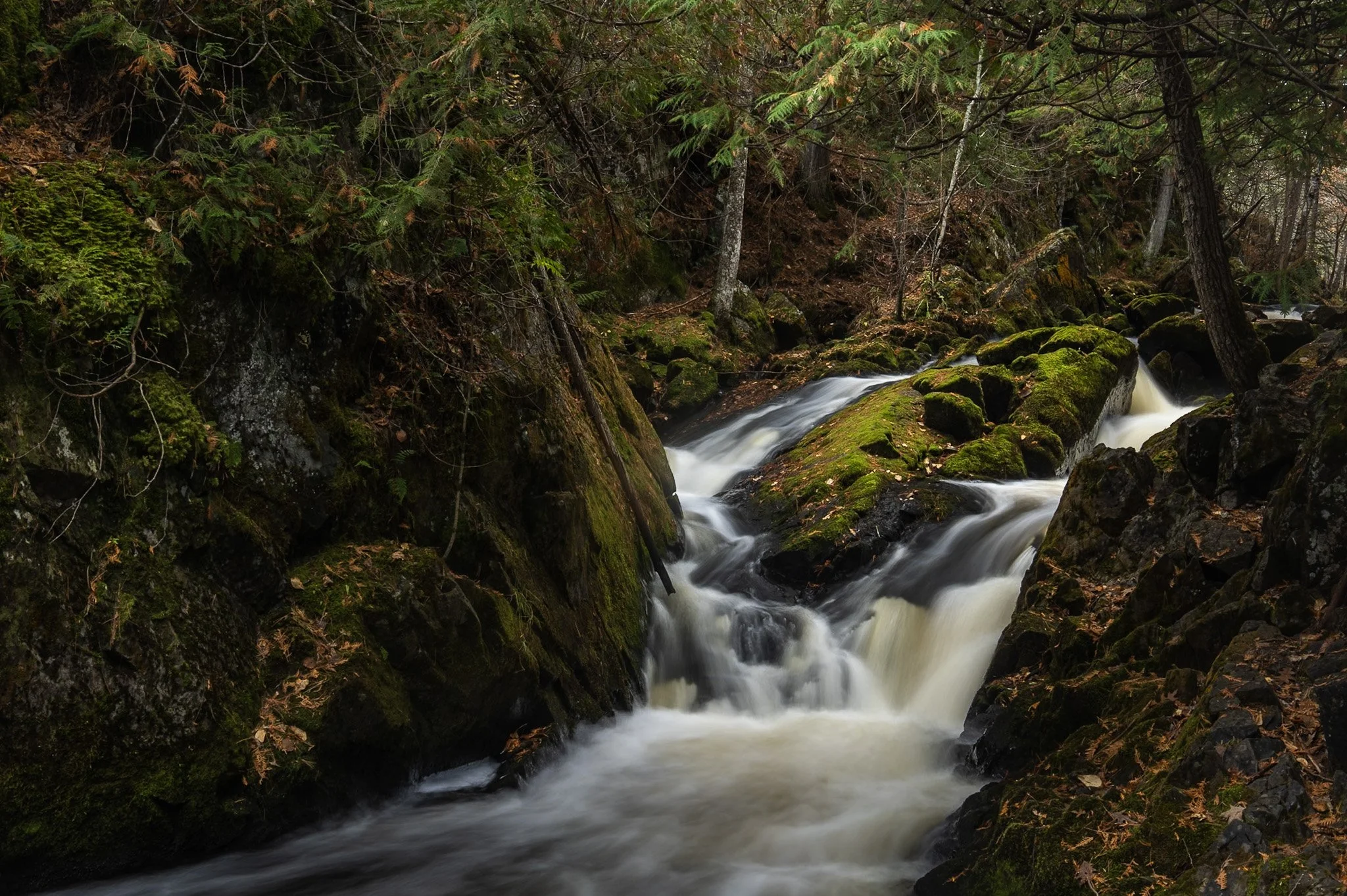
Smalley Falls, located in the Chequamegon National Forest of northern Wisconsin, is known for its serene and scenic beauty. Part of the Brule River, these falls are not as widely known as some of the others in the region, making it a particularly peaceful spot to visit.
The region is primarily composed of ancient Precambrian rock formations, some of the oldest on Earth, dating back about 1.6 to 2.6 billion years. Glacial till, which consists of a mixture of soil, clay, sand, and gravel, can be found in the area, deposited by the retreating glaciers that once covered much of Wisconsin. This sediment supports the lush vegetation and forest ecosystem surrounding Smalley Falls.
This particular composition required some scrambling and, again, careful positioning of my tripod legs on various levels of rocks to allow for the long exposure. This area immediately transported my mind to the lush forests of the Pacific Northwest, a site not often found in the Midwest landscape.

In the Midwest, nuclear power plants are a vital part of the energy infrastructure, and many of them are surrounded by sprawling cornfields. This unusual pairing is more practical than it might seem. Nuclear plants require large safety buffer zones, which makes rural farmland an ideal setting.
At the same time, the actual footprint of a nuclear facility is relatively small, allowing the surrounding land to continue being used for agriculture. Illinois, in particular, stands out as the top nuclear-generating state in the country, with 11 reactors at six sites, most of them nestled in farming regions.
Having just finished photographing these monoliths from the other side, I was stunned by the scene developing in my rear view mirror as I sped down the country road. With someone tailgating me, I signaled at the next service road, parked in front of a farm, and quickly set up my tripod to grab this shot.
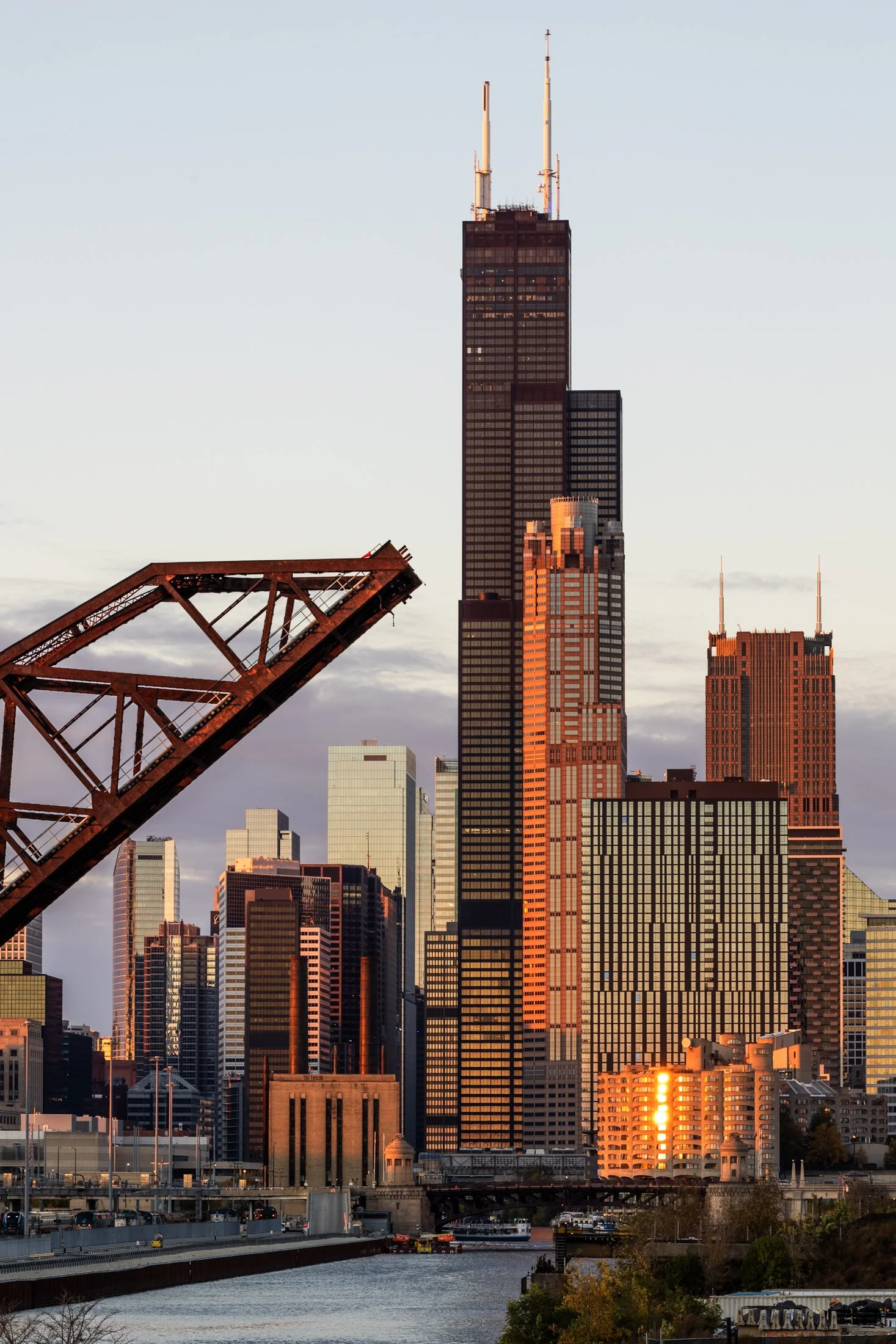
The Canal Street railroad bridge located north of Chinatown in Chicago, Illinois, it one of the most famous bridges in Chicago. Built for the Pennsylvania Railroad, it was finished in 1914 and designated as a national landmark in 2007.
The bridge replaced a swing bridge that was in the same location so to prevent obstructing traffic, the bridge was built in the raised position while the old bridge still operated. Upon completion, the old bridge was demolished and the railroad bridge still operates to this day.
On a trip to Chinatown with some fellow photographers at sunset, this view caught my eye as we headed north. The bridge provided a compositional pointer finger to one of Chicago’s most iconic landmark, the Willis Tower (although it will forever be known to Chicagoans as the Sears).

Art on the MART is a large-scale public art installation in Chicago that transforms the façade of the Merchandise Mart building into a digital canvas. Launched in 2018, it features nightly projections of contemporary art across 2.5 acres of the building’s river-facing side, making it the largest digital art projection in the world.
The installation showcases work from local, national, and international artists, often in collaboration with cultural institutions like the Art Institute of Chicago and the Chicago Symphony Orchestra. The projections are free and open to the public, and they typically run from spring through fall.
This offered me a secluded area to shoot, away from the hustle and bustle of the main viewing platform along the river, and provided the perfect vantage point to show off all that makes Chicago great, especially its world class architecture.
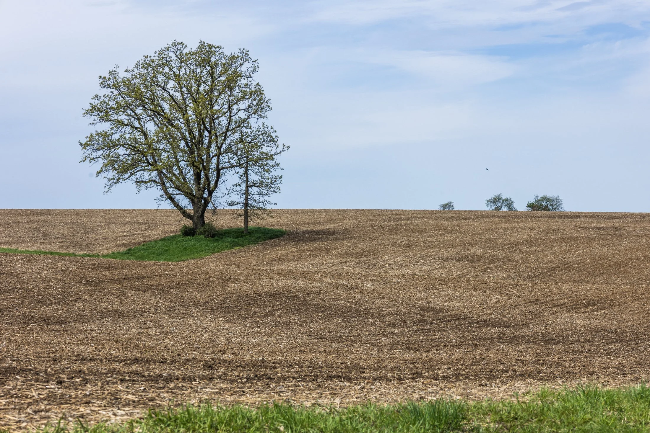
The cornfields near Polo, IL follow twists and turns as the land enters the Driftless Area. It is here where the sinuous and hilly terrain begin to take over. This area, and Illinois in general, is a very prominent agricultural hub for a variety of crops.
Previously a historic route to Galena, this picturesque area was rift with natural prairie prior to its transformation for agricultural purposes, but the beauty still remains.
This area is one I have visited often and will eventually be a part of a series when I capture the right fall photo. The composition of this lone tree set against the distant row of trees in the background shows what is possibly an old boundary tree isolated in a crop field.
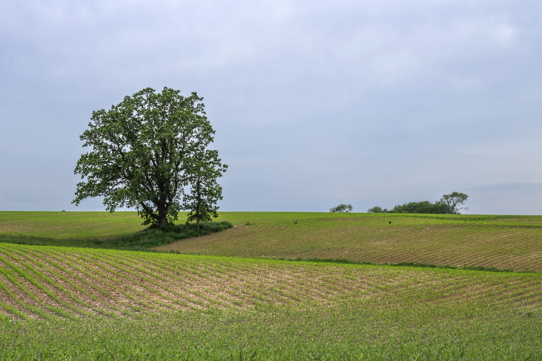
The cornfields near Polo, IL follow twists and turns as the land enters the Driftless Area. It is here where the sinuous and hilly terrain begin to take over. This area, and Illinois in general, is a very prominent agricultural hub for a variety of crops.
Previously a historic route to Galena, this picturesque area was rift with natural prairie prior to its transformation for agricultural purposes, but the beauty still remains.
This area is one I have visited often and will eventually be a part of a series when I capture the right fall photo. The composition of this lone tree set against the distant row of trees in the background shows what is possibly an old boundary tree isolated in a crop field.
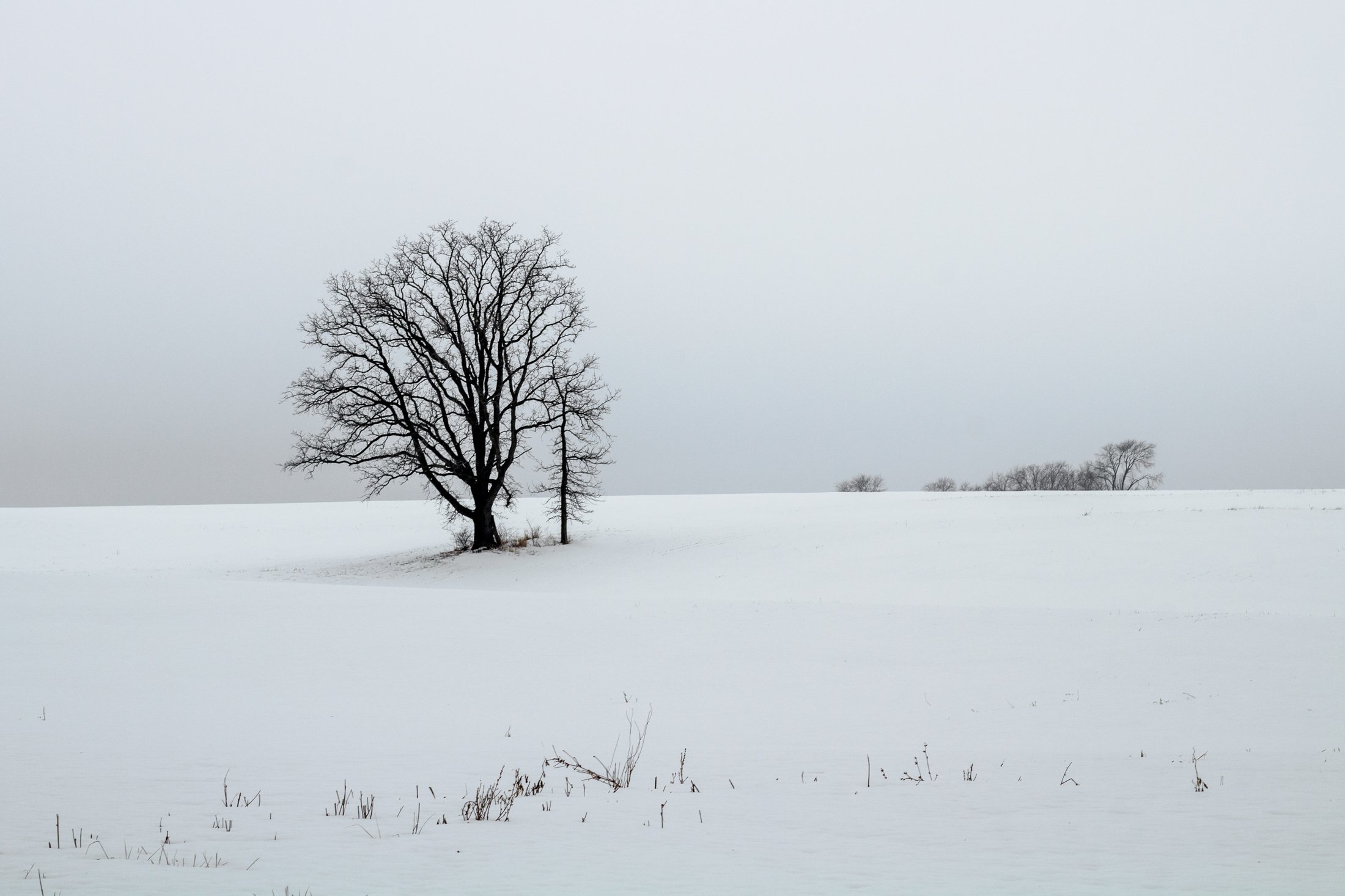
The cornfields near Polo, IL follow twists and turns as the land enters the Driftless Area. It is here where the sinuous and hilly terrain begin to take over. This area, and Illinois in general, is a very prominent agricultural hub for a variety of crops.
This particular area is one I have revisited often, and is part of an ongoing seasonal series yet to be published. This specific scene reminded me of something out of the film Fargo, with the delicate blanket of snow covering the fertile soil beneath.
The composition of this lone tree set against the distant row of trees in the background provided the proper depth for the open spaces these farmlands offer. Previously a historic route to Galena, this picturesque area was rift with natural prairie prior to its transformation for agricultural purposes, but the beauty still remains.
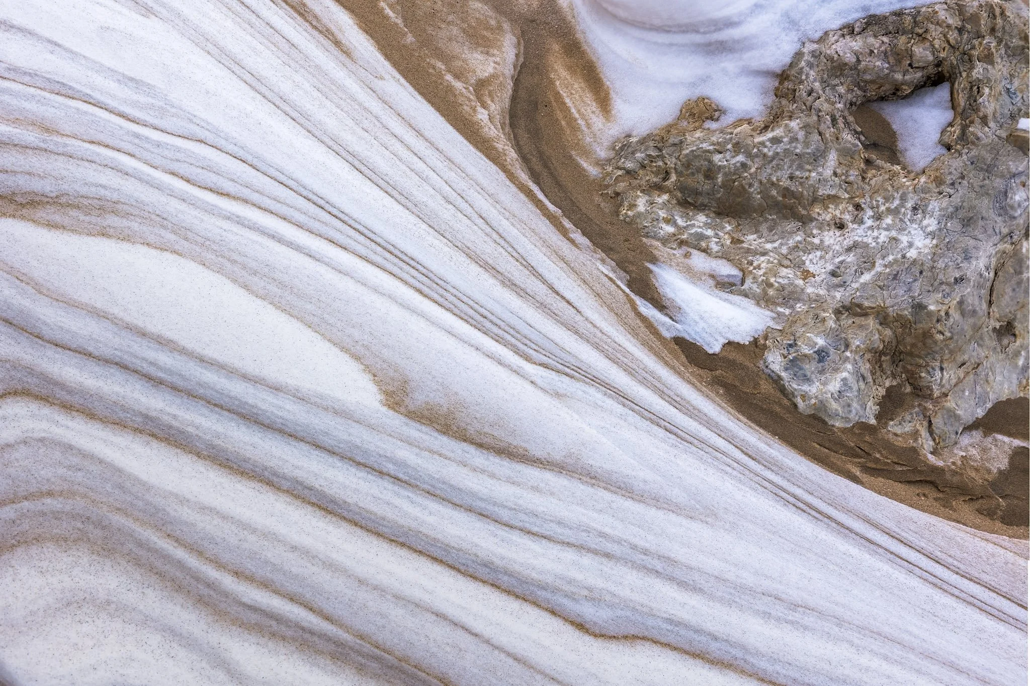
These naturally occurring abstract patterns, created by the interplay of wind, water, and sediment, decorate the beaches of Manistee, Michigan. The fine-grained sand reminds one of marble, with its dramatic and delicate textures. They’re a quiet, fleeting reminder of nature’s handiwork.
This was my second visit to the Manistee Lighthouse, with both events being particularly cold days. This day just happened to be my birthday. Finding the right frame for these abstractions can take a bit, and on a cold day like this, it is a race against frostbite.
I love the transition of form in this frame, juxtaposing the sinuous form of the snow-covered sand against the solid rock underneath. The variation in nature’s abstract forms has always fascinated me, and become something I keep an eye out for in each location I visit.

“Time is, time was, but time shall be no more.”
- James Joyce (Portrait of an Artist as a Young Man) -

These naturally occurring abstract patterns, created by the interplay of wind, water, and sediment, decorate the beaches of Manistee, Michigan. The fine-grained sand reminds one of marble, with its dramatic and delicate textures. They’re a quiet, fleeting reminder of nature’s handiwork.
This was my second visit to the Manistee Lighthouse, with both events being particularly cold days. This day just happened to be my birthday. Finding the right frame for these abstractions can take a bit, and on a cold day like this, it is a race against frostbite. This frame, out of all the ones I took, felt like the best representation of the abstract art in the natural world.

The Garfield Park Conservatory in Chicago, Illinois contains different flora from all around the world, and is located right off the Green Line on the El system making it easy access for many in Chicago through public transportation.
Cactus flowers primarily bloom in spring or early summer and in many cultures are a symbol of strength, endurance, and persistence. They characteristically have thick petals and stamens to protect the reproductive parts from harsh desert winds or sand.
I brought a small tripod and LED light to the conservatory to capture a range of different plants with more color and drama than ambient light typically allows and this little cactus flower captured the light just right.

The cornfields near Savannah, IL follow twists and turns as the land enters the Driftless Area. It is here it becomes more sinuous and hilly with various streams run through the land.
It holds the name due to the fact that during the last Ice Age, it was left untouched by the glaciers during. As a result, the Driftless Area features rugged, unglaciated terrain with deep valleys, ridges, and bluffs. The absence of glaciers left the streams to carve out their path over thousands of years.
This particular stream sat tucked off a dirt road in the hills surrounding Savannah, IL, unassuming, beautiful.
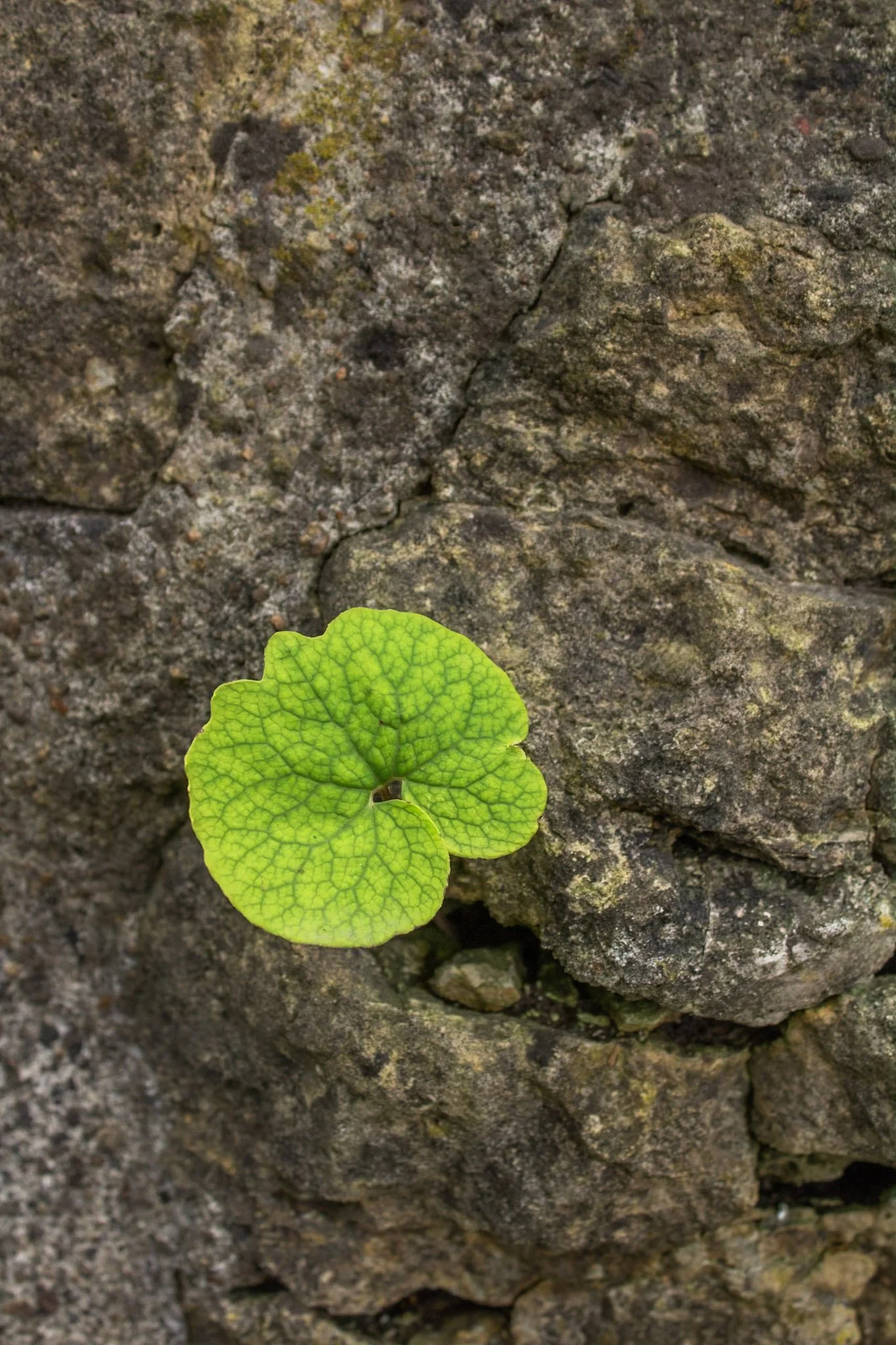
This photo was taken at the Hurstville Lime Kilns, located north of Maquoketa, Iowa.
Listed on the National Register of Historic Places, four kilns remain from the operation that supplied much of the Midwest masonry efforts during the late 1800s and early 1900s.
This one spec of green among a bed of stone immediately caught my eye, and I was fascinated with the way it somehow found its way through. Life always seems to find a way to adapt to its environment.
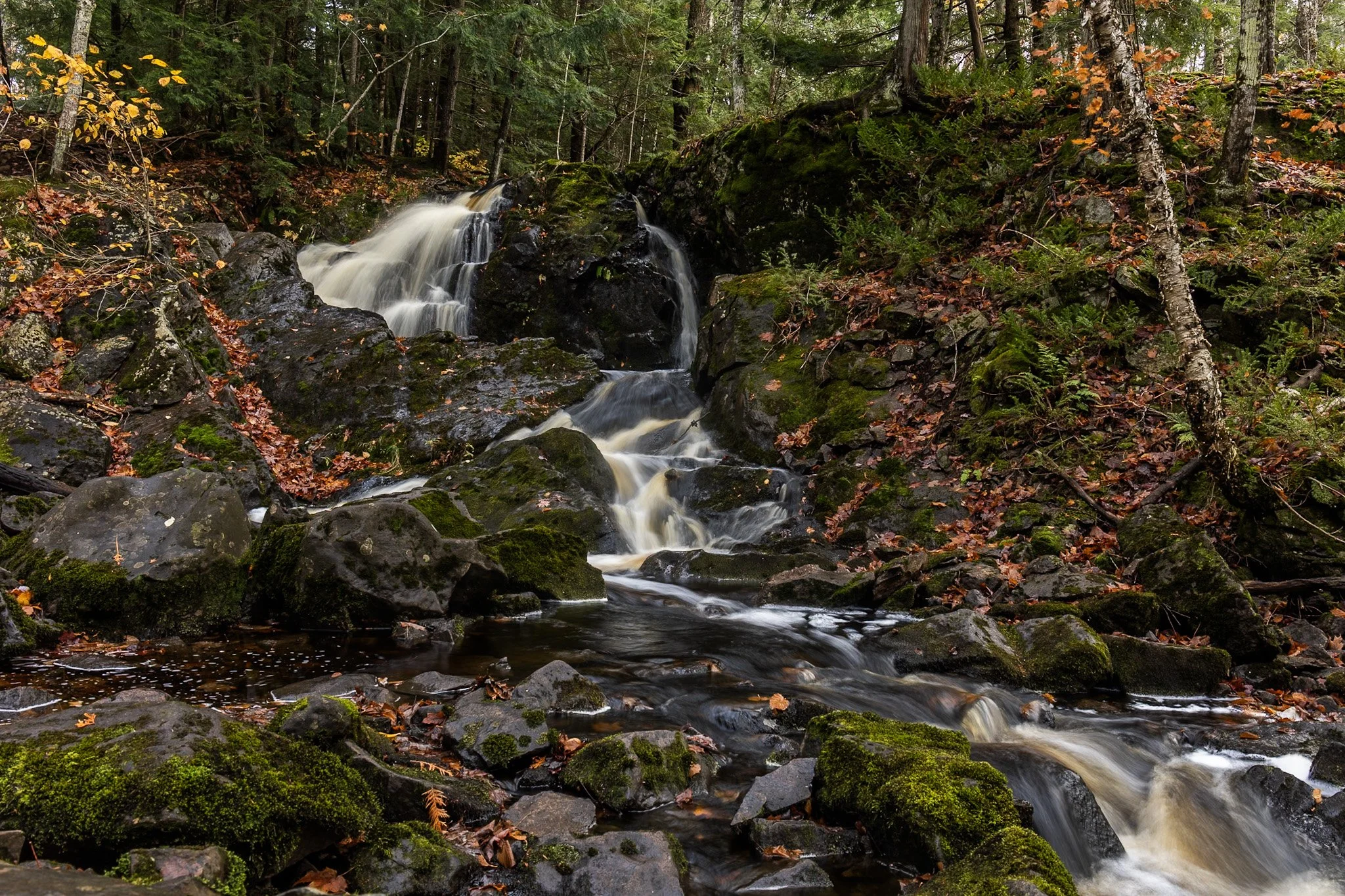
Located near Twin Lakes State Park, Wyandotte Falls finds its source from the Misery River in the Keweenaw Peninsula. The falls consist of a series of short cascades rocky ledges in a quiet, forested setting. The falls create an atmosphere that is reminiscent of a fairy tale forest.
This long exposure required the balancing of my tripod on the river rocks to get the composition that showed its varied pathways. Fall always adds something to a scene like this, and after chasing loud, roaring waterfalls all day, this was a serene end to the day.

Pictured Rocks National Lakeshore and the surround area offer up some of the best waterfalls in the Midwest as well as an incredibly diverse ecosystem including huge cliffs, expansive beaches, towering sand dunes, rocky shores, and freshwater sea caves.
Mosquito Falls, pictured here, appears on the ten mile round trip hike to Chapel Rock. The falls are fed by the Mosquito River which draws from the area’s streams and swamps eventually emptying into Lake Superior.
This photo required some scrambling to get down into the basin as well as balancing my tripod legs precariously on a downed log, keeping my hands close by during the exposure in case it fell into the river from a small shake. A lesson from a mishap years earlier in a cave.
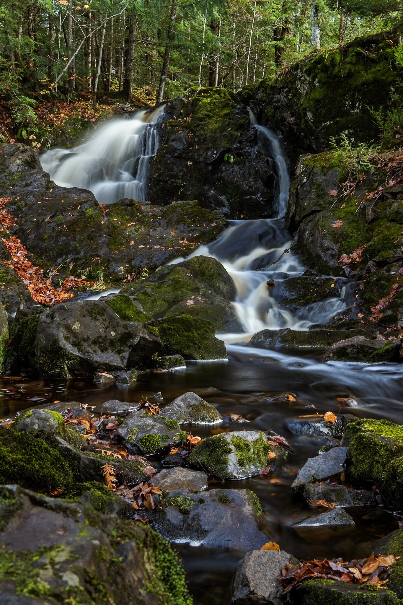
Located near Twin Lakes State Park, Wyandotte Falls finds its source from the Misery River in the Keweenaw Peninsula. The falls consist of a series of short cascades rocky ledges in a quiet, forested setting. The falls create an atmosphere that is reminiscent of a fairy tale forest.
This long exposure required the balancing of my tripod on the river rocks to get the composition that showed its varied pathways. Fall always adds something to a scene like this, and after chasing loud, roaring waterfalls all day, this was a serene end to the day.

The escarpment at Pictured Rocks, in this case Chapel Rock, is part of the dramatic sandstone cliff formations that define the Pictured Rocks National Lakeshore along Lake Superior in Michigan’s Upper Peninsula. Chapel Rock itself is a striking feature of this escarpment — a freestanding column of Nape sandstone, shaped by centuries of erosion from wind, water, and ice.
This section of the escarpment showcases the layered and weathered nature of the sandstone, with its rich textures and colors—ranging from golden hues to deep reds and greens—caused by the mineral content in groundwater.
After a long day of backpacking, I set up camp and filtered water from Lake Superior while setting up this shot. I found the rock against the passing storm a particularly interesting composition, showing the fascinating rock that has been a source of wonder for centuries.

The lone white pine on Chapel Rock, located in Pictured Rocks National Lakeshore, is estimated to be about 250 years old. There once was an archway connecting the rock to the mainland but it collapsed in the 1940s.
Chapel Beach and the mouth of Chapel River is adjacent to Chapel Rock, and is popular backcountry campground and hiking destination, offering a secluded beach as well as access to many waterfalls.
After a long day of backpacking, I set up camp and filtered water from Lake Superior while setting up this shot. The mouth of the Chapel River is pictured here, showing the diversity of this picturesque environment that has been a source of wonder for centuries.
The fall colors of Pictured Rocks National Lakeshore are one of the marvels of the Upper Peninsula, especially in the early morning. Pictured here is the Au Sable Light, a lighthouse that was built in 1874 to prevent shipwrecks on Lake Superior.
The shoreline in this area is considered one of North America's most beautiful, but was once considered the most deadly areas for ships due to rocks under the shallow surface, violent storms, and frequent fog.
Requiring an early wakeup call, this photo involved positioning myself precariously on the shifting sands of the Grand Sable dunes before the sunrise. The changing color over the next hour was an amazing sight to behold as well as the moment the light broke across this stretch of coast.