

Waterfalls

Waterfalls
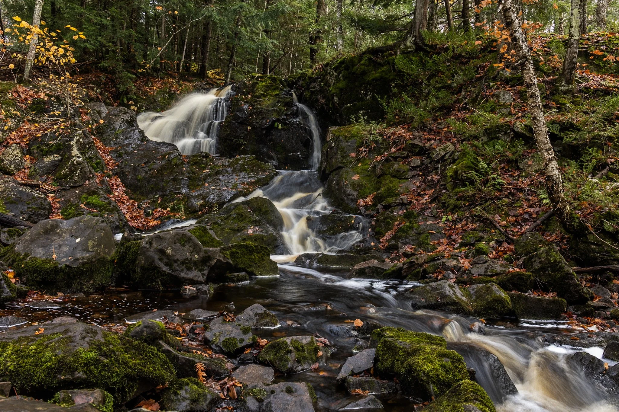
Located near Twin Lakes State Park, Wyandotte Falls finds its source from the Misery River in the Keweenaw Peninsula. The falls consist of a series of short cascades rocky ledges in a quiet, forested setting. The falls create an atmosphere that is reminiscent of a fairy tale forest.
This long exposure required the balancing of my tripod on the river rocks to get the composition that showed its varied pathways. Fall always adds something to a scene like this, and after chasing loud, roaring waterfalls all day, this was a serene end to the day.
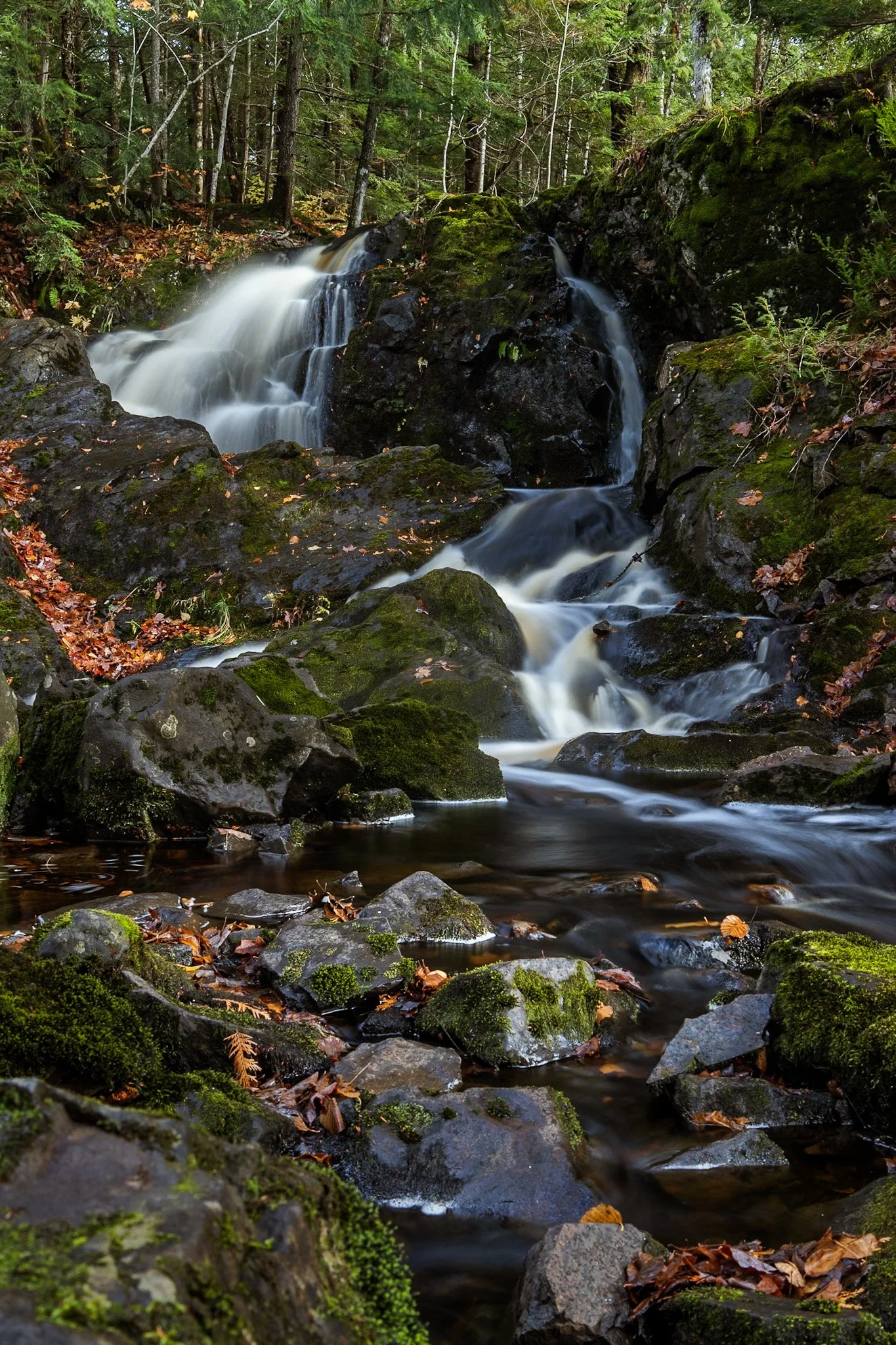
Located near Twin Lakes State Park, Wyandotte Falls finds its source from the Misery River in the Keweenaw Peninsula. The falls consist of a series of short cascades rocky ledges in a quiet, forested setting. The falls create an atmosphere that is reminiscent of a fairy tale forest.
This long exposure required the balancing of my tripod on the river rocks to get the composition that showed its varied pathways. Fall always adds something to a scene like this, and after chasing loud, roaring waterfalls all day, this was a serene end to the day.

Starved Rock State Park in LaSalle County, Illinois transforms into a stunning winter landscape, and its waterfalls freeze into towering columns of ice. These frozen waterfalls are a major seasonal attraction, drawing hikers, photographers, and ice climbers to the park’s deep sandstone canyons.
Formed by melting snow and natural springs, the waterfalls normally flow through narrow cliff faces, but in winter, they become massive ice formations, sometimes reaching over 80 feet tall. The contrast between the icy formations and the ancient, rust-colored rock walls creates a dramatic and otherworldly scene.
This photo required some careful maneuvering to get to the right position as well as making sure my tripod stayed stable on the ice. Taken earlier in my career, I had not come to appreciate the magic of crampons when navigating slick ice.
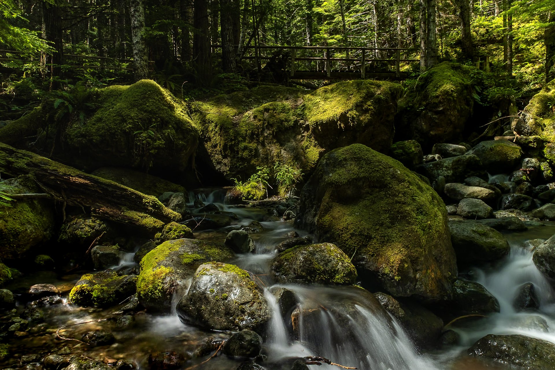
The Staircase area of Olympic National Park is a lesser known area of the park, tucked away along the southeastern edge of the park, near Lake Cushman. It’s known for old-growth forest, moss-draped trees, and multiple rivers flowing through.
This was my third time to Olympic National park and each trip continues to reveal more of its beauty. I stayed in a tiny home near Lake Cushman, which offered early morning access to the trails in the surrounding area.
This particular photo was taken on the Staircase Rapids Loop which follows the Skokomish River through the dense rainforest. Capturing both the cascade and one of the countless bridges crossing the river puts on display the sheer amount of greenery to be found in the only rainforest in the lower 48.
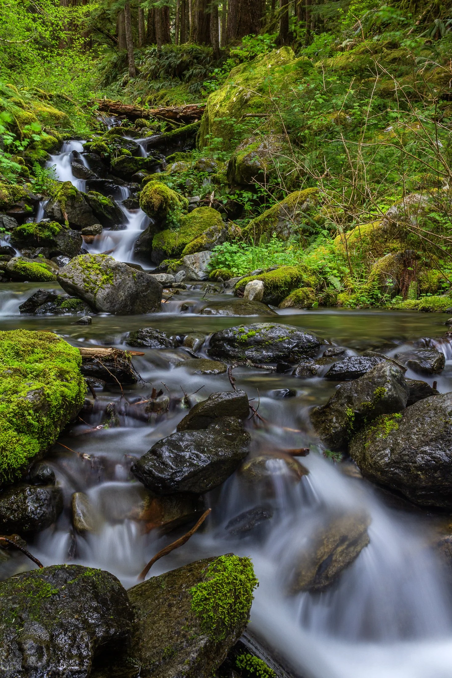
Enchanted Valley, dubbed the “Valley of 10,000 Waterfalls” requires a 15 mile hike through the Quinault Rainforest in Olympic National Park. It is one of the few rainforest in the United States, and receives 140-167 inches of rain per year. The precipitation leaves Olympic National Park with one of the most biodiverse ecosystems in the United States.
The Enchanted Valley Chalet at the end of the trail was built in 1931 and was originally meant to be a rustic lodge for hikers. Eventually it transformed into a monitoring station during WW2 to scout for potential Pacific Coast enemy threats. After the war it returned to its original purpose for backpackers and rangers.
The trail crosses many streams on the way to the chalet allowing us to forgo storing water for the hike while backpacking and instead drink the glacial melt from the streams via a LifeStraw. I have not tasted water better than that before or since.

Enchanted Valley, dubbed the “Valley of 10,000 Waterfalls” requires a 15 mile hike through the Quinault Rainforest in Olympic National Park. One of the few rainforest in the United States, it receives 140-167 inches of rain per year. The precipitation leaves Olympic National Park with one of the most biodiverse ecosystems in the United States.
The Enchanted Valley Chalet at the end of the trail was built in 1931 and was originally meant to be a rustic lodge for hikers, eventually being used during WW2 to monitor potential Pacific Coast enemy threats. After the war it returned to its original purpose for backpackers and rangers.
The area is known for a surplus of black bears, and during our time there over two nights, we were mere visitors in their home. It is not the easiest thing to retire to your tent with a 400 pound black bear scrounging for berries outside it!
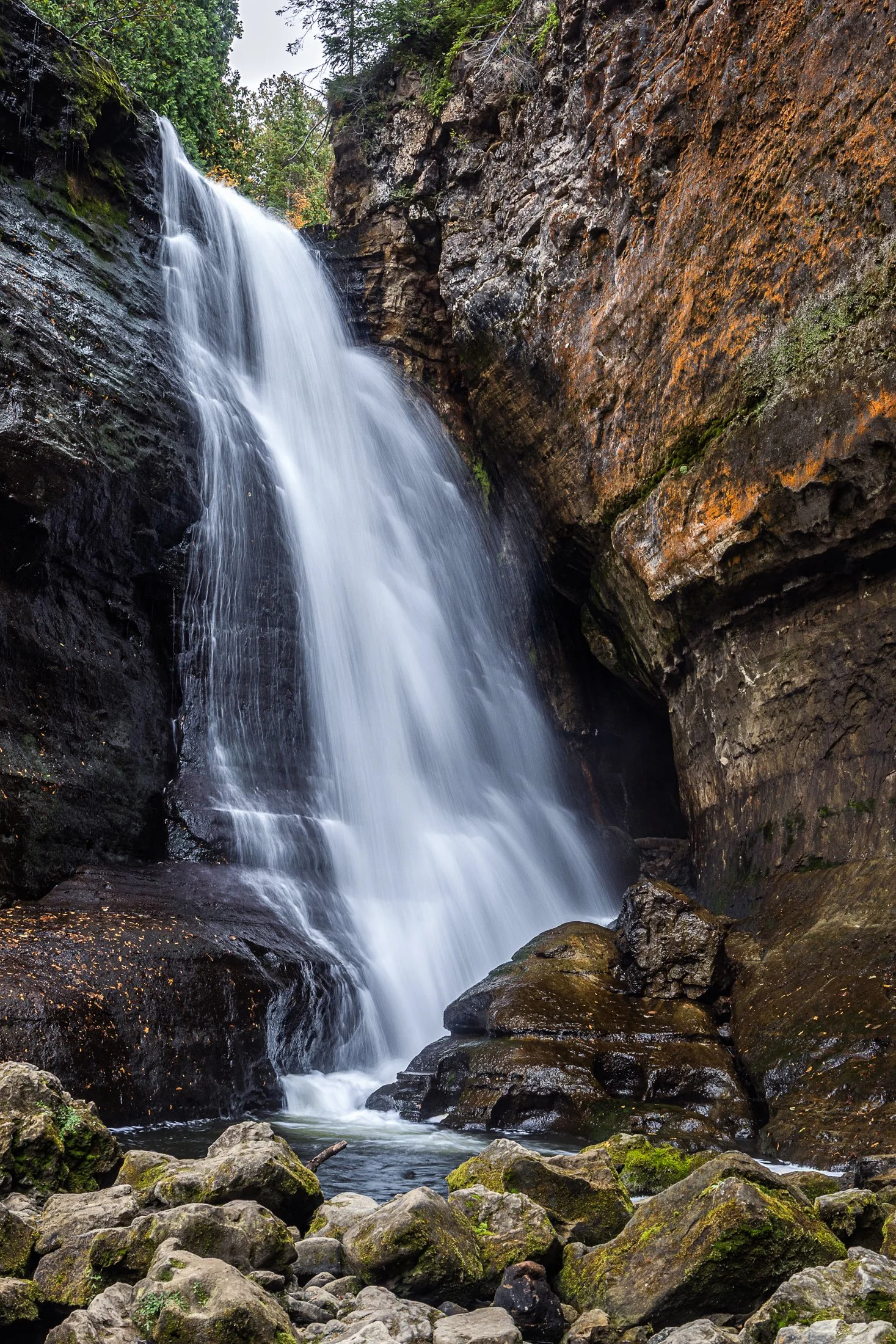
Pictured Rocks National Lakeshore, located near Munising, Michigan, offers up some of the best waterfalls in the Midwest. This, coupled with saturated colors during the dramatic fall foliage, make it a fall vacation spot for many a midwesterner.
The name Miners Falls derives from the local mining history around the area during the 19th century copper boom. The waterfall along with the nearby Pictured Rocks became a big tourist attraction following the decline of the mining industry there.
The continual downpour of this water was amazing to witness. While a fast shutter speed would have captured the pure force of this fall, I found the slower shutter speed revealed its picturesque beauty.

Wallace is fascinating quaint mining town with a rich history, located in the Rocky Mountain area of Idaho.
During the late 1800’s it was a thriving silver mining town but The Great Fire of 1910 almost destroyed it. Ed Pulaski, a fire fighter who saved the lives of all but one of his 42 man crew as well as 2 horses by navigating the ravine later invented the Pulaski tool, considered one of the most important fire fighting tools to this day.
I grabbed this photo while hiking this fairy tale trail that is unique in its presentation of signs as you hike telling the story of Pulaski rescuing his troop from The Great Fire by hiding in a mining tunnel. This tunnel is the final destination of the hike.
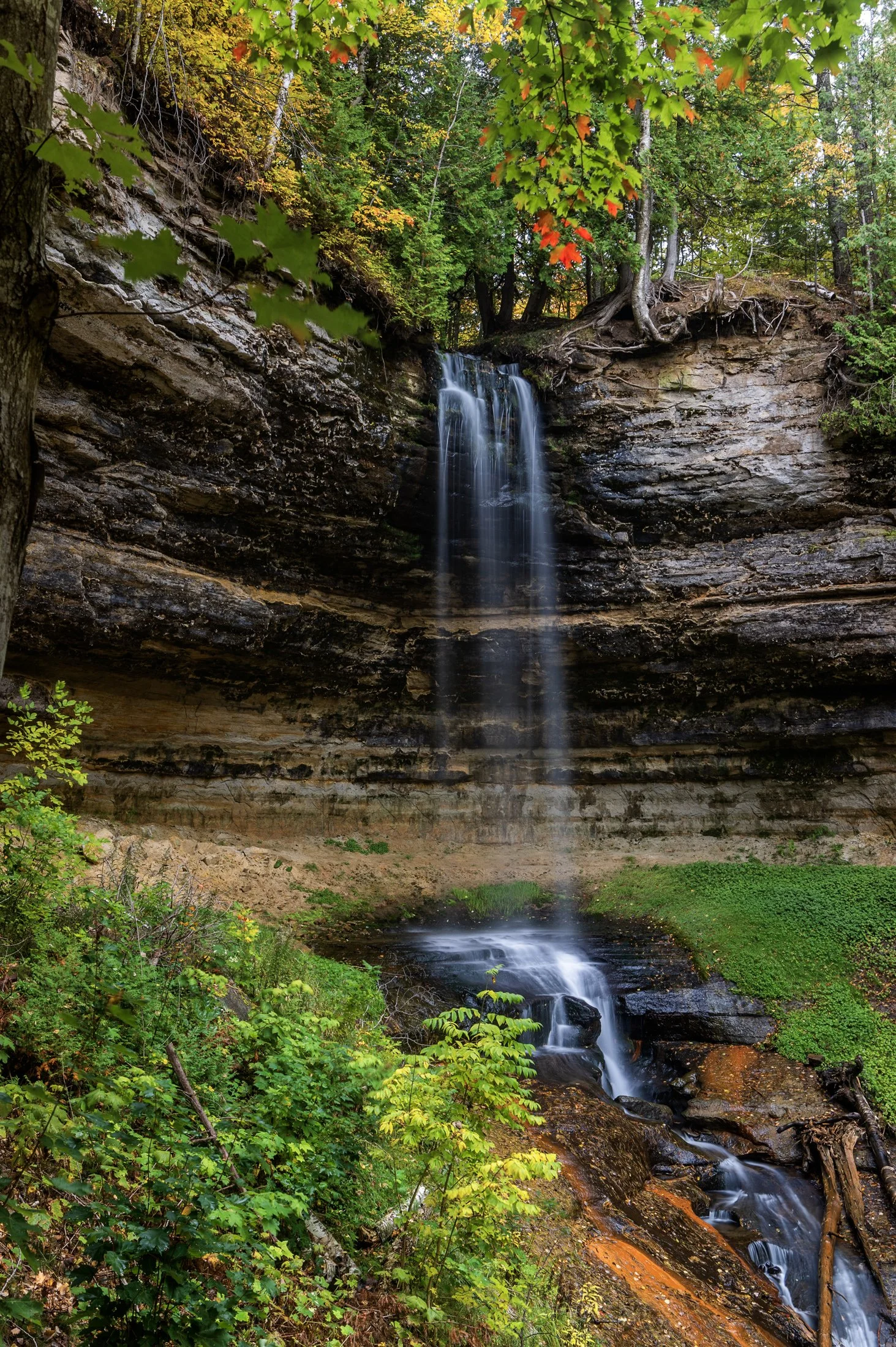
Pictured Rocks National Lakeshore, located outside of Munising, Michigan, offers up some of the best waterfalls in the Midwest. This, paired with the unbelievable colors that arise during peak fall season, make it a top travel destination.
Right near the town of Munising, the eponymous falls are easily accessible with a viewing area for all ages. A paved trail leads directly to the falls directly from the Pictured Rocks Visitors Center.
The peak foliage against these historically picturesque falls accentuated this long exposure, complimenting the beauty of the surrounding sandstone valley, formed through extensive periods of erosion.

Artist’s Point is one of the most spectacular places to view the Grand Canyon of the Yellowstone. Located on the south rim, it offers one of the most iconic views in the entire park — a dramatic panorama of the Lower Yellowstone Falls framed by the colorful, rugged canyon walls.
It was originally thought, though it may be another nearby location, to be the location where artist Thomas Moran sketched his famous images during the 1871 Hayden Expedition, which helped lead to Yellowstone’s designation as the first National Park.
This photograph required an early wakeup call while the roads were still covered in a thick grey fog. When we arrived it was finally beginning to burn off, and the yellows of the morning sun coated this beautiful jagged canyon in light.

The Indian Peaks Wilderness is a protected wilderness area in north-central Colorado, encompassing approximately 73,931 acres within the Arapaho and Roosevelt National Forests, as well as a portion of Rocky Mountain National Park.
Established by Congress in 1978, it offers a pristine natural environment characterized by rugged granite peaks, glacially carved valleys, and over 50 alpine lakes.
Hiking up to Lone Eagle Peak was one of the most tiring hike of my life, due to my added camera weight while backpacking, but the trek was more than worth it. This was taken right as we were leaving the area, and luckily I turned around to see this composition encapsulating all that makes this wilderness truly unique.

Pictured Rocks National Lakeshore and the surround area offer up some of the best waterfalls in the Midwest as well as countless other sights sprinkled throughout the area.
Mosquito Falls at Pictured Rocks National Lakeshore can be found while meandering on your way to the famous Chapel Rock. The falls are fed by the Mosquito River which draws from the area’s streams and swamps eventually emptying into Lake Superior.
This photo required some scrambling into the basin and then balancing my tripod legs precariously on different sections of a log, keeping my hands close by during the exposure in case it fell, a lesson I had learned years earlier photographing in a cave.

Mirror Lake near Granby, Colorado, is a pristine alpine gem nestled in the Indian Peaks Wilderness, offering a breathtaking reflection of the dramatic Lone Eagle Peak.
Accessible via a scenic hike from Monarch Lake, Mirror Lake sits at an elevation of over 10,000 feet and is renowned for its crystal-clear waters and tranquil setting. The lake is a popular destination for backpackers, photographers, and nature lovers seeking a true backcountry experience in the wilderness.
While this was one of the most tiring hikes of my life, due to my added camera weight while backpacking, the trek was more than worth it. For this shot I traversed some large boulders to position myself on a small island to get the right angle for this shot.

Pictured Rocks National Lakeshore and the surround area offer up some of the best waterfalls in the Midwest as well as an incredibly diverse ecosystem including huge cliffs, expansive beaches, towering sand dunes, rocky shores, and freshwater sea caves.
Mosquito Falls, pictured here, appears on the ten mile round trip hike to Chapel Rock. The falls are fed by the Mosquito River which draws from the area’s streams and swamps eventually emptying into Lake Superior.
This photo required some scrambling to get down into the basin as well as balancing my tripod legs precariously on a downed log, keeping my hands close by during the exposure in case it fell into the river from a small shake. A lesson from a mishap years earlier in a cave.

Artist’s Point is one of the most spectacular places to view the Grand Canyon of the Yellowstone. Located on the south rim, it offers one of the most iconic views in the entire park — a dramatic panorama of the Lower Yellowstone Falls framed by the colorful, rugged canyon walls.
It was thought, although it may be another location nearby, to be the location where artist Thomas Moran sketched his famous images during the 1871 Hayden Expedition, which helped lead to Yellowstone’s designation as the first National Park.
This photograph required an early wakeup call while the roads were still covered in a thick grey fog. When we arrived it was finally beginning to burn off, and the yellows of the morning sun coated this beautiful jagged canyon in light.

Hiking the Cascade Canyon Trial in Grand Teton National Park is nothing short of epic. The sheer size of these mountains makes one feel very, very small. The trail runs along Cascade Creek where one can see various wildlife such as moose, bear, and deer.
Snowmelt in the spring and early summer provides vital water for rivers and streams in the Jackson Hole valley and surrounding areas. The Snake River, which runs through the region, is largely fed by snowmelt from the Grand Teton and surrounding mountains.
This shot was an attempt to show the sheer scale of Tetons as I had tried to show a moose against the backdrop and it was a mere speck in the foreground and yet this still does not do justice to the scale of these mountains.

Hidden Falls of Grand Teton National Park is one of the first things you may miss after jumping on Inspiration Point Trailhead after a ferry ride across Jenny Lake as the trail is not one that stands out.
This area is immensely popular in the summer as the Jenny Lake Trail intersects with it leading to Inspiration Point. This lookout point looks out over Jenny Lake and the surrounding distances that seem to continue on forever.
This waterfall was in full force due to the snowmelt from the winter and to get this particular vantage point involved a bit of scrambling. In the back corner you can see the Teton range extending further into the park.
Smalley Falls, located in the Chequamegon National Forest of northern Wisconsin, is known for its serene and scenic beauty. Part of the Brule River, these falls are not as widely known as some of the others in the region, making it a particularly peaceful spot to visit.
The region is primarily composed of ancient Precambrian rock formations, some of the oldest on Earth, dating back about 1.6 to 2.6 billion years. Glacial till, which consists of a mixture of soil, clay, sand, and gravel, can be found in the area, deposited by the retreating glaciers that once covered much of Wisconsin. This sediment supports the lush vegetation and forest ecosystem surrounding Smalley Falls.
This particular composition required some scrambling and, again, careful positioning of my tripod legs on various levels of rocks to allow for the long exposure. This area immediately transported my mind to the lush forests of the Pacific Northwest, a site not often found in the Midwest landscape.