

Lakes

Lakes
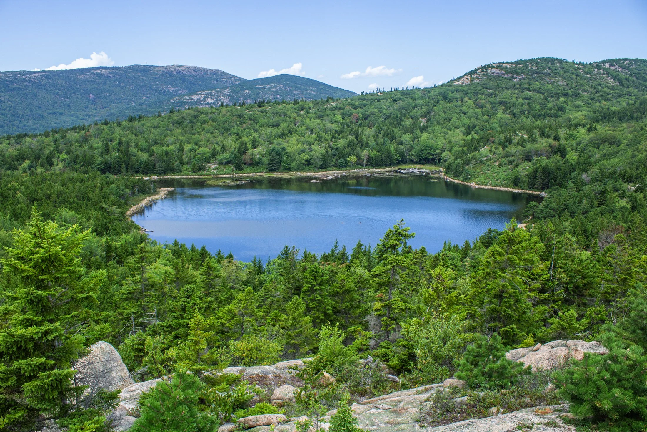
Acadia National Park, located southwest of Bar Harbor, is as picturesque as a national park can be. The varied terrain presents itself as one thing and then transforms into another. Known for its rugged coast and rocky cliffs, the national park offers a variety of hiking trails, loops, and climbs giving you a different perspective every direction you look.
This pond, known as The Bowl, was formed by glacial activity like many of the features in Acadia. This left a rounded, shallow basin surrounded by hills and rocky outcrops such as the one this photo was taken from.
Following a hike from our campsite a few miles away, we were able to avoid parking debacle Acadia is often known for. Climbing the precarious Beehive Trail, we were affording stunning views of the Atlantic Ocean on one side, and this picturesque lake on the other.
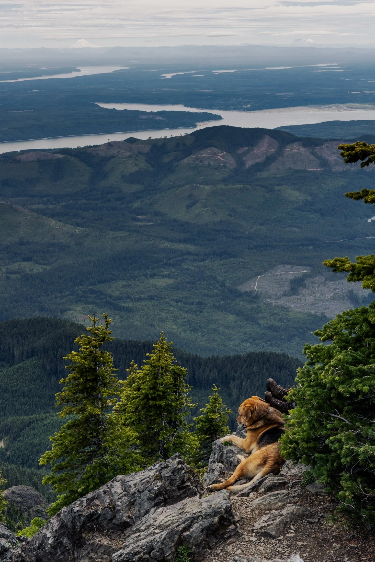
Mount Ellinor is part of the southeastern Olympic Mountains in western Washington state. The mountain is a beautiful one and shows clear signs of past glaciers.
During the ice ages, glaciers carved out the valleys and sharpened the ridges around the area. The views of Lake Cushman become even more amazing when you realize the whole area was shaped by ice and water
This particular photo was taken right after reaching the summit. On the way down I came across curious scene when turning a corner. The boots sticking out next to the owners dog felt like something out of a Dr. Seuss book. This quick snap reminded me dogs hike too.

From above, Chicago’s famous grid system becomes a kind of urban quilt, stitched with rivers, highways, and rails. The skyline, punctuated by towers like the Willis Tower (though for Chicagoans it will forever be known as the Sears) and the St. Regis, rises like a great sculpture.
The city’s architecture seamlessly incorporates styles ranging from Gothic Revival and Art Deco to International and Postmodern, all layered along the river and gridded streets. Notable landmarks like Marina City, the Tribune Tower, and buildings by Frank Lloyd Wright create a living timeline of American design.
This photograph was taken while departing for O’Hare, heading toward New York. This was the tail-end of a storm and the cumulonimbus clouds gave a staggering scale of the sky in relation to the city, one which will forever remain my home.

The lone white pine on Chapel Rock, located in Pictured Rocks National Lakeshore, is estimated to be about 250 years old. There once was an archway connecting the rock to the mainland but it collapsed in the 1940s.
Chapel Beach and the mouth of Chapel River is adjacent to Chapel Rock, and is popular backcountry campground and hiking destination, offering a secluded beach as well as access to many waterfalls.
After a long day of backpacking, I set up camp and filtered water from Lake Superior while setting up this shot. The mouth of the Chapel River is pictured here, showing the diversity of this picturesque environment that has been a source of wonder for centuries.

“Time is, time was, but time shall be no more.”
- James Joyce (Portrait of an Artist as a Young Man) -

Mirror Lake near Granby, Colorado, is a pristine alpine gem nestled in the Indian Peaks Wilderness, offering a breathtaking reflection of the dramatic Lone Eagle Peak.
Accessible via a scenic hike from Monarch Lake, Mirror Lake sits at an elevation of over 10,000 feet and is renowned for its crystal-clear waters and tranquil setting. The lake is a popular destination for backpackers, photographers, and nature lovers seeking a true backcountry experience in the wilderness.
While this was one of the most tiring hikes of my life, due to my added camera weight while backpacking, the trek was more than worth it. After making camp the previous night, this day involved traversing the surrounding area. I found this view summed up the vibe of this surreal setting.

Crater Lake, located in Southern Oregon, feels too big for a single frame. I struggled to fathom its size while I stared at it. And the blue reflected by that lake one of the most saturated blues I’ve ever seen in nature.
This deep blue comes a myriad of factors but, two big ones are the fact that the lake’s source is almost entirely snowfall and rainfall leading to very little sediment. The other factor is how deep the lake is. Crater Lake is a whopping 1,943 feet, leading to more pronounced absorption of wavelengths other than blue.
I felt it deserved its own frame.

Door County is a travel destination for many a midwesterner. The area is known for its limestone cliffs, wineries, shops, and much more.
The limestone bluffs surrounding the region are the remnants of the Niagara Escarpment, a 1000-mile long slope of rock from 400-500 million years ago that resists the faster erosion of other type of rocks such as sandstone.
This shot reminded me once again of all the things that make the Midwest truly unique.

The lone white pine on Chapel Rock, located in Pictured Rocks National Lakeshore is estimated to be about 250 years old. There once was an archway connecting the rock to the mainland but it collapsed in the 1940s.
Chapel Beach and the mouth of Chapel River is adjacent to Chapel Rock. The area invites hikers and boaters to linger, and a popular backcountry campground is found here, offering a secluded beach and access to many waterfalls.
After a long day of hiking, taking this sunset boat tour along Pictured Rock’s coast was a perfect way to end the day. It allowed stunning views as well as completely unique photographic perspectives not possible from the shore.
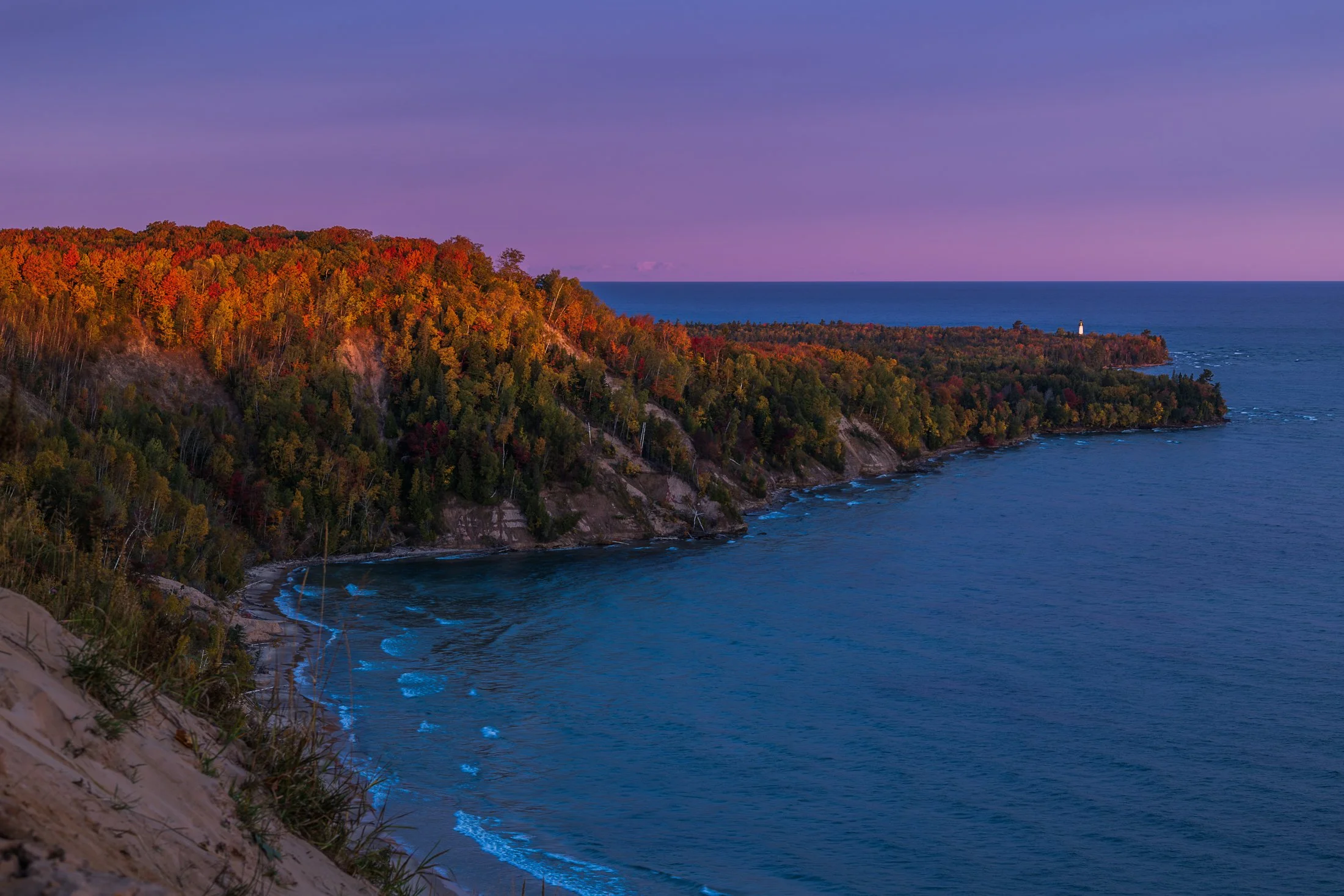
The fall colors of Pictured Rocks National Lakeshore are one of the marvels of the Upper Peninsula, especially in the early morning. Pictured here is the Au Sable Light, a lighthouse that was built in 1874 to prevent shipwrecks on Lake Superior.
The shoreline in this area is considered one of North America's most beautiful, but was once considered the most deadly areas for ships due to rocks under the shallow surface, violent storms, and frequent fog.
Requiring an early wakeup call, this photo involved positioning myself precariously on the shifting sands of the Grand Sable dunes before the sunrise. The changing color over the next hour was an amazing sight to behold as well as the moment the light broke across this stretch of coast.

Mirror Lake near Granby, Colorado, is a pristine alpine gem nestled in the Indian Peaks Wilderness, offering a breathtaking reflection of the dramatic Lone Eagle Peak.
Accessible via a scenic hike from Monarch Lake, Mirror Lake sits at an elevation of over 10,000 feet and is renowned for its crystal-clear waters and tranquil setting. The lake is a popular destination for backpackers, photographers, and nature lovers seeking a true backcountry experience in the wilderness.
While this was one of the most tiring hikes of my life, due to my added camera weight while backpacking, the trek was more than worth it. For this shot I traversed some large boulders to position myself on a small island to get the right angle for this shot.

Wizard Island is a volcanic cinder cone located within Crater Lake National Park. Crater Lake is the result of the eruption of an ancient volcanic named Mount Mazama, which erupted 7,700 years ago.
This eruption is what formed the caldera that is Crater Lake with Wizard island appeared later from subsequent lava flows into the lake. Visitors can even take seasonal boat tours to the island and hike to the summit.
Planning to camp for the night at Crater Lake, I showed up to a completely empty and snow-filled campground, leaving me to drive up to the lake, grab some photos, and move on to the next town. But that two hours I spend there were awe-inspiring. The blue in that lake is unlike any other found in nature.

Pictured Rocks National Lakeshore, located near Munising, Michigan, is known nationally as a tourist destination due to its dramatic bluffs overhanging Lake Superior, numerous waterfalls, and stunning fall foliage.
These bluffs, as well as the roads around Pictured Rocks, are accentuated by truly dramatic leaf color change for about two weeks in the fall, leading to a flock of photographers and tourists from all over the world.
Lake superior provided a the perfect complementary hue for these extremely saturated yellow leaves, a rare combination of color in nature.

The Grand Island East Channel Light was constructed in 1867 by the United States Lighthouse Service to help ships navigate the dangerous waters of the East Channel of Grand Island, which has historically been a busy route for steamships and commercial vessels.
The area was notorious for shipwrecks during the 1800s due to the complexity of the navigation and the strong currents in the surrounding waters. Decommissioned in the early 1970s the Lighthouse remains as an iconic stop on Pictured Rock Cruises.
While taking the cruise, I positioned myself on the outside seats to grab this photo, requiring a quick shutter speed and precise timing to get this compositon.

Crater Lake, located in Southern Oregon, in my humble opinion, is too big for a single frame—plain and simple. But the blue reflected back from the water it contains might be the purest saturation of blue I’ve ever seen in nature.
This deep blue comes a myriad of factors but, two big ones are the fact that the lake’s source is almost entirely snowfall and rainfall leading to very little sediment. The other factor is how deep the lake is. Crater Lake is a whopping 1,943 feet, leading to more pronounced absorption of wavelengths other than blue.
I arrived at Crater Lake a week after the road to the lake had been opened and the remnants of the snow were everywhere, a fact that altered my camping plans as the campground was deserted, but the two hours I spent at the lake were magical.
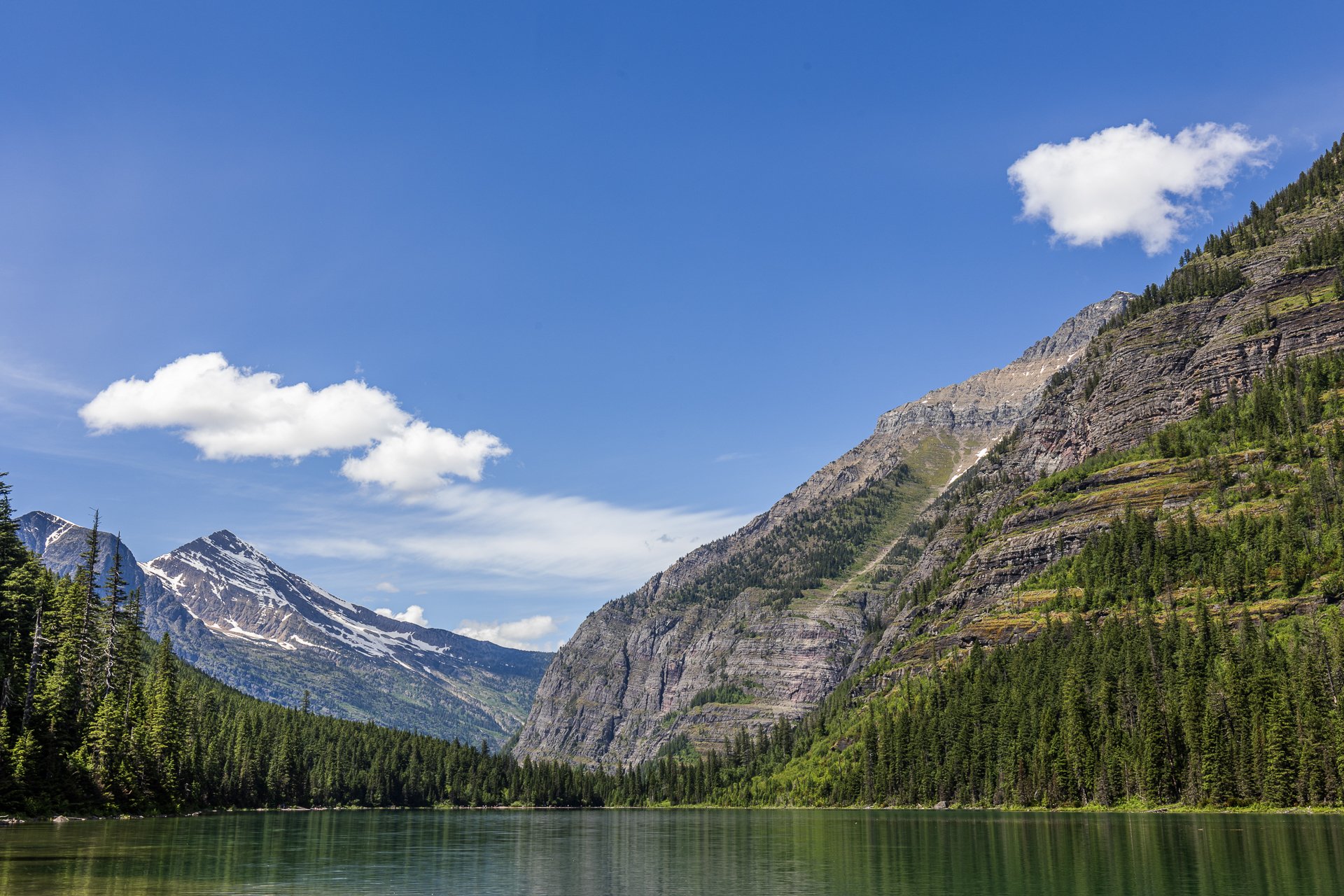
It’s very difficult to explain the expanse and epic nature of Glacier National Park to those who have not been, and even more difficult to encapsulate it in a photograph.
Avalanche Lake is one of the most popular hikes in the park, at 4.5 miles round trip, where you might have the chance to glimpse grizzly bears in their natural habitat. Named for the Avalanche Basin the lake sits in, avalanches are common in the winter and gives way to stunning view in the summer.
This photo required maneuvering into the wetlands, sacrificing a bit of dryness in my boots, and positioning my tripod on some rocks. When everything was set up, I was able to take in the magic of this area.
Lover’s Leap Arch, located in Pictured Rocks National Lakeshore, near Munising, Michigan, is one of the park's most iconic and photographed spots. The towering 200-foot cliffs and turquoise waters are often photographed from the local boat cruise and are rarely seen from this vantage point.
The cliffs colors, created by mineral staining, gives the area its "painted" appearance and inspiring the park’s name. According to Native American legend, Lover's Leap got its name from a heartbroken woman’s jump to her death after her lover’s failure to return from a journey.
Part of my 22-mile backpacking trip along cliff, this stormy day lead to Lake Superior’s waves continually crashing into the cliffs, often reaching their full height. These are the same storms that lead to the wreck of many ships, including the Edmund Fitzgerald.