
Best Sellers

Best Sellers
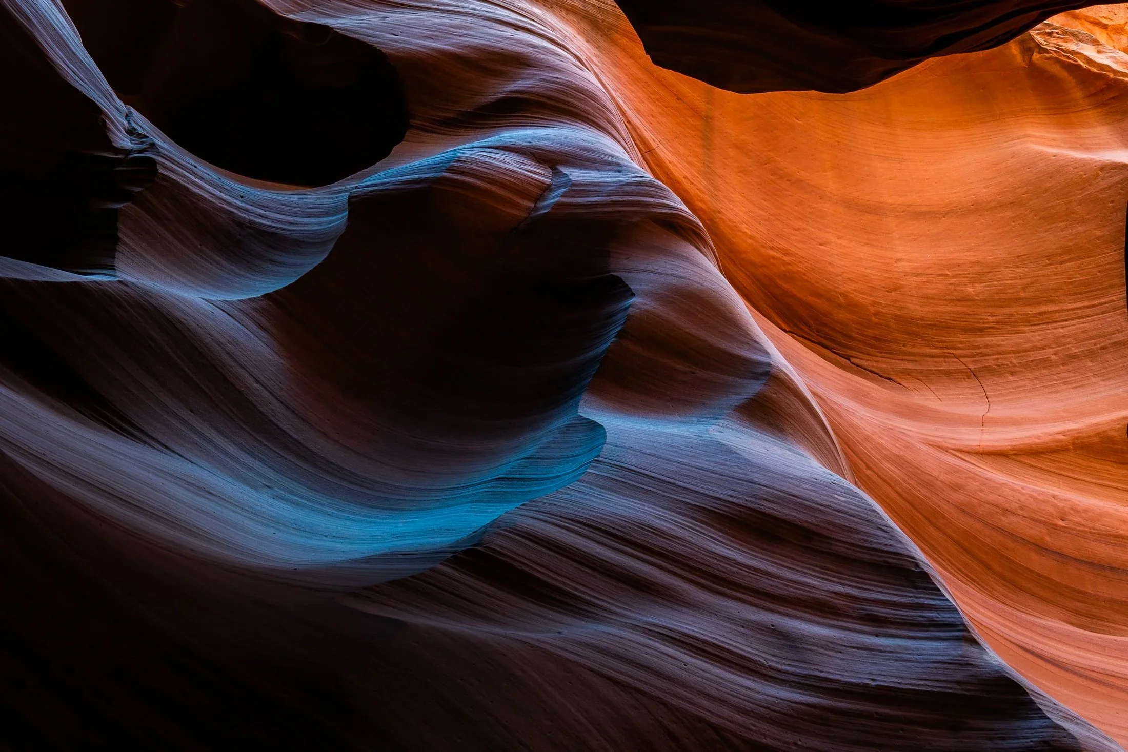
Antelope Canyon, located in northern Arizona within the Navajo Nation right outside the town of Page, is one of the most picturesque slot canyons in the world. Running over 23 miles, it was formed over millennia through consistent erosion, primarily through the actions of flash floods that sculpt the sandstone rock into smooth, undulating forms.
Having traveled to Page numerous times, I had always opted for Buckskin Gulch, another slot canyon in the area that resides on BLM land and does not require a paid tour. My fourth time in the area I decided to partake on a tour and the views did not disappoint. Guided by a local Diné (Navajo) tour guide, I was entreated to various stories of Navajo belief as well as given a private photography tour of the canyons.
The canyons continually conceal and reveal form throughout the day, as the sun follows its path across the sky. My tour followed a relatively short section of the greater Antelope Canyon, and yet I found I could have spent days here and never arrive at the same photo twice. This abstract section reinforces the stunning tonality and color nature creates in the shade of these canyons.

Enchanted Valley, dubbed the “Valley of 10,000 Waterfalls” requires a 15 mile hike through the Quinault Rainforest in Olympic National Park. One of the few rainforest in the United States, it receives 140-167 inches of rain per year. The precipitation leaves Olympic National Park with one of the most biodiverse ecosystems in the United States.
The Enchanted Valley Chalet at the end of the trail was built in 1931 and was originally meant to be a rustic lodge for hikers, eventually being used during WW2 to monitor potential Pacific Coast enemy threats. After the war it returned to its original purpose for backpackers and rangers.
The area is known for a surplus of black bears, and during our time there over two nights, we were mere visitors in their home. It is not the easiest thing to retire to your tent with a 400 pound black bear scrounging for berries outside it!
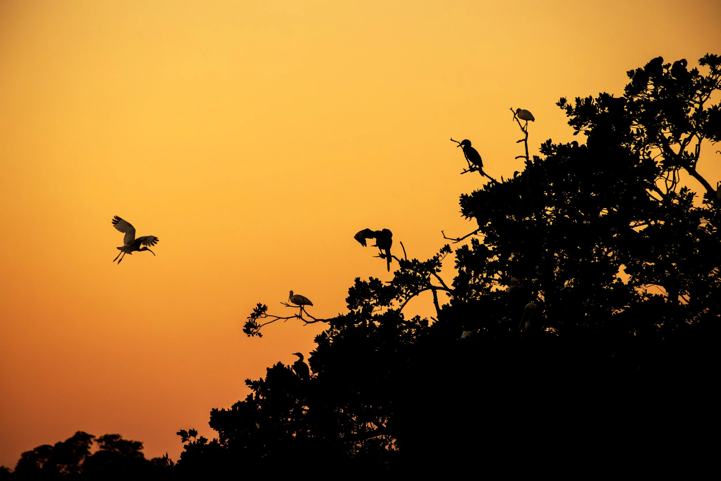
Everglades National Park is a park that doesn’t present itself as grandly as the others, it requires those with patience to see its true beauty.
Known colloquially at the “River of Grass”, the Everglades is one of the only ecosystems to house both alligators and crocodiles. It also contains one of the largest mangrove forests in the world and, due to the diverse ecosystem, all manner of birds make it their home.
I happened to be the lone passenger on as sunset Everglades boat tour and the captain was kind enough to veer off the usual course and tailor it to my photography. At the end of the tour, when he brought me to one of the mangrove rookeries these birds call home, an egret flew into frame and began its landing as I snapped the photo. It was a sunset I’ll never forget.
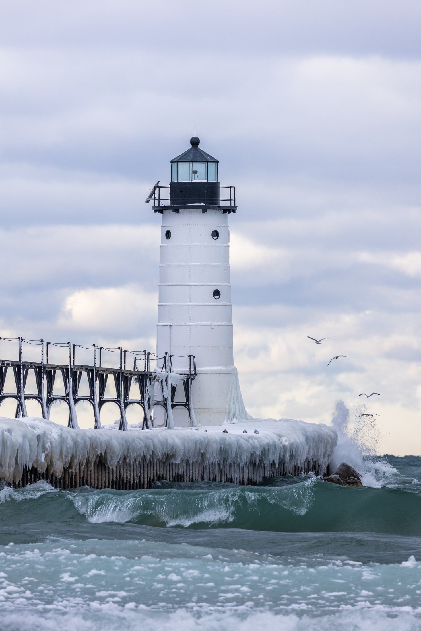
The Manistee North Pier Lighthouse, located in Manistee, Michigan, is as picturesque as any lighthouse can be.
Constructed in 1870, the wooden lighthouse was changed to steel in 1927, providing an important means of safely guiding ships in the lumber industry during the end of the 19th century.
This was my second visit to the Manistee Lighthouse, with both events being particularly cold days. This day just happened to be my birthday. The wind was fierce, and after setting up the shot, I was lucky enough to have some avian tourists enter my frame.
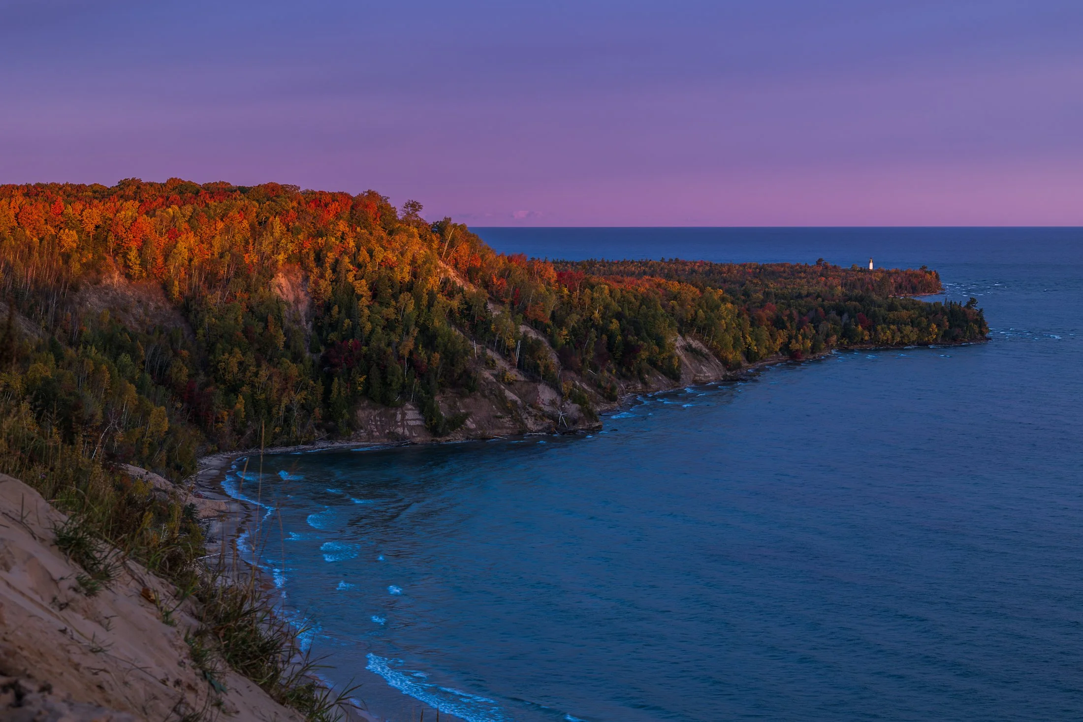
The fall colors of Pictured Rocks National Lakeshore are one of the marvels of the Upper Peninsula, especially in the early morning. Pictured here is the Au Sable Light, a lighthouse that was built in 1874 to prevent shipwrecks on Lake Superior.
The shoreline in this area is considered one of North America's most beautiful, but was once considered the most deadly areas for ships due to rocks under the shallow surface, violent storms, and frequent fog.
Requiring an early wakeup call, this photo involved positioning myself precariously on the shifting sands of the Grand Sable dunes before the sunrise. The changing color over the next hour was an amazing sight to behold as well as the moment the light broke across this stretch of coast.
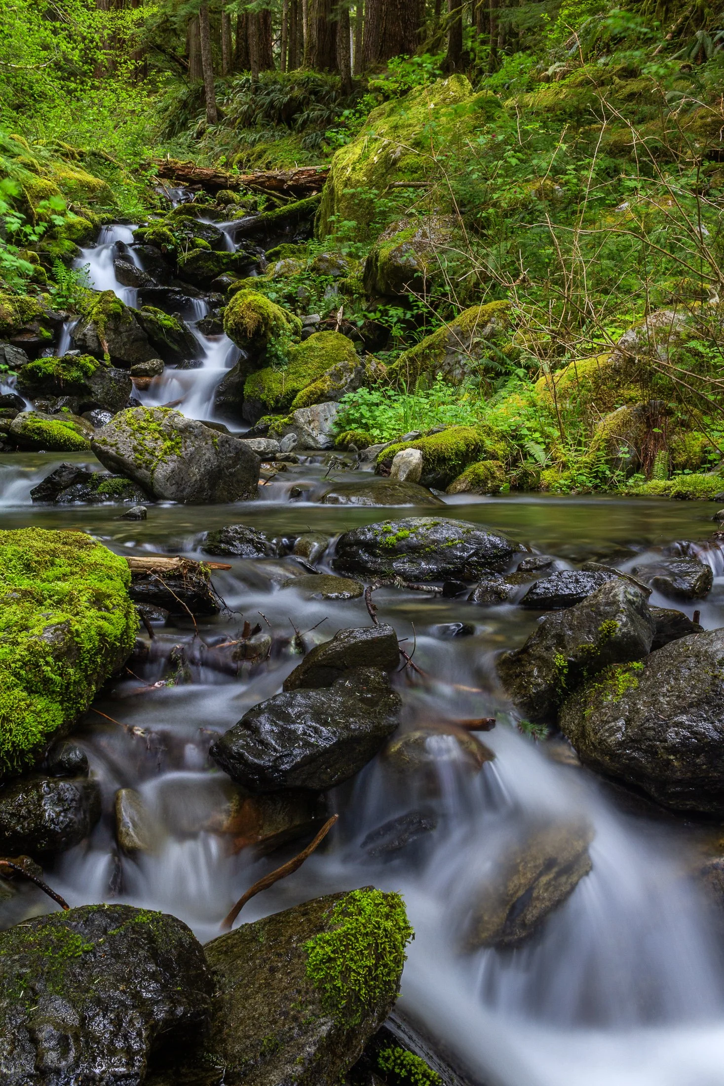
Enchanted Valley, dubbed the “Valley of 10,000 Waterfalls” requires a 15 mile hike through the Quinault Rainforest in Olympic National Park. It is one of the few rainforest in the United States, and receives 140-167 inches of rain per year. The precipitation leaves Olympic National Park with one of the most biodiverse ecosystems in the United States.
The Enchanted Valley Chalet at the end of the trail was built in 1931 and was originally meant to be a rustic lodge for hikers. Eventually it transformed into a monitoring station during WW2 to scout for potential Pacific Coast enemy threats. After the war it returned to its original purpose for backpackers and rangers.
The trail crosses many streams on the way to the chalet allowing us to forgo storing water for the hike while backpacking and instead drink the glacial melt from the streams via a LifeStraw. I have not tasted water better than that before or since.

The Palouse region, located in southeastern Washington and extending into portions of Idaho and Oregon, was originally home to the Palus people, historically known for breeding strong horses, but the U.S. government did not acknowledge them as a distinct tribe in the late 1800s as settlers arrived under the Homestead Act.
Indigenous communities were displaced, and the land was drastically reshaped by agriculture. The region’s deep loess soil and steep terrain led farmers to adopt contour plowing, giving the fields their signature flowing appearance.
Traveling through the Palouse region was an out of body experience. The word space took on a new meaning as I meandered through its rolling hills. This scene, found on one of the many gravel roads winding through the area, seemed to recall Bliss, photographed by Charles O’Rear in California.
Maybe Microsoft needs a new screensaver…

Early morning in Yellowstone National Park usually comes with thick fog. This fog is caused by the area’s geothermal activity where the warm moisture arising from the hot springs, geysers, and fumaroles meets the cool air of the early morning.
Orb-weaver spiders, known for their iconic wheel-shaped webs, exist in large numbers in the park, making the temperate geysers their home. Their intricate webs are a work of art, and when glistening in the morning dew, like the one pictured here, they reveal their true beauty.
This one appeared as I strolled the boardwalk of the mud pits in the early morning, and I immediately set up my tripod. This exact imagery is referenced in the allegory of Indra’s Net; the buddhist conception of the world.

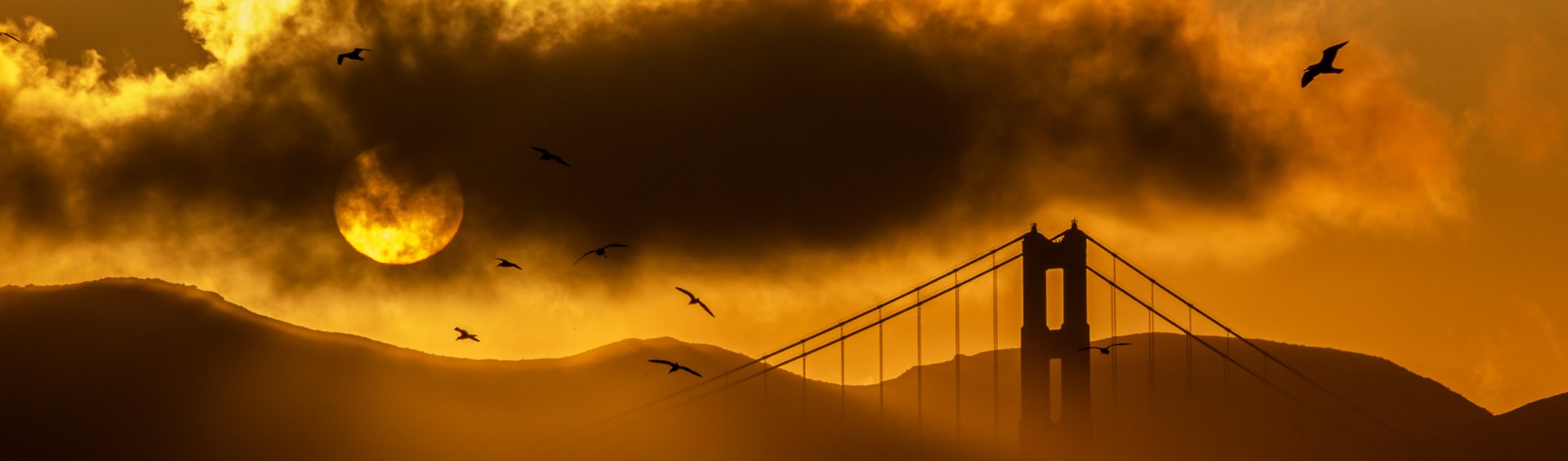
Opened in 1937, the Golden Gate Bridge is a marvel of modern engineering. Designed by one Joseph Strauss, the bridge was painted orange to help visibility through the common San Francisco fog. The bridge runs 1.7 miles in length and extends to a height of 746 feet.
Seagulls are a familiar presence around the Golden Gate Bridge. These large, intelligent birds are often seen soaring in the updrafts, perched on railings, or scavenging along the nearby shorelines
This shot was another case of being in the right place at the right time. Arriving at my hotel an hour before sunset completely spent from a full day drive along Big Sur, I dropped my bag in my hotel and immediately started walking towards the bridge. Miscalculating the distance it would take to reach the vantage point I had planned, this shot came as a result of randomly being in the right place at the right time.

Iconic, religious, Hollywood-graced, the West Mitten Butte watches over the land of Monument Valley, a stunning area residing along the Utah-Arizona border.
These buttes hold major religious significance for the Navajo. Legend holds they are the remains of great religious deities. Filmmaker John Ford found his home in Monument Valley, countless westerns there with John Wayne, with the Mittens featuring prominently in such films as “The Searchers” (1956) and have now become icons of the American West.
Monument Valley maintains one of the best campsites I’ve ever had the pleasure of camping at, and it is a perfect one for photographing the Mittens. The campsite sits atop a sand band looking straight out towards The Mittens, evoking a drive-in movie theater, replacing the screen with one of the best views in the West.

Mount Hood is an iconic stratovolcano located just outside Portland, Oregon in the Cascade Range. Standing at 11,240 feet, it is the highest peak in Oregon and one of the most recognizable mountains in the Pacific Northwest.
Visible from miles around, the mountain is often in full view from Portland, Oregon, located about 50 miles to the west, and offers up near perfect symmetry and a towering presence.
Only visiting for a day and having the Japanese Gardens planned for the next morning, I had not planned to photograph this day as a stop in Portland requires me to make the rounds at Powell Books, Blue Moon Camera, and Music Millennium, but I after I got back, I decided to walk up the street from my Airbnb at sunset and found myself in the perfect location to capture this magnificent mountain.
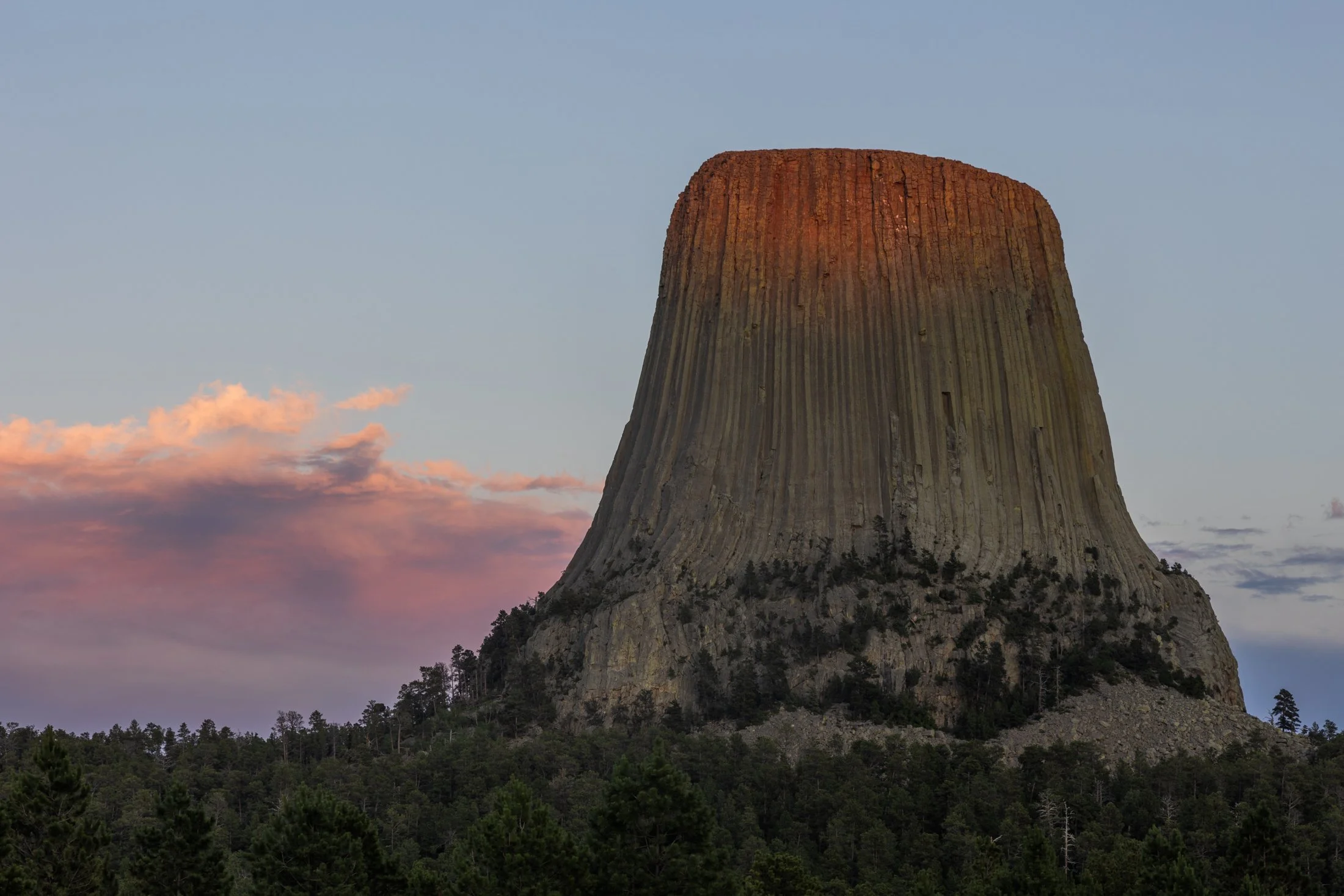
Standing at 867 feet tall, Devil’s Tower, located in eastern Wyoming, has been a sacred site for Native Americans for centuries as well as being featured prominently in “ Close Encounters of the Third Kind” (1977).
The Lakota tribe refers to it as Mato Tipila, roughly translating to “Bear Lodge”. One narrative surrounding its formation involves two girls attempting to escape a large bear by scurrying up a rock formation. The Great Spirit, seeing their plight, rose the rock high into the air to protect them. As the bear attempted to reach them, he clawed the sides of the rock, which formed the basalt columns seen today.
After renting a cabin at the nearby KOA, where “Close Encounters of the Third Kind” is shown every night in front of the monolith, I drove to the southern side at sunset to capture the light slowly fading from the tower. While standing there I could only think one thought; the energy of this land is palpable.

From above, Chicago’s famous grid system becomes a kind of urban quilt, stitched with rivers, highways, and rails. The skyline, punctuated by towers like the Willis Tower (though for Chicagoans it will forever be known as the Sears) and the St. Regis, rises like a great sculpture.
The city’s architecture seamlessly incorporates styles ranging from Gothic Revival and Art Deco to International and Postmodern, all layered along the river and gridded streets. Notable landmarks like Marina City, the Tribune Tower, and buildings by Frank Lloyd Wright create a living timeline of American design.
This photograph was taken while departing for O’Hare, heading toward New York. This was the tail-end of a storm and the cumulonimbus clouds gave a staggering scale of the sky in relation to the city, one which will forever remain my home.

The Grand Teton mountain range is one of the most breathtaking views in the contiguous United States. The main faulting that formed the range occurred around 10 million years ago during the Miocene epoch.
Since then, the range has continued to rise while the Jackson Hole basin has subsided, deepening the valley. This valley has become an idyllic vacation spot for many tourists during the summer months.
The road leading from the east to Grand Teton National Park is a one of the most spectacular ways to be introduced to the Tetons, and this one point perspective on US Route 26 provided the perfect example.

Yellowstone is home to the largest free-ranging bison population in the U.S., offering a rare glimpse into their natural behavior in the wild.
They live in majestic matriarchal family herds where the experienced older cows provide protection, social structure, and learning opportunities for younger bison while the bulls often live alone or in bachelor groups, joining the family herds during the summer mating season.
Wild bison in the US once ran into the millions but were almost hunted to extinction in the 1800s. Yellowstone now serves as a sanctuary for these creatures, but their protection must constantly be guarded, for while humans have the ability to eradicate nature, they also have the ability to preserve it.
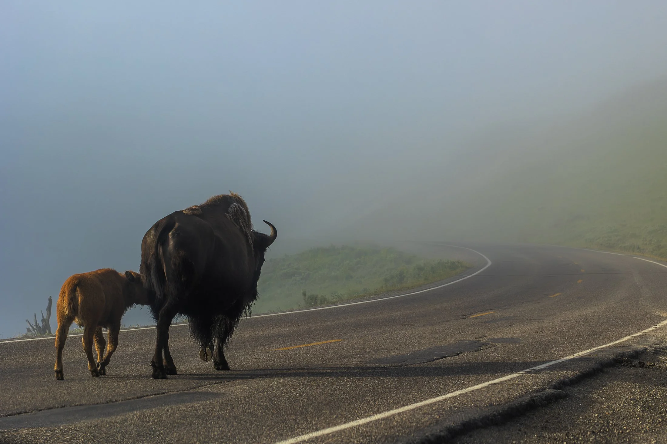
Yellowstone is home to the largest free-ranging bison population in the U.S., offering a rare glimpse into their natural behavior in the wild. Wild bison in the US once ran into the millions but were almost hunted to extinction in the 1800s. Yellowstone now serves as a sanctuary for these creatures.
They live in majestic matriarchal family herds where the experienced older cows provide protection, social structure, and learning opportunities for younger bison while the bulls often live alone or in bachelor groups, joining the family herds during the summer mating season.
When visiting Yellowstone, it becomes readily apparent we are visitors in their home. Traffic is frequently stopped to allow these bison to pass on the road. This shot came from one such instance as the bison herd migrated to the other side of the road.
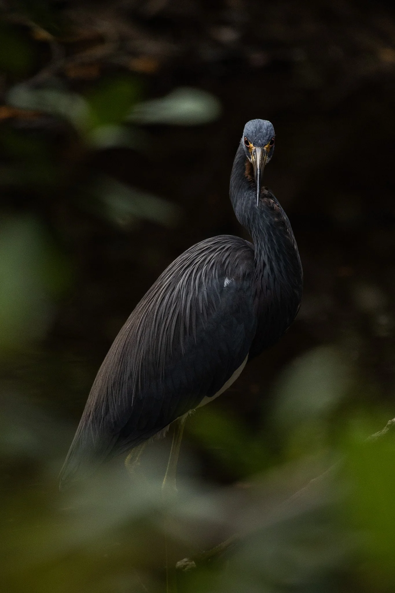
The Tricolored Heron is known for its vibrant plumage, with dark shades of blue, purple. It is an expert hunter, often employing a unique technique where it attracts prey by creating a contrast with its bright chest feathers in the water.
They are social creatures, often found hunting in groups and nesting in colonies with other wading birds. During breeding season, their plumage becomes even more colorful with long, elegant plumes on their heads and necks.
This specific heron was found on a lone dirt road surrounded by trees and swamp on each side. The birds here seem to enjoy a secluded paradise meandering among the Everglades swampy foliage. This guy noticed my lens and gave me a beautiful glare during a moment of soft light creeping through the shadowy of the swamp.

Cumberland Island National Seashore, located near St. Marys, Georgia, is a pristine 18 mile stretch of undeveloped wilderness unique to the East Coast. The island is known for its feral horses, possibly left over from the Spaniards during the 1700s.
The island has a long history, and was once owned by the Carnegie Family who then dedicated the island to the National Park Service in 1972. The island has faced various threats to its wilderness status over the years and has been defended through the continuous efforts of Carol Ruckdeschel, one of the few persons allowed to live on the island.
I arrived at Plum Orchard Mansion for a tour of the defunct Carnegie mansion dedicated in 1898. The area is frequented by the wild horses (technically feral) of the island. I was lucky enough to capture this black stallion bathed in light, highlighting its beauty if not also its complicated existence.

The Palouse region, located in southeastern Washington and extending into portions of Idaho and Oregon, was originally home to the Palus people, historically known for breeding strong horses, but the U.S. government did not acknowledge them as a distinct tribe in the late 1800s as settlers arrived under the Homestead Act.
Indigenous communities were displaced, and the land was drastically reshaped by agriculture. The region’s deep loess soil and steep terrain led farmers to adopt contour plowing, giving the fields their signature flowing appearance.
I raced the descending sun following a long drive from Seattle, arriving just in time to catch the sunset atop Steptoe Butte, the one elevated area among the farmland. I set up next to a group of amateur photographers taking a class led by a knowledgeable local — which brings me to an interesting detail about the Palouse: I only encountered two types of people there — farmers and photographers. There might not be a better place to learn photography.
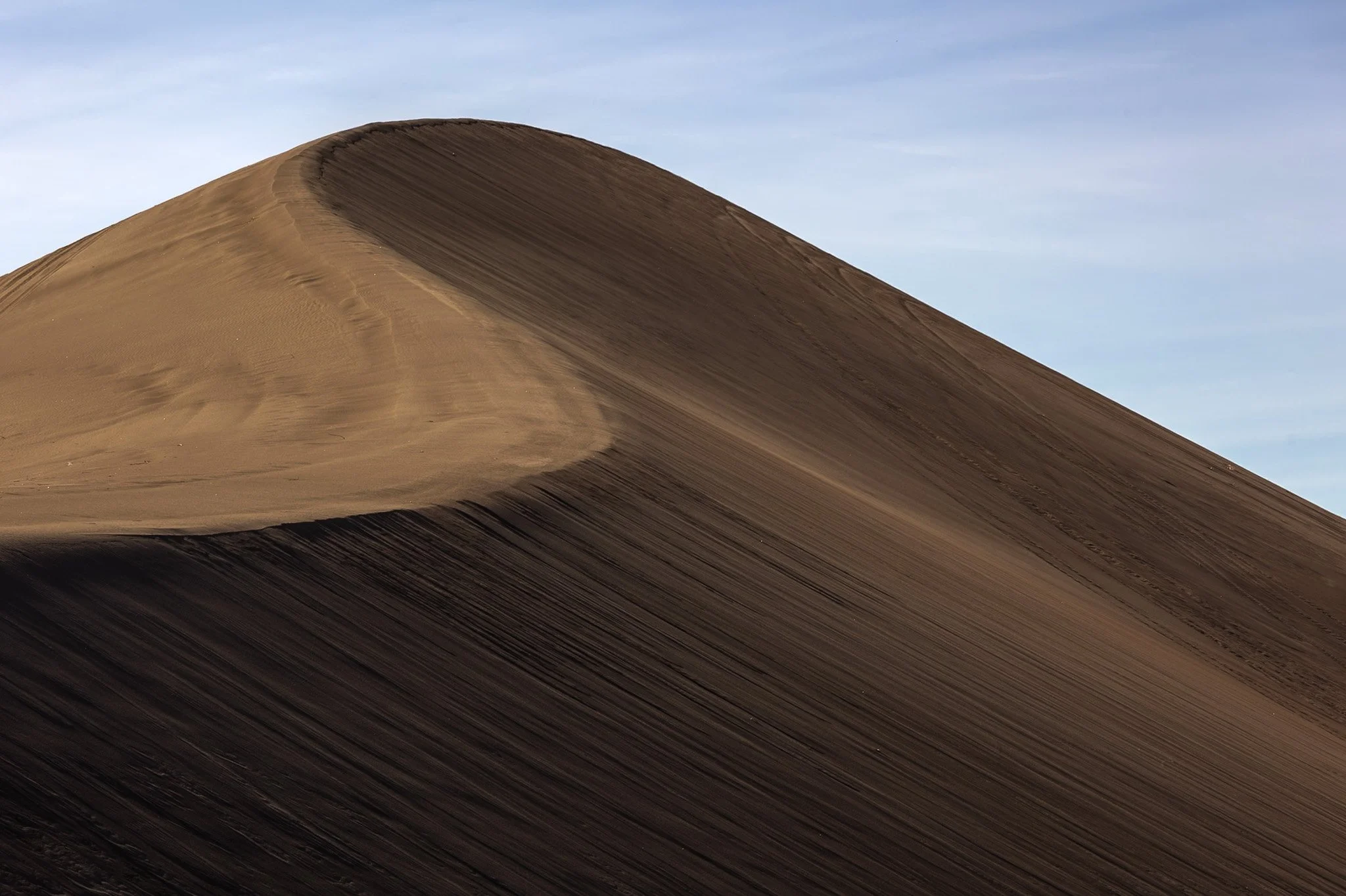
The dunes in and around Death Valley are primarily shaped by wind, which picks up and transports sand particles across the valley floor. Sediment from surrounding mountains supplies the sand forming these natural features.
The wind's constant movement reshape the dunes, causing them to shift across the valley, often forming barchan dunes which hold crescent shapes, such as the one seen here.
I found this specific dune formation completely deserted (excuse the pun) in the early morning. Walking to the base of it, it was tough not to be struck by the gigantic sense of time, space, and form the area offers up. This telephoto capture isolated its gentle untouched waves towering on the horizon from miles away.

Wizard Island is a volcanic cinder cone located within Crater Lake National Park. Crater Lake is the result of the eruption of an ancient volcanic named Mount Mazama, which erupted 7,700 years ago.
This eruption is what formed the caldera that is Crater Lake with Wizard island appeared later from subsequent lava flows into the lake. Visitors can even take seasonal boat tours to the island and hike to the summit.
Planning to camp for the night at Crater Lake, I showed up to a completely empty and snow-filled campground, leaving me to drive up to the lake, grab some photos, and move on to the next town. But that two hours I spend there were awe-inspiring. The blue in that lake is unlike any other found in nature.
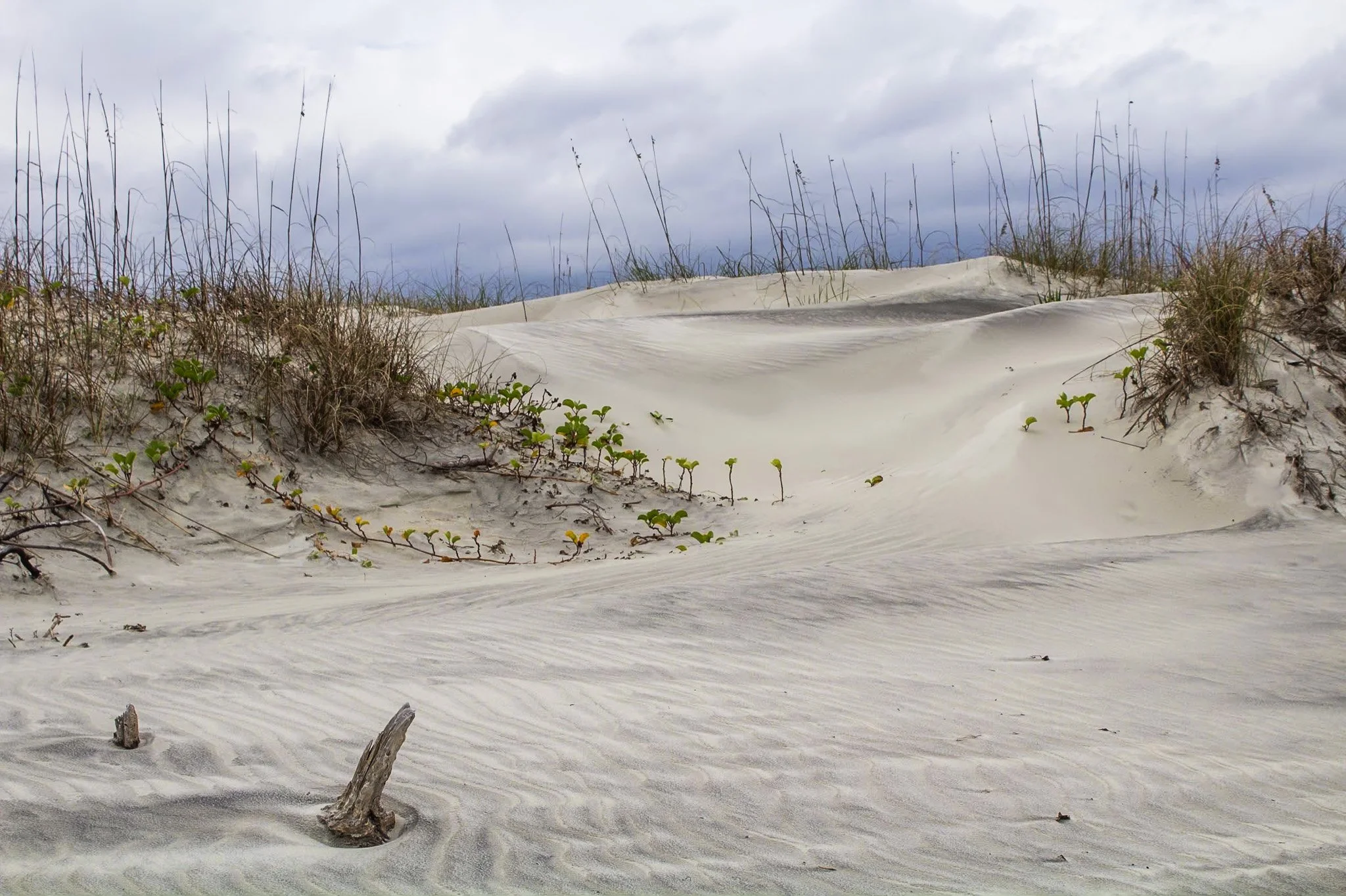
This photo was from my first visit to Cumberland Island National Seashore, located on the border of Georgia and Florida with access via a Ferry from St. Marys, Georgia. I would revisit this same island four years later, affording me the opportunity to finally explore all 18 miles of it.
The beach here is pristine, a stark comparison to the islands directly north and south of it which have been developed for residential and tourist activities. The island has faced various threats to its wilderness status and has been defended through the constant efforts of Carol Ruckdeschel, one of the few persons permitted to live on the island, and who I had the pleasure of meeting randomly on my second visit.
This photo was taken in the early morning on an overcast day following my sunrise shoot, and the feel of this specific patch of sprawling dunes system felt like something out of a painting.

The Heceta Head Lighthouse, built in 1894, is one of the most photographed lighthouses in Oregon, if not the United States, and remains operational as a navigational aid. One of the original light keepers' houses still stands nearby and now serves as a bed-and-breakfast.
The wildlife here is rife with sea lions, harbor seals, and migrating gray whales often seen from the headland, especially during the spring and winter migration seasons, as well as numerous seabirds who make the cliffs their home.
The waves that slam into the cliffs on a windy day, like the one captured here, shows the sheer force of nature at work. I took this as the mist continually covered my lens, requiring me to wipe it between each exposure as I waited for the rogue wave to strike.
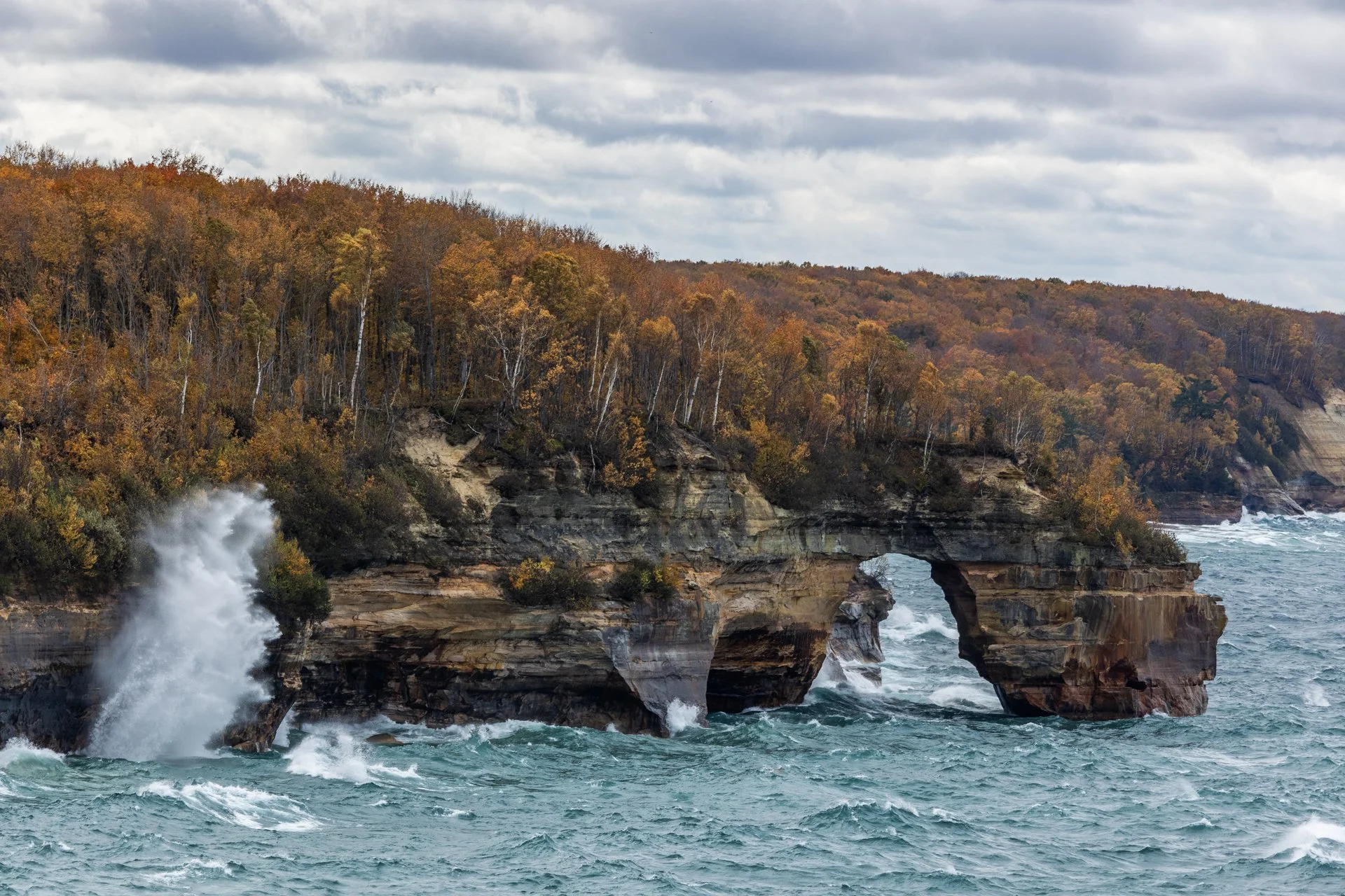
Lover’s Leap Arch, located in Pictured Rocks National Lakeshore, near Munising, Michigan, is one of the park's most iconic and photographed spots. The towering 200-foot cliffs and turquoise waters are often photographed from the local boat cruise and are rarely seen from this vantage point.
The cliffs colors, created by mineral staining, gives the area its "painted" appearance and inspiring the park’s name. According to Native American legend, Lover's Leap got its name from a heartbroken woman’s jump to her death after her lover’s failure to return from a journey.
Part of my 22-mile backpacking trip along cliff, this stormy day lead to Lake Superior’s waves continually crashing into the cliffs, often reaching their full height. These are the same storms that lead to the wreck of many ships, including the Edmund Fitzgerald.
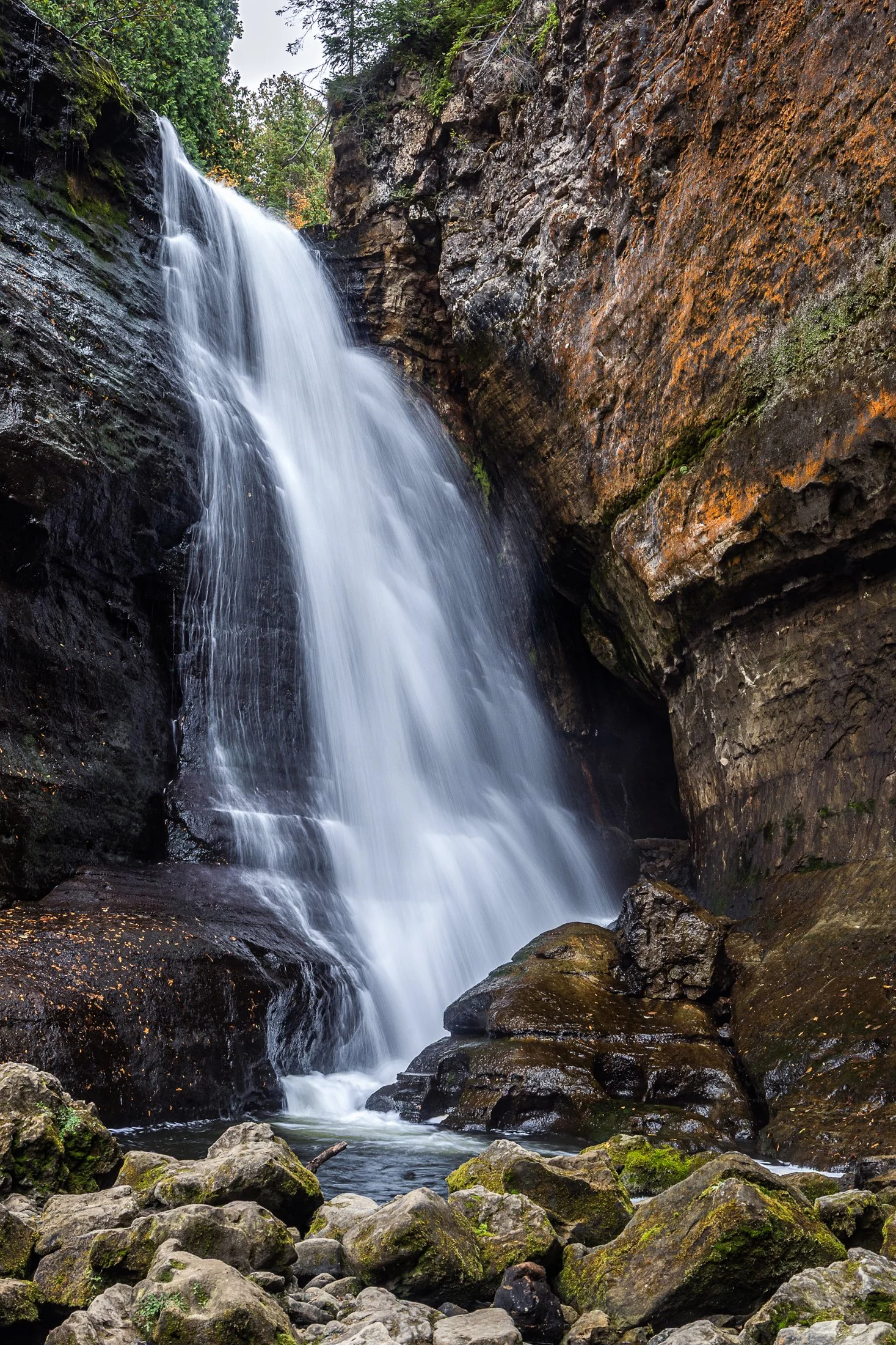
Pictured Rocks National Lakeshore, located near Munising, Michigan, offers up some of the best waterfalls in the Midwest. This, coupled with saturated colors during the dramatic fall foliage, make it a fall vacation spot for many a midwesterner.
The name Miners Falls derives from the local mining history around the area during the 19th century copper boom. The waterfall along with the nearby Pictured Rocks became a big tourist attraction following the decline of the mining industry there.
The continual downpour of this water was amazing to witness. While a fast shutter speed would have captured the pure force of this fall, I found the slower shutter speed revealed its picturesque beauty.

The Grand Island East Channel Light was constructed in 1867 by the United States Lighthouse Service to help ships navigate the dangerous waters of the East Channel of Grand Island, which has historically been a busy route for steamships and commercial vessels.
The area was notorious for shipwrecks during the 1800s due to the complexity of the navigation and the strong currents in the surrounding waters. Decommissioned in the early 1970s the Lighthouse remains as an iconic stop on Pictured Rock Cruises.
While taking the cruise, I positioned myself on the outside seats to grab this photo, requiring a quick shutter speed and precise timing to get this compositon.
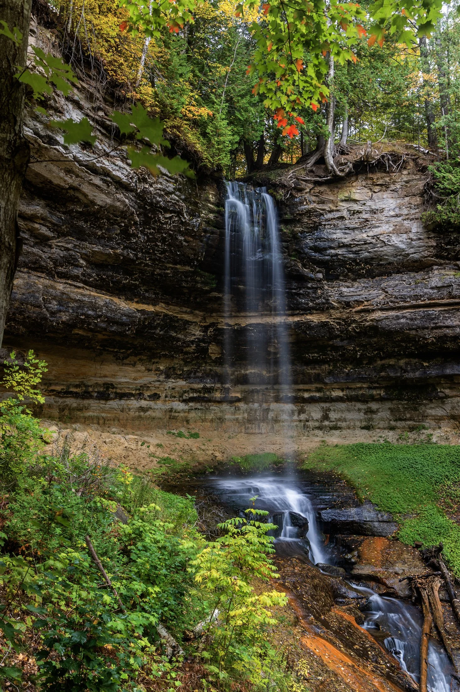
Pictured Rocks National Lakeshore, located outside of Munising, Michigan, offers up some of the best waterfalls in the Midwest. This, paired with the unbelievable colors that arise during peak fall season, make it a top travel destination.
Right near the town of Munising, the eponymous falls are easily accessible with a viewing area for all ages. A paved trail leads directly to the falls directly from the Pictured Rocks Visitors Center.
The peak foliage against these historically picturesque falls accentuated this long exposure, complimenting the beauty of the surrounding sandstone valley, formed through extensive periods of erosion.

The Palouse region, located in southeastern Washington, extending into Idaho and Oregon was originally home to the Palus people. The area was transformed in the 1800s as settlers arrived under the Homestead Act.
Indigenous communities were displaced, and the land was reshaped by agriculture. The region’s deep loess soil and steep terrain led farmers to adopt contour plowing, giving the fields their signature flowing appearance.
Traveling through the Palouse region was an out of body experience. The word space takes on a new meaning as you meander through its rolling hills. The vibrant colors and different stages of tilling make each turn unique. Finding the form and color of this hillside fascinating, I decided it was worthy of its own frame.
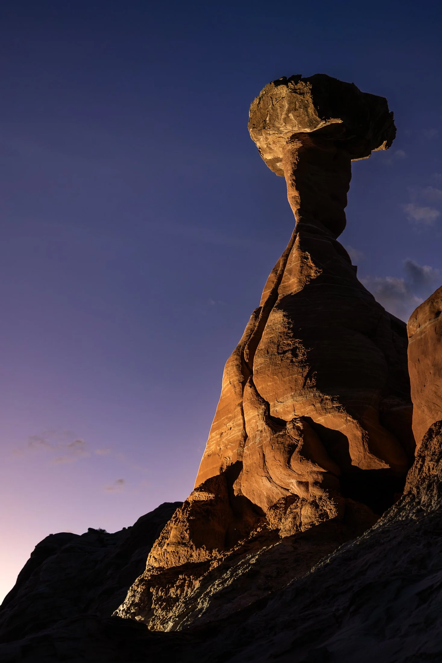
The Toadstool Hoodoos, located outside of Kanab, Utah and Page, Arizona, are part of the greater Grand Staircase-Escalante National Monument. The trail is unassuming, located at a small turnoff on Highway 89. The trail to the hoodoos meanders through the valleys of small eroded plateaus with large amounts of scree covering the area.
These unique formations find their creation from the Dakota Sandstone boulders that sit atop the Entrada Sandstone pedestals. Once the softer Entrada Sandstone erodes, the Dakota Sandstone resides leaving a cap, like a mushroom, on top.
This photo was taken after a group of friends and I decided to stop off here for sunset following a particularly exhausting 8 mile hike through Buckskin Gulch. With the setting sun providing enough darkness for me to use my off camera flash, I channeled my inner studio photographer and directed my friend where to hold the flash to best reveal its form, giving rise to magnificent colors and striations against the purple hue of the setting sun.
The cornfields near Polo, IL follow twists and turns as the land enters the Driftless Area. It is here where the sinuous and hilly terrain begin to take over. This area, and Illinois in general, is a very prominent agricultural hub for a variety of crops.
This particular area is one I have revisited often, and is part of an ongoing seasonal series yet to be published. This specific scene reminded me of something out of the film Fargo, with the delicate blanket of snow covering the fertile soil beneath.
The composition of this lone tree set against the distant row of trees in the background provided the proper depth for the open spaces these farmlands offer. Previously a historic route to Galena, this picturesque area was rift with natural prairie prior to its transformation for agricultural purposes, but the beauty still remains.