

Coasts

Coasts
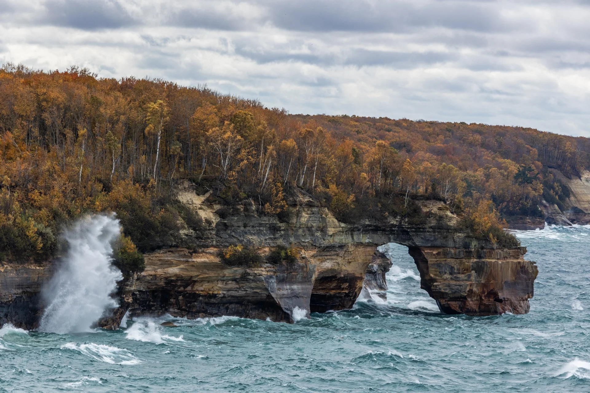
Lover’s Leap Arch, located in Pictured Rocks National Lakeshore, near Munising, Michigan, is one of the park's most iconic and photographed spots. The towering 200-foot cliffs and turquoise waters are often photographed from the local boat cruise and are rarely seen from this vantage point.
The cliffs colors, created by mineral staining, gives the area its "painted" appearance and inspiring the park’s name. According to Native American legend, Lover's Leap got its name from a heartbroken woman’s jump to her death after her lover’s failure to return from a journey.
Part of my 22-mile backpacking trip along cliff, this stormy day lead to Lake Superior’s waves continually crashing into the cliffs, often reaching their full height. These are the same storms that lead to the wreck of many ships, including the Edmund Fitzgerald.
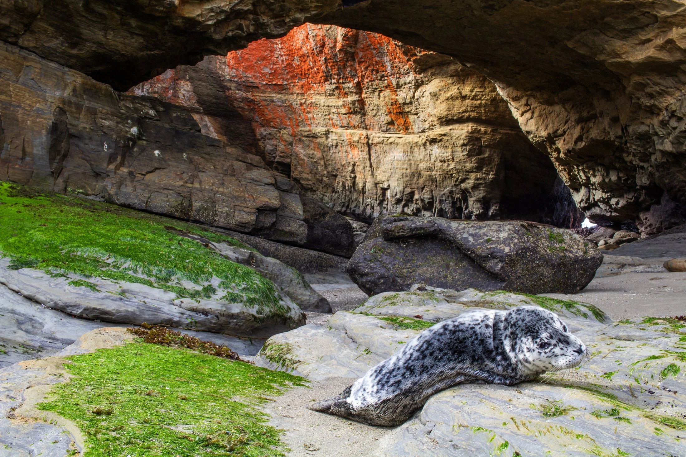
Oregon has been experiencing an uptick in sea lion strandings, particularly along the central and northern coasts. In the fall of 2023, the Oregon Marine Mammal Stranding Network reported several daily calls about sick or dead sea lions.
In Oregon, while pups do sometimes rest alone on beaches naturally, the rising number of reports of lethargic or underweight pups reflects broader ecological challenges. Many of these cases are related to malnutrition, toxins from algal blooms, or disease outbreaks like leptospirosis.
This little guy made my heart pang after running into it when walking into the Devil’s Punchbowl at low tide. There was no one around and I was not sure of the situation until a local apleated and said this was a strange site. We called the OMMSN, and they said it was most likely a mother leaving its pup while it forged some food. The local promised to keep an eye out for a couple hours to see if the mother returned while I pushed on to Portland.
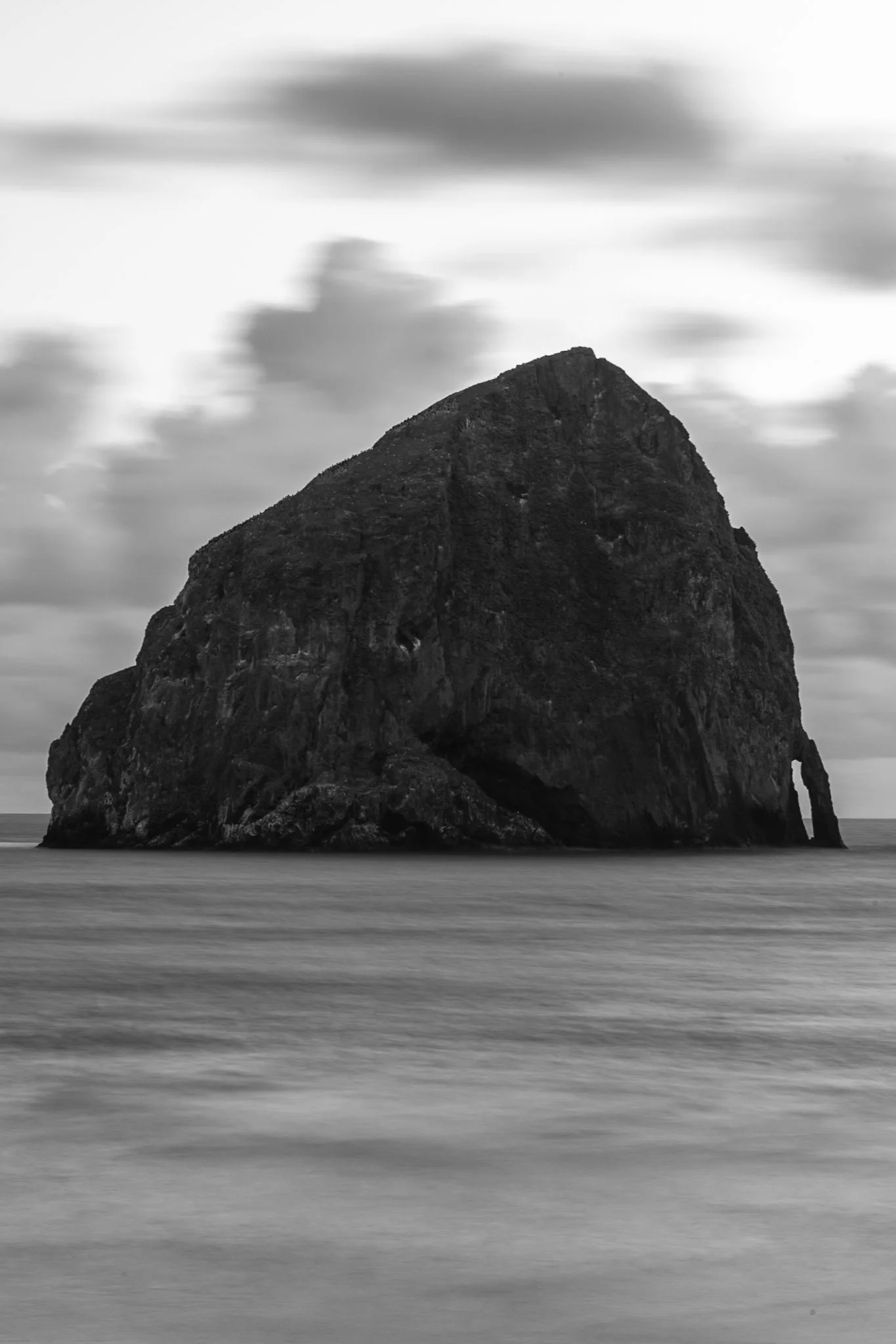
Haystack Rock near Pacific City, also known as Chief Kiwanda Rock, is an enormous sea stack located just offshore from Cape Kiwanda in Pacific City, Oregon.
Standing approximately 327 feet, it is one of the tallest sea stacks on the Oregon coast, even taller than the more famous Haystack Rock in Cannon Beach.
This was taken during a bustling evening near the Pelican Brewing Company, where patrons dined as the light broke through at golden hour, giving way to these stunning clouds behind the sea stack. After taking a sunset shot, I found the solitary nature of the rock against the ocean waves fascinating and wanted a visual that gave a sense of its unmoving nature over the past 17 million years.

Haystack Rock near Pacific City, also known as Chief Kiwanda Rock, is an enormous sea stack located just offshore from Cape Kiwanda in Pacific City, Oregon.
While setting up my long exposure settings and checking for sensor spots, I inadvertently captured this image that I did not review until I was back home editing.
There are certain abstract images that stick with me due to either the juxtaposition of form, or an undefinable impressionist quality. This image, taken at 1/10th of a second, brought to mind the world’s continual turn without the need for our recognition, endless fleeting moments in time.
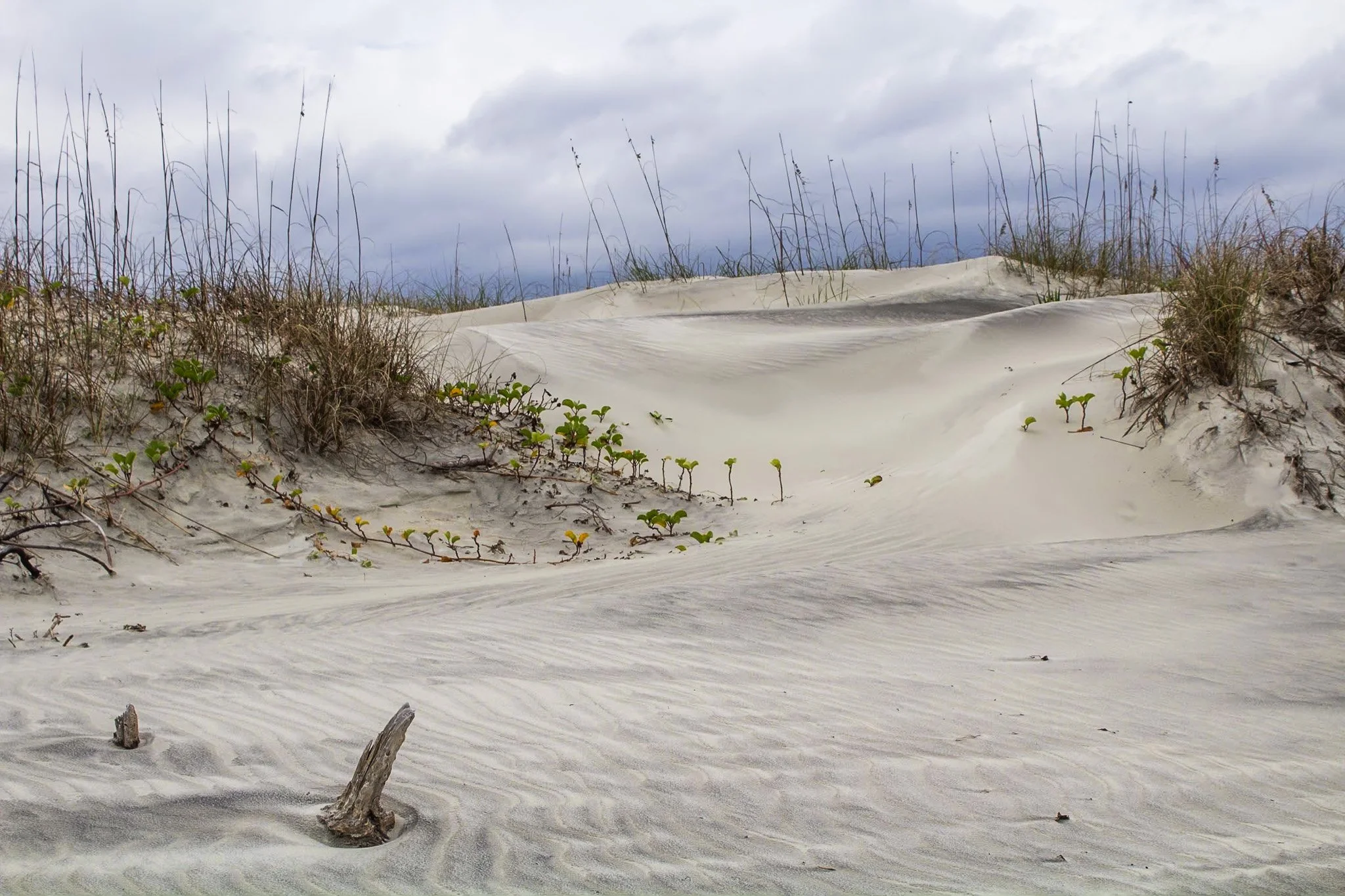
This photo was from my first visit to Cumberland Island National Seashore, located on the border of Georgia and Florida with access via a Ferry from St. Marys, Georgia. I would revisit this same island four years later, affording me the opportunity to finally explore all 18 miles of it.
The beach here is pristine, a stark comparison to the islands directly north and south of it which have been developed for residential and tourist activities. The island has faced various threats to its wilderness status and has been defended through the constant efforts of Carol Ruckdeschel, one of the few persons permitted to live on the island, and who I had the pleasure of meeting randomly on my second visit.
This photo was taken in the early morning on an overcast day following my sunrise shoot, and the feel of this specific patch of sprawling dunes system felt like something out of a painting.

The escarpment at Pictured Rocks, in this case Chapel Rock, is part of the dramatic sandstone cliff formations that define the Pictured Rocks National Lakeshore along Lake Superior in Michigan’s Upper Peninsula. Chapel Rock itself is a striking feature of this escarpment — a freestanding column of Nape sandstone, shaped by centuries of erosion from wind, water, and ice.
This section of the escarpment showcases the layered and weathered nature of the sandstone, with its rich textures and colors—ranging from golden hues to deep reds and greens—caused by the mineral content in groundwater.
After a long day of backpacking, I set up camp and filtered water from Lake Superior while setting up this shot. I found the rock against the passing storm a particularly interesting composition, showing the fascinating rock that has been a source of wonder for centuries.

The lone white pine on Chapel Rock, located in Pictured Rocks National Lakeshore, is estimated to be about 250 years old. There once was an archway connecting the rock to the mainland but it collapsed in the 1940s.
Chapel Beach and the mouth of Chapel River is adjacent to Chapel Rock, and is popular backcountry campground and hiking destination, offering a secluded beach as well as access to many waterfalls.
After a long day of backpacking, I set up camp and filtered water from Lake Superior while setting up this shot. The mouth of the Chapel River is pictured here, showing the diversity of this picturesque environment that has been a source of wonder for centuries.

Carl G. Washburne Memorial State Park may be the one of the most scenic stretches of the entire Oregon Coast. Located about 15 miles north of Florence, and only a few miles past Heceta Head Lighthouse (a trail connects the two parks), the surrounding area offers a portal to another world.
The China Creek Trail weaves through coastal forests terminating on the beach, and the picturesque Hobbit Trail, known for its moss-draped trees and old-growth forest, make the hiking here magical.
This photograph was taken moments after sundown, following a chaotic two hours of trying to photography too many areas at once. I used the last remaining daylight to grab this abstract before retiring to my campsite across the main road. The park is a quiet place, unassuming, and it is here that shows Oregon’s true beauty.

Carl G. Washburne Memorial State Park may be the one of the most scenic stretches along the entire Oregon Coast. Located about 15 miles north of Florence, and only a few miles past Heceta Head Lighthouse (a trail connects the park), this area offers a portal to another world.
The China Creek Trail which weaves through coastal forests terminating on the beach, and the picturesque Hobbit Trail known for its moss-draped trees and old-growth forest.
This photograph was taken after sundown following a chaotic two hours of photographing. I used the last remaining daylight to grab this abstract before retiring to my campsite across the main road. It is a quiet place, unassuming, and it is here that shows Oregon’s true beauty.

Highway 1 through Big Sur, California, is one of the most iconic drives in the world, offering dramatic views of the rugged Californian coast. Known for its winding road, narrow bridges, and steep cliffs, this section of highway hugs the coastline for nearly 90 miles before terminating just south of San Francisco.
Originally completed in the 1930s using convict labor and WPA funding, the road has been repeatedly closed and rebuilt due to landslides and erosion common in the area. Despite its challenges, Highway 1 remains a vital lifeline for Big Sur’s small communities and tourism-based economy.
Driving the One is something that cannot be described and must be experienced. This shot was accomplished by holding the camera out the driver’s side window, making sure I had a high shutter speed to stop motion, and trying to angle it in a way that might lead to a good composition. It was a lucky shot and not a great way to photograph, safety first.

Heceta Head is one of the most iconic and picturesque stretches along the Oregon Coast. Known for its historic lighthouse, dramatic cliffs, and panoramic views of the Pacific Ocean, it must be seen to be believed.
Located just north of Florence, Oregon, Heceta Head offers a blend of natural beauty, maritime history, and coastal ecology.
This photo came after photographing the Heceta Head lighthouse, which resides right behind this stunning view. The road curve seen in the distance is also the location of the nation’s only natural Sea Lion caves, accessible to tourists via an elevator.

The Oregon Coast holds many treasures and its relationship with the Pacific leads to its dramatic cliffs. Stretching endlessly westward, the Pacific creates a boundless horizon that seems to hold no end.
Long before roads carved through these coastal towns dotting the headlands, this was a remote and mysterious frontier. Pirate ships, privateers, and explorers found their way to this region, exploring its untouched mysteries. Legends linger of hidden coves that sheltered their treasures, buried beneath shifting sands or unexplored coves.
This photograph was taken right near the lookout to Heceta Head, and while that lighthouse is as picturesque as any can be, it was this drama playing out in the clouds that drew my eye. It seemed to point me back to an unremembered time, before roads, towns, and civilization.

The Oregon Dunes are one of the most unique and dramatic landscapes along the Oregon Coast, stretching roughly 40 miles from Florence to Coos Bay. Formed over thousands of years by wind, rain, and ocean forces, these dunes make up the largest coastal sand dune system in North America.
Some dunes will reach heights of up to 500 feet, creating a surreal and constantly shifting landscape that feels more like a desert than part of the lush Pacific Northwest. This vast expanse also contains coastal forests, wetlands, and freshwater lakes, making it an incredibly diverse ecosystem.
This lookout, pointing south, shows the beginnings of the dune system. I stopped off on the side of the road to grab this shot on my way to John Dellenback Dunes, one of the highlights of my trip and my first time stepping in quick sand.

Harris Beach State Park, located just north of Brookings, Oregon, is a coastal haven renowned for its dramatic scenery, diverse wildlife, and rich marine ecosystems.
The park's centerpiece is Goat Island (also known as Bird Island), the largest offshore island along the Oregon Coast. This National Wildlife Refuge is a breeding ground for over 100,000 seabirds, including tufted puffins and Leach’s storm-petrels, making it a prime spot for birdwatching.
This photo was taken during a quiet moment alone on the beach as the last vestiges of light began to disappear. Harris Beach is one of my favorite places on the Oregon Coast, offering endless photographic opportunities and true tranquility.

Harris Beach State Park, located just north of Brookings, Oregon, is a coastal haven renowned for its dramatic scenery, diverse wildlife, and rich marine ecosystems.
The park's centerpiece is Goat Island (also known as Bird Island), the largest offshore island along the Oregon Coast. This National Wildlife Refuge is a breeding ground for over 100,000 seabirds, including tufted puffins and Leach’s storm-petrels, making it a prime spot for birdwatching.
This photo was taken during a quiet moment as the last vestiges of light revealed eerie silhouettes of the rock formations surrounding Harris Beach. It is one of my favorite places on the Oregon Coast, offering endless photographic opportunities, a great campsite, and a beach unlike any other.

The Heceta Head Lighthouse, built in 1894, is one of the most photographed lighthouses in Oregon, if not the United States, and remains operational as a navigational aid. One of the original light keepers' houses still stands nearby and now serves as a bed-and-breakfast.
The wildlife here is rife with sea lions, harbor seals, and migrating gray whales often seen from the headland, especially during the spring and winter migration seasons, as well as numerous seabirds who make the cliffs their home.
The waves that slam into the cliffs on a windy day, like the one captured here, shows the sheer force of nature at work. I took this as the mist continually covered my lens, requiring me to wipe it between each exposure as I waited for the rogue wave to strike.

Oregon has been experiencing an uptick in sea lion strandings, particularly along the central and northern coasts. In the fall of 2023, the Oregon Marine Mammal Stranding Network reported several daily calls about sick or dead sea lions.
In Oregon, while pups do sometimes rest alone on beaches naturally, the rising number of reports of lethargic or underweight pups reflects broader ecological challenges. Many of these cases are related to malnutrition, toxins from algal blooms, or disease outbreaks like leptospirosis.
This little guy made my heart pang after running into it when walking into the Devil’s Punchbowl at low tide. There was no one around and I was not sure of the situation until a local apleated and said this was a strange site. We called the OMMSN, and they said it was most likely a mother leaving its pup while it forged some food. We weren’t completely convinced but I had to move on to Portland and could not stay to find out. The local promised to keep an eye out for a couple hours to see if the mother returned.
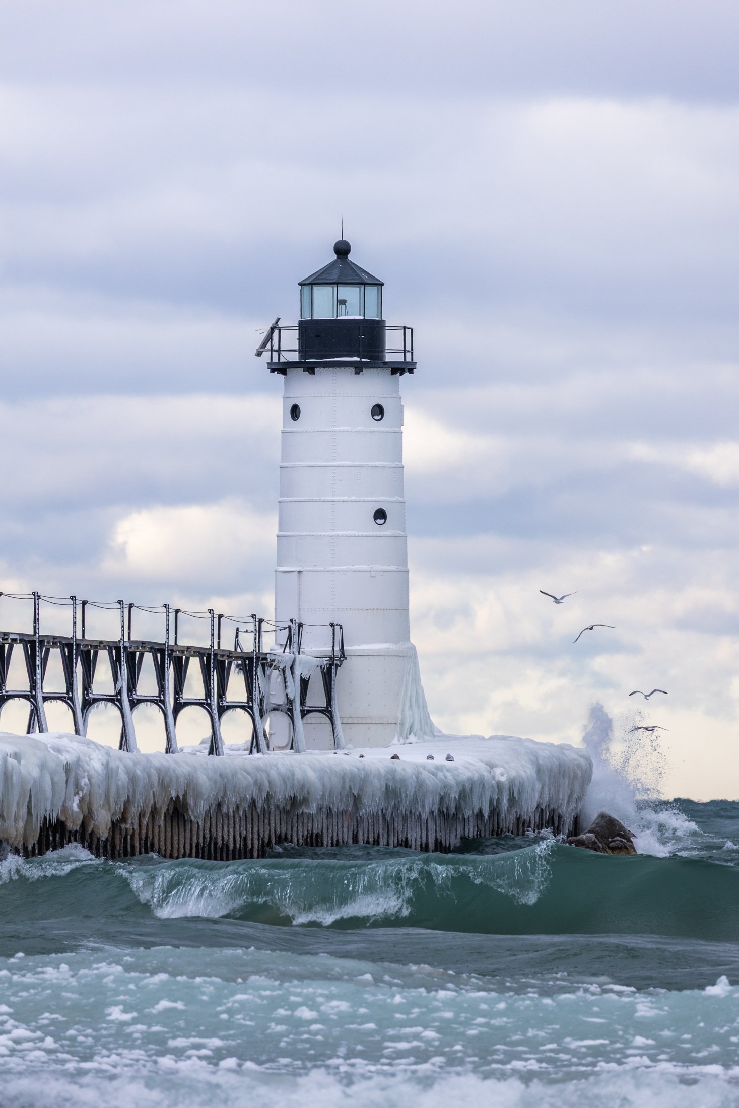
The Manistee North Pier Lighthouse, located in Manistee, Michigan, is as picturesque as any lighthouse can be.
Constructed in 1870, the wooden lighthouse was changed to steel in 1927, providing an important means of safely guiding ships in the lumber industry during the end of the 19th century.
This was my second visit to the Manistee Lighthouse, with both events being particularly cold days. This day just happened to be my birthday. The wind was fierce, and after setting up the shot, I was lucky enough to have some avian tourists enter my frame.

Haystack Rock near Pacific City, also known as Chief Kiwanda Rock, is an enormous sea stack located just offshore from Cape Kiwanda in Pacific City, Oregon.
Standing approximately 327 feet, it is one of the tallest sea stacks on the Oregon coast, even taller than the more famous Haystack Rock in Cannon Beach.
This was taken during a bustling evening near the Pelican Brewing Company, where patrons dined as the light broke through at golden hour, giving way to these stunning clouds behind the sea stack, casting its true form in silhouette. And if you look closely you’ll see the staggering amount of birds which call it home.

The South Coast Wilderness Trail is a stunning, rugged, and truly wild 17 mile one-way hike through Olympic National Park. One of the last undeveloped coastlines in the contiguous United States, Olympic’s protection status ensures native species like sea otters, bald eagles, bears, and migrating whales will continue to thrive in this pristine wilderness.
Switching between stretches of picturesque coast and dense rainforest, the trek (which is at sea level) entails 2,000 feet in elevation change, due to the use of ladders and ropes to maneuver up and down coastal embankments.
After setting up camp, I descended a very steep sand embankment via a rope wrapped around a tree to reach this secluded beach. It was a peaceful moment photographing these majestic sea stacks at sunset alone on this pristine beach.
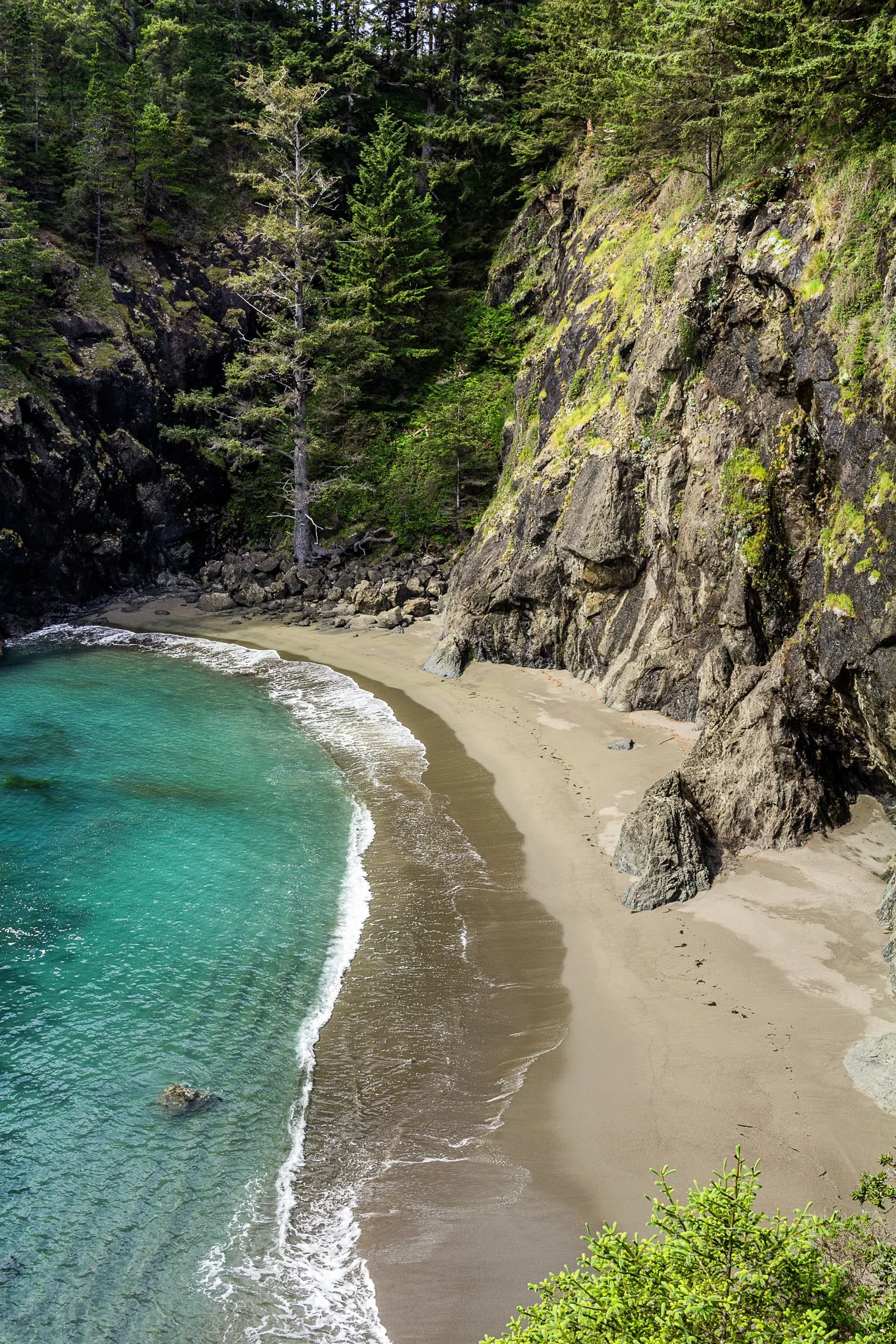
Samuel H. Boardman State Park, located along the southern Oregon coast near Brookings, Oregon, is renowned for its stunning coastal landscapes and diverse natural beauty. The park stretches for 12 miles along the coast, offering a variety of scenic views and ecosystems, from rugged cliffs to pristine beaches.
One of the park's most iconic features is its collection of sea stacks — tall, isolated rock formations that rise out of the ocean. These formations are often surrounded by crashing waves, adding to the dramatic beauty of the area.
While climbing out on to a precarious rocky perch with a 200 foot fall on either side to photograph some sea stacks, I noticed this beautiful cove to my right. It reminded me of something out of a Robert Louis Stevenson story where buried treasure might reside.

Carl G. Washburne Memorial State Park is one of the most scenic areas on the entire Oregon Coast. Located about 15 miles north of Florence and only a few miles north of the Heceta Head Lighthouse, the beach and surrounding trails can transport one to a different world.
The area is known for two fascinating trails; the China Creek Trail which weaves through coastal forests finally arriving on the beach, and Hobbit Trail known for its moss-draped trees and old-growth forest.
This photograph was taken after the last few visitors disappeared into the darkness of the coastal scrub. One word remains in my mind from those moments on the beach: ethereal.

Cumberland Island National Seashore is a pristine 18 mile stretch of undeveloped wilderness unique to the East Coast.
The island has a long history, and was once owned by the Carnegie Family who then dedicated the island to the National Park Service in 1972. The island has faced various threats to its wilderness status and has been defended through the continued efforts of Carol Ruckdeschel, one of the few persons allowed to live on the island.
I had visited the wild protected beaches of both the Atlantic and Pacific Ocean in the same calendar year when I took this photo, and I cannot divide my love for both. The sunrise peaked through the clouds this particular morning, while I photographed on an empty beach. It is a peaceful memory I recall often.

The Manistee North Pier Lighthouse, located in Manistee, Michigan, is as picturesque as any lighthouse can be.
Constructed in 1870, the wooden lighthouse was changed to steel in 1927, providing an important means of safety guiding ships during the lumber industry of the last 19th century. The lighthouse is now on the National Register of Historic Places.
This photo was taken on a particularly cold evening while heading up to Sleeping Bear Dunes. With a windchill of -4 degrees, waiting for this moment required patience, warm clothing, and slowly freezing fingers.

Olympic National Park protects over 70 miles of coastline making one of the longest protected coastlines in the contiguous United States.
Located near Forks, Washington this coast features a multitude of sea stacks littered a short distance from the beaches. Wildlife is rife with bears occasionally feeding from the rivers emptying out from the rainforest and bald eagles being a frequent sight.
Taken at Mosquito Creek after setting up camp, I descended a steep sand bank via a rope tied to a tree and walked the beach alone at sunset. I set up my tripod and got lost in the waves oscillating beneath my feet.

Door County is a travel destination for many a midwesterner. The area is known for its limestone cliffs, wineries, shops, and much more.
The limestone bluffs surrounding the region are the remnants of the Niagara Escarpment, a 1000-mile long slope of rock from 400-500 million years ago that resists the faster erosion of other type of rocks such as sandstone.
This shot reminded me once again of all the things that make the Midwest truly unique.

St. Marys is a quaint little town in southern Georgia. The town provides ferry access to Cumberland Island National Seashore, which offers 18 miles of undeveloped wilderness.
St. Marys became a point of conflict during the War of 1812, with the British raiding the town in 1815. It established itself as a port town, with shipping and trade. The town’s economy declined following the abolish of slavery and reestablished itself as tourist community in the mid-20th century.
This photograph was taken while returning from Cumberland Island on the daily ferry. The sun lined up perfectly along this strip of clouds making the bay and the surrounding boats shimmer gold.

Cumberland Island National Seashore is a pristine 18 mile stretch of undeveloped wilderness near St. Marys, Georgia. The area is unique, showing the true beauty of untouched land on the East Coast.
The island has a long history, and was once owned by the Carnegie Family who then dedicated the island to the National Park Service in 1972. The island has faced various threats to its wilderness status and has been staunchly defended through the efforts of Carol Ruckdeschel, one of the few persons allowed to live on the island.
This sunrise required a particularly early wakeup call. The sun seemed to stick to the horizon evoking the imagery of the 1950’s nuclear tests. This gull flew at the right moment, accentuating this curious image.

Carl G. Washburne Memorial State Park may be the one of the most scenic stretches of the entire Oregon Coast. Located about 15 miles north of Florence, and only a few miles past Heceta Head Lighthouse (a trail connects the two parks), the surrounding area offers a portal to another world.
The China Creek Trail, which weaves through coastal forests terminating on the beach, and the picturesque Hobbit Trail, known for its moss-draped trees and old-growth forest, make the hiking here magical.
This photograph was taken as the last few visitors began disappearing into the darkness of the coastal scrub where the parking lot was obscured from view. I had set up camp across the main road at the State Park, allowing me to photographing after sunset before retiring to my cozy campsite, headlamp in tow. It is a quiet place, unassuming, and it is here that shows Oregon’s true beauty.
The South Coast Wilderness Trail is a stunning, rugged, and truly wild 17 mile one-way hike through Olympic National Park. One of the last undeveloped coastlines in the contiguous United States, Olympic’s protection status ensures native species like sea otters, bald eagles, bears, and migrating whales will continue to thrive in this pristine wilderness.
Switching between stretches of picturesque coast and dense rainforest, the trek (which is at sea level) entails 2,000 feet in elevation change, due to the use of ladders and ropes to maneuver up and down coastal embankments.
This was one such area on my backpacking trip where the trail climbed several hundred feet following a rope climb from the beach. The blue of this area of the Pacific is stunning, especially contrasted with the lush greenery of Olympic’s rainforest.