

Beiges

Beiges
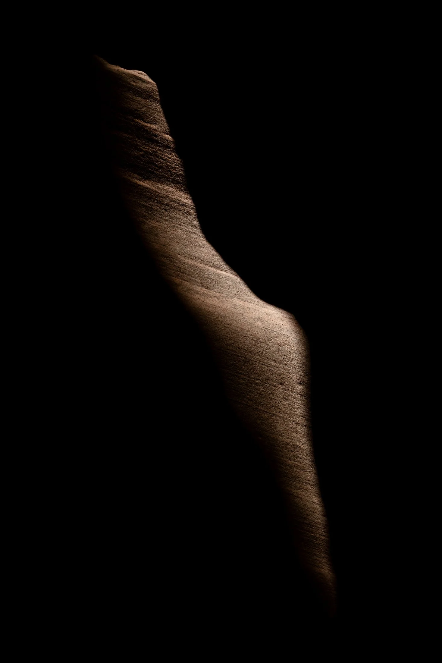
Buckskin Gulch, located in the Paria Canyon-Vermilion Cliffs Wilderness area, is the longest and deepest slot canyon in United States and possibly the world.
Marked by their sinuous carved rock, typically sandstone, slot canyons are often formed through water erosion over long periods of time. Flash floods are what make these strikingly beautiful canyons also some of the most dangerous to hike, with the runoff from a storm ten miles away potentially leading to the canyon on a day with clear skies.
These walls form their own abstract art where light reveals and conceals form, changing each minute with the path of the sun. On my third venture into this slot canyon, the light caught this particular patch of sandstone highlighting its sinuous nature allowing for an eerie contemplation of the form itself.
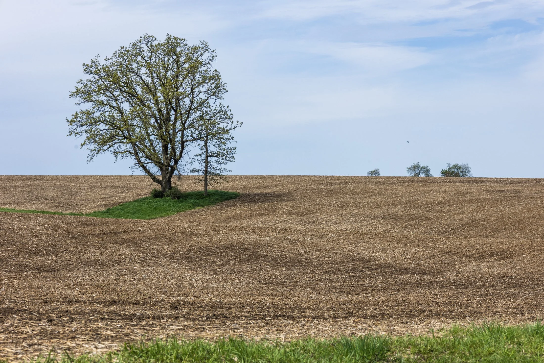
The cornfields near Polo, IL follow twists and turns as the land enters the Driftless Area. It is here where the sinuous and hilly terrain begin to take over. This area, and Illinois in general, is a very prominent agricultural hub for a variety of crops.
Previously a historic route to Galena, this picturesque area was rift with natural prairie prior to its transformation for agricultural purposes, but the beauty still remains.
This area is one I have visited often and will eventually be a part of a series when I capture the right fall photo. The composition of this lone tree set against the distant row of trees in the background shows what is possibly an old boundary tree isolated in a crop field.
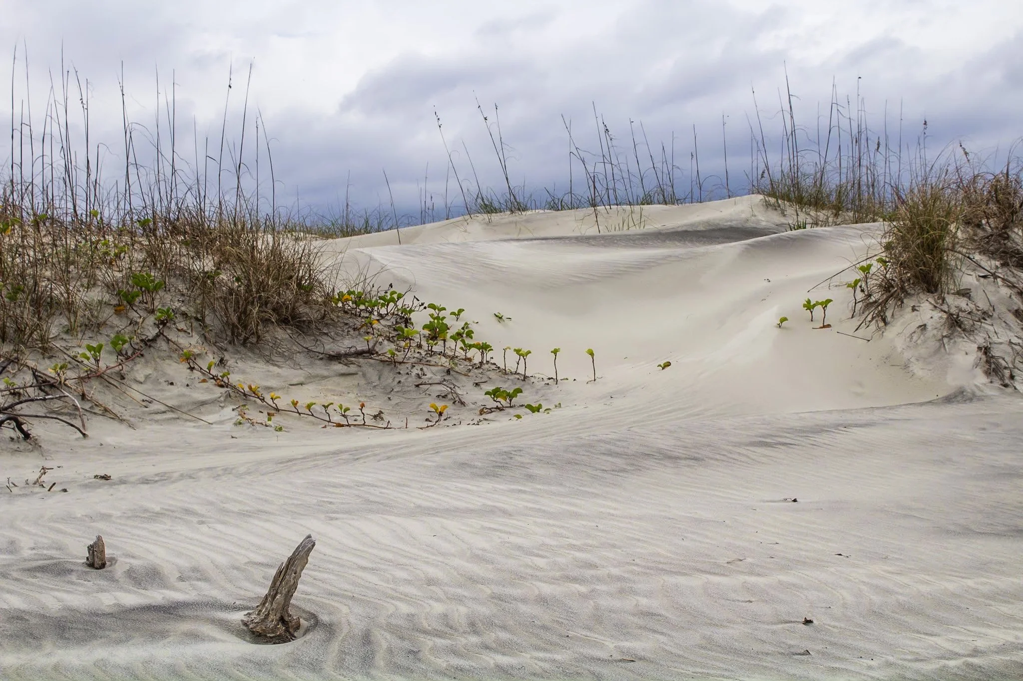
This photo was from my first visit to Cumberland Island National Seashore, located on the border of Georgia and Florida with access via a Ferry from St. Marys, Georgia. I would revisit this same island four years later, affording me the opportunity to finally explore all 18 miles of it.
The beach here is pristine, a stark comparison to the islands directly north and south of it which have been developed for residential and tourist activities. The island has faced various threats to its wilderness status and has been defended through the constant efforts of Carol Ruckdeschel, one of the few persons permitted to live on the island, and who I had the pleasure of meeting randomly on my second visit.
This photo was taken in the early morning on an overcast day following my sunrise shoot, and the feel of this specific patch of sprawling dunes system felt like something out of a painting.
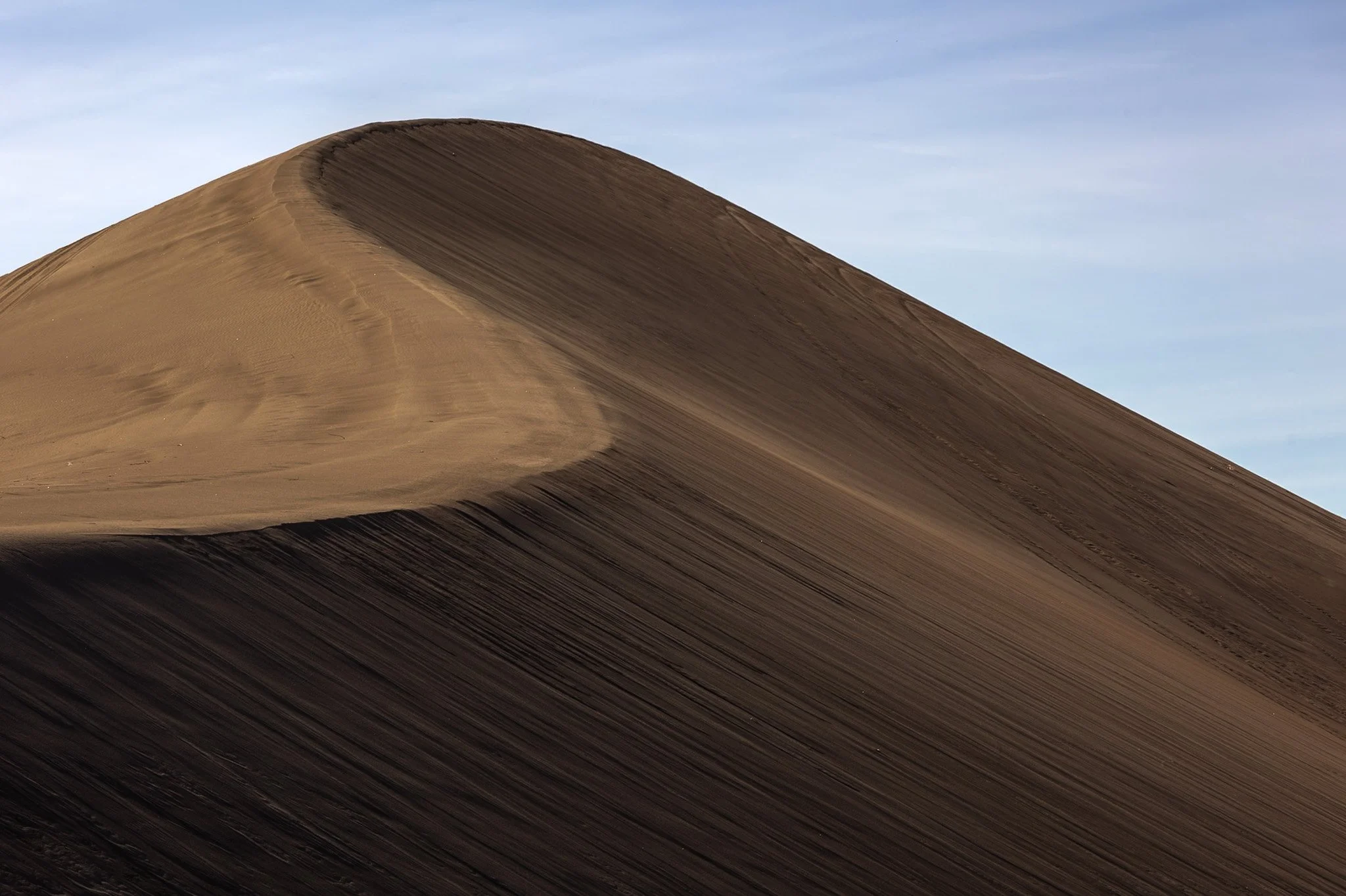
The dunes in and around Death Valley are primarily shaped by wind, which picks up and transports sand particles across the valley floor. Sediment from surrounding mountains supplies the sand forming these natural features.
The wind's constant movement reshape the dunes, causing them to shift across the valley, often forming barchan dunes which hold crescent shapes, such as the one seen here.
I found this specific dune formation completely deserted (excuse the pun) in the early morning. Walking to the base of it, it was tough not to be struck by the gigantic sense of time, space, and form the area offers up. This telephoto capture isolated its gentle untouched waves towering on the horizon from miles away.

Starved Rock State Park in LaSalle County, Illinois transforms into a stunning winter landscape, with its waterfalls freezing into towering columns of ice. These frozen waterfalls are a major seasonal attraction, drawing hikers, photographers, and ice climbers to the park’s deep sandstone canyons.
Formed by melting snow and natural springs, the waterfalls normally flow through narrow cliff faces, but in winter, they become massive ice formations, sometimes reaching over 80 feet tall. The contrast between the icy formations and the ancient, rust-colored rock walls creates a dramatic and otherworldly scene.
This photo required some careful maneuvering to get to the right position as well as making sure my tripod stayed stable on the ice. This dead leaf stood out among a sea of white and grey and allowed me to capture a long exposure yet the leaf remained still. Taken earlier in my career, I had not come to appreciate the magic of crampons when navigating slick ice.

The Oregon Dunes are one of the most unique and dramatic landscapes along the Oregon Coast, stretching roughly 40 miles from Florence to Coos Bay. Formed over thousands of years by wind, rain, and ocean forces, these dunes make up the largest coastal sand dune system in North America.
Some dunes will reach heights of up to 500 feet, creating a surreal and constantly shifting landscape that feels more like a desert than part of the lush Pacific Northwest. This vast expanse also contains coastal forests, wetlands, and freshwater lakes, making it an incredibly diverse ecosystem.
This lookout, pointing south, shows the beginnings of the dune system. I stopped off on the side of the road to grab this shot on my way to John Dellenback Dunes, one of the highlights of my trip and my first time stepping in quick sand.

The Palouse region, located in southeastern Washington, extending into Idaho and Oregon was originally home to the Palus people. The area was transformed in the 1800s as settlers arrived under the Homestead Act.
Indigenous communities were displaced, and the land was reshaped by agriculture. The region’s deep loess soil and steep terrain led farmers to adopt contour plowing, giving the fields their signature flowing appearance.
Traveling through the Palouse region was an out of body experience. The word space takes on a new meaning as you meander through its rolling hills. The vibrant colors and different stages of tilling make each turn unique. Finding the form and color of this hillside fascinating, I decided it was worthy of its own frame.
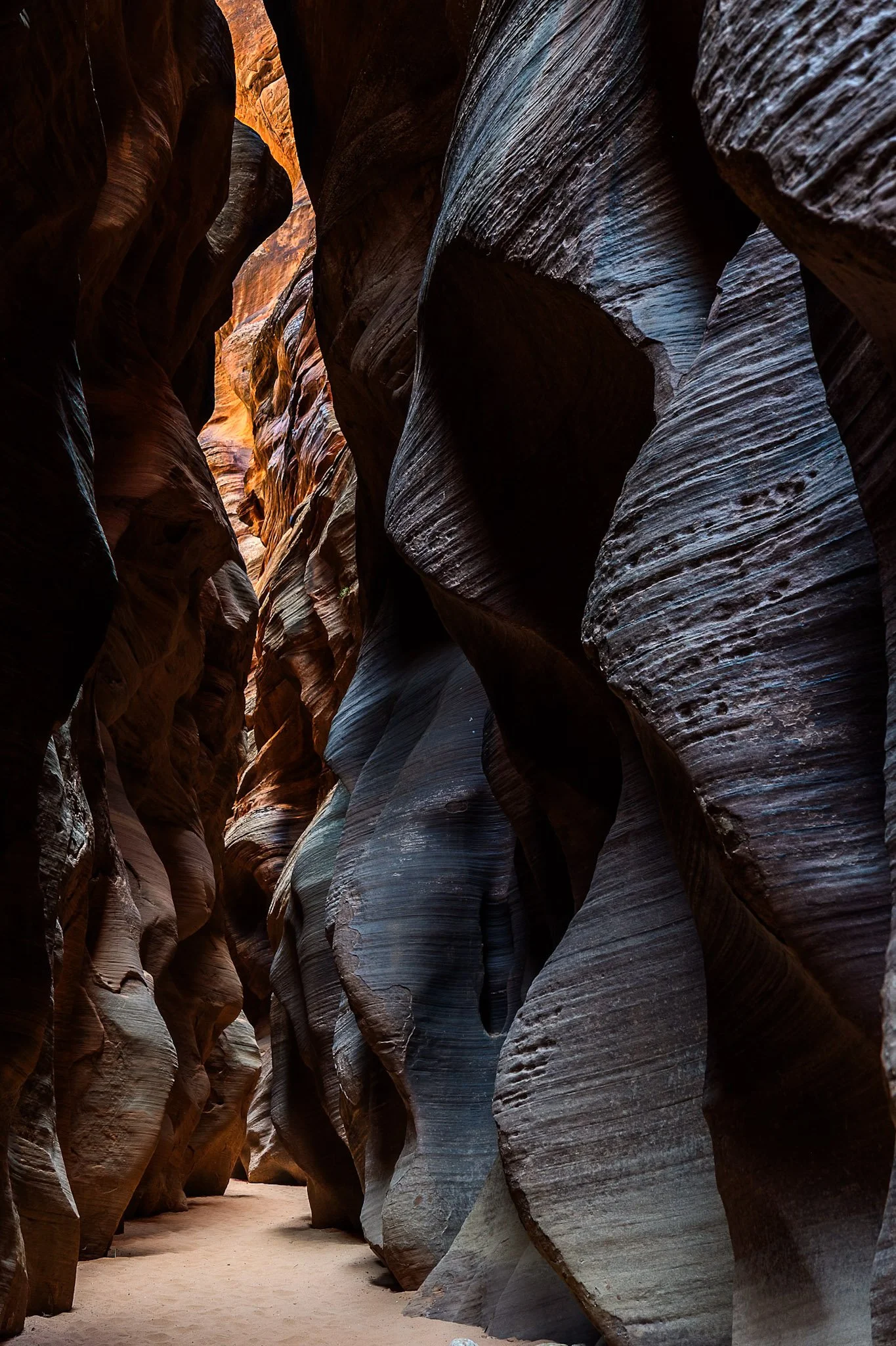
Buckskin Gulch, located in the Paria Canyon-Vermilion Cliffs Wilderness area, is the longest and deepest slot canyon in United States and possibly the world.
Marked by their sinuous carved rock, typically sandstone, slot canyons are often formed through water erosion, particularly flash floods. These are what make these beautiful canyons so dangerous, as water can be carried from a rainstorm many miles away leading to deadly flash flood during clear skies with no escape route.
Fairly deep into the canyon at this point, I had made sure to observed several weather apps before embarking. Two years earlier with only one day to hike it, I called off the hike due to a 1% chance of rain. I later found out that chance was responsible for flooded the canyon, trail, and road all the way to US Route 89, a distance of three miles.

The Bisti Badlands are a remote and alien world in northwest New Mexico located in the Bisti/De-Na-Zin Wilderness, protected by the Bureau of Land Management.
The name comes from the Dinë (Navajo) word “Bistahi” translating roughly to “among the adobe formations”. The wind-formed hoodoos in this region are numerous leading to bizarre formations, varied colors, and precariously balanced rocks.
Backpacking into the desolate desert the previous night, a place where no trail exits, I woke up early the next morning to capture the morning light. This land lives beautiful isolation, undisturbed, as the elements continue their magnificent sculpting each day.

John Dellenback Dunes Trail is one of the best “trails” in the Oregon Dunes National Recreation Area near Florence, Oregon. The sand dunes here one of the largest coastal sand dune systems in the world.
This area inspired Frank Herbert to write the science fiction book Dune. Herbert found this and the surrounding areas fascinating, studying desert ecology and erosion at a time when Oregon was establishing a way to combat the damage of the shifting dunes on the local towns by planting European Beachgrass.
Hiking these dunes was an exhausting but exhilarating experience requiring some astute navigation as a majority of the ”trail” can only be found by wooden markets in the sand, sometimes entirely buried by the dunes. This lone tree stuck out among the dunes as I turned around to keep my bearings.
Joshua Tree National Park, located in southeastern California, about 150 miles east of Los Angeles, is famous for its dramatic granite rock formations. Over tens to hundreds of millions of years uplift and weathering left the overlying rock exposed.
This physical weathering peeled the outer layers from the rock while desert flash floods carried away loosened material, leaving stacked, rounded boulders, domes, and monoliths.
This was my third trip to Joshua Tree and each time has been a different adventure. The grippy granite rock makes it a very fun park to rock scramble in but this particular day rain and fog dominated the landscape, a unique occurrence that required the correct gear to capture this image. This unique formation is located right next to Arch Rock and the maze-like quality showed off the singular uniqueness of this National Park.