

Trees
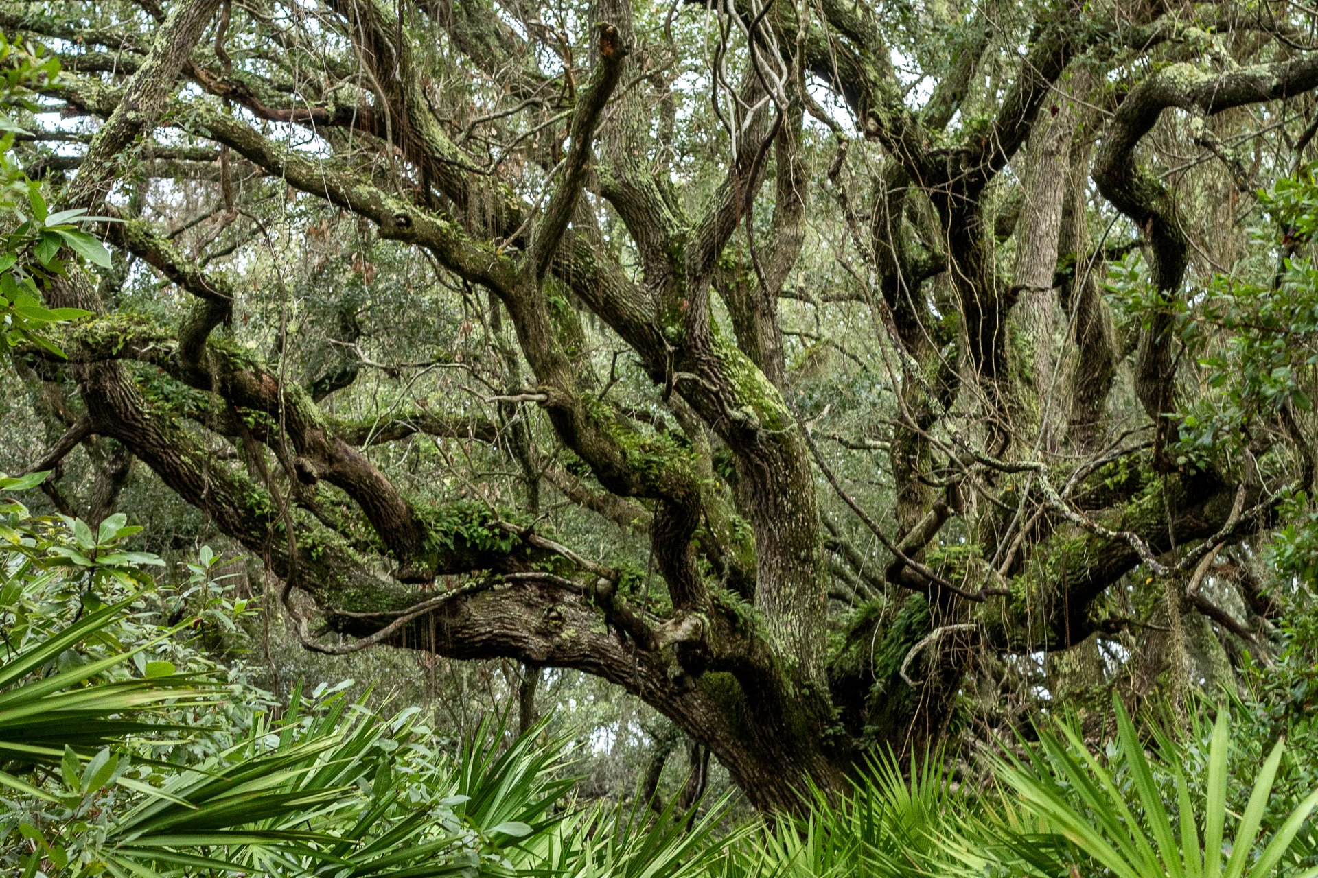
Trees
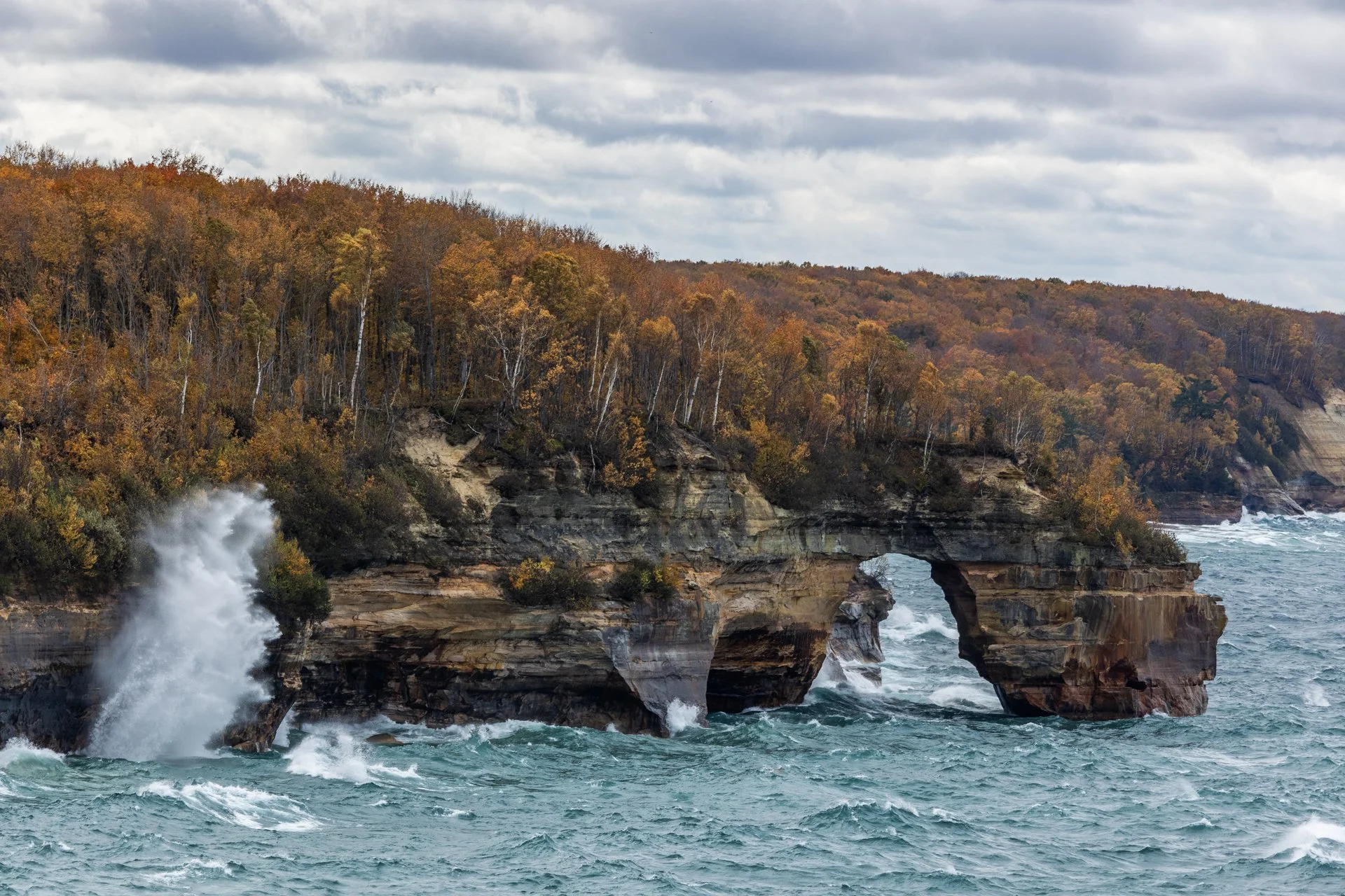
Lover’s Leap Arch, located in Pictured Rocks National Lakeshore, near Munising, Michigan, is one of the park's most iconic and photographed spots. The towering 200-foot cliffs and turquoise waters are often photographed from the local boat cruise and are rarely seen from this vantage point.
The cliffs colors, created by mineral staining, gives the area its "painted" appearance and inspiring the park’s name. According to Native American legend, Lover's Leap got its name from a heartbroken woman’s jump to her death after her lover’s failure to return from a journey.
Part of my 22-mile backpacking trip along cliff, this stormy day lead to Lake Superior’s waves continually crashing into the cliffs, often reaching their full height. These are the same storms that lead to the wreck of many ships, including the Edmund Fitzgerald.
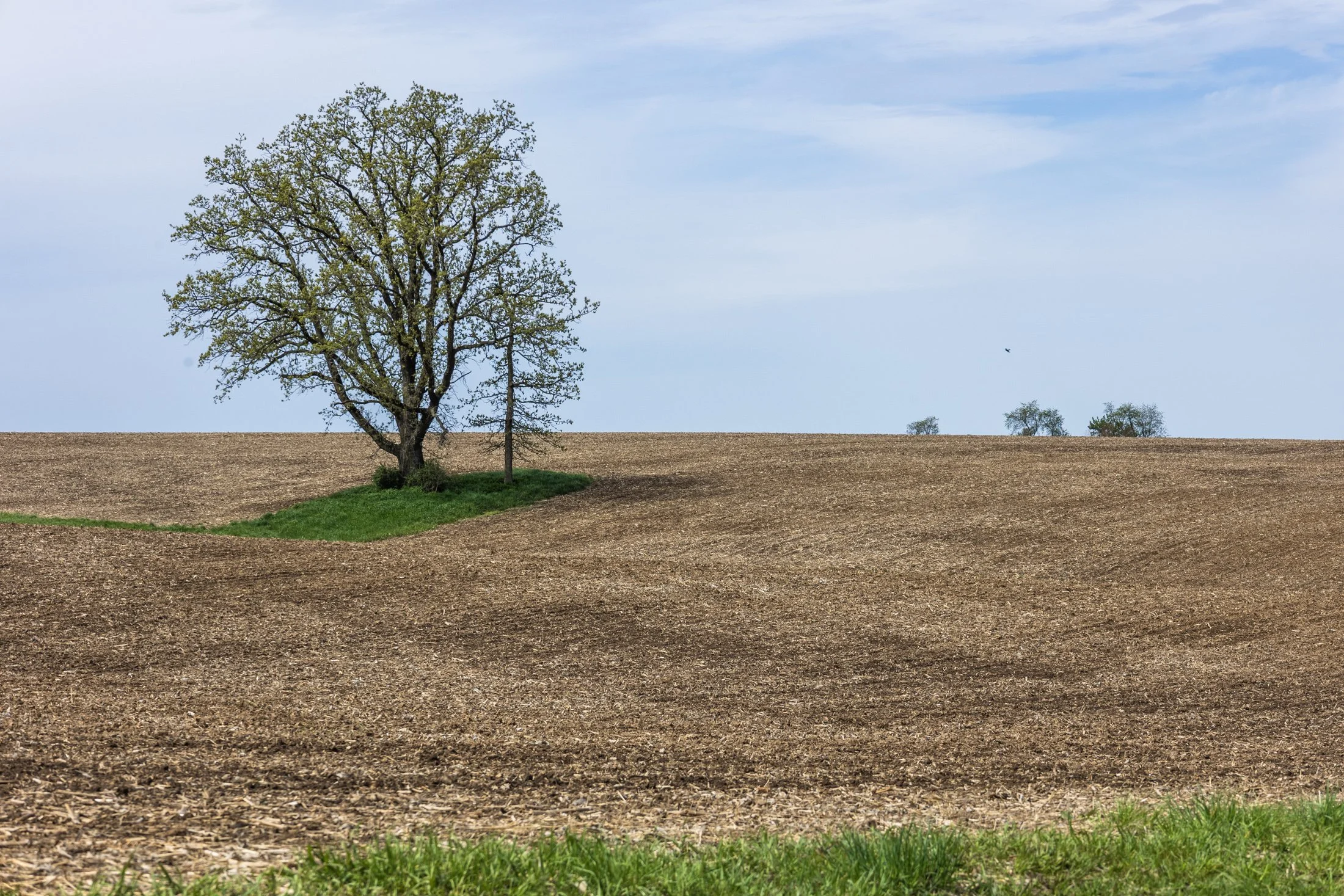
The cornfields near Polo, IL follow twists and turns as the land enters the Driftless Area. It is here where the sinuous and hilly terrain begin to take over. This area, and Illinois in general, is a very prominent agricultural hub for a variety of crops.
Previously a historic route to Galena, this picturesque area was rift with natural prairie prior to its transformation for agricultural purposes, but the beauty still remains.
This area is one I have visited often and will eventually be a part of a series when I capture the right fall photo. The composition of this lone tree set against the distant row of trees in the background shows what is possibly an old boundary tree isolated in a crop field.
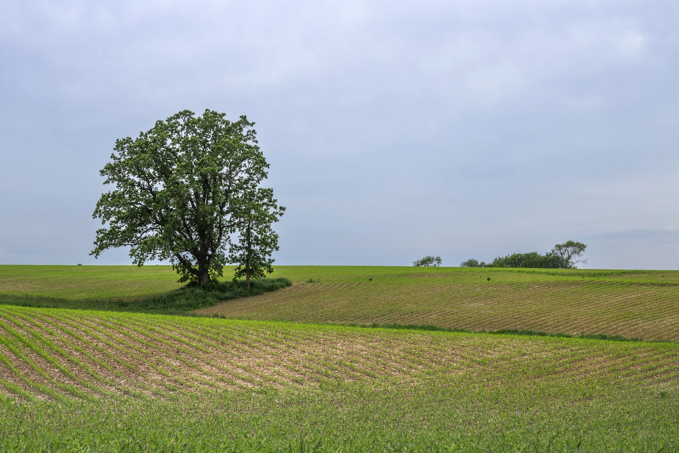
The cornfields near Polo, IL follow twists and turns as the land enters the Driftless Area. It is here where the sinuous and hilly terrain begin to take over. This area, and Illinois in general, is a very prominent agricultural hub for a variety of crops.
Previously a historic route to Galena, this picturesque area was rift with natural prairie prior to its transformation for agricultural purposes, but the beauty still remains.
This area is one I have visited often and will eventually be a part of a series when I capture the right fall photo. The composition of this lone tree set against the distant row of trees in the background shows what is possibly an old boundary tree isolated in a crop field.
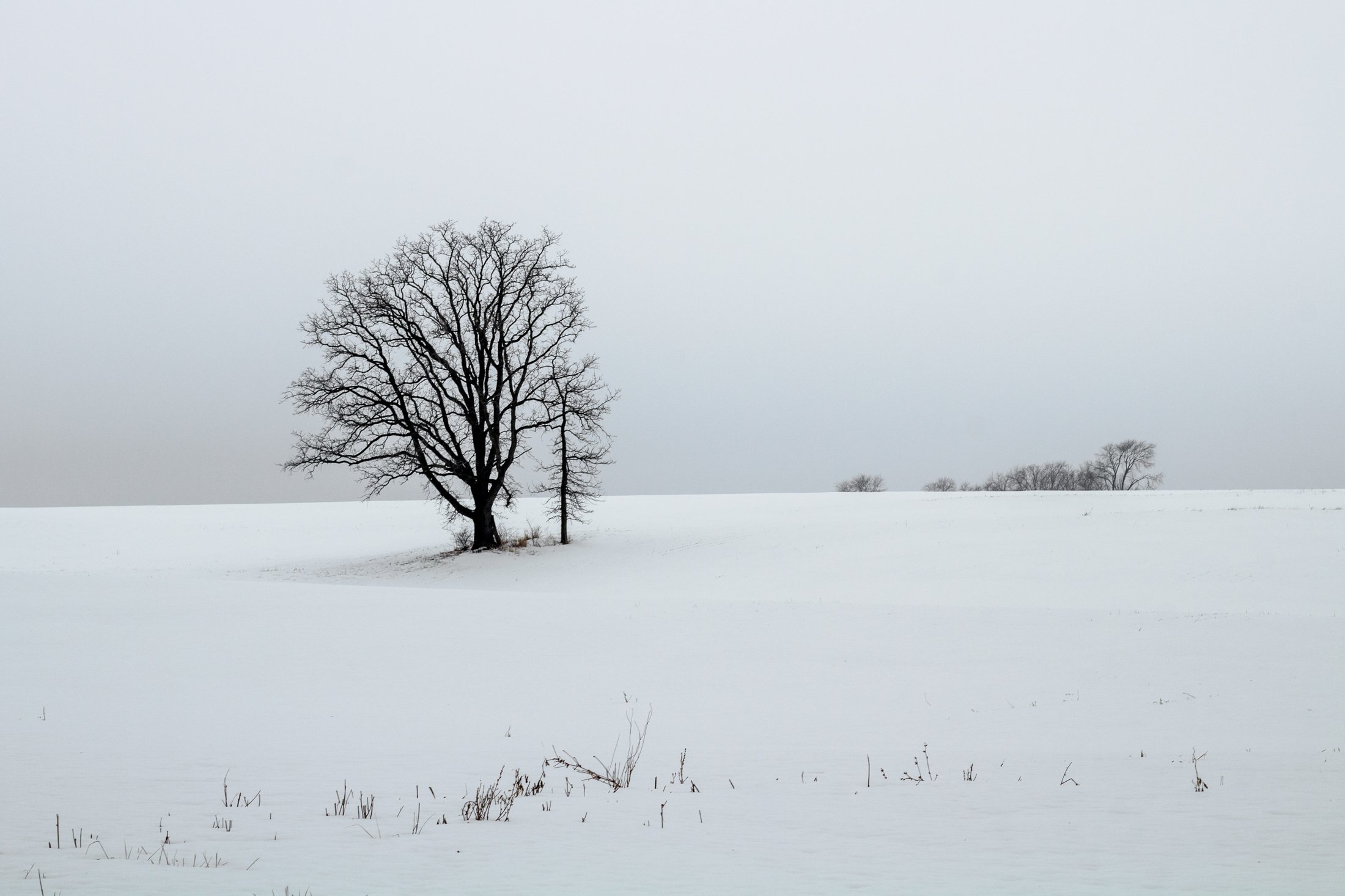
The cornfields near Polo, IL follow twists and turns as the land enters the Driftless Area. It is here where the sinuous and hilly terrain begin to take over. This area, and Illinois in general, is a very prominent agricultural hub for a variety of crops.
This particular area is one I have revisited often, and is part of an ongoing seasonal series yet to be published. This specific scene reminded me of something out of the film Fargo, with the delicate blanket of snow covering the fertile soil beneath.
The composition of this lone tree set against the distant row of trees in the background provided the proper depth for the open spaces these farmlands offer. Previously a historic route to Galena, this picturesque area was rift with natural prairie prior to its transformation for agricultural purposes, but the beauty still remains.
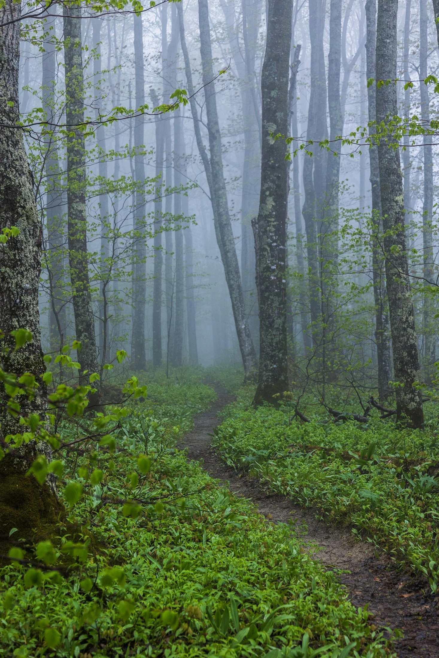
Pictured Rocks National Lakeshore, located near Munising, Michigan, already provides a stunning hiking opportunity for those willing to trek its bluffs, but in the early morning they can often take on a surreal atmosphere as the fog rolls in, transforming the area into a mystic forest.
This fog is often the result of the extremely cold waters of Lake Superior mixing with the warmer air from the land. As the fog rolls in, it muffles sound and adds depth to the already vibrant sandstone cliffs, creating a dramatic backdrop for an already stunning hike.
This particular photo occurred during an 11 mile backpacking trek along the cliffs, providing the one respite from a continuous onslaught of rain throughout the day. The experience of hiking through this atmosphere must be experienced, as this photo barely does it justice, but this winding trail disappearing into the fog serves as a glimpse into its magic.
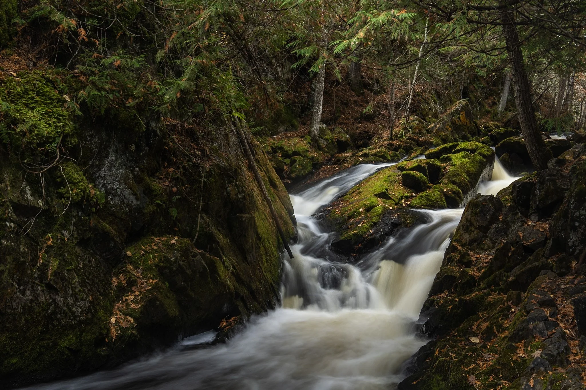
Smalley Falls, located in the Chequamegon National Forest of northern Wisconsin, is known for its serene and scenic beauty. Part of the Brule River, these falls are not as widely known as some of the others in the region, making it a particularly peaceful spot to visit.
The region is primarily composed of ancient Precambrian rock formations, some of the oldest on Earth, dating back about 1.6 to 2.6 billion years. Glacial till, which consists of a mixture of soil, clay, sand, and gravel, can be found in the area, deposited by the retreating glaciers that once covered much of Wisconsin. This sediment supports the lush vegetation and forest ecosystem surrounding Smalley Falls.
This particular composition required some scrambling and, again, careful positioning of my tripod legs on various levels of rocks to allow for the long exposure. This area immediately transported my mind to the lush forests of the Pacific Northwest, a site not often found in the Midwest landscape.
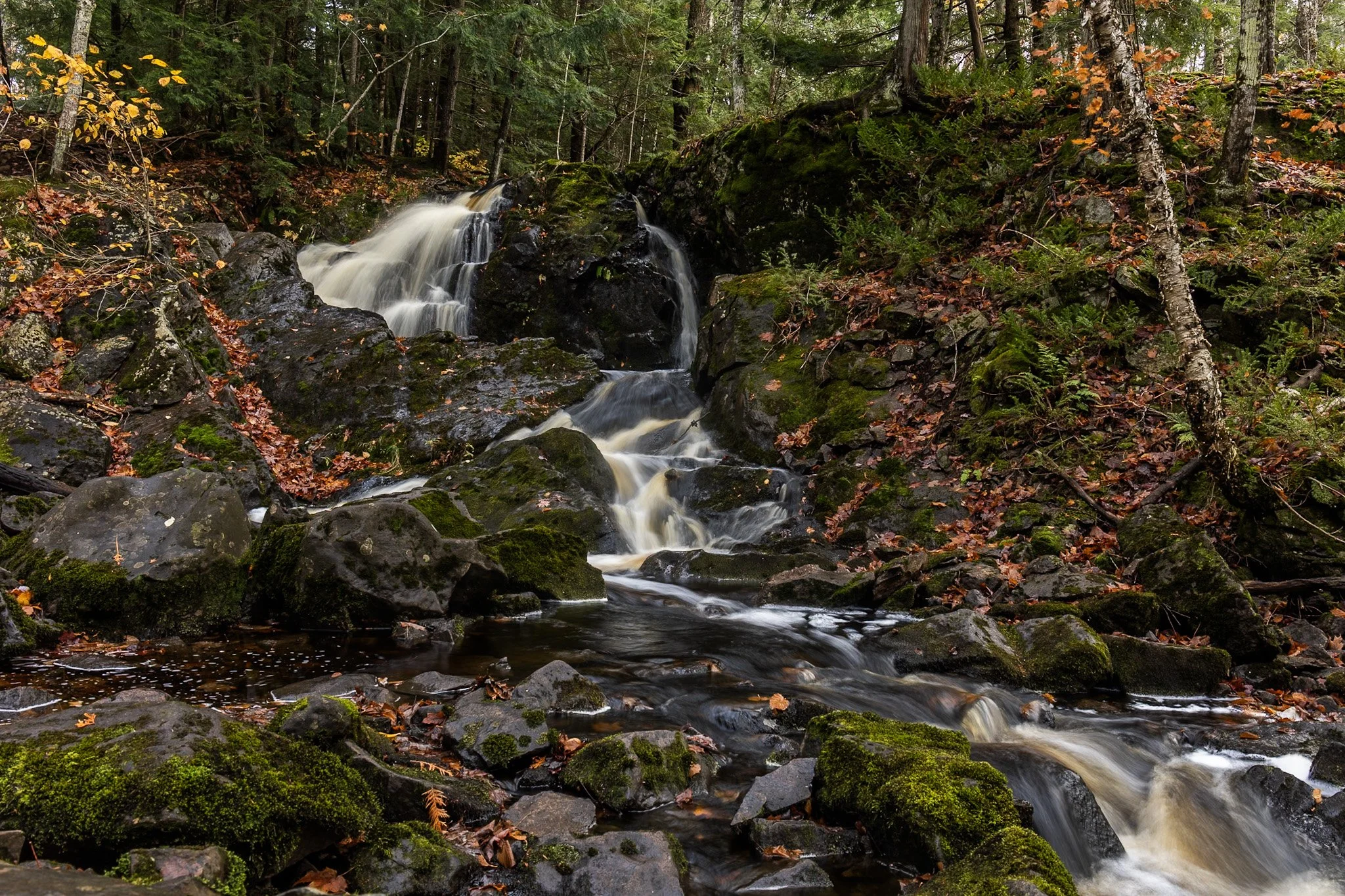
Located near Twin Lakes State Park, Wyandotte Falls finds its source from the Misery River in the Keweenaw Peninsula. The falls consist of a series of short cascades rocky ledges in a quiet, forested setting. The falls create an atmosphere that is reminiscent of a fairy tale forest.
This long exposure required the balancing of my tripod on the river rocks to get the composition that showed its varied pathways. Fall always adds something to a scene like this, and after chasing loud, roaring waterfalls all day, this was a serene end to the day.
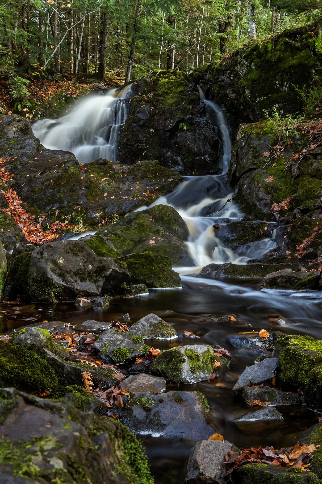
Located near Twin Lakes State Park, Wyandotte Falls finds its source from the Misery River in the Keweenaw Peninsula. The falls consist of a series of short cascades rocky ledges in a quiet, forested setting. The falls create an atmosphere that is reminiscent of a fairy tale forest.
This long exposure required the balancing of my tripod on the river rocks to get the composition that showed its varied pathways. Fall always adds something to a scene like this, and after chasing loud, roaring waterfalls all day, this was a serene end to the day.

The escarpment at Pictured Rocks, in this case Chapel Rock, is part of the dramatic sandstone cliff formations that define the Pictured Rocks National Lakeshore along Lake Superior in Michigan’s Upper Peninsula. Chapel Rock itself is a striking feature of this escarpment — a freestanding column of Nape sandstone, shaped by centuries of erosion from wind, water, and ice.
This section of the escarpment showcases the layered and weathered nature of the sandstone, with its rich textures and colors—ranging from golden hues to deep reds and greens—caused by the mineral content in groundwater.
After a long day of backpacking, I set up camp and filtered water from Lake Superior while setting up this shot. I found the rock against the passing storm a particularly interesting composition, showing the fascinating rock that has been a source of wonder for centuries.

The lone white pine on Chapel Rock, located in Pictured Rocks National Lakeshore, is estimated to be about 250 years old. There once was an archway connecting the rock to the mainland but it collapsed in the 1940s.
Chapel Beach and the mouth of Chapel River is adjacent to Chapel Rock, and is popular backcountry campground and hiking destination, offering a secluded beach as well as access to many waterfalls.
After a long day of backpacking, I set up camp and filtered water from Lake Superior while setting up this shot. The mouth of the Chapel River is pictured here, showing the diversity of this picturesque environment that has been a source of wonder for centuries.

“The sky is the ultimate art gallery just above us.”
-Ralph Waldo Emerson-
On my drives across the corn belt, I’ve always been enamored with the lone trees among the endless fields.
Some say they are for markers for property boundaries, others that they were once a primary source of shade for farmers from a bygone era. Whatever the case, their air of mystery sits majestic among the expansive cornfields of the Midwest.

Cumberland Island National Seashore is a pristine 18 mile stretch of undeveloped wilderness unique to the East Coast.
The island has a long history, and was once owned by the Carnegie Family who then dedicated the island to the National Park Service in 1972. The island has faced various threats to its wilderness status and has been defended through the efforts of Carol Ruckdeschel, one of the few persons allowed to live on the island.
While wandering back to my campsite coming from the deserted airstrip strewn with feral horses, I found this scarlet sunset right across from my campsite, the clouds accentuated by the pointing fingers of the tall Loblolly Pines prevalent on the island.

Cumberland Island National Seashore, located near St. Marys, Georgia, is a pristine 18 mile stretch of undeveloped wilderness unique to the East Coast. The island is known for its feral horses, possibly left over from the Spaniards during the 1700s.
The island has a long history, and was once owned by the Carnegie Family who then dedicated the island to the National Park Service in 1972. The island has faced various threats to its wilderness status over the years and has been defended through the continuous efforts of Carol Ruckdeschel, one of the few persons allowed to live on the island.
I arrived at Plum Orchard Mansion for a tour of the defunct Carnegie mansion dedicated in 1898. The area is frequented by the wild horses (technically feral) of the island. I was lucky enough to capture this black stallion bathed in light, highlighting its beauty if not also its complicated existence.
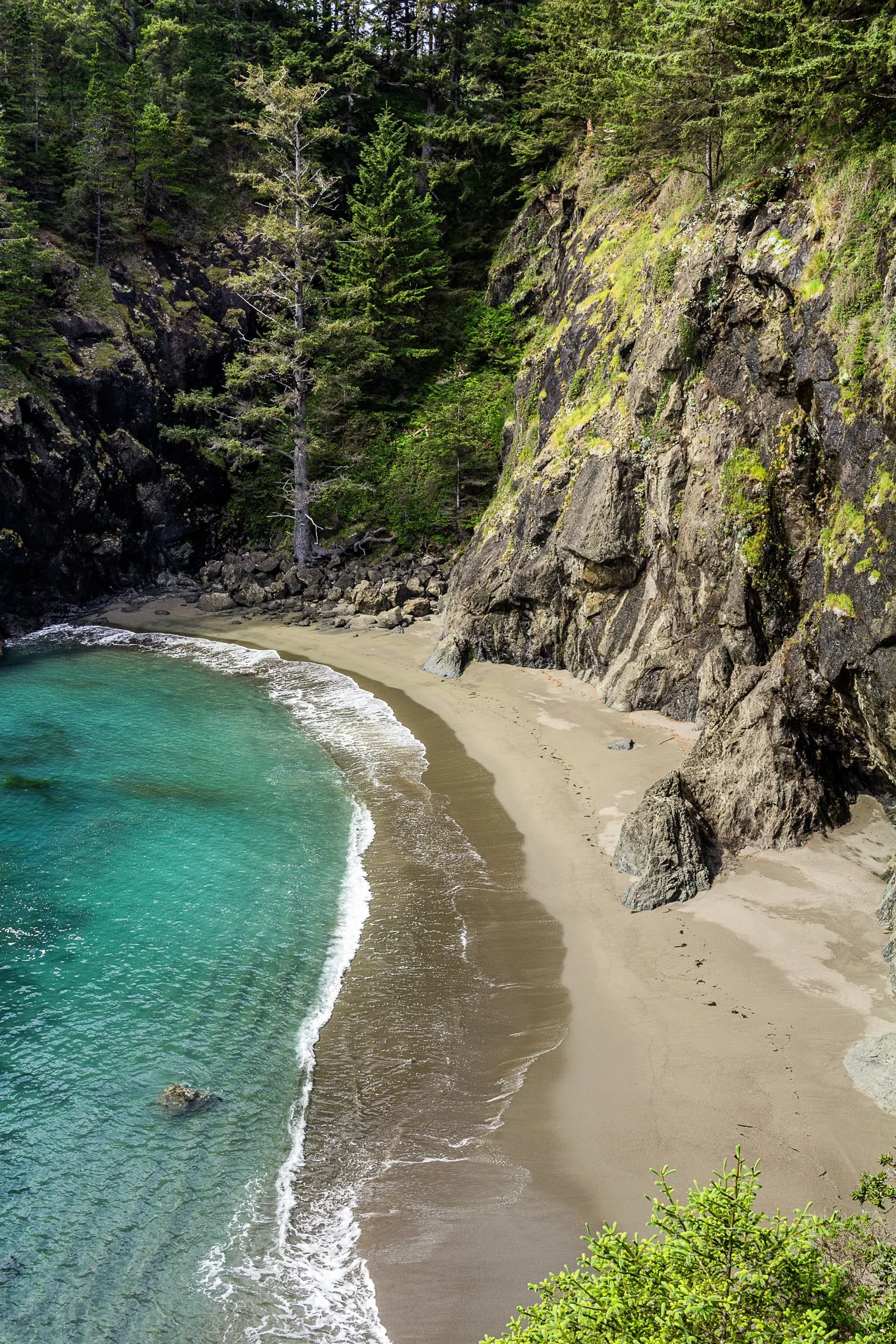
Samuel H. Boardman State Park, located along the southern Oregon coast near Brookings, Oregon, is renowned for its stunning coastal landscapes and diverse natural beauty. The park stretches for 12 miles along the coast, offering a variety of scenic views and ecosystems, from rugged cliffs to pristine beaches.
One of the park's most iconic features is its collection of sea stacks — tall, isolated rock formations that rise out of the ocean. These formations are often surrounded by crashing waves, adding to the dramatic beauty of the area.
While climbing out on to a precarious rocky perch with a 200 foot fall on either side to photograph some sea stacks, I noticed this beautiful cove to my right. It reminded me of something out of a Robert Louis Stevenson story where buried treasure might reside.
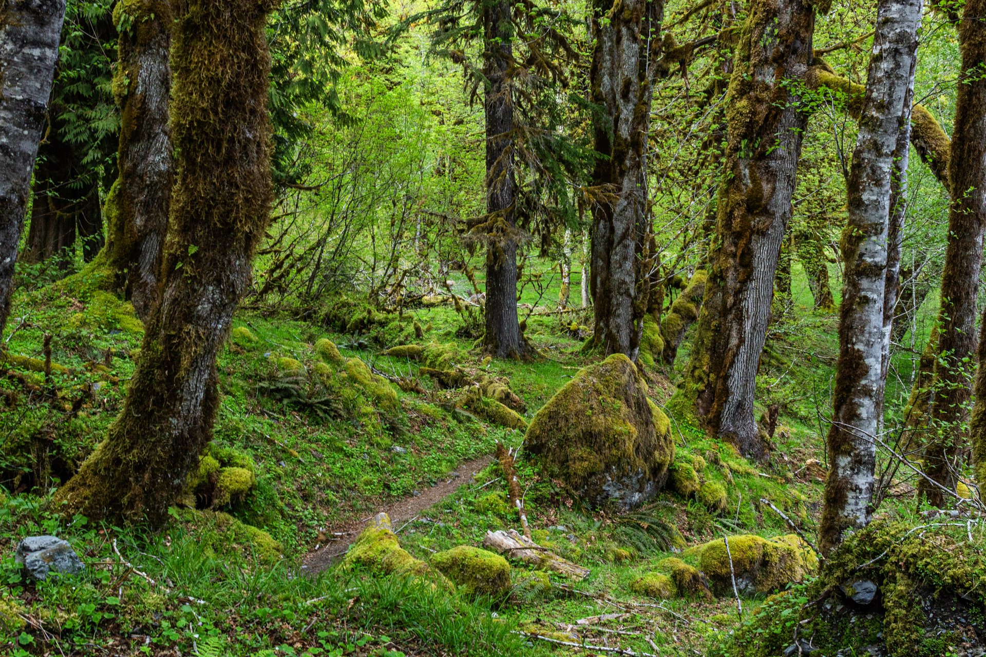
Enchanted Valley, dubbed the “Valley of 10,000 Waterfalls”, requires a 15 mile hike through the Quinault Rainforest in Olympic National Park. The rainforest receives a whopping 140-167 inches of rain per year. This precipitation allows Olympic National Park to maintain its incredibly biodiverse ecosystem.
The Enchanted Valley Chalet is at the terminus of the trail and was built in 1931. Originally meant to be a rustic lodge for hikers, it was used during WW2 to monitor potential Pacific Coast enemy threats. After the war it returned to its original purpose for backpackers and rangers.
The trail meanders along the river crossing many small streams on the way to the Chalet. Elk, bear, and marmots frequent the forest, rife with moss-laden trees, decaying logs with small trees growing out of them, and every type of green you can imagine. It truly is a fairy tale rainforest.

Early morning in Yellowstone National Park, located in northwest Wyoming, often comes with thick fog.
This fog is caused by the area’s geothermal activity where the warm moisture arising from the hot springs, geysers, and fumaroles meets the cool air of the early morning.
While heading to Artist’s Point early in the morning, I noticed the weird quality of light occurring and stopped off at a turnout to capture this eerie orange coloring.

The land near Savannah, IL marks a change to the typical flatness of Illinois. Known as the Driftless Area, the land becomes more sinuous and roads begin to twist and turn.
During the winter, when these lands turn to a frozen tundra, it reminds one of moods made famous in the film “Fargo” (1996). These lone trees have been thought to have marked boundary lines between properties before modern surveying techniques or to have offered shade during the work day.
There is something about these isolated trees in rural Illinois that continually draws my eye. I always wonder if they wonder where their neighbors went. They remain a beautiful contrast to the endless rows of cornfield, changing seasonal with the crop.

Crater Lake, located in Southern Oregon, in my humble opinion, is too big for a single frame—plain and simple. But the blue reflected back from the water it contains might be the purest saturation of blue I’ve ever seen in nature.
This deep blue comes a myriad of factors but, two big ones are the fact that the lake’s source is almost entirely snowfall and rainfall leading to very little sediment. The other factor is how deep the lake is. Crater Lake is a whopping 1,943 feet, leading to more pronounced absorption of wavelengths other than blue.
I arrived at Crater Lake a week after the road to the lake had been opened and the remnants of the snow were everywhere, a fact that altered my camping plans as the campground was deserted, but the two hours I spent at the lake were magical.

The cornfields near Savannah, IL follow twists and turns as the land enters the Driftless Area. It is here it becomes more sinuous and hilly with various streams run through the land.
It holds the name due to the fact that during the last Ice Age, it was left untouched by the glaciers during. As a result, the Driftless Area features rugged, unglaciated terrain with deep valleys, ridges, and bluffs. The absence of glaciers left the streams to carve out their path over thousands of years.
This particular stream sat tucked off a dirt road in the hills surrounding Savannah, IL, unassuming, beautiful.

The lone white pine on Chapel Rock, located in Pictured Rocks National Lakeshore is estimated to be about 250 years old. There once was an archway connecting the rock to the mainland but it collapsed in the 1940s.
Chapel Beach and the mouth of Chapel River is adjacent to Chapel Rock. The area invites hikers and boaters to linger, and a popular backcountry campground is found here, offering a secluded beach and access to many waterfalls.
After a long day of hiking, taking this sunset boat tour along Pictured Rock’s coast was a perfect way to end the day. It allowed stunning views as well as completely unique photographic perspectives not possible from the shore.

Buckskin Gulch, located in the Paria Canyon-Vermilion Cliffs Wilderness area, is the longest and deepest slot canyon in United States and possibly the world.
Marked by their sinuous carved rock, typically sandstone, slot canyons are often formed through water erosion over long periods of time and are particularly prone to flash floods. With these floods comes large debris, and often it does not always escape the canyon.
The base of this large tree is one such beautifully eerie example, requiring some maneuvering to proceed further into the canyon. On the way back I made sure to highlight this unique occurrence with one quick shot.

Cumberland Island National Seashore is a pristine 18 mile stretch of undeveloped wilderness unique to the East Coast.
The island has a long history, and was once owned by the Carnegie Family who then dedicated the island to the National Park Service in 1972. The island has faced various threats to its wilderness status and has been defended through the continued efforts of Carol Ruckdeschel, one of the few persons allowed to live on the island.
This was the view at my backcountry campsite at the north end of the island where the bay sat still as birds and the rare dolphin would pass by. This was the beautiful end to a long 10 mile hike.

Pictured Rocks National Lakeshore, located near Munising, Michigan, is known nationally as a tourist destination due to its dramatic bluffs overhanging Lake Superior, numerous waterfalls, and stunning fall foliage.
These bluffs, as well as the roads around Pictured Rocks, are accentuated by truly dramatic leaf color change for about two weeks in the fall, leading to a flock of photographers and tourists from all over the world.
Lake superior provided a the perfect complementary hue for these extremely saturated yellow leaves, a rare combination of color in nature.

John Dellenback Dunes Trail is one of the best “trails” in the Oregon Dunes National Recreation Area near Florence, Oregon. The sand dunes here one of the largest coastal sand dune systems in the world.
This area inspired Frank Herbert to write the science fiction book Dune. Herbert found this and the surrounding areas fascinating, studying desert ecology and erosion at a time when Oregon was establishing a way to combat the damage of the shifting dunes on the local towns by planting European Beachgrass.
Hiking these dunes was an exhausting but exhilarating experience requiring some astute navigation as a majority of the ”trail” can only be found by wooden markets in the sand, sometimes entirely buried by the dunes. This lone tree stuck out among the dunes as I turned around to keep my bearings.

Wizard Island is a volcanic cinder cone located within Crater Lake National Park. Crater Lake is the result of the eruption of an ancient volcanic named Mount Mazama, which erupted 7,700 years ago.
This eruption is what formed the caldera that is Crater Lake with Wizard island appeared later from subsequent lava flows into the lake. Visitors can even take seasonal boat tours to the island and hike to the summit.
Planning to camp for the night at Crater Lake, I showed up to a completely empty and snow-filled campground, leaving me to drive up to the lake, grab some photos, and move on to the next town. But that two hours I spend there were awe-inspiring. The blue in that lake is unlike any other found in nature.
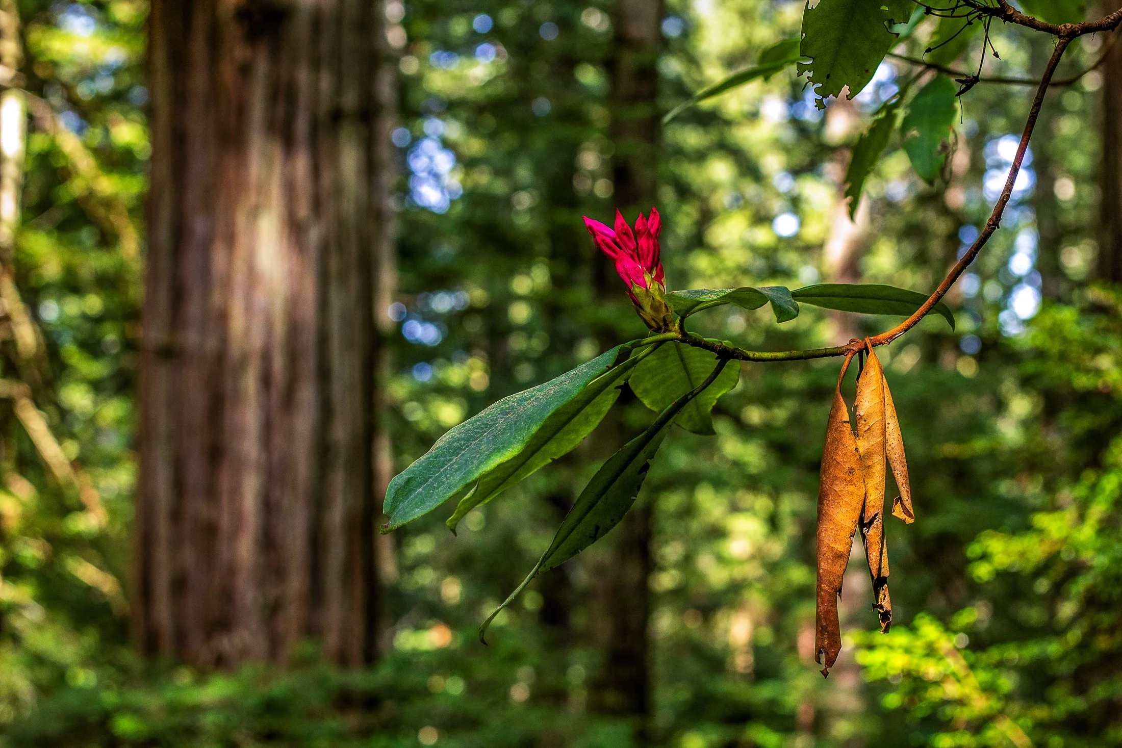
Humboldt County of Northern California is home to the southern section of the towering Redwood Forests which are conjoined effort of the National & State Park systems.
Contained within this section is the 31-mile world famous Avenue of the Giants. A mostly flat drive with gentle curves, passing secluded forest hamlets, campgrounds, picnic areas, and areas along the Eel River.
Offering extensive hiking trails, this was taken on a 5 mile loop, and finding this budding flower next to a dying leaf providing the perfect foreground to this vast redwood background.
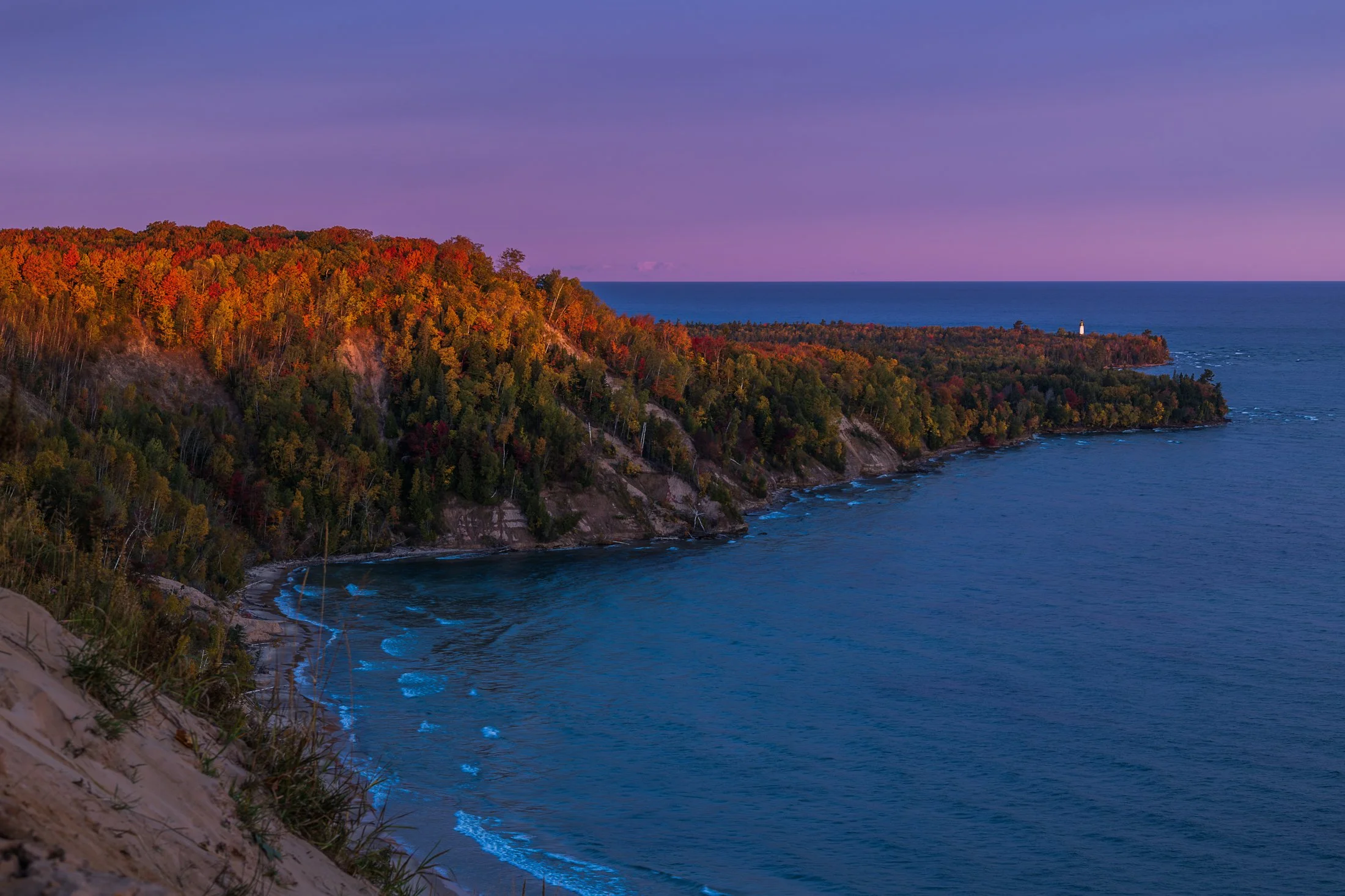
The fall colors of Pictured Rocks National Lakeshore are one of the marvels of the Upper Peninsula, especially in the early morning. Pictured here is the Au Sable Light, a lighthouse that was built in 1874 to prevent shipwrecks on Lake Superior.
The shoreline in this area is considered one of North America's most beautiful, but was once considered the most deadly areas for ships due to rocks under the shallow surface, violent storms, and frequent fog.
Requiring an early wakeup call, this photo involved positioning myself precariously on the shifting sands of the Grand Sable dunes before the sunrise. The changing color over the next hour was an amazing sight to behold as well as the moment the light broke across this stretch of coast.

The Grand Island East Channel Light was constructed in 1867 by the United States Lighthouse Service to help ships navigate the dangerous waters of the East Channel of Grand Island, which has historically been a busy route for steamships and commercial vessels.
The area was notorious for shipwrecks during the 1800s due to the complexity of the navigation and the strong currents in the surrounding waters. Decommissioned in the early 1970s the Lighthouse remains as an iconic stop on Pictured Rock Cruises.
While taking the cruise, I positioned myself on the outside seats to grab this photo, requiring a quick shutter speed and precise timing to get this compositon.
The area around Starved Rock State Park near Utica, Illinois, is one of the most scenic Illinois has to offer. The Illinois River cuts through the area and was one of the few areas in Illinois not flattened by glacial drift.
This beautiful tree on the bank of the Illinois river is a Sycamore, known as the London Plane. Often planted in the Victorian area to help quell the London pollution caused by the Industrial Revolution, this tree has been a stable of urban development. It can incur a disease known as the Witches Broom, causing the shoots to bunch up which also offers a natural nest for nearby birds.
Camping on the edge of the Illinois after a trip to Starved Rock, I set up my tripod to capture the active birds at sunset, but then this Sycamore caught my eye. The composition of the eerie branches against the beautiful purple glow of the setting sun was mad even better by the birds passing through the area.