

Black | White

The Grand Teton mountain range is one of the most breathtaking views in the contiguous United States. The main faulting that formed the range occurred around 10 million years ago during the Miocene epoch.
Since then, the range has continued to rise while the Jackson Hole basin has subsided, deepening the valley. This valley has become an idyllic vacation spot for many tourists during the summer months.
The road leading from the east to Grand Teton National Park is a one of the most spectacular ways to be introduced to the Tetons, and this one point perspective on US Route 26 provided the perfect example.

Buckskin Gulch, located in the Paria Canyon-Vermilion Cliffs Wilderness area, is the longest and deepest slot canyon in United States and possibly the world.
Marked by their sinuous carved rock, typically sandstone, slot canyons are often formed through water erosion over long periods of time. Flash floods are what make these strikingly beautiful canyons also some of the most dangerous to hike, with the runoff from a storm ten miles away potentially leading to the canyon on a day with clear skies.
These walls form their own abstract art where light reveals and conceals form, changing each minute with the path of the sun. This patch in particular caught my eye, evoking nature’s version of yin and yang.

Iconic, religious, Hollywood-graced, the East and West Mitten Buttes tower over the landscape at Monument Valley along the Utah-Arizona border.
These buttes hold religious significance for the Navajo People with legend holding that they are the remains of great religious deities. Later John Ford found his home in Monument Valley and made countless westerns there with John Wayne, with the Mittens featuring prominently in films such as “The Searchers” (1956).
Monument Valley maintains one of the best campsites I’ve ever had the pleasure of camping at. It sits atop a sand band looking out towards The Mittens, evoking a drive-in movie theater, replacing the screen with one of the best views in the West. I later focused my efforts on the West Mitten at sunset.
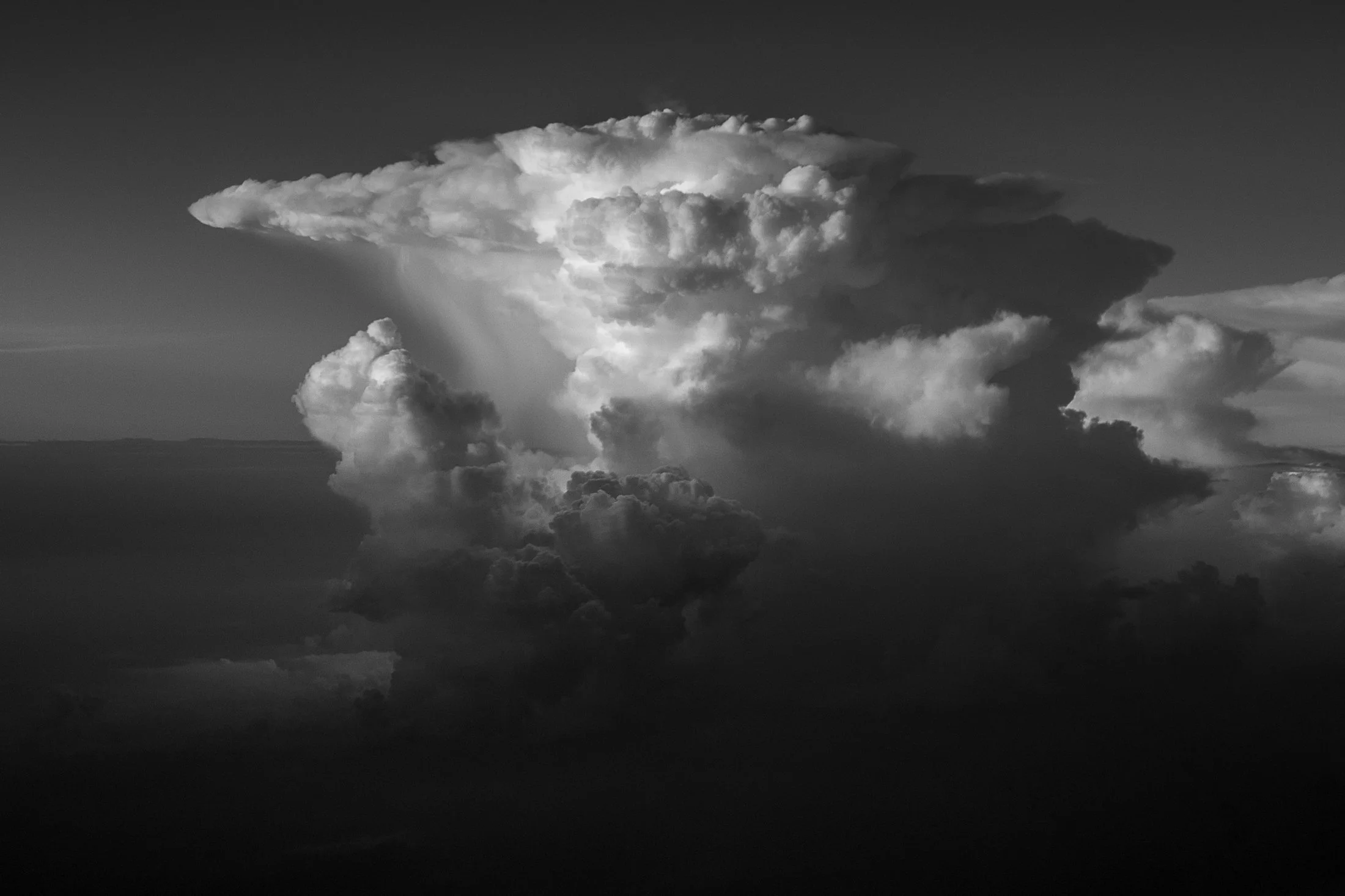
Cumulonimbus clouds are among the most powerful and visually striking clouds in the atmosphere. The only clouds that produce thunder and lightning, these towering giants can reach heights of over 12 miles.
One of the most distinctive features of a mature cumulonimbus cloud is its anvil-shaped top such as the one seen here, which forms when the cloud's upward growth is halted by the tropopause, causing the upper part to spread out horizontally.
I was lucky enough to witness this fascinating formation while taking off from Chicago at the tail end of a storm. The sheer size was daunting, and the setting sun raked against the cloud perfectly. This is an alternate to the color version, as I found both offer completely different vibes.
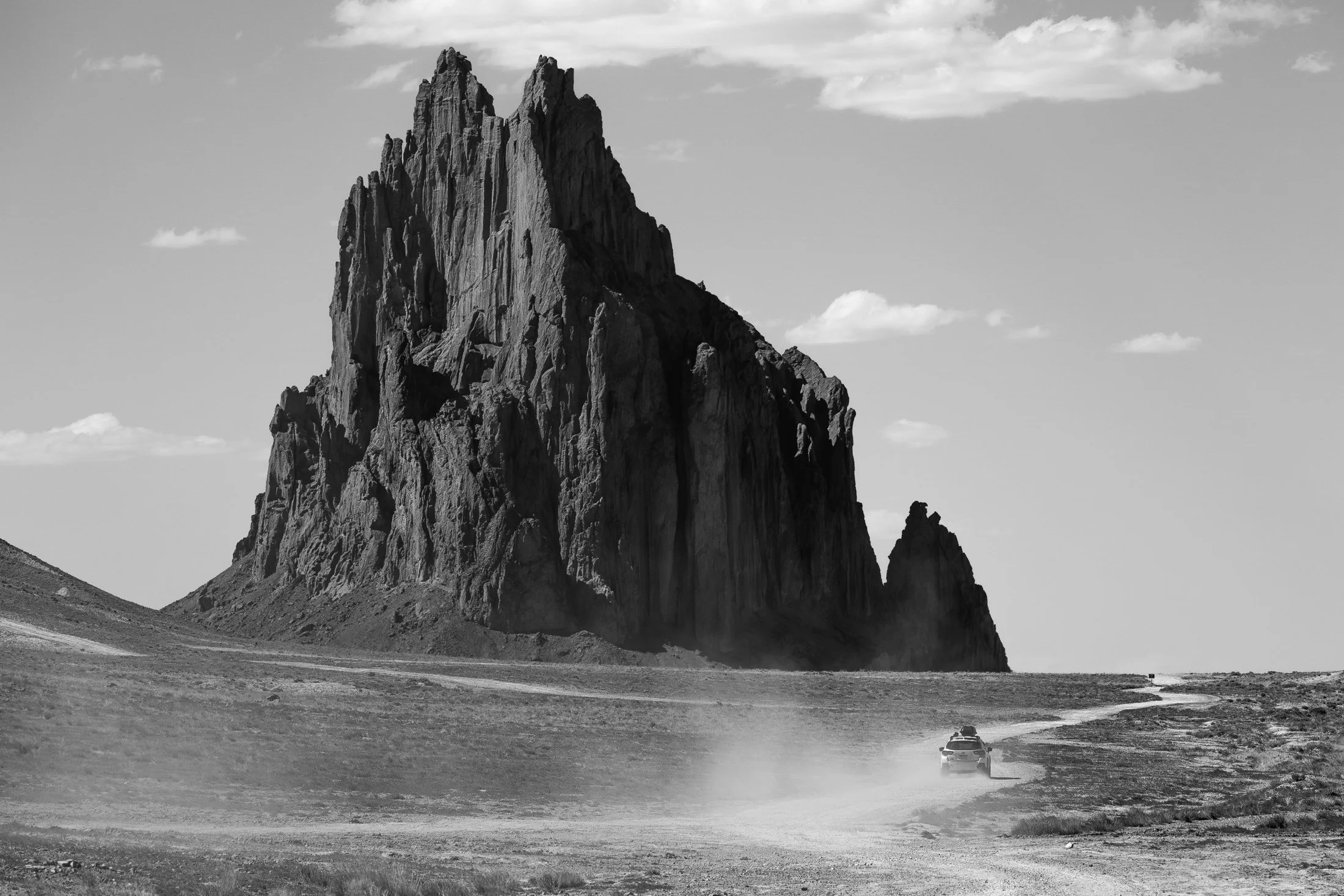
Located outside of Shiprock, New Mexico, the eponymous monolith is known by the Diné as Tsé Bit'a'í, which translates roughly to "Rock with Wings." The sacred site is a significant landmark to the Diné people, and approaching beyond a certain distance is off-limits to non-Diné travelers.
Tsé Bit'a'í is believed to be the remnant of a giant bird that played a crucial role in the creation story of the Diné. The formation, a volcanic neck, rises about 1,583 feet (482 meters) above the surrounding desert and is often considered one of the most iconic geological features in the region.
Upon approach, its gargantuan size becomes apparent, and one is left awestruck. There is no grand entrance, no signs of tourism, just the monolith towering over the surrounding land. A single car drove past, revealing a strange notion of time and space.

From above, Chicago’s famous grid system becomes a kind of urban quilt, stitched with rivers, highways, and rails. The skyline, punctuated by towers like the Willis Tower (though for Chicagoans it will forever be known as the Sears) and the St. Regis, rises like a great sculpture.
The city’s architecture seamlessly incorporates styles ranging from Gothic Revival and Art Deco to International and Postmodern, all layered along the river and gridded streets. Notable landmarks like Marina City, the Tribune Tower, and buildings by Frank Lloyd Wright create a living timeline of American design.
This photograph was taken while departing for O’Hare, heading toward New York. This was the tail-end of a storm and the cumulonimbus clouds gave a staggering scale of the sky in relation to the city, one which will forever remain my home.

The Grand Staircase-Escalante National Monument region is renowned for its expansive layers of sedimentary rock, shaped over millions of years by wind, water, and tectonic activity.
Visitors to the area encounter a breathtaking variety of rock features, including narrow slot canyons, towering cliffs, slick rock domes, and natural arches. These rocks not only define the physical character of the region but also serve as a natural record of Earth’s history.
This photograph was taken due to the need to escape the intense heat of the area, finding refuge in this little pocket of rock, providing important shade. This shade was a full 30 degree cooler from that of the exposed sun. While lying on a large slab of broken rock, the view above was an abstract wonder, only needing the right framing.
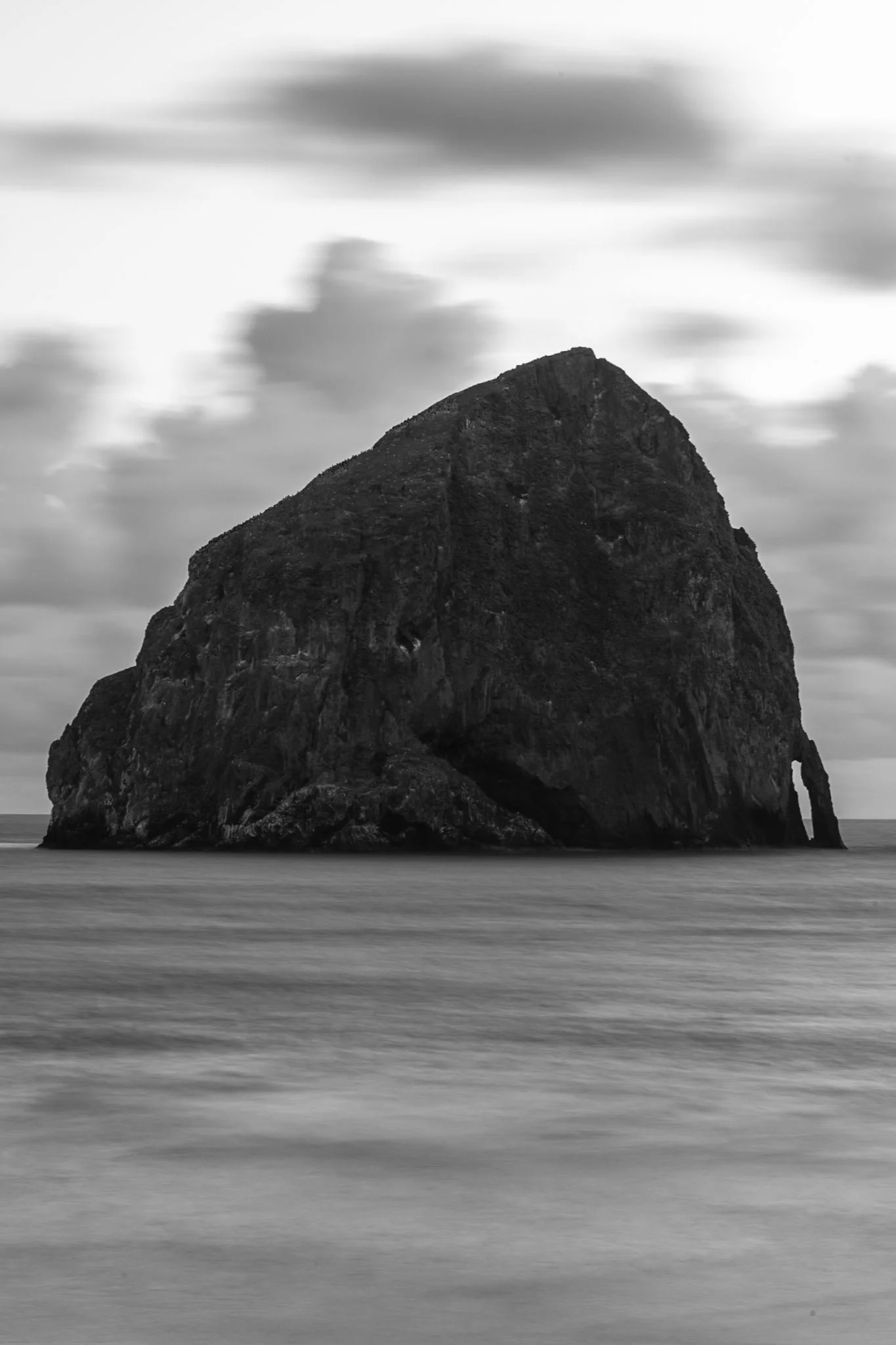
Haystack Rock near Pacific City, also known as Chief Kiwanda Rock, is an enormous sea stack located just offshore from Cape Kiwanda in Pacific City, Oregon.
Standing approximately 327 feet, it is one of the tallest sea stacks on the Oregon coast, even taller than the more famous Haystack Rock in Cannon Beach.
This was taken during a bustling evening near the Pelican Brewing Company, where patrons dined as the light broke through at golden hour, giving way to these stunning clouds behind the sea stack. After taking a sunset shot, I found the solitary nature of the rock against the ocean waves fascinating and wanted a visual that gave a sense of its unmoving nature over the past 17 million years.

Grand Teton National Park is one of the most stunning mountain ranges in America. The fact that it is located right near Yellowstone makes these two National Parks a one-two knockout.
The Teton Range are prone to strong winds, especially in the spring and fall. These winds often create wispy cirrus clouds accenting the beauty of this staggering mountain range.
I found this scene after showing up to the National Park rather late after a long drive across Wyoming. These peaks are some of the most magnificent America has to offer, and their sheer prominence is a sight to behold.

Named the most “Beautiful Place in America” by Good Morning America, Sleeping Bear Dunes National Lakeshore is a Midwest vacation destination located near Empire, Michigan.
The sands at Sleeping Bear are constantly shifting, with the tallest dune exceeding 400 feet. Originating during the last Ice Age, these sands were formed through glaciers slow grinding down of the rock.
Noticing the moving sand while hiking, its flow became a subject onto itself. This photo provides a strange juxtaposition between concrete sand and the windblown abstraction.

Mirror Lake near Granby, Colorado, is a pristine alpine gem nestled in the Indian Peaks Wilderness, offering a breathtaking reflection of the dramatic Lone Eagle Peak.
Accessible via a scenic hike from Monarch Lake, Mirror Lake sits at an elevation of over 10,000 feet and is renowned for its crystal-clear waters and tranquil setting. The lake is a popular destination for backpackers, photographers, and nature lovers seeking a true backcountry experience in the wilderness.
While this was one of the most tiring hikes of my life, due to my added camera weight while backpacking, the trek was more than worth it. After making camp the previous night, this day involved traversing the surrounding area. I found this view summed up the vibe of this surreal setting.

Cumberland Island National Seashore is a pristine 18 mile stretch of undeveloped wilderness unique to the East Coast. With this comes an undeveloped beach that provides a stunning juxtaposition to the developed lands north and south of it.
The island has a long history, and was once owned by the Carnegie Family who then dedicated the island to the National Park Service in 1972. The island has faced various threats to its wilderness status and has been defended through the continued efforts of Carol Ruckdeschel, one of the few persons allowed to live on the island.
Through multiple visits to Cumberland, I have always found the sands particularly beautiful, creating myriads of abstract patterns. Each time I visit, I spend time with these Rorschach tests.

Buckskin Gulch, located in the Paria Canyon-Vermilion Cliffs Wilderness area, is the longest and deepest slot canyon in United States and possibly the world.
Marked by their sinuous carved rock, typically sandstone, slot canyons are often formed through water erosion over long periods of time and are particularly prone to flash floods. With these floods comes large debris, and often it does not always escape the canyon.
The base of this large tree is one such beautifully eerie example, requiring some maneuvering to proceed further into the canyon. On the way back I made sure to highlight this unique occurrence with one quick shot.
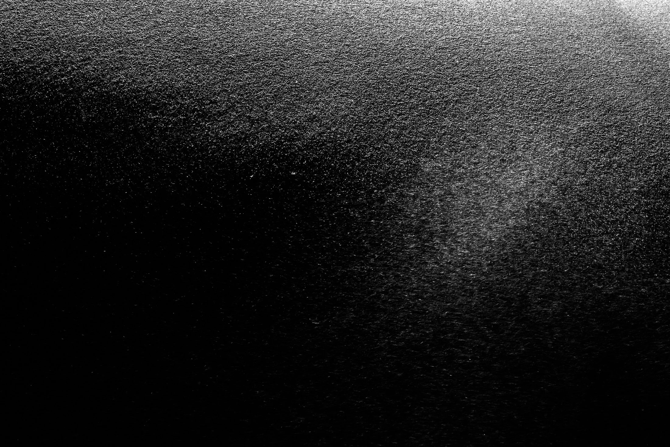
Named the most “Beautiful Place in America” by Good Morning America, Sleeping Bear Dunes National Lakeshore is a Midwest vacation destination located near Empire, Michigan.
The sands at Sleeping Bear are constantly shifting, with the tallest dune exceeding 400 feet. Originating during the last Ice Age, these sands were formed through glaciers grinding down the rock.
Noticing the moving sand while hiking, its flow became a subject onto itself. This photo provides a strange juxtaposition between concrete sand and the windblown abstraction.

The Indian Peaks Wilderness is a protected wilderness area in north-central Colorado, encompassing approximately 73,931 acres within the Arapaho and Roosevelt National Forests, as well as a portion of Rocky Mountain National Park.
Established by Congress in 1978, it offers a pristine natural environment characterized by rugged granite peaks, glacially carved valleys, and over 50 alpine lakes.
Hiking up to Lone Eagle Peak was one of the most tiring hike of my life, due to my added camera weight while backpacking, but the trek was more than worth it. This was taken right as we were leaving the area, and luckily I turned around to see this composition encapsulating all that makes this wilderness truly unique.

Canyon de Chelly National Monument is a joint venture between Navajo Nation and The National Park Service to preserve this unique area of land. The ruins throughout the monument are remnants of the Anasazi who inhabited the region between 750 and 1300 CE.
These people built their domiciles into the sides of the canyon, which offered protection from the elements as well as neighboring enemies. The land is now owned by Navajo Nation and is a sacred site. It is unique for an NPS area in that the Dinë people live on and farm the land.
The sheer size of the canyon is a sight to behold, and this area has been the fascination of photographers since the 1800s, with photographer Edward S. Curtis being one of the first to show its massive scale on celluloid.
Early morning in Yellowstone National Park usually comes with thick fog. This fog is caused by the area’s geothermal activity where the warm moisture arising from the hot springs, geysers, and fumaroles meets the cool air of the early morning.
Orb-weaver spiders, known for their iconic wheel-shaped webs, exist in large numbers in the park, making the temperate geysers their home. Their intricate webs are a work of art, and when glistening in the morning dew, like the one pictured here, they reveal their true beauty.
This one appeared as I strolled the boardwalk of the mud pits in the early morning, and I immediately set up my tripod. This exact imagery is referenced in the allegory of Indra’s Net; the buddhist conception of the world.