

Oranges

Oranges
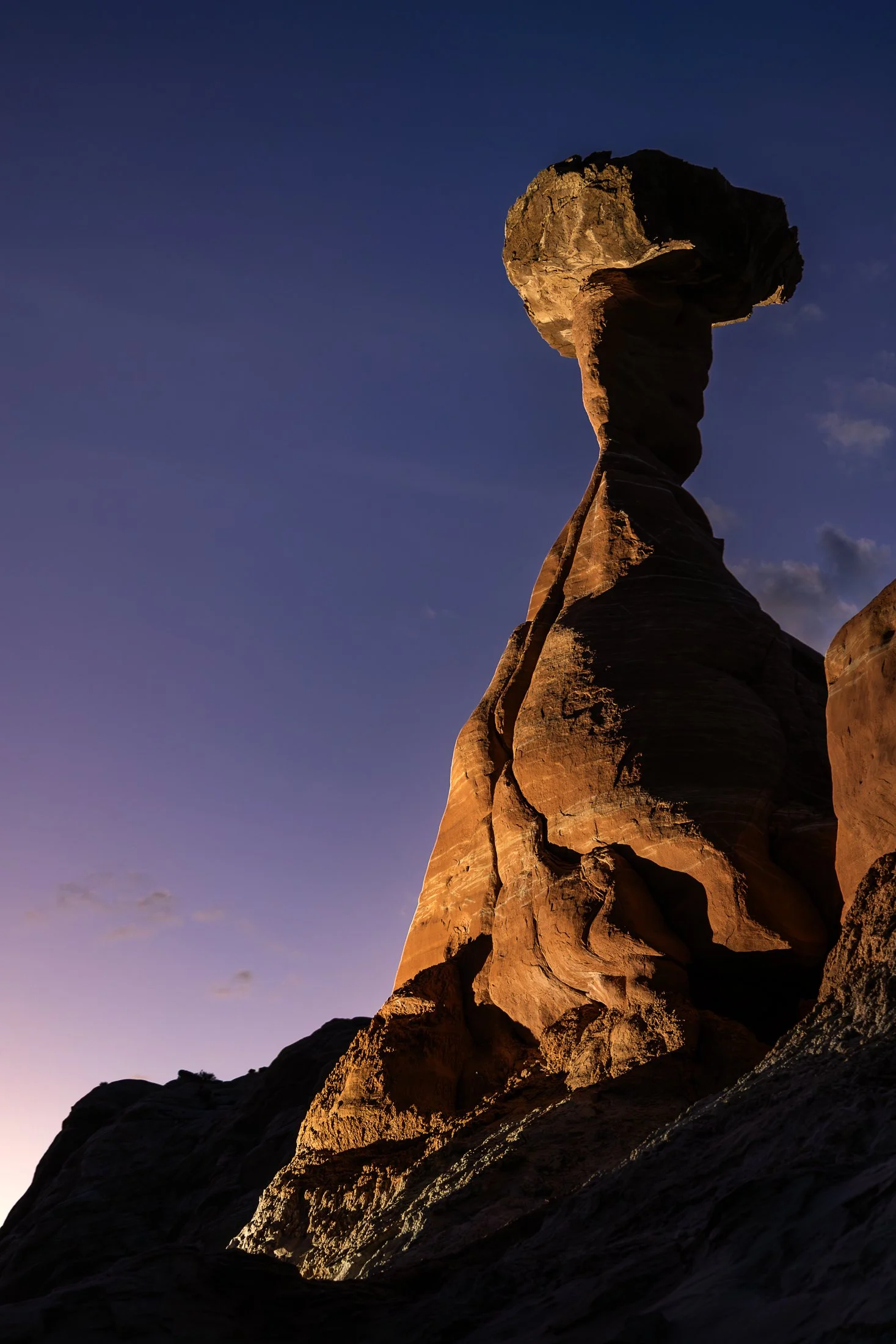
The Toadstool Hoodoos, located outside of Kanab, Utah and Page, Arizona, are part of the greater Grand Staircase-Escalante National Monument. The trail is unassuming, located at a small turnoff on Highway 89. The trail to the hoodoos meanders through the valleys of small eroded plateaus with large amounts of scree covering the area.
These unique formations find their creation from the Dakota Sandstone boulders that sit atop the Entrada Sandstone pedestals. Once the softer Entrada Sandstone erodes, the Dakota Sandstone resides leaving a cap, like a mushroom, on top.
This photo was taken after a group of friends and I decided to stop off here for sunset following a particularly exhausting 8 mile hike through Buckskin Gulch. With the setting sun providing enough darkness for me to use my off camera flash, I channeled my inner studio photographer and directed my friend where to hold the flash to best reveal its form, giving rise to magnificent colors and striations against the purple hue of the setting sun.
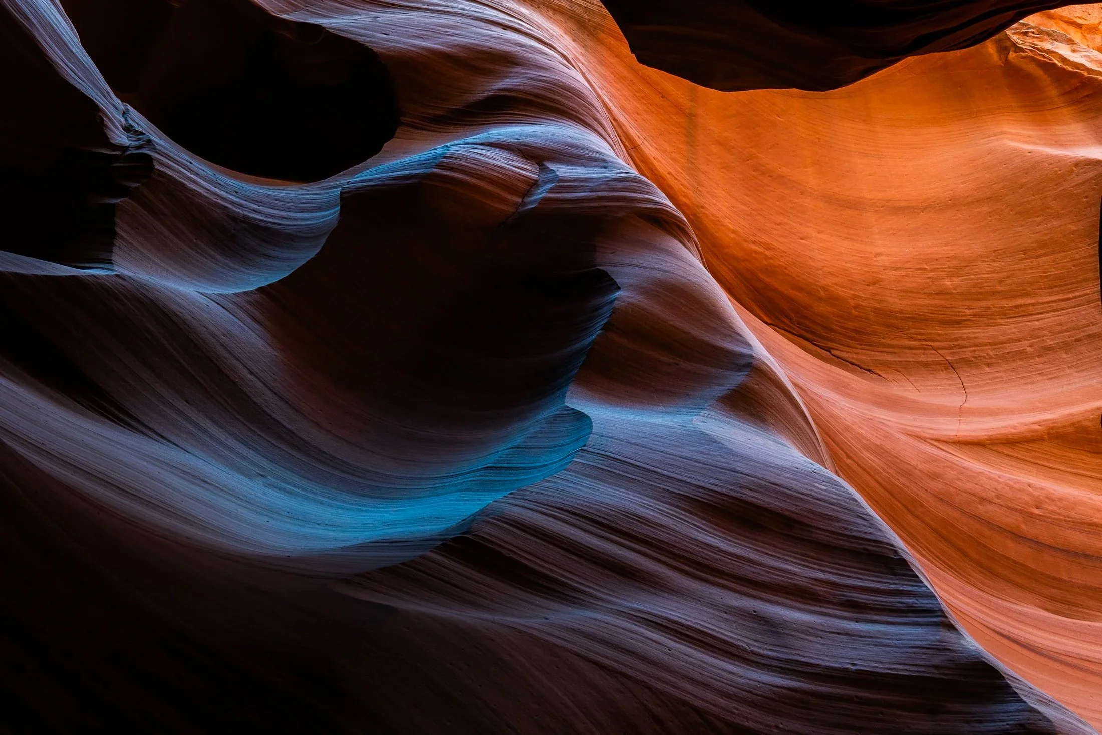
Antelope Canyon, located in northern Arizona within the Navajo Nation right outside the town of Page, is one of the most picturesque slot canyons in the world. Running over 23 miles, it was formed over millennia through consistent erosion, primarily through the actions of flash floods that sculpt the sandstone rock into smooth, undulating forms.
Having traveled to Page numerous times, I had always opted for Buckskin Gulch, another slot canyon in the area that resides on BLM land and does not require a paid tour. My fourth time in the area I decided to partake on a tour and the views did not disappoint. Guided by a local Diné (Navajo) tour guide, I was entreated to various stories of Navajo belief as well as given a private photography tour of the canyons.
The canyons continually conceal and reveal form throughout the day, as the sun follows its path across the sky. My tour followed a relatively short section of the greater Antelope Canyon, and yet I found I could have spent days here and never arrive at the same photo twice. This abstract section reinforces the stunning tonality and color nature creates in the shade of these canyons.
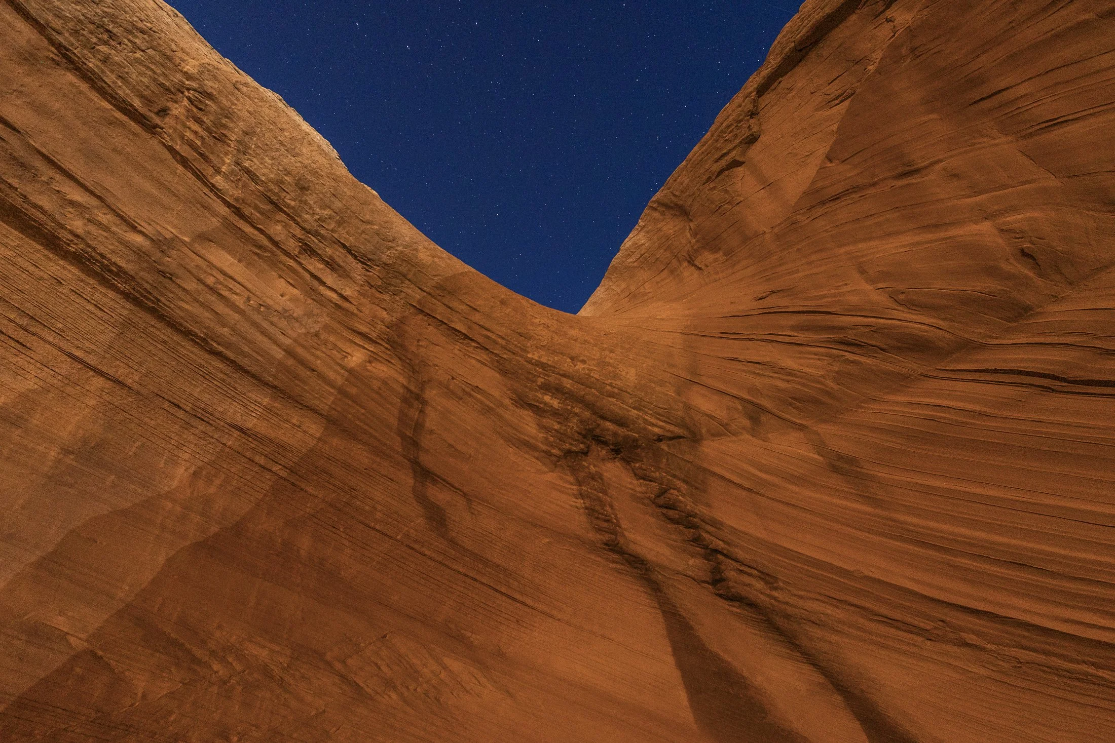
Page, Arizona, near Grand Staircase–Escalante National Monument, is one of my favorite towns in the Southwest. A crossroads between the Grand Canyon, Monument Valley, and Zion National Park, the area has become a vacation destination for desert residents and tourists alike, offering recreational water activities such as charting a boat through the flooded canyons of the man-made Lake Powell.
Lake Powell is a key part of the community which stores and regulates water from the Colorado River for the area as well as powering the Glen Canyon Dam which provides hydroelectric electricity to surrounding area and beyond. The red rock in this area is next to none, with every area offering beautiful trails and hidden views around each corner of the city.
This photo was taken in one such area which was behind a local gas station a mile outside of town. This is a well known sand cave that has gone viral on social media. The feeling of being in this cave is stunning, but I found the warped red rock a much more fascinating feature. Using a long exposure, I used my headlamp to paint the rock against the starry night.
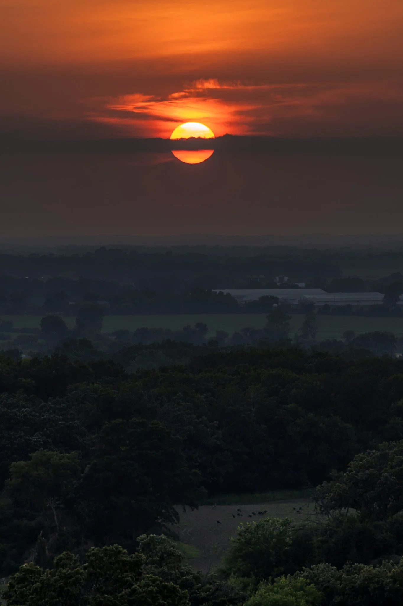
Kettle Moraine is a beautiful unique region in southeastern Wisconsin, shaped by the massive glaciers carving the landscape during the last ice age. The area features continuous rolling hills, deep valleys, and kettle lakes.
Named for the unique glacial carvings, kettles exist as depressions in the earth that fill with water over time, creating serene ponds and lakes. John Muir’s family immigrated to Wisconsin as a child, settling on a farm near the rugged terrain of the Kettle Moraine. This area played a crucial role in shaping his philosophy of conservation and his advocacy for preserving wild spaces.
Hiking through the forests of Kettle Moraine was an experience i did not expect. Each turn reveals a new region distinct from the last. This hike from my campsite to the one prominent overlook in the area ended with a stunning sunset overlooking the pastoral lands below.

Buckskin Gulch, located in the Paria Canyon-Vermilion Cliffs Wilderness area, is the longest and deepest slot canyon in United States and possibly the world.
Marked by their sinuous carved rock, typically sandstone, slot canyons are often formed through water erosion over long periods of time. Flash floods are what make these strikingly beautiful canyons also some of the most dangerous to hike, with the runoff from a storm ten miles away potentially leading to the canyon on a day with clear skies.
These walls form their own abstract art where light reveals and conceals form, changing each minute with the path of the sun. This patch in particular caught my eye, not only for its abstract nature, but the small patch of life growing along its walls.

Carl G. Washburne Memorial State Park may be the one of the most scenic stretches of the entire Oregon Coast. Located about 15 miles north of Florence, and only a few miles past Heceta Head Lighthouse (a trail connects the two parks), the surrounding area offers a portal to another world.
The China Creek Trail weaves through coastal forests terminating on the beach, and the picturesque Hobbit Trail, known for its moss-draped trees and old-growth forest, make the hiking here magical.
This photograph was taken moments after sundown, following a chaotic two hours of trying to photography too many areas at once. I used the last remaining daylight to grab this abstract before retiring to my campsite across the main road. The park is a quiet place, unassuming, and it is here that shows Oregon’s true beauty.

Carl G. Washburne Memorial State Park may be the one of the most scenic stretches along the entire Oregon Coast. Located about 15 miles north of Florence, and only a few miles past Heceta Head Lighthouse (a trail connects the park), this area offers a portal to another world.
The China Creek Trail which weaves through coastal forests terminating on the beach, and the picturesque Hobbit Trail known for its moss-draped trees and old-growth forest.
This photograph was taken after sundown following a chaotic two hours of photographing. I used the last remaining daylight to grab this abstract before retiring to my campsite across the main road. It is a quiet place, unassuming, and it is here that shows Oregon’s true beauty.

In the Midwest, nuclear power plants are a vital part of the energy infrastructure, and many of them are surrounded by sprawling cornfields. This unusual pairing is more practical than it might seem. Nuclear plants require large safety buffer zones, which makes rural farmland an ideal setting.
At the same time, the actual footprint of a nuclear facility is relatively small, allowing the surrounding land to continue being used for agriculture. Illinois, in particular, stands out as the top nuclear-generating state in the country, with 11 reactors at six sites, most of them nestled in farming regions.
Having just finished photographing these monoliths from the other side, I was stunned by the scene developing in my rear view mirror as I sped down the country road. With someone tailgating me, I signaled at the next service road, parked in front of a farm, and quickly set up my tripod to grab this shot.

Harris Beach State Park, located just north of Brookings, Oregon, is a coastal haven renowned for its dramatic scenery, diverse wildlife, and rich marine ecosystems.
The park's centerpiece is Goat Island (also known as Bird Island), the largest offshore island along the Oregon Coast. This National Wildlife Refuge is a breeding ground for over 100,000 seabirds, including tufted puffins and Leach’s storm-petrels, making it a prime spot for birdwatching.
This photo was taken during a quiet moment alone on the beach as the last vestiges of light began to disappear. Harris Beach is one of my favorite places on the Oregon Coast, offering endless photographic opportunities and true tranquility.

Harris Beach State Park, located just north of Brookings, Oregon, is a coastal haven renowned for its dramatic scenery, diverse wildlife, and rich marine ecosystems.
The park's centerpiece is Goat Island (also known as Bird Island), the largest offshore island along the Oregon Coast. This National Wildlife Refuge is a breeding ground for over 100,000 seabirds, including tufted puffins and Leach’s storm-petrels, making it a prime spot for birdwatching.
This photo was taken during a quiet moment as the last vestiges of light revealed eerie silhouettes of the rock formations surrounding Harris Beach. It is one of my favorite places on the Oregon Coast, offering endless photographic opportunities, a great campsite, and a beach unlike any other.
Everglades National Park is a park that reveals itself slowly, it requires those with patience and keen observation to see its true beauty.
Known colloquially at the “River of Grass”, the Everglades is one of the largest wetland ecosystems in the world. One of the only places in the world in which both alligators and crocodiles coexist, it also contains one of the largest mangrove forests systems in the world. But it’s true beauty is the sanctuary it provides for all manner of birds make it their home or migratory stopping point.
This photo was taken sitting around a fire at my campsite following a long day of kayaking through a mangrove forest strewn with alligators. Requiring the stitching of two photos, this is one of the few images I offer that was not captured in camera due to the nature of how depth of field works in a camera versus our eye, but the light and view was too good to not attempt to emulate what I saw.

“The sky is the ultimate art gallery just above us.”
-Ralph Waldo Emerson-
On my drives across the corn belt, I’ve always been enamored with the lone trees among the endless fields.
Some say they are for markers for property boundaries, others that they were once a primary source of shade for farmers from a bygone era. Whatever the case, their air of mystery sits majestic among the expansive cornfields of the Midwest.

“Time is, time was, but time shall be no more.”
- James Joyce (Portrait of an Artist as a Young Man) -
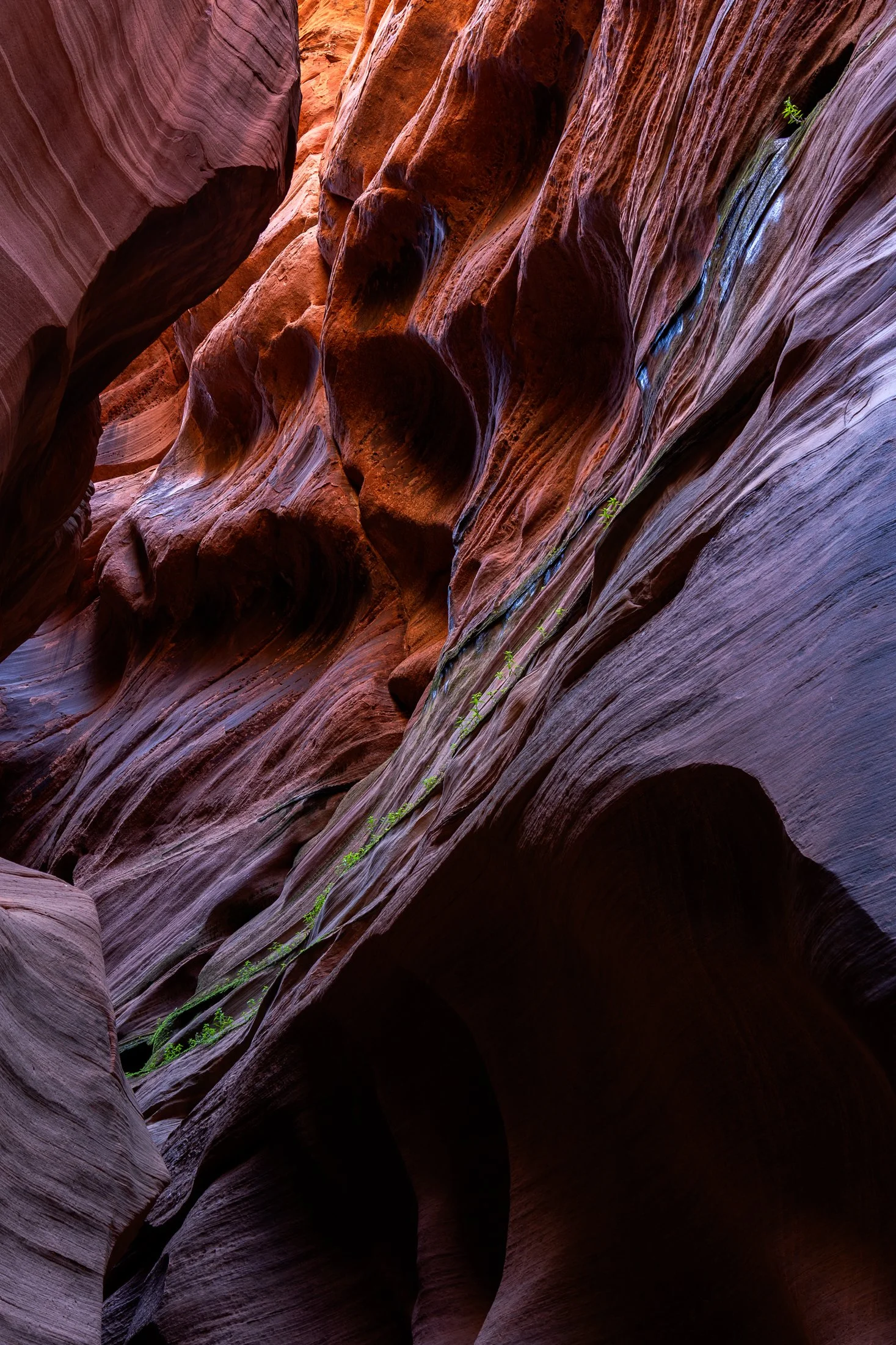
Buckskin Gulch, located in the Paria Canyon-Vermilion Cliffs Wilderness area, is the longest and deepest slot canyon in United States and possibly the world.
Marked by their sinuous carved rock, typically sandstone, slot canyons are often formed through water erosion over long periods of time, often coming from flash floods. This is what make hiking these beautiful canyons so dangerous. A storm from ten miles away can funnel into the canyon on a day with clear blue skies.
The plant growth on the side of this canyon is a unique sight. Small amounts of water and sunlight find their way to these plants allowing them to survive in this surreal environment.

Early morning in Yellowstone National Park, located in northwest Wyoming, often comes with thick fog.
This fog is caused by the area’s geothermal activity where the warm moisture arising from the hot springs, geysers, and fumaroles meets the cool air of the early morning.
While heading to Artist’s Point early in the morning, I noticed the weird quality of light occurring and stopped off at a turnout to capture this eerie orange coloring.

St. Marys is a quaint little town in southern Georgia. The town provides ferry access to Cumberland Island National Seashore, which offers 18 miles of undeveloped wilderness.
St. Marys became a point of conflict during the War of 1812, with the British raiding the town in 1815. It established itself as a port town, with shipping and trade. The town’s economy declined following the abolish of slavery and reestablished itself as tourist community in the mid-20th century.
This photograph was taken while returning from Cumberland Island on the daily ferry. The sun lined up perfectly along this strip of clouds making the bay and the surrounding boats shimmer gold.

A sunset over the Tetons is one of the most stunning views nature has to offer. One reason the Teton Range is famous is due to the dramatic prominence visible from the eastern side, which rises sharply from 4,000 to 7,000 feet above the valley floor.
Aerial debris will often obscure the Tetons during sunset leading to a fascinating ghostly form on the landscape, but when the air is clear the sunsets are incredible, accentuating the fascinating form of one of America’s greatest mountain range.
The mosquitos were in full force as I rushed to set up my tripod shortly after arriving at Grand Teton. I rented a rustic cabin (offered at the Grand Teton campsite), consisting of two unfinished cots and a fire pit. I drove down to the lake and set up this shot while providing a perfect meal for the skeeters.

Lone Eagle Peak is a marvel among Colorado’s already stunning collection of mountains peaks.
Named for Charles Lindbergh, the “Lone Eagle”, after his historic transcontinental flight, the mountain is tucked in the Indian Peaks Wilderness and requires at 15 mile hike to reach base where two mountain lakes sit.
This was captured at one of the most tiring moments in my life; 15 miles up the mountain with 50 lbs of camping and camera gear. I now travel lighter when climbing mountains. I arrived at camp completely spent, and struggled to make the effort to grab this shot as the light faded from the mountain.

Cumberland Island National Seashore is a pristine 18 mile stretch of undeveloped wilderness unique to the East Coast.
The island has a long history, and was once owned by the Carnegie Family who then dedicated the island to the National Park Service in 1972. The island has faced various threats to its wilderness status and has been defended through the continued efforts of Carol Ruckdeschel, one of the few persons allowed to live on the island.
This was the view at my backcountry campsite at the north end of the island where the bay sat still as birds and the rare dolphin would pass by. This was the beautiful end to a long 10 mile hike.

Cumberland Island National Seashore is a pristine 18 mile stretch of undeveloped wilderness unique to the East Coast.
The island has a long history, and was once owned by the Carnegie Family who then dedicated the island to the National Park Service in 1972. The island has faced various threats to its wilderness status and has been defended through the continued efforts of Carol Ruckdeschel, one of the few persons allowed to live on the island.
I had visited the wild protected beaches of both the Atlantic and Pacific Ocean in the same calendar year when I took this photo, and I cannot divide my love for both. The sunrise peaked through the clouds this particular morning, while I photographed on an empty beach. It is a peaceful memory I recall often.
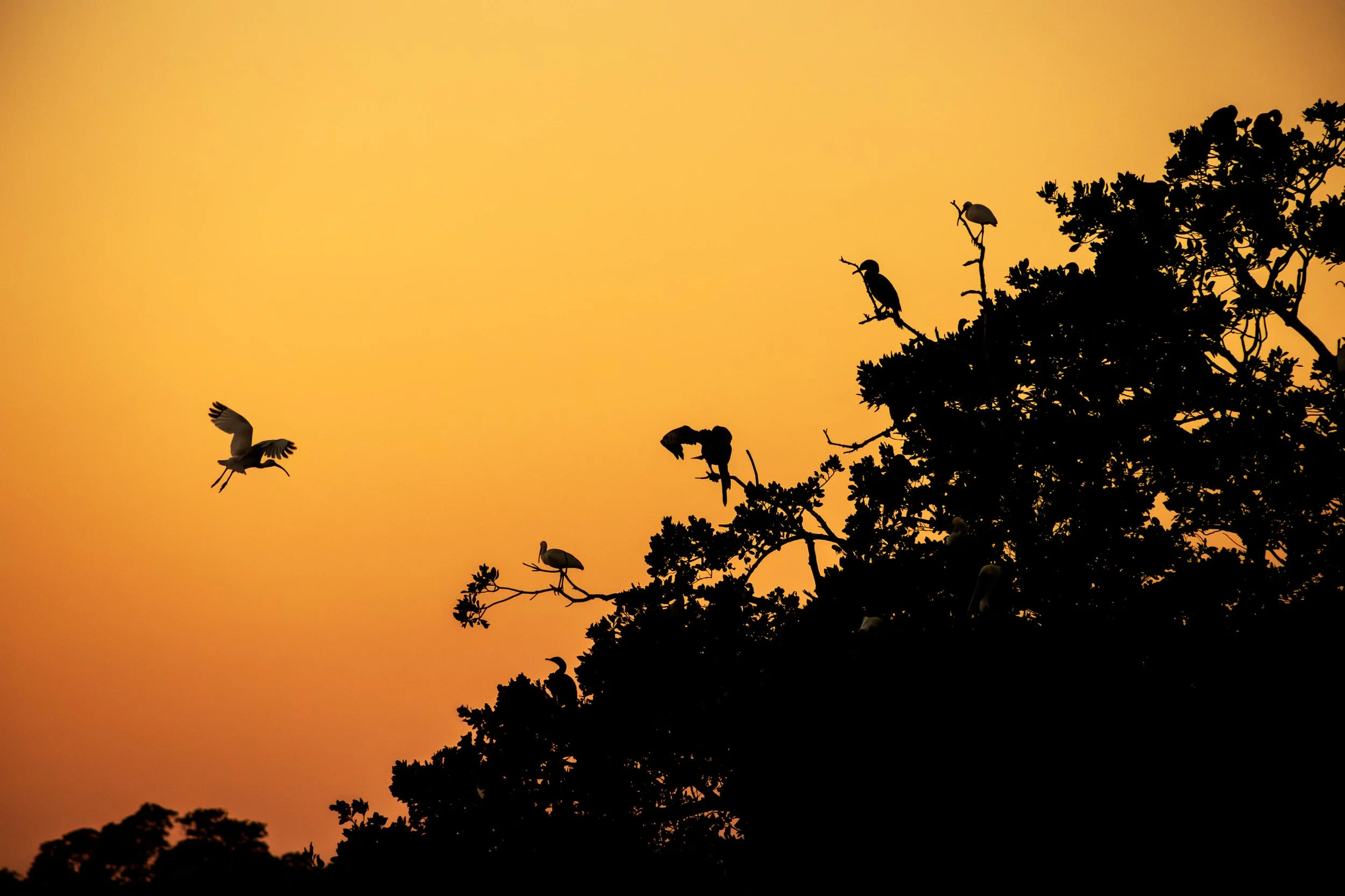
Everglades National Park is a park that doesn’t present itself as grandly as the others, it requires those with patience to see its true beauty.
Known colloquially at the “River of Grass”, the Everglades is one of the only ecosystems to house both alligators and crocodiles. It also contains one of the largest mangrove forests in the world and, due to the diverse ecosystem, all manner of birds make it their home.
I happened to be the lone passenger on as sunset Everglades boat tour and the captain was kind enough to veer off the usual course and tailor it to my photography. At the end of the tour, when he brought me to one of the mangrove rookeries these birds call home, an egret flew into frame and began its landing as I snapped the photo. It was a sunset I’ll never forget.

Cumberland Island National Seashore is a pristine 18 mile stretch of undeveloped wilderness unique to the East Coast.
The island has a long history, and was once owned by the Carnegie Family who then dedicated the island to the National Park Service in 1972. The island has faced various threats to its wilderness status and has been defended through the constant efforts of Carol Ruckdeschel, one of the few persons allowed to live on the island.
This was my first trip on the island, and luckily I was the sole person on this wild beach on an early December morning. The sun rays fanned out on the horizon in a way I had never seen before, but it was this sand bank that made the shot, producing a fascinating abstraction of the landscape.

The Bisti Badlands are a remote and alien world in northwest New Mexico located in the Bisti/De-Na-Zin Wilderness, protected by the Bureau of Land Management.
The name comes from the Dinë (Navajo) word “Bistahi” translating roughly to “among the adobe formations”. The wind-formed hoodoos in this region are numerous leading to bizarre formations, varied colors, and precariously balanced rocks.
Backpacking into the desolate desert the previous night, a place where no trail exits, I woke up early the next morning to capture the morning light. This land lives beautiful isolation, undisturbed, as the elements continue their magnificent sculpting each day.

Olympic National Park protects over 70 miles of coastline making one of the longest protected coastlines in the contiguous United States.
Located near Forks, Washington this coast features a multitude of sea stacks littered a short distance from the beaches. Wildlife is rife with bears occasionally feeding from the rivers emptying out from the rainforest and bald eagles being a frequent sight.
Taken at Mosquito Creek after setting up camp, I descended a steep sand bank via a rope tied to a tree and walked the beach alone at sunset. I set up my tripod and got lost in the waves oscillating beneath my feet.
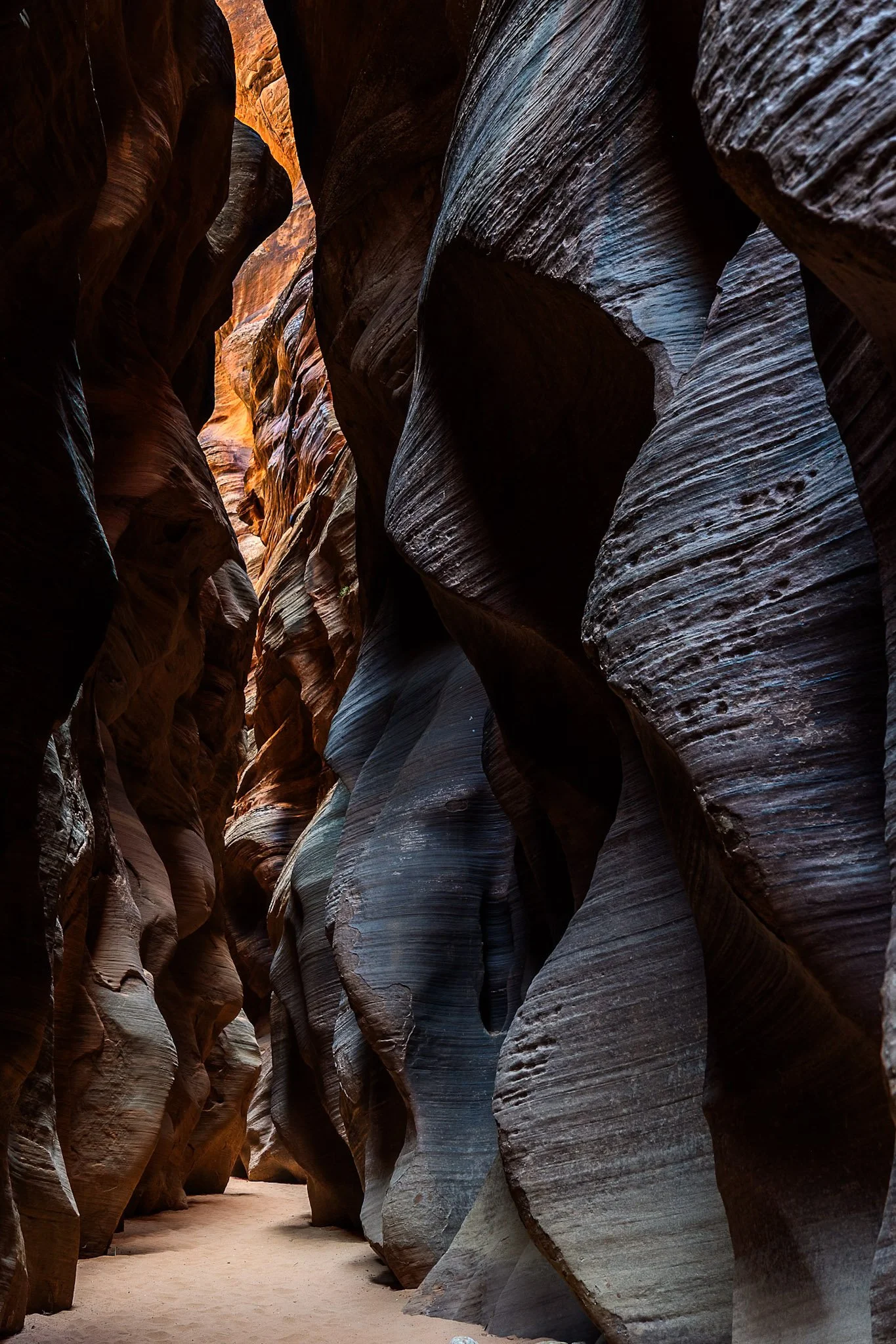
Buckskin Gulch, located in the Paria Canyon-Vermilion Cliffs Wilderness area, is the longest and deepest slot canyon in United States and possibly the world.
Marked by their sinuous carved rock, typically sandstone, slot canyons are often formed through water erosion, particularly flash floods. These are what make these beautiful canyons so dangerous, as water can be carried from a rainstorm many miles away leading to deadly flash flood during clear skies with no escape route.
Fairly deep into the canyon at this point, I had made sure to observed several weather apps before embarking. Two years earlier with only one day to hike it, I called off the hike due to a 1% chance of rain. I later found out that chance was responsible for flooded the canyon, trail, and road all the way to US Route 89, a distance of three miles.

Grand Prismatic in Yellowstone National Park is one of the most popular tourist attractions in the park.
Part of the Midway Geyser Basic, this area is fueled by the Yellowstone Caldera, one of the largest volcanic systems in the world.
This turquoise pool is an offshoot of the bigger Grand Prismatic, showcasing the wide open spaces Yellowstone is known for.

Originally covered by oceans and rivers, Monument Valley is a testament to time. Located on the Colorado Plateau near the Arizona-Utah Border, the valley displays the wondrous effects of weathering and erosion.
With the softer rock being eaten away over time by the elements, the harder rock is left exposed in curious and awe-inspiring formations that have religious significance for the Diné (Navajo) People and iconic significance for the American West.
Pictured here is “Sentinel Rock” profiled with an edge light from the setting sun. I was able to capture this photo right from my campsite, one of the most beautiful I’ve ever camped at, which also sits facing The Mittens.

Springbrook Prairie Natural Preserve, located in Naperville, Illinois, is one of the few remaining natural prairies in Illinois, spanning 1,800 acres.
Known as the Prairie State, Illinois’ prairie is now .1% of what it once was, owing this to farming, industrialization, and the scrawling metropolis of Chicago. This Preserve is one of the largest in the Chicagoland area and visiting it is a step back in time.
Planning to photograph the prairie at sunset, this cloud formation became the most interesting thing in the area. The wispy cirrus clouds caught the descending light at just the right angle crystalizing this the fleeting moment.

Iconic, religious, Hollywood-graced, the West Mitten Butte watches over the land of Monument Valley, a stunning area residing along the Utah-Arizona border.
These buttes hold major religious significance for the Navajo. Legend holds they are the remains of great religious deities. Filmmaker John Ford found his home in Monument Valley, countless westerns there with John Wayne, with the Mittens featuring prominently in such films as “The Searchers” (1956) and have now become icons of the American West.
Monument Valley maintains one of the best campsites I’ve ever had the pleasure of camping at, and it is a perfect one for photographing the Mittens. The campsite sits atop a sand band looking straight out towards The Mittens, evoking a drive-in movie theater, replacing the screen with one of the best views in the West.
The dunes in and around Coral Pink Sand Dunes State Park, located on the border of Utah, are primarily shaped by wind and erosion, which picks up and transports sand particles across the valley floor. Sediment from surrounding mountains supplies the sand forming these natural features.
The area is known for frequent ATV usage, allowing visitors to traverse the dune system in style. Sandboarding is also available for purchase from the state park, but be careful, as these boards gain some speed especially on the larger dunes.
This was my third visit to the state park, and there’s a reason I keep coming back. The campsite is phenomenal, allowing access to the dune system from the campground. I grabbed this shot right before my friend’s footprints ruined the pristine, untouched dune. This was the first stop on my most recent trip to the Kanab area, with the next stop being the dangerously beautiful Buckskin Gulch.