

Roads

Roads
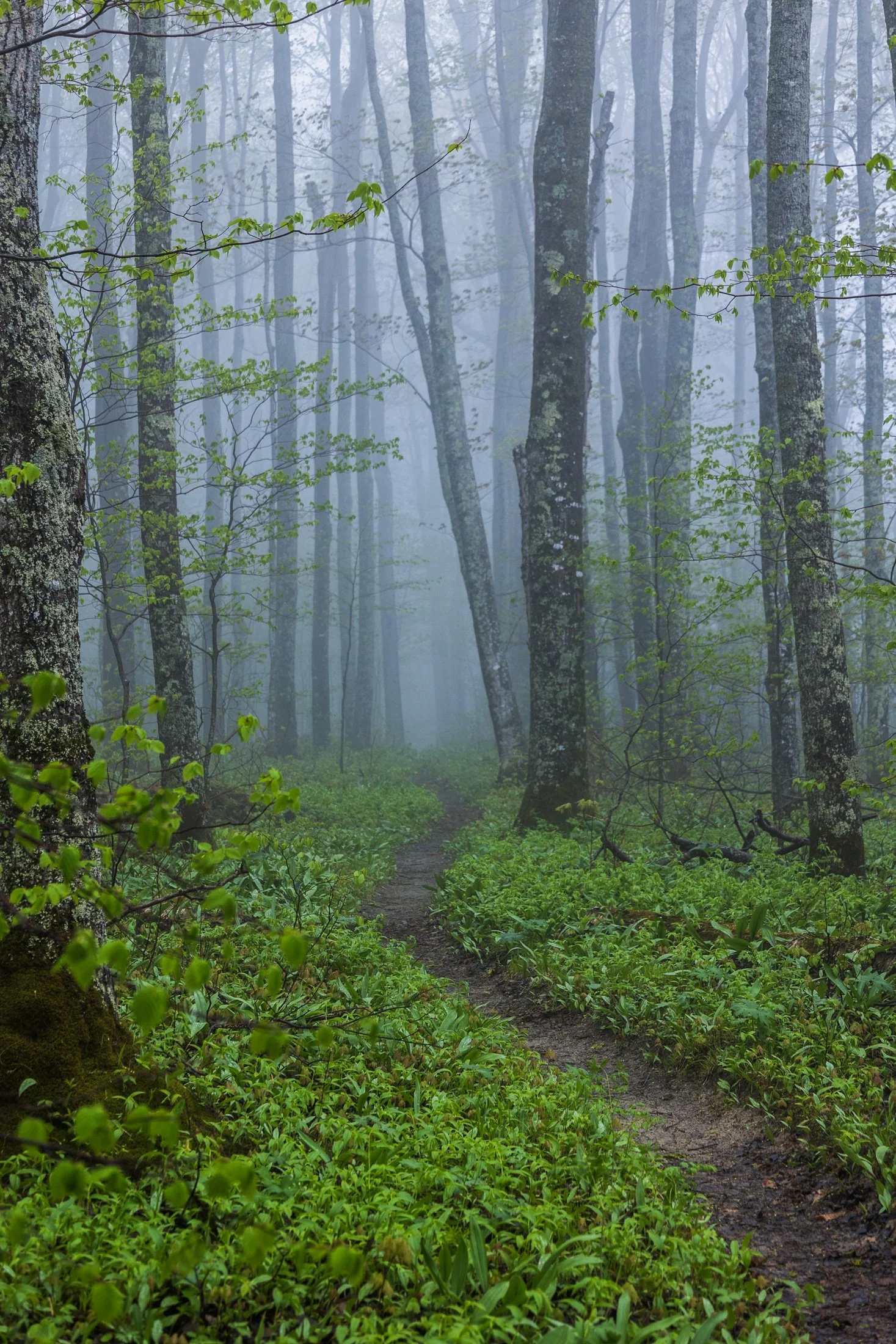
Pictured Rocks National Lakeshore, located near Munising, Michigan, already provides a stunning hiking opportunity for those willing to trek its bluffs, but in the early morning they can often take on a surreal atmosphere as the fog rolls in, transforming the area into a mystic forest.
This fog is often the result of the extremely cold waters of Lake Superior mixing with the warmer air from the land. As the fog rolls in, it muffles sound and adds depth to the already vibrant sandstone cliffs, creating a dramatic backdrop for an already stunning hike.
This particular photo occurred during an 11 mile backpacking trek along the cliffs, providing the one respite from a continuous onslaught of rain throughout the day. The experience of hiking through this atmosphere must be experienced, as this photo barely does it justice, but this winding trail disappearing into the fog serves as a glimpse into its magic.

From above, Chicago’s famous grid system becomes a kind of urban quilt, stitched with rivers, highways, and rails. The skyline, punctuated by towers like the Willis Tower (though for Chicagoans it will forever be known as the Sears) and the St. Regis, rises like a great sculpture.
The city’s architecture seamlessly incorporates styles ranging from Gothic Revival and Art Deco to International and Postmodern, all layered along the river and gridded streets. Notable landmarks like Marina City, the Tribune Tower, and buildings by Frank Lloyd Wright create a living timeline of American design.
This photograph was taken while departing for O’Hare, heading toward New York. This was the tail-end of a storm and the cumulonimbus clouds gave a staggering scale of the sky in relation to the city, one which will forever remain my home.

Highway 1 through Big Sur, California, is one of the most iconic drives in the world, offering dramatic views of the rugged Californian coast. Known for its winding road, narrow bridges, and steep cliffs, this section of highway hugs the coastline for nearly 90 miles before terminating just south of San Francisco.
Originally completed in the 1930s using convict labor and WPA funding, the road has been repeatedly closed and rebuilt due to landslides and erosion common in the area. Despite its challenges, Highway 1 remains a vital lifeline for Big Sur’s small communities and tourism-based economy.
Driving the One is something that cannot be described and must be experienced. This shot was accomplished by holding the camera out the driver’s side window, making sure I had a high shutter speed to stop motion, and trying to angle it in a way that might lead to a good composition. It was a lucky shot and not a great way to photograph, safety first.
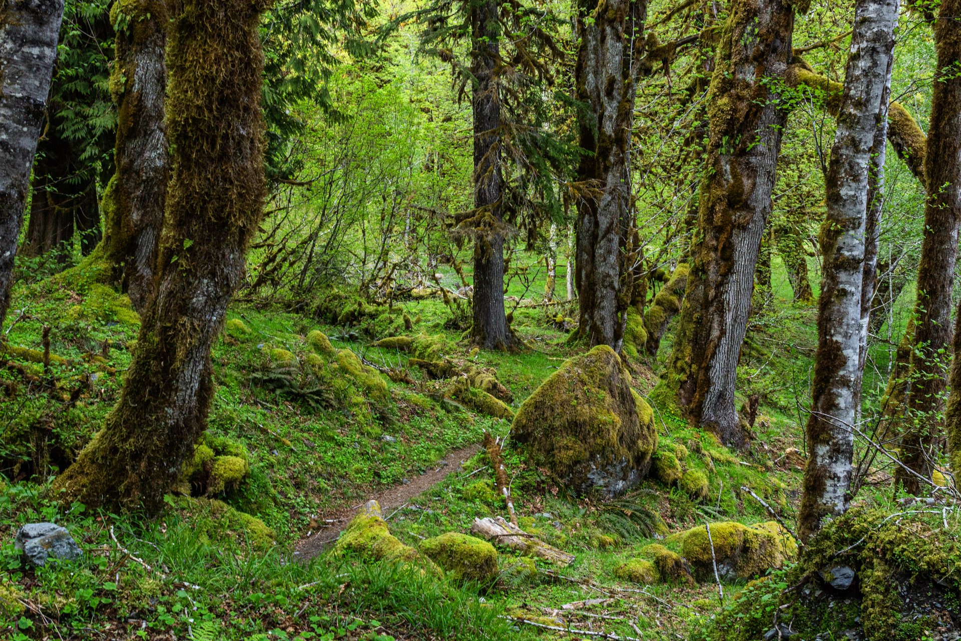
Enchanted Valley, dubbed the “Valley of 10,000 Waterfalls”, requires a 15 mile hike through the Quinault Rainforest in Olympic National Park. The rainforest receives a whopping 140-167 inches of rain per year. This precipitation allows Olympic National Park to maintain its incredibly biodiverse ecosystem.
The Enchanted Valley Chalet is at the terminus of the trail and was built in 1931. Originally meant to be a rustic lodge for hikers, it was used during WW2 to monitor potential Pacific Coast enemy threats. After the war it returned to its original purpose for backpackers and rangers.
The trail meanders along the river crossing many small streams on the way to the Chalet. Elk, bear, and marmots frequent the forest, rife with moss-laden trees, decaying logs with small trees growing out of them, and every type of green you can imagine. It truly is a fairy tale rainforest.

The Grand Teton mountain range is one of the most breathtaking views in the contiguous United States. The main faulting that formed the range occurred around 10 million years ago during the Miocene epoch.
Since then, the range has continued to rise while the Jackson Hole basin has subsided, deepening the valley. This valley has become an idyllic vacation spot for many tourists during the summer months.
The road leading from the east to Grand Teton National Park is a one of the most spectacular ways to be introduced to the Tetons, and this one point perspective on US Route 26 provided the perfect example.

Yellowstone is home to the largest free-ranging bison population in the U.S., offering a rare glimpse into their natural behavior in the wild.
They live in majestic matriarchal family herds where the experienced older cows provide protection, social structure, and learning opportunities for younger bison while the bulls often live alone or in bachelor groups, joining the family herds during the summer mating season.
Wild bison in the US once ran into the millions but were almost hunted to extinction in the 1800s. Yellowstone now serves as a sanctuary for these creatures, but their protection must constantly be guarded, for while humans have the ability to eradicate nature, they also have the ability to preserve it.

Mammoth Cave National Park, located in south central Kentucky, is the largest cave system in the world. The tunnels of Mammoth cave are what give it its name, with some chambers the size of large subway systems.
The cave has been a source of tourism in the United States all the way back to the 1800s with enslaved men being some of the first tour guides and explorers of the cave, and the history of Mammoth Cave is entwined with African American history.
I took this photo after an amazing tour of the cave and caught the guard on his way out. I’ve always found the entrance unassuming without a hint as to what lies in wait but 300 feet further.

Congaree National Park in South Carolina is the largest intact expanse of old growth bottomland hardwood forest remaining in the southeastern United States.
The Congaree River floodplain had a rich history with bootlegging during the prohibition era, where authorities would be hard pressed to find the spirits stored in the recesses of the swamp land that locals knew well.
I spent one night at Congaree, and it has stuck in my mind since. Tho capture this photo I needed to creep further onto the flooded boardwalk to get the right angle resulting in water flooded my boots. It took great effort to dry them out for my backpacking trip the following morning.

It was once of the most scenic stretches of railroad in the country. Winding through nine tunnels and over seven high steel trestles, the 15-mile route crossed the rugged Bitterroot Mountains between Idaho and Montana. It is known as the Route of the Hiawatha.
The route has now been converted to a rails-to-trails path but it was originally constructed in the 1890’s the railroad and connected the Eastern United States to the Pacific Northwest via the Northern Pacific Railroad. It was finally converted to a trail in the 1970s.
I rented a bike at Lookout Pass for the day, and while a big thunderstorm hung on the periphery, and caused some minor inconvenience. Biking through 10 pitch black tunnels with only a headlamp is an experience I will never forget.
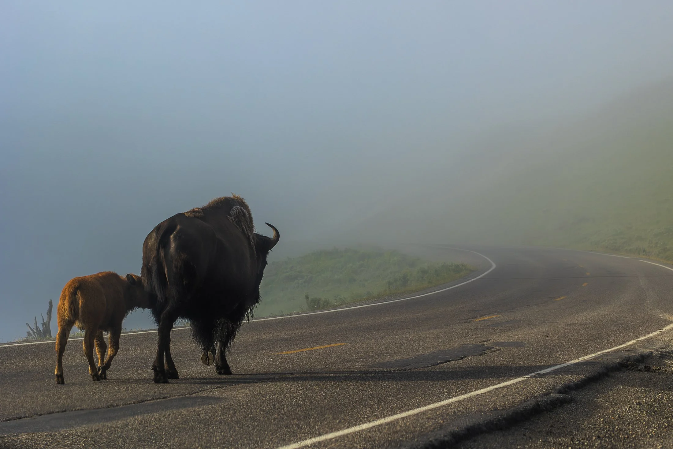
Yellowstone is home to the largest free-ranging bison population in the U.S., offering a rare glimpse into their natural behavior in the wild. Wild bison in the US once ran into the millions but were almost hunted to extinction in the 1800s. Yellowstone now serves as a sanctuary for these creatures.
They live in majestic matriarchal family herds where the experienced older cows provide protection, social structure, and learning opportunities for younger bison while the bulls often live alone or in bachelor groups, joining the family herds during the summer mating season.
When visiting Yellowstone, it becomes readily apparent we are visitors in their home. Traffic is frequently stopped to allow these bison to pass on the road. This shot came from one such instance as the bison herd migrated to the other side of the road.

Congaree National Park in South Carolina is the largest intact expanse of old growth bottomland hardwood forest remaining in the southeastern United States. The Congaree River floodplain had a rich history including being a prominent area for bootleggers to hide their wares during the prohibition era. Authorities would be hard pressed to find the spirits stored in the recesses of the swamp land where the locals knew like the back of their hand.
Congaree is a mysterious land and one I would like to come back and kayak through as the boardwalks were completely flooded when I arrived. While this prevented me from exploring much of it, it was a prime example of the beauty of the area, one which cannot be tamed.
The best angle to capture this flooded boardwalk required the sacrifice of the dryness of my boots. I needed to dry them out before the next morning’s backpacking trip so I blasted the heat in my car with my shoes next to the vent while I sat in 90 degree bumper to bumper traffic. All worth it.
The South Coast Wilderness Trail is a stunning, rugged, and truly wild 17 mile one-way hike through Olympic National Park. One of the last undeveloped coastlines in the contiguous United States, Olympic’s protection status ensures native species like sea otters, bald eagles, bears, and migrating whales will continue to thrive in this pristine wilderness.
Switching between stretches of picturesque coast and dense rainforest, the trek (which is at sea level) entails 2,000 feet in elevation change, due to the use of ladders and ropes to maneuver up and down coastal embankments.
This was one such area on my backpacking trip where the trail climbed several hundred feet following a rope climb from the beach. The blue of this area of the Pacific is stunning, especially contrasted with the lush greenery of Olympic’s rainforest.