
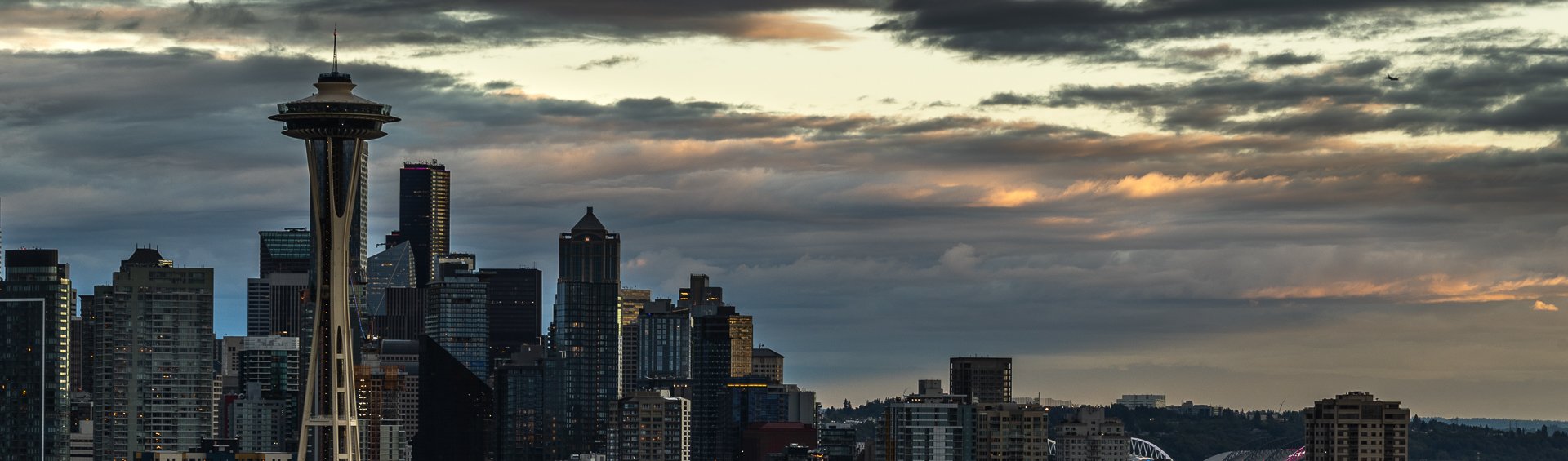
Pacific Northwest

Pacific
Northwest

Wizard Island is a volcanic cinder cone located within Crater Lake National Park. Crater Lake is the result of the eruption of an ancient volcanic named Mount Mazama, which erupted 7,700 years ago.
This eruption is what formed the caldera that is Crater Lake with Wizard island appeared later from subsequent lava flows into the lake. Visitors can even take seasonal boat tours to the island and hike to the summit.
Planning to camp for the night at Crater Lake, I showed up to a completely empty and snow-filled campground, leaving me to drive up to the lake, grab some photos, and move on to the next town. But that two hours I spend there were awe-inspiring. The blue in that lake is unlike any other found in nature.
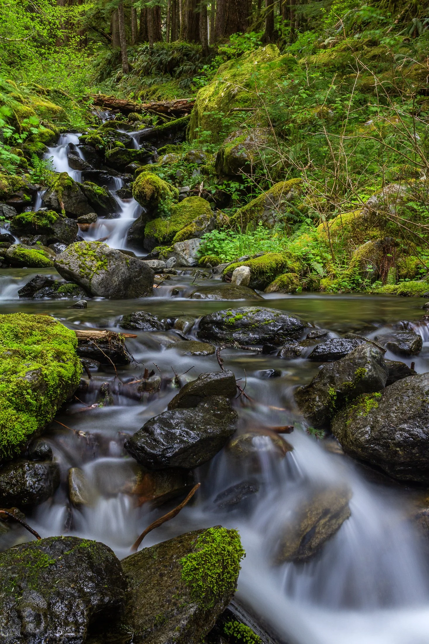
Enchanted Valley, dubbed the “Valley of 10,000 Waterfalls” requires a 15 mile hike through the Quinault Rainforest in Olympic National Park. It is one of the few rainforest in the United States, and receives 140-167 inches of rain per year. The precipitation leaves Olympic National Park with one of the most biodiverse ecosystems in the United States.
The Enchanted Valley Chalet at the end of the trail was built in 1931 and was originally meant to be a rustic lodge for hikers. Eventually it transformed into a monitoring station during WW2 to scout for potential Pacific Coast enemy threats. After the war it returned to its original purpose for backpackers and rangers.
The trail crosses many streams on the way to the chalet allowing us to forgo storing water for the hike while backpacking and instead drink the glacial melt from the streams via a LifeStraw. I have not tasted water better than that before or since.

The Palouse region, located in southeastern Washington and extending into portions of Idaho and Oregon, was originally home to the Palus people, historically known for breeding strong horses, but the U.S. government did not acknowledge them as a distinct tribe in the late 1800s as settlers arrived under the Homestead Act.
Indigenous communities were displaced, and the land was drastically reshaped by agriculture. The region’s deep loess soil and steep terrain led farmers to adopt contour plowing, giving the fields their signature flowing appearance.
Traveling through the Palouse region was an out of body experience. The word space took on a new meaning as I meandered through its rolling hills. This scene, found on one of the many gravel roads winding through the area, seemed to recall Bliss, photographed by Charles O’Rear in California.
Maybe Microsoft needs a new screensaver…

Mount Hood is an iconic stratovolcano located just outside Portland, Oregon in the Cascade Range. Standing at 11,240 feet, it is the highest peak in Oregon and one of the most recognizable mountains in the Pacific Northwest.
Visible from miles around, the mountain is often in full view from Portland, Oregon, located about 50 miles to the west, and offers up near perfect symmetry and a towering presence.
Only visiting for a day and having the Japanese Gardens planned for the next morning, I had not planned to photograph this day as a stop in Portland requires me to make the rounds at Powell Books, Blue Moon Camera, and Music Millennium, but I after I got back, I decided to walk up the street from my Airbnb at sunset and found myself in the perfect location to capture this magnificent mountain.

The Palouse region, located in southeastern Washington, extending into Idaho and Oregon was originally home to the Palus people. The area was transformed in the 1800s as settlers arrived under the Homestead Act.
Indigenous communities were displaced, and the land was reshaped by agriculture. The region’s deep loess soil and steep terrain led farmers to adopt contour plowing, giving the fields their signature flowing appearance.
Traveling through the Palouse region was an out of body experience. The word space takes on a new meaning as you meander through its rolling hills. The vibrant colors and different stages of tilling make each turn unique. Finding the form and color of this hillside fascinating, I decided it was worthy of its own frame.

The Heceta Head Lighthouse, built in 1894, is one of the most photographed lighthouses in Oregon, if not the United States, and remains operational as a navigational aid. One of the original light keepers' houses still stands nearby and now serves as a bed-and-breakfast.
The wildlife here is rife with sea lions, harbor seals, and migrating gray whales often seen from the headland, especially during the spring and winter migration seasons, as well as numerous seabirds who make the cliffs their home.
The waves that slam into the cliffs on a windy day, like the one captured here, shows the sheer force of nature at work. I took this as the mist continually covered my lens, requiring me to wipe it between each exposure as I waited for the rogue wave to strike.
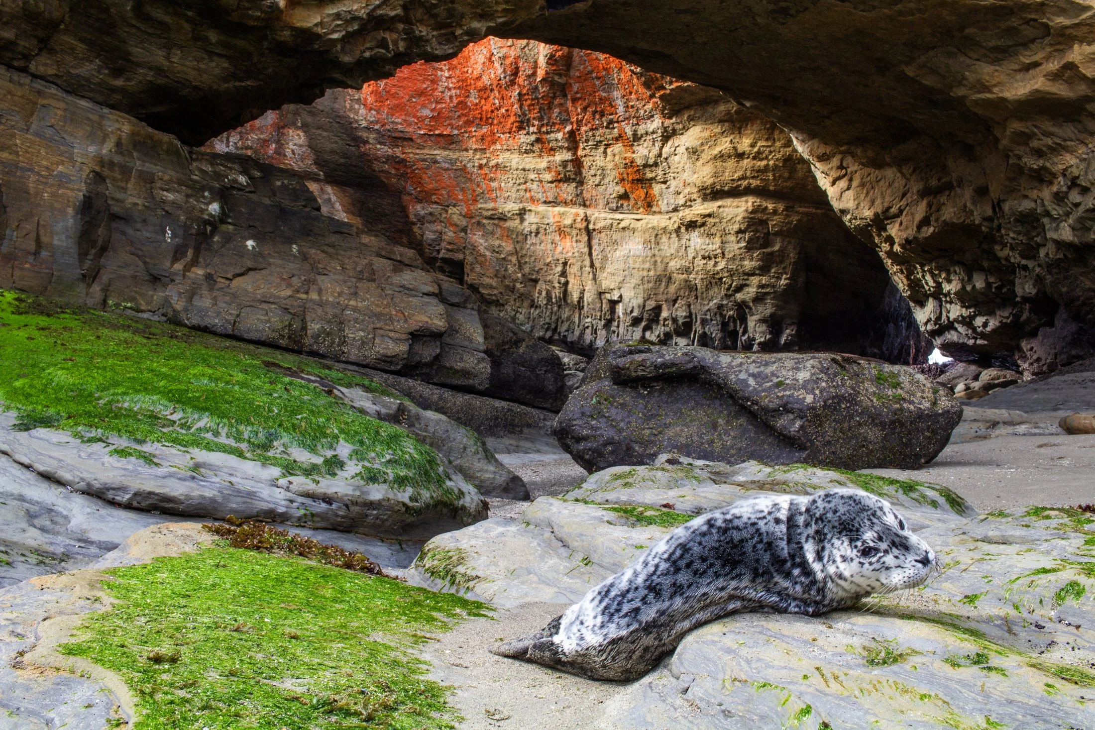
Oregon has been experiencing an uptick in sea lion strandings, particularly along the central and northern coasts. In the fall of 2023, the Oregon Marine Mammal Stranding Network reported several daily calls about sick or dead sea lions.
In Oregon, while pups do sometimes rest alone on beaches naturally, the rising number of reports of lethargic or underweight pups reflects broader ecological challenges. Many of these cases are related to malnutrition, toxins from algal blooms, or disease outbreaks like leptospirosis.
This little guy made my heart pang after running into it when walking into the Devil’s Punchbowl at low tide. There was no one around and I was not sure of the situation until a local apleated and said this was a strange site. We called the OMMSN, and they said it was most likely a mother leaving its pup while it forged some food. The local promised to keep an eye out for a couple hours to see if the mother returned while I pushed on to Portland.
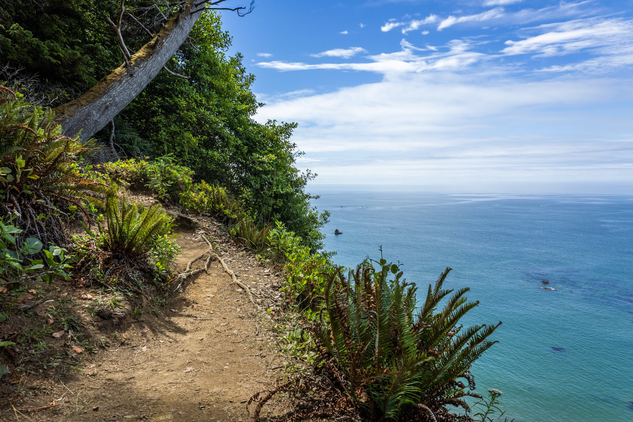
The South Coast Wilderness Trail is a stunning, rugged, and truly wild 17 mile one-way hike through Olympic National Park. One of the last undeveloped coastlines in the contiguous United States, Olympic’s protection status ensures native species like sea otters, bald eagles, bears, and migrating whales will continue to thrive in this pristine wilderness.
Switching between stretches of picturesque coast and dense rainforest, the trek (which is at sea level) entails 2,000 feet in elevation change, due to the use of ladders and ropes to maneuver up and down coastal embankments.
This was one such area on my backpacking trip where the trail climbed several hundred feet following a rope climb from the beach. The blue of this area of the Pacific is stunning, especially contrasted with the lush greenery of Olympic’s rainforest.

Haystack Rock near Pacific City, also known as Chief Kiwanda Rock, is an enormous sea stack located just offshore from Cape Kiwanda in Pacific City, Oregon.
Standing approximately 327 feet, it is one of the tallest sea stacks on the Oregon coast, even taller than the more famous Haystack Rock in Cannon Beach.
This was taken during a bustling evening near the Pelican Brewing Company, where patrons dined as the light broke through at golden hour, giving way to these stunning clouds behind the sea stack, casting its true form in silhouette. And if you look closely you’ll see the staggering amount of birds which call it home.

The Oregon Dunes are one of the most unique and dramatic landscapes along the Oregon Coast, stretching roughly 40 miles from Florence to Coos Bay. Formed over thousands of years by wind, rain, and ocean forces, these dunes make up the largest coastal sand dune system in North America.
Some dunes will reach heights of up to 500 feet, creating a surreal and constantly shifting landscape that feels more like a desert than part of the lush Pacific Northwest. This vast expanse also contains coastal forests, wetlands, and freshwater lakes, making it an incredibly diverse ecosystem.
This lookout, pointing south, shows the beginnings of the dune system. I stopped off on the side of the road to grab this shot on my way to John Dellenback Dunes, one of the highlights of my trip and my first time stepping in quick sand.
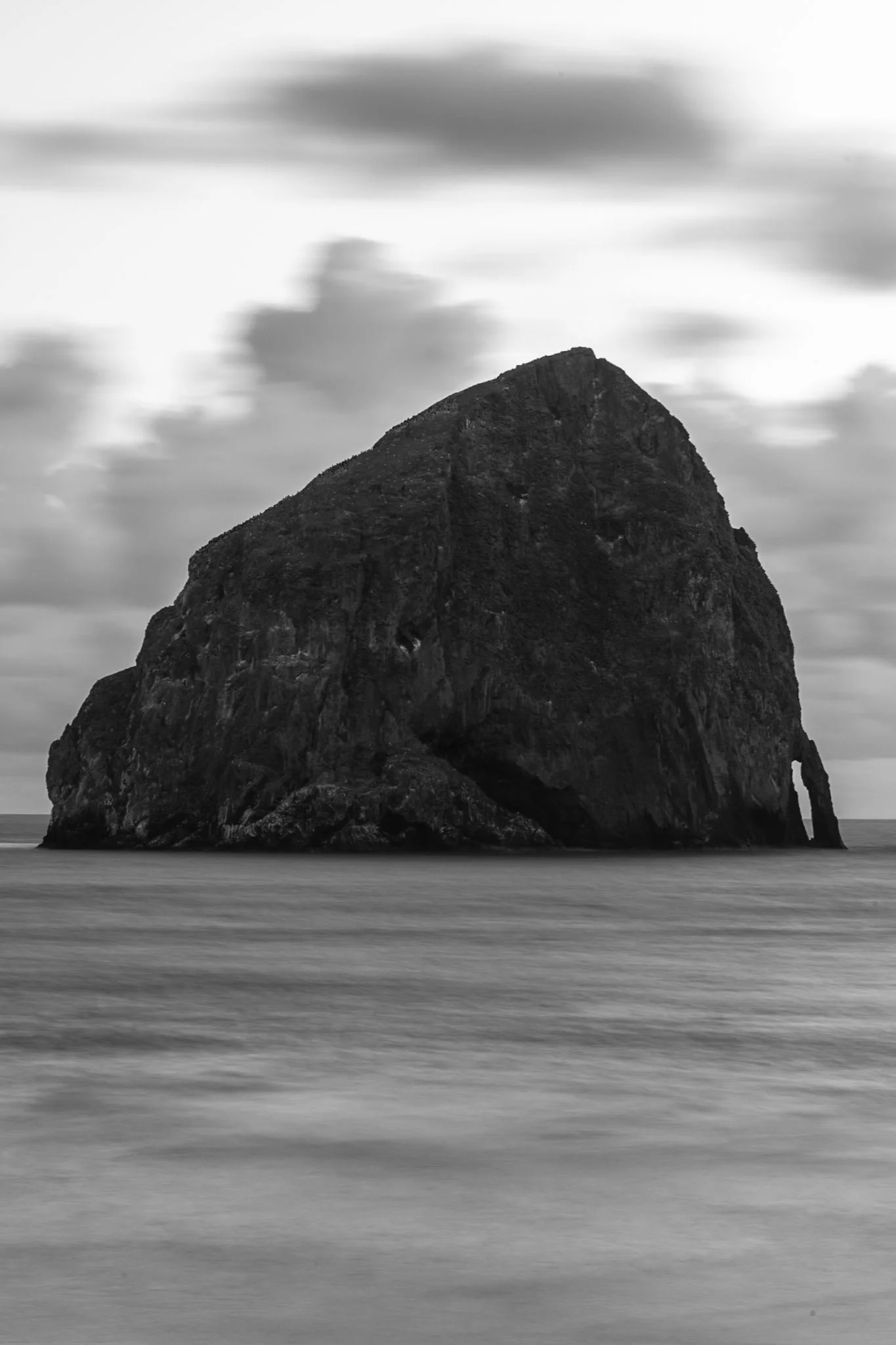
Haystack Rock near Pacific City, also known as Chief Kiwanda Rock, is an enormous sea stack located just offshore from Cape Kiwanda in Pacific City, Oregon.
Standing approximately 327 feet, it is one of the tallest sea stacks on the Oregon coast, even taller than the more famous Haystack Rock in Cannon Beach.
This was taken during a bustling evening near the Pelican Brewing Company, where patrons dined as the light broke through at golden hour, giving way to these stunning clouds behind the sea stack. After taking a sunset shot, I found the solitary nature of the rock against the ocean waves fascinating and wanted a visual that gave a sense of its unmoving nature over the past 17 million years.
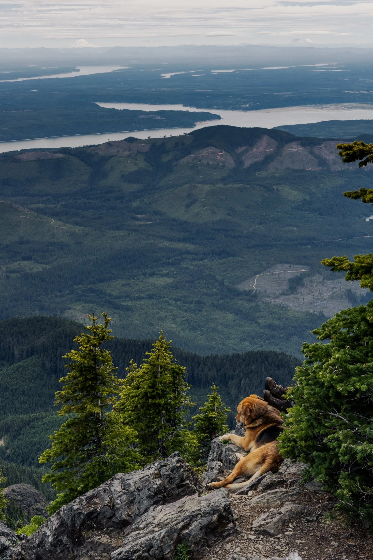
Mount Ellinor is part of the southeastern Olympic Mountains in western Washington state. The mountain is a beautiful one and shows clear signs of past glaciers.
During the ice ages, glaciers carved out the valleys and sharpened the ridges around the area. The views of Lake Cushman become even more amazing when you realize the whole area was shaped by ice and water
This particular photo was taken right after reaching the summit. On the way down I came across curious scene when turning a corner. The boots sticking out next to the owners dog felt like something out of a Dr. Seuss book. This quick snap reminded me dogs hike too.

The Oregon Coast holds many treasures and its relationship with the Pacific leads to its dramatic cliffs. Stretching endlessly westward, the Pacific creates a boundless horizon that seems to hold no end.
Long before roads carved through these coastal towns dotting the headlands, this was a remote and mysterious frontier. Pirate ships, privateers, and explorers found their way to this region, exploring its untouched mysteries. Legends linger of hidden coves that sheltered their treasures, buried beneath shifting sands or unexplored coves.
This photograph was taken right near the lookout to Heceta Head, and while that lighthouse is as picturesque as any can be, it was this drama playing out in the clouds that drew my eye. It seemed to point me back to an unremembered time, before roads, towns, and civilization.

Carl G. Washburne Memorial State Park may be the one of the most scenic stretches along the entire Oregon Coast. Located about 15 miles north of Florence, and only a few miles past Heceta Head Lighthouse (a trail connects the park), this area offers a portal to another world.
The China Creek Trail which weaves through coastal forests terminating on the beach, and the picturesque Hobbit Trail known for its moss-draped trees and old-growth forest.
This photograph was taken after sundown following a chaotic two hours of photographing. I used the last remaining daylight to grab this abstract before retiring to my campsite across the main road. It is a quiet place, unassuming, and it is here that shows Oregon’s true beauty.
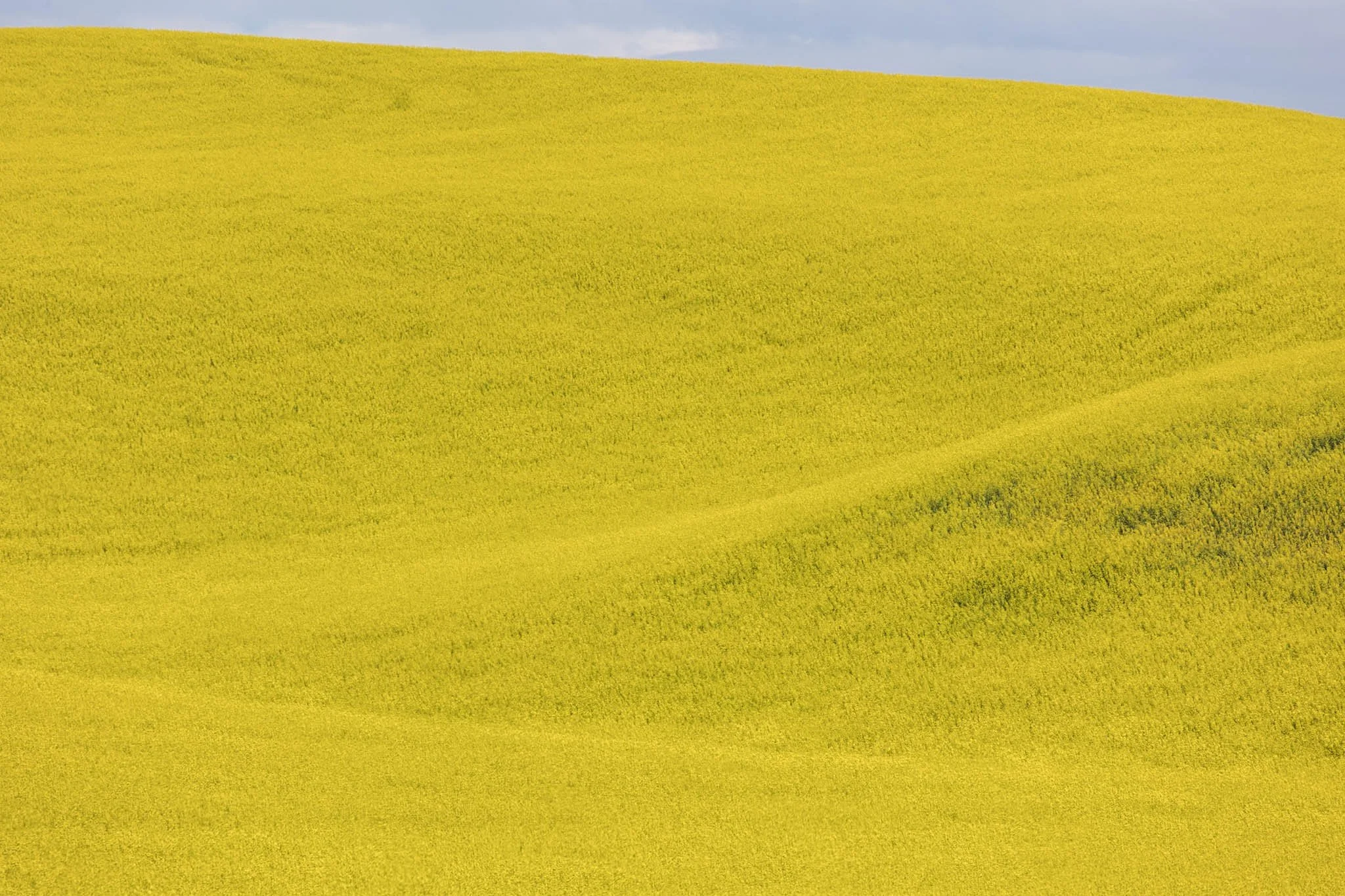
The Palouse region, located in southeastern Washington, extending into Idaho and Oregon was originally home to the Palus people. The area was transformed in the 1800s as settlers arrived under the Homestead Act.
Indigenous communities were displaced, and the land was reshaped by agriculture. The region’s deep loess soil and steep terrain led farmers to adopt contour plowing, giving the fields their signature flowing appearance.
Traveling through the Palouse region was an out of body experience. The word space takes on a new meaning as you meander through its rolling hills. The vibrant colors and different stages of tilling make each turn unique. The sheer amount of yellow extending in the areas growing the canola plant was mind-boggling.

Carl G. Washburne Memorial State Park may be the one of the most scenic stretches of the entire Oregon Coast. Located about 15 miles north of Florence, and only a few miles past Heceta Head Lighthouse (a trail connects the two parks), the surrounding area offers a portal to another world.
The China Creek Trail weaves through coastal forests terminating on the beach, and the picturesque Hobbit Trail, known for its moss-draped trees and old-growth forest, make the hiking here magical.
This photograph was taken moments after sundown, following a chaotic two hours of trying to photography too many areas at once. I used the last remaining daylight to grab this abstract before retiring to my campsite across the main road. The park is a quiet place, unassuming, and it is here that shows Oregon’s true beauty.

Heceta Head is one of the most iconic and picturesque stretches along the Oregon Coast. Known for its historic lighthouse, dramatic cliffs, and panoramic views of the Pacific Ocean, it must be seen to be believed.
Located just north of Florence, Oregon, Heceta Head offers a blend of natural beauty, maritime history, and coastal ecology.
This photo came after photographing the Heceta Head lighthouse, which resides right behind this stunning view. The road curve seen in the distance is also the location of the nation’s only natural Sea Lion caves, accessible to tourists via an elevator.

Haystack Rock near Pacific City, also known as Chief Kiwanda Rock, is an enormous sea stack located just offshore from Cape Kiwanda in Pacific City, Oregon.
While setting up my long exposure settings and checking for sensor spots, I inadvertently captured this image that I did not review until I was back home editing.
There are certain abstract images that stick with me due to either the juxtaposition of form, or an undefinable impressionist quality. This image, taken at 1/10th of a second, brought to mind the world’s continual turn without the need for our recognition, endless fleeting moments in time.
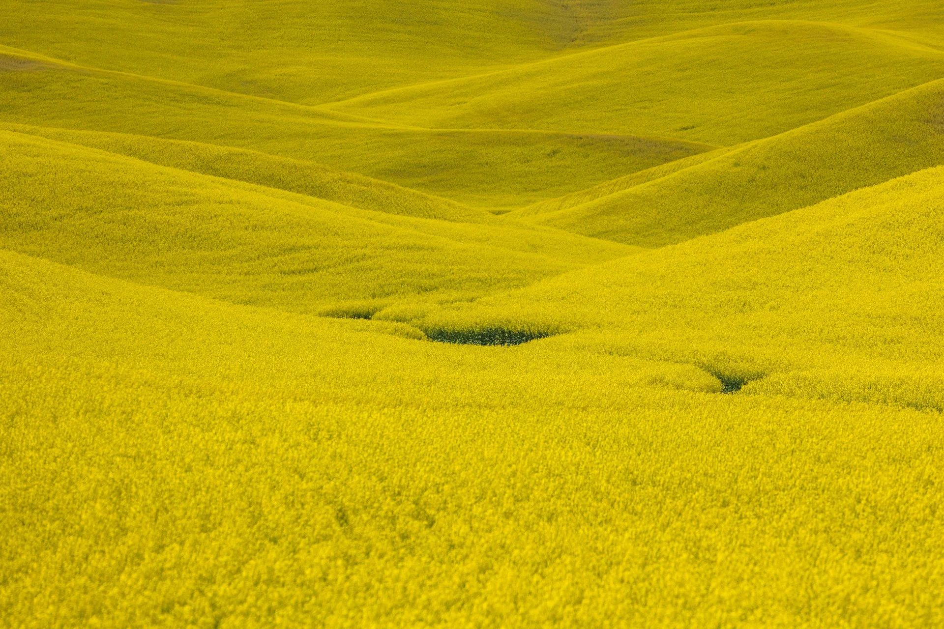
The Palouse region, located in southeastern Washington, extending into Idaho and Oregon was originally home to the Palus people. The area was transformed in the 1800s as settlers arrived under the Homestead Act.
Indigenous communities were displaced, and the land was reshaped by agriculture. The region’s deep loess soil and steep terrain led farmers to adopt contour plowing, giving the fields their signature flowing appearance.
Traveling through the Palouse region was an out of body experience. The word space takes on a new meaning as you meander through its rolling hills. The vibrant colors and different stages of tilling make each turn unique. The sheer amount of yellow extending in the areas growing the canola plant was mind-boggling.

Harris Beach State Park, located just north of Brookings, Oregon, is a coastal haven renowned for its dramatic scenery, diverse wildlife, and rich marine ecosystems.
The park's centerpiece is Goat Island (also known as Bird Island), the largest offshore island along the Oregon Coast. This National Wildlife Refuge is a breeding ground for over 100,000 seabirds, including tufted puffins and Leach’s storm-petrels, making it a prime spot for birdwatching.
This photo was taken during a quiet moment alone on the beach as the last vestiges of light began to disappear. Harris Beach is one of my favorite places on the Oregon Coast, offering endless photographic opportunities and true tranquility.

Harris Beach State Park, located just north of Brookings, Oregon, is a coastal haven renowned for its dramatic scenery, diverse wildlife, and rich marine ecosystems.
The park's centerpiece is Goat Island (also known as Bird Island), the largest offshore island along the Oregon Coast. This National Wildlife Refuge is a breeding ground for over 100,000 seabirds, including tufted puffins and Leach’s storm-petrels, making it a prime spot for birdwatching.
This photo was taken during a quiet moment as the last vestiges of light revealed eerie silhouettes of the rock formations surrounding Harris Beach. It is one of my favorite places on the Oregon Coast, offering endless photographic opportunities, a great campsite, and a beach unlike any other.

Oregon has been experiencing an uptick in sea lion strandings, particularly along the central and northern coasts. In the fall of 2023, the Oregon Marine Mammal Stranding Network reported several daily calls about sick or dead sea lions.
In Oregon, while pups do sometimes rest alone on beaches naturally, the rising number of reports of lethargic or underweight pups reflects broader ecological challenges. Many of these cases are related to malnutrition, toxins from algal blooms, or disease outbreaks like leptospirosis.
This little guy made my heart pang after running into it when walking into the Devil’s Punchbowl at low tide. There was no one around and I was not sure of the situation until a local apleated and said this was a strange site. We called the OMMSN, and they said it was most likely a mother leaving its pup while it forged some food. We weren’t completely convinced but I had to move on to Portland and could not stay to find out. The local promised to keep an eye out for a couple hours to see if the mother returned.

The Palouse region, located in southeastern Washington and extending into portions of Idaho and Oregon, was originally home to the Palus people, historically known for breeding strong horses, but the U.S. government did not acknowledge them as a distinct tribe in the late 1800s as settlers arrived under the Homestead Act.
Indigenous communities were displaced, and the land was drastically reshaped by agriculture. The region’s deep loess soil and steep terrain led farmers to adopt contour plowing, giving the fields their signature flowing appearance.
I raced the descending sun following a long drive from Seattle, arriving just in time to catch the sunset atop Steptoe Butte, the one elevated area among the farmland. I set up next to a group of amateur photographers taking a class led by a knowledgeable local — which brings me to an interesting detail about the Palouse: I only encountered two types of people there — farmers and photographers. There might not be a better place to learn photography.
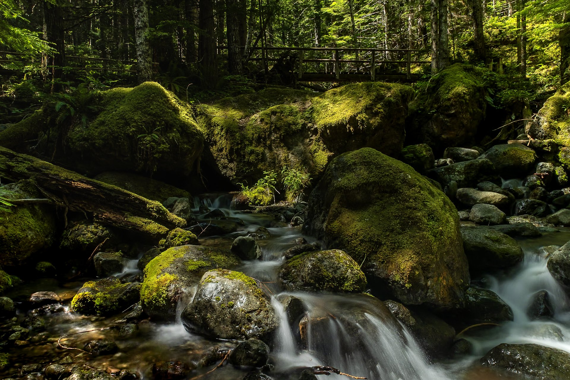
The Staircase area of Olympic National Park is a lesser known area of the park, tucked away along the southeastern edge of the park, near Lake Cushman. It’s known for old-growth forest, moss-draped trees, and multiple rivers flowing through.
This was my third time to Olympic National park and each trip continues to reveal more of its beauty. I stayed in a tiny home near Lake Cushman, which offered early morning access to the trails in the surrounding area.
This particular photo was taken on the Staircase Rapids Loop which follows the Skokomish River through the dense rainforest. Capturing both the cascade and one of the countless bridges crossing the river puts on display the sheer amount of greenery to be found in the only rainforest in the lower 48.
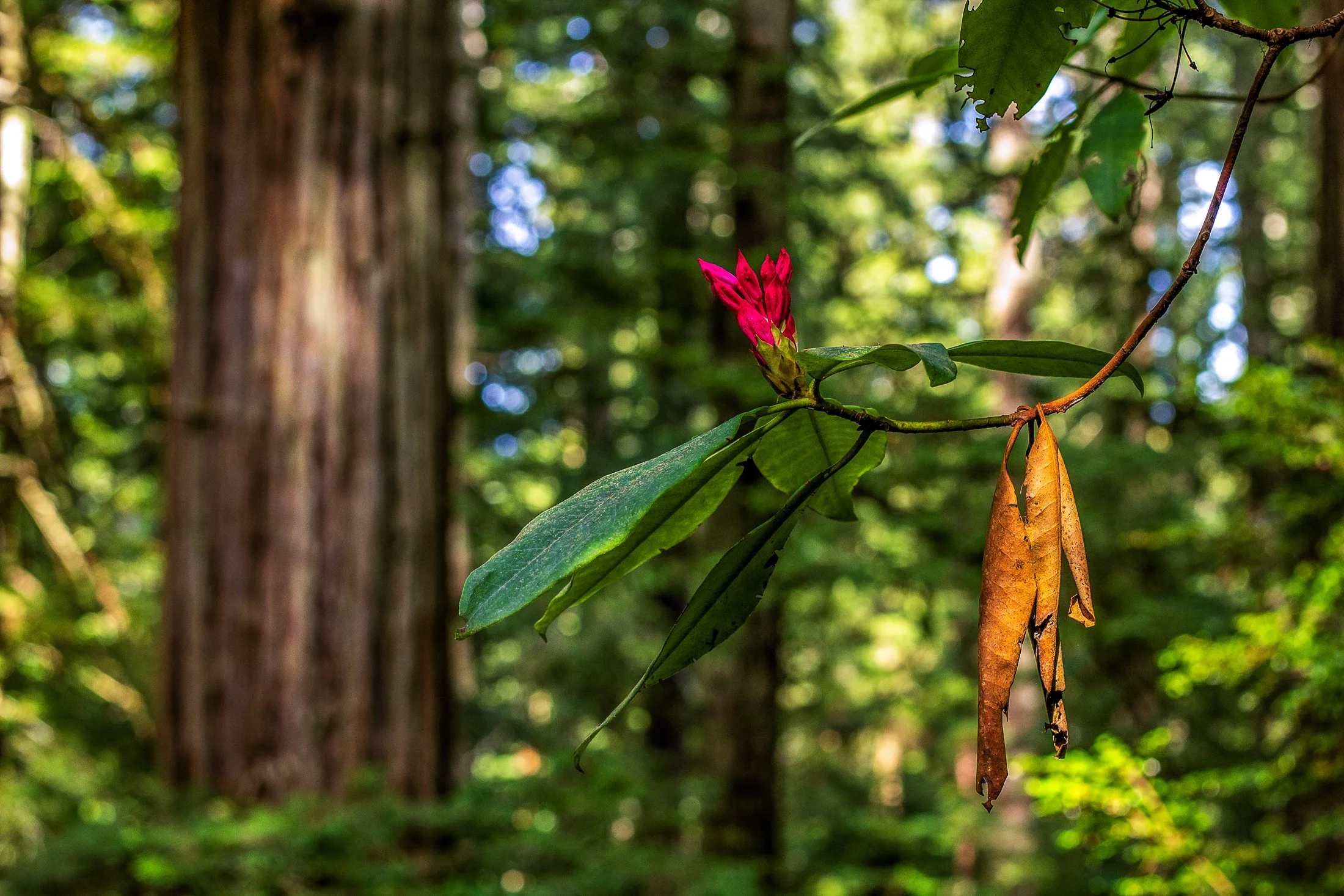
Humboldt County of Northern California is home to the southern section of the towering Redwood Forests which are conjoined effort of the National & State Park systems.
Contained within this section is the 31-mile world famous Avenue of the Giants. A mostly flat drive with gentle curves, passing secluded forest hamlets, campgrounds, picnic areas, and areas along the Eel River.
Offering extensive hiking trails, this was taken on a 5 mile loop, and finding this budding flower next to a dying leaf providing the perfect foreground to this vast redwood background.

The South Coast Wilderness Trail is a stunning, rugged, and truly wild 17 mile one-way hike through Olympic National Park. One of the last undeveloped coastlines in the contiguous United States, Olympic’s protection status ensures native species like sea otters, bald eagles, bears, and migrating whales will continue to thrive in this pristine wilderness.
Switching between stretches of picturesque coast and dense rainforest, the trek (which is at sea level) entails 2,000 feet in elevation change, due to the use of ladders and ropes to maneuver up and down coastal embankments.
After setting up camp, I descended a very steep sand embankment via a rope wrapped around a tree to reach this secluded beach. It was a peaceful moment photographing these majestic sea stacks at sunset alone on this pristine beach.

John Dellenback Dunes Trail is one of the best “trails” in the Oregon Dunes National Recreation Area near Florence, Oregon. The sand dunes here one of the largest coastal sand dune systems in the world.
This area inspired Frank Herbert to write the science fiction book Dune. Herbert found this and the surrounding areas fascinating, studying desert ecology and erosion at a time when Oregon was establishing a way to combat the damage of the shifting dunes on the local towns by planting European Beachgrass.
Hiking these dunes was an exhausting but exhilarating experience requiring some astute navigation as a majority of the ”trail” can only be found by wooden markets in the sand, sometimes entirely buried by the dunes. This lone tree stuck out among the dunes as I turned around to keep my bearings.
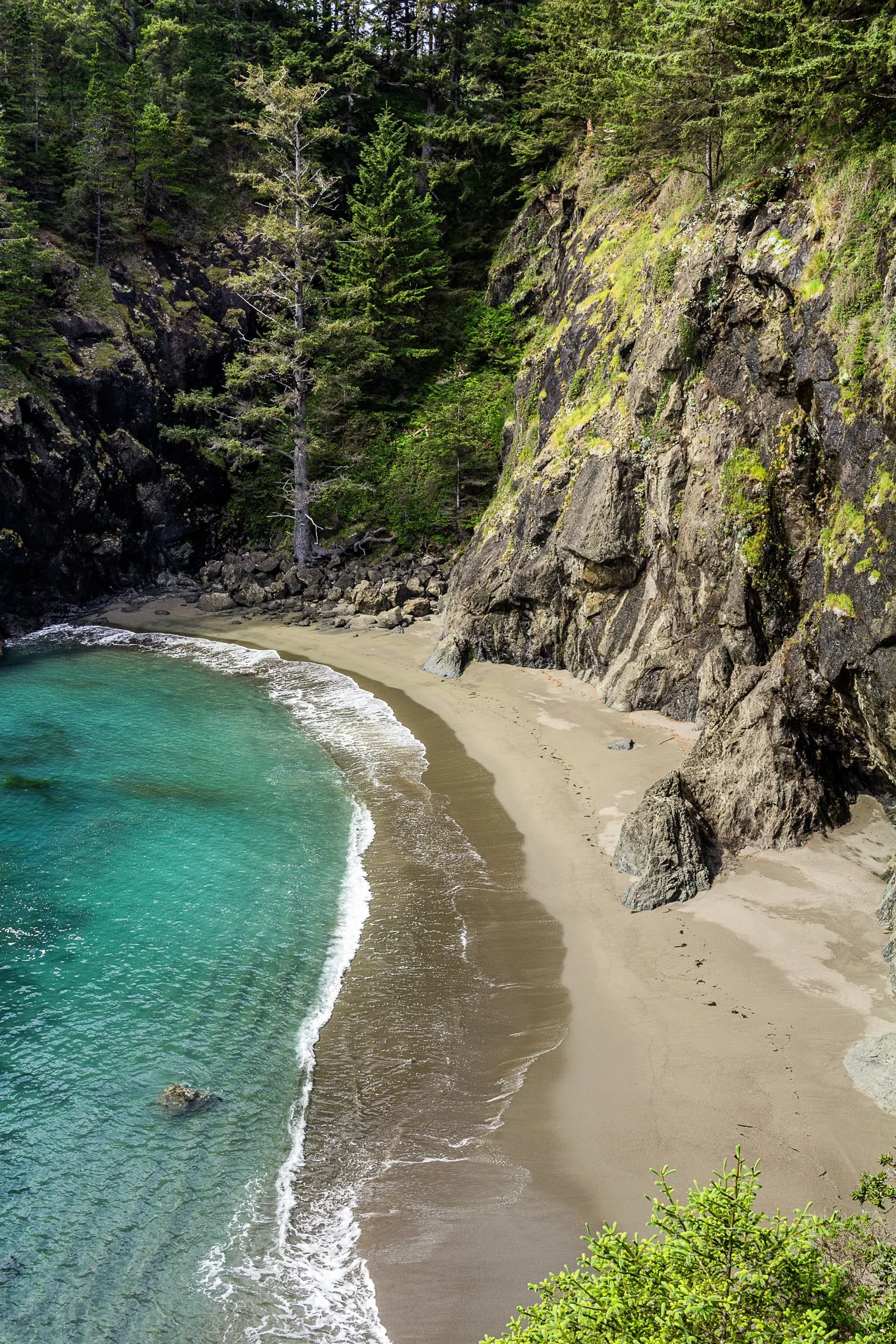
Samuel H. Boardman State Park, located along the southern Oregon coast near Brookings, Oregon, is renowned for its stunning coastal landscapes and diverse natural beauty. The park stretches for 12 miles along the coast, offering a variety of scenic views and ecosystems, from rugged cliffs to pristine beaches.
One of the park's most iconic features is its collection of sea stacks — tall, isolated rock formations that rise out of the ocean. These formations are often surrounded by crashing waves, adding to the dramatic beauty of the area.
While climbing out on to a precarious rocky perch with a 200 foot fall on either side to photograph some sea stacks, I noticed this beautiful cove to my right. It reminded me of something out of a Robert Louis Stevenson story where buried treasure might reside.
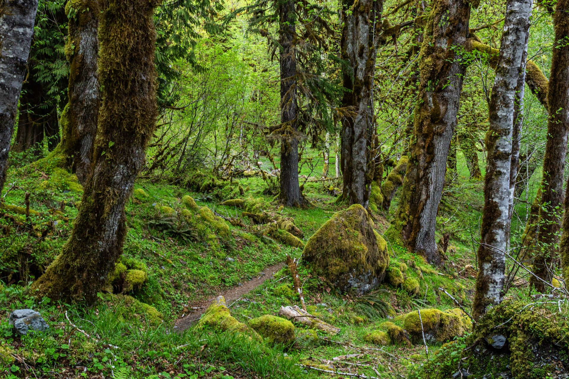
Enchanted Valley, dubbed the “Valley of 10,000 Waterfalls”, requires a 15 mile hike through the Quinault Rainforest in Olympic National Park. The rainforest receives a whopping 140-167 inches of rain per year. This precipitation allows Olympic National Park to maintain its incredibly biodiverse ecosystem.
The Enchanted Valley Chalet is at the terminus of the trail and was built in 1931. Originally meant to be a rustic lodge for hikers, it was used during WW2 to monitor potential Pacific Coast enemy threats. After the war it returned to its original purpose for backpackers and rangers.
The trail meanders along the river crossing many small streams on the way to the Chalet. Elk, bear, and marmots frequent the forest, rife with moss-laden trees, decaying logs with small trees growing out of them, and every type of green you can imagine. It truly is a fairy tale rainforest.
Enchanted Valley, dubbed the “Valley of 10,000 Waterfalls” requires a 15 mile hike through the Quinault Rainforest in Olympic National Park. One of the few rainforest in the United States, it receives 140-167 inches of rain per year. The precipitation leaves Olympic National Park with one of the most biodiverse ecosystems in the United States.
The Enchanted Valley Chalet at the end of the trail was built in 1931 and was originally meant to be a rustic lodge for hikers, eventually being used during WW2 to monitor potential Pacific Coast enemy threats. After the war it returned to its original purpose for backpackers and rangers.
The area is known for a surplus of black bears, and during our time there over two nights, we were mere visitors in their home. It is not the easiest thing to retire to your tent with a 400 pound black bear scrounging for berries outside it!