

Horizontal
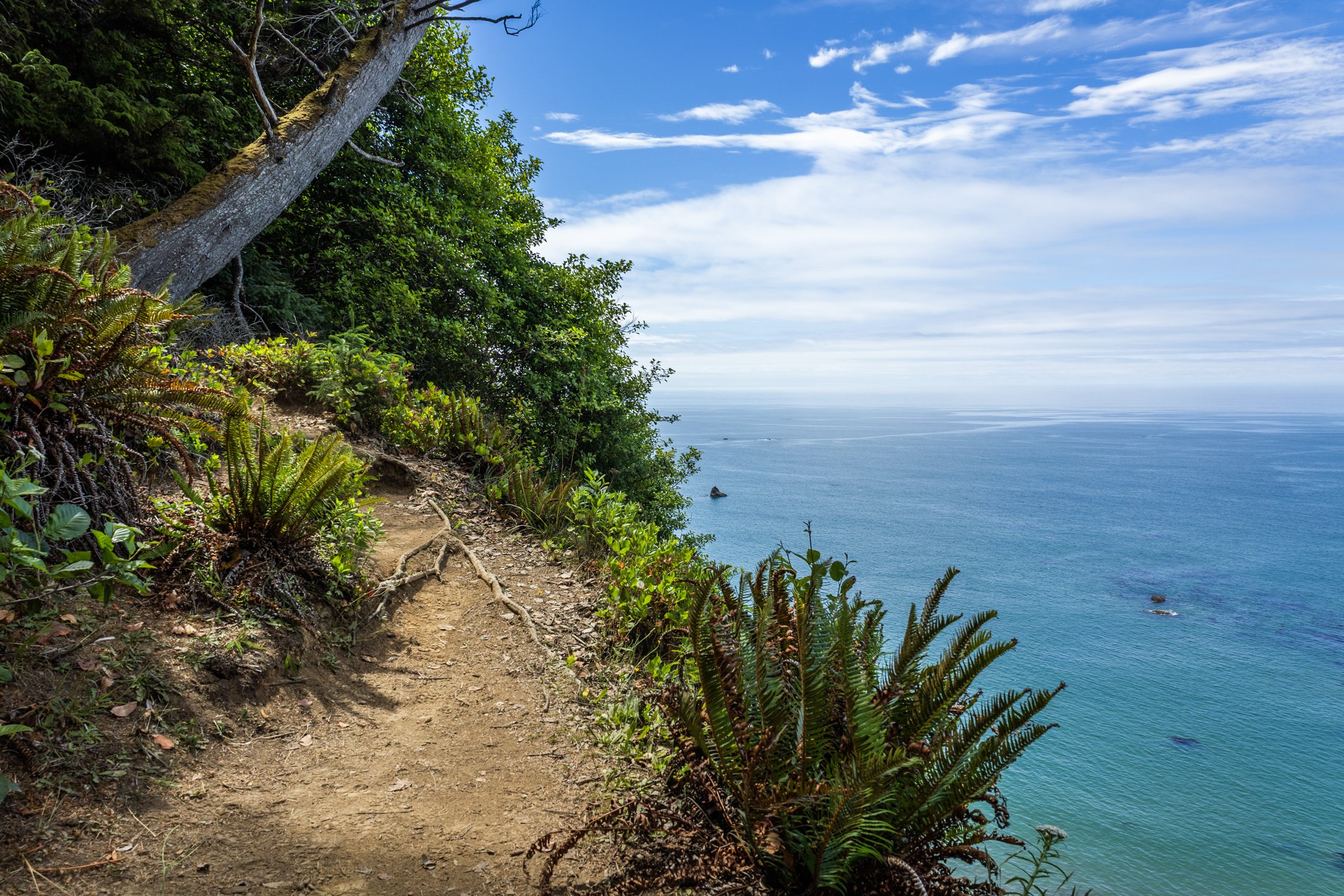
The South Coast Wilderness Trail is a stunning, rugged, and truly wild 17 mile one-way hike through Olympic National Park. One of the last undeveloped coastlines in the contiguous United States, Olympic’s protection status ensures native species like sea otters, bald eagles, bears, and migrating whales will continue to thrive in this pristine wilderness.
Switching between stretches of picturesque coast and dense rainforest, the trek (which is at sea level) entails 2,000 feet in elevation change, due to the use of ladders and ropes to maneuver up and down coastal embankments.
This was one such area on my backpacking trip where the trail climbed several hundred feet following a rope climb from the beach. The blue of this area of the Pacific is stunning, especially contrasted with the lush greenery of Olympic’s rainforest.

The dunes in and around Coral Pink Sand Dunes State Park, located on the border of Utah, are primarily shaped by wind and erosion, which picks up and transports sand particles across the valley floor. Sediment from surrounding mountains supplies the sand forming these natural features.
The area is known for frequent ATV usage, allowing visitors to traverse the dune system in style. Sandboarding is also available for purchase from the state park, but be careful, as these boards gain some speed especially on the larger dunes.
This was my third visit to the state park, and there’s a reason I keep coming back. The campsite is phenomenal, allowing access to the dune system from the campground. I grabbed this shot right before my friend’s footprints ruined the pristine, untouched dune. This was the first stop on my most recent trip to the Kanab area, with the next stop being the dangerously beautiful Buckskin Gulch.
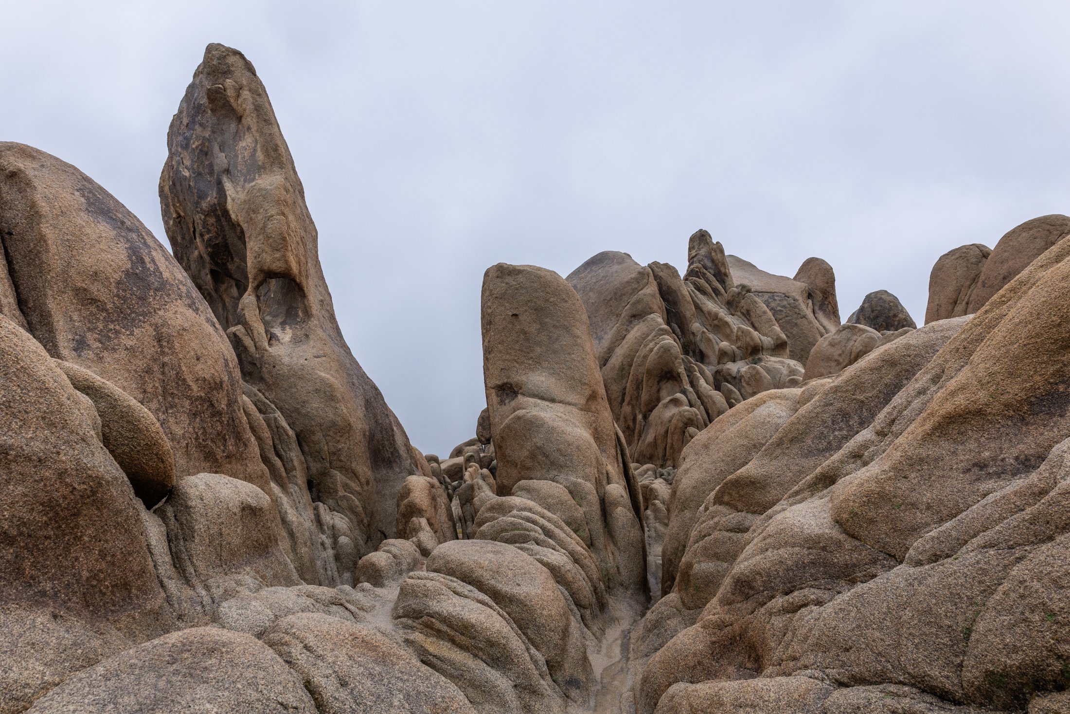
Joshua Tree National Park, located in southeastern California, about 150 miles east of Los Angeles, is famous for its dramatic granite rock formations. Over tens to hundreds of millions of years uplift and weathering left the overlying rock exposed.
This physical weathering peeled the outer layers from the rock while desert flash floods carried away loosened material, leaving stacked, rounded boulders, domes, and monoliths.
This was my third trip to Joshua Tree and each time has been a different adventure. The grippy granite rock makes it a very fun park to rock scramble in but this particular day rain and fog dominated the landscape, a unique occurrence that required the correct gear to capture this image. This unique formation is located right next to Arch Rock and the maze-like quality showed off the singular uniqueness of this National Park.
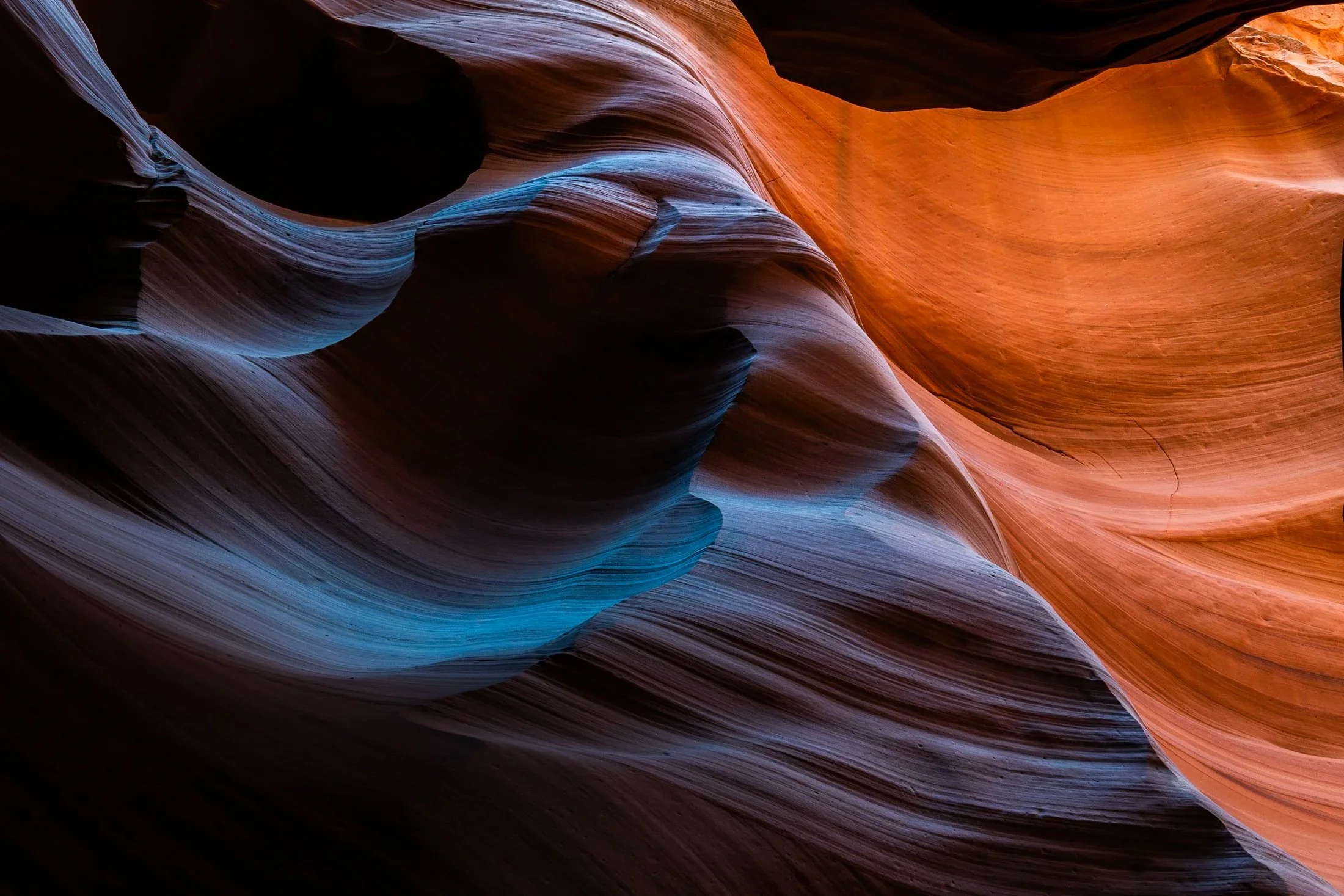
Antelope Canyon, located in northern Arizona within the Navajo Nation right outside the town of Page, is one of the most picturesque slot canyons in the world. Running over 23 miles, it was formed over millennia through consistent erosion, primarily through the actions of flash floods that sculpt the sandstone rock into smooth, undulating forms.
Having traveled to Page numerous times, I had always opted for Buckskin Gulch, another slot canyon in the area that resides on BLM land and does not require a paid tour. My fourth time in the area I decided to partake on a tour and the views did not disappoint. Guided by a local Diné (Navajo) tour guide, I was entreated to various stories of Navajo belief as well as given a private photography tour of the canyons.
The canyons continually conceal and reveal form throughout the day, as the sun follows its path across the sky. My tour followed a relatively short section of the greater Antelope Canyon, and yet I found I could have spent days here and never arrive at the same photo twice. This abstract section reinforces the stunning tonality and color nature creates in the shade of these canyons.
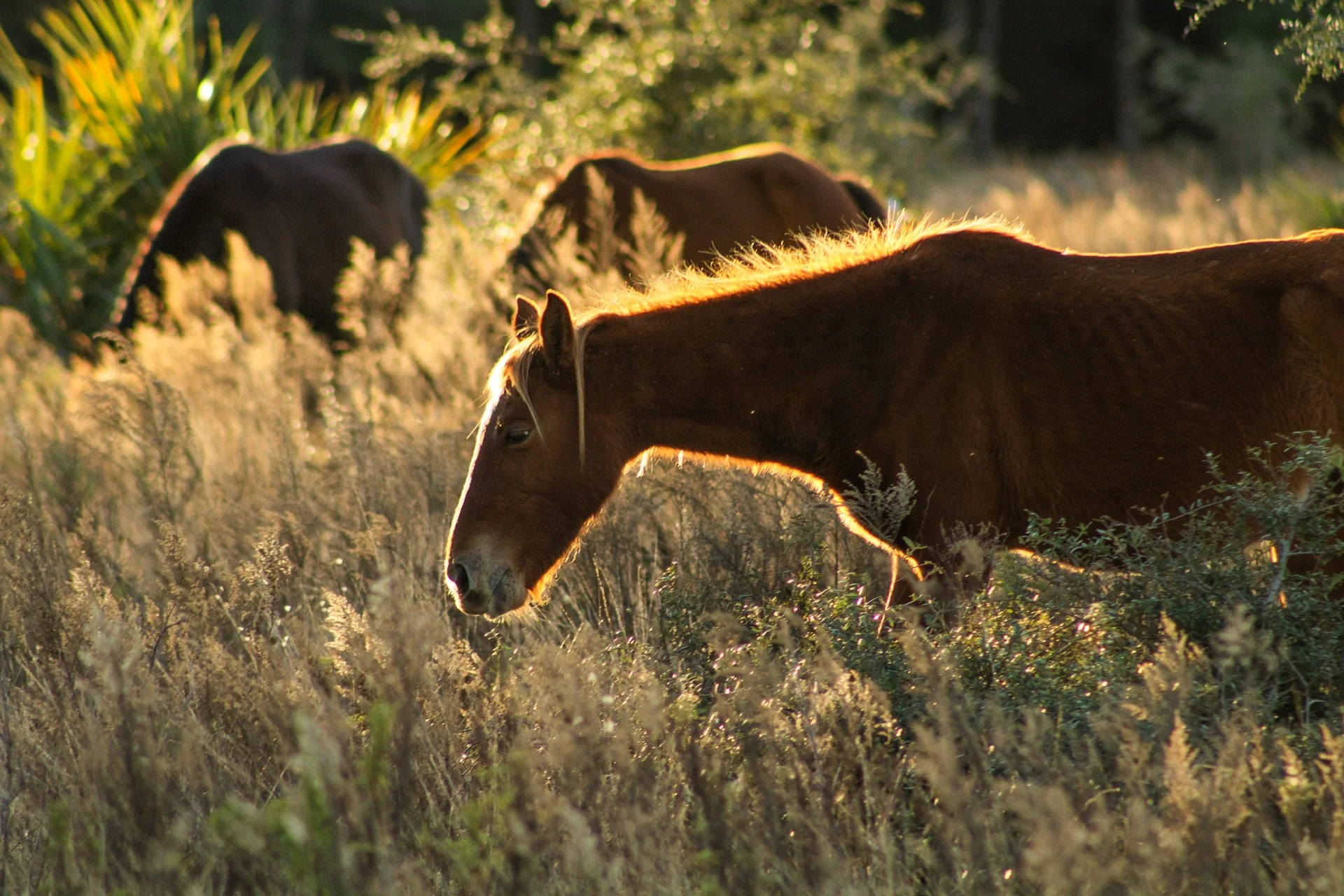
Cumberland Island National Seashore, located near St. Marys, Georgia, is a pristine 18 mile stretch of undeveloped wilderness unique to the East Coast. The island is known for its feral horses, possibly left over from the Spaniards during the 1700s.
The island has a long history, and was once owned by the Carnegie Family who then dedicated the island to the National Park Service in 1972. The island has faced various threats to its wilderness status over the years and has been defended through the continuous efforts of Carol Ruckdeschel, one of the few persons allowed to live on the island.
Heading out from my backcountry campsite to a small airplane landing strip, this area is frequented by the wild horses (technically feral) of the island. I was able to observe this group of horses grazing in golden hour light highlighting the area’s beauty as well as their complicated existence.
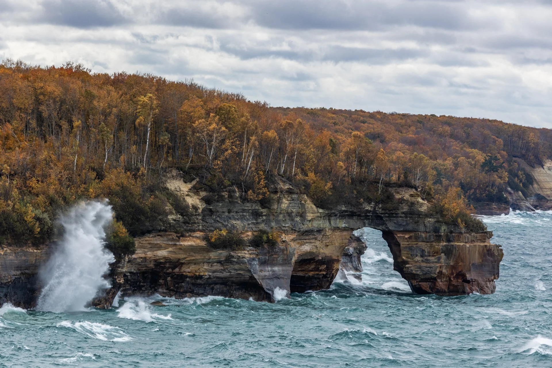
Lover’s Leap Arch, located in Pictured Rocks National Lakeshore, near Munising, Michigan, is one of the park's most iconic and photographed spots. The towering 200-foot cliffs and turquoise waters are often photographed from the local boat cruise and are rarely seen from this vantage point.
The cliffs colors, created by mineral staining, gives the area its "painted" appearance and inspiring the park’s name. According to Native American legend, Lover's Leap got its name from a heartbroken woman’s jump to her death after her lover’s failure to return from a journey.
Part of my 22-mile backpacking trip along cliff, this stormy day lead to Lake Superior’s waves continually crashing into the cliffs, often reaching their full height. These are the same storms that lead to the wreck of many ships, including the Edmund Fitzgerald.
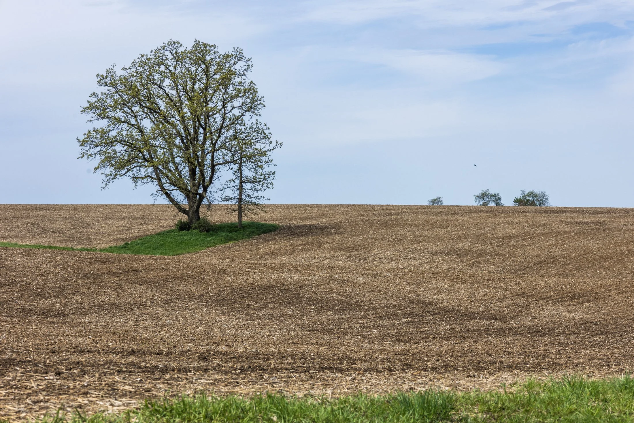
The cornfields near Polo, IL follow twists and turns as the land enters the Driftless Area. It is here where the sinuous and hilly terrain begin to take over. This area, and Illinois in general, is a very prominent agricultural hub for a variety of crops.
Previously a historic route to Galena, this picturesque area was rift with natural prairie prior to its transformation for agricultural purposes, but the beauty still remains.
This area is one I have visited often and will eventually be a part of a series when I capture the right fall photo. The composition of this lone tree set against the distant row of trees in the background shows what is possibly an old boundary tree isolated in a crop field.
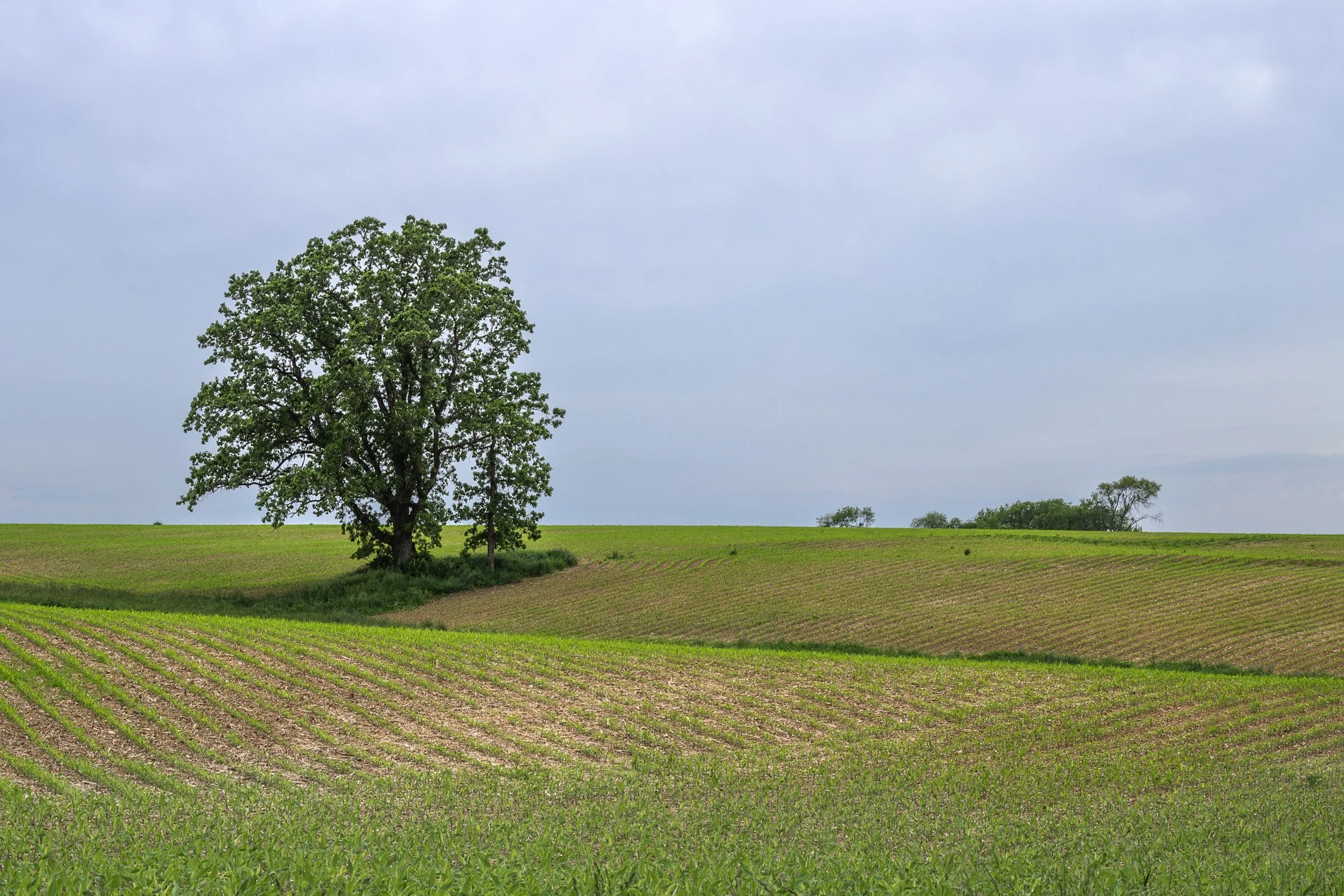
The cornfields near Polo, IL follow twists and turns as the land enters the Driftless Area. It is here where the sinuous and hilly terrain begin to take over. This area, and Illinois in general, is a very prominent agricultural hub for a variety of crops.
Previously a historic route to Galena, this picturesque area was rift with natural prairie prior to its transformation for agricultural purposes, but the beauty still remains.
This area is one I have visited often and will eventually be a part of a series when I capture the right fall photo. The composition of this lone tree set against the distant row of trees in the background shows what is possibly an old boundary tree isolated in a crop field.
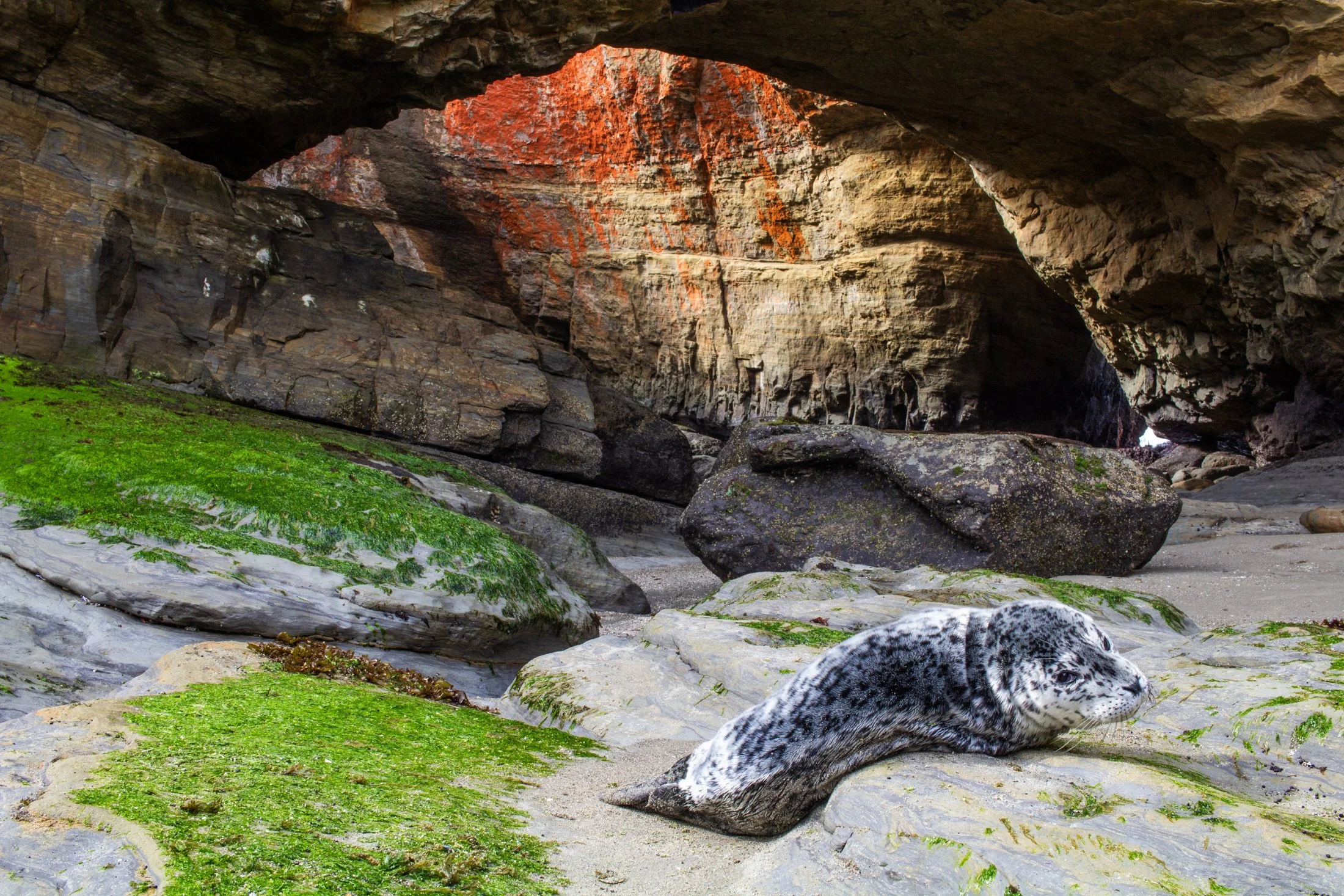
Oregon has been experiencing an uptick in sea lion strandings, particularly along the central and northern coasts. In the fall of 2023, the Oregon Marine Mammal Stranding Network reported several daily calls about sick or dead sea lions.
In Oregon, while pups do sometimes rest alone on beaches naturally, the rising number of reports of lethargic or underweight pups reflects broader ecological challenges. Many of these cases are related to malnutrition, toxins from algal blooms, or disease outbreaks like leptospirosis.
This little guy made my heart pang after running into it when walking into the Devil’s Punchbowl at low tide. There was no one around and I was not sure of the situation until a local apleated and said this was a strange site. We called the OMMSN, and they said it was most likely a mother leaving its pup while it forged some food. The local promised to keep an eye out for a couple hours to see if the mother returned while I pushed on to Portland.
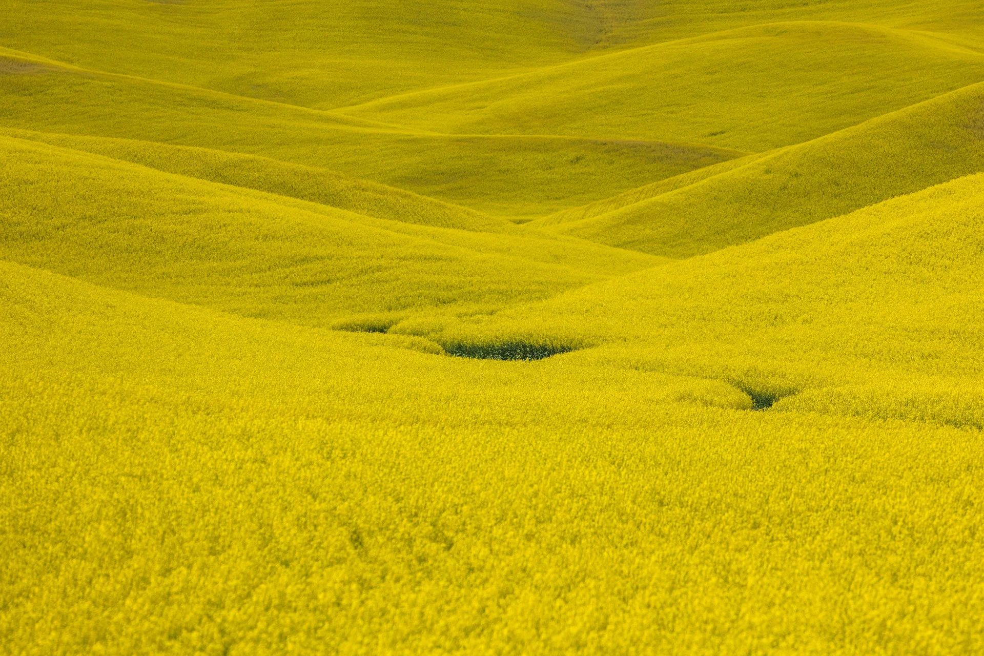
The Palouse region, located in southeastern Washington, extending into Idaho and Oregon was originally home to the Palus people. The area was transformed in the 1800s as settlers arrived under the Homestead Act.
Indigenous communities were displaced, and the land was reshaped by agriculture. The region’s deep loess soil and steep terrain led farmers to adopt contour plowing, giving the fields their signature flowing appearance.
Traveling through the Palouse region was an out of body experience. The word space takes on a new meaning as you meander through its rolling hills. The vibrant colors and different stages of tilling make each turn unique. The sheer amount of yellow extending in the areas growing the canola plant was mind-boggling.

Haystack Rock near Pacific City, also known as Chief Kiwanda Rock, is an enormous sea stack located just offshore from Cape Kiwanda in Pacific City, Oregon.
While setting up my long exposure settings and checking for sensor spots, I inadvertently captured this image that I did not review until I was back home editing.
There are certain abstract images that stick with me due to either the juxtaposition of form, or an undefinable impressionist quality. This image, taken at 1/10th of a second, brought to mind the world’s continual turn without the need for our recognition, endless fleeting moments in time.
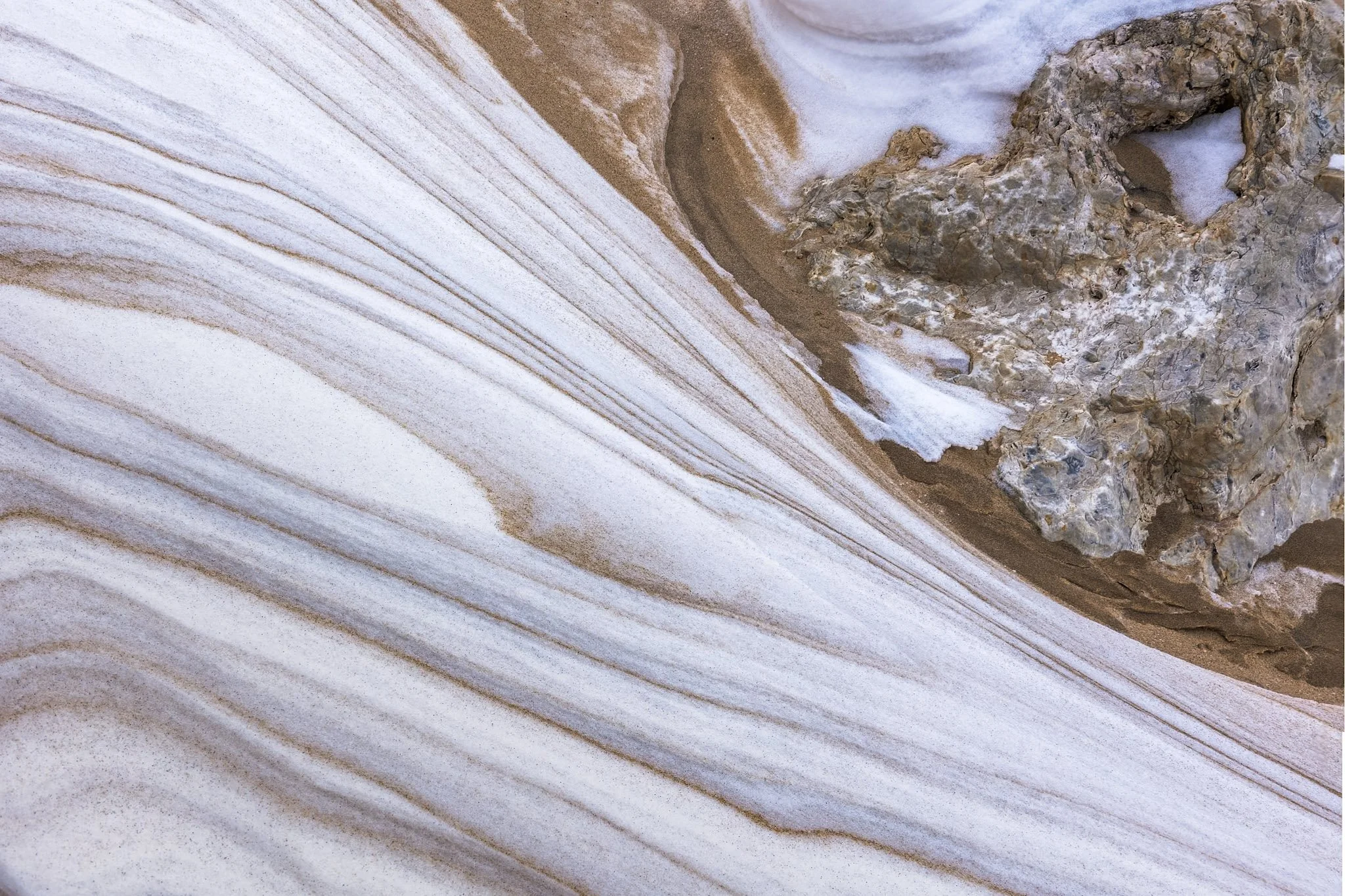
These naturally occurring abstract patterns, created by the interplay of wind, water, and sediment, decorate the beaches of Manistee, Michigan. The fine-grained sand reminds one of marble, with its dramatic and delicate textures. They’re a quiet, fleeting reminder of nature’s handiwork.
This was my second visit to the Manistee Lighthouse, with both events being particularly cold days. This day just happened to be my birthday. Finding the right frame for these abstractions can take a bit, and on a cold day like this, it is a race against frostbite.
I love the transition of form in this frame, juxtaposing the sinuous form of the snow-covered sand against the solid rock underneath. The variation in nature’s abstract forms has always fascinated me, and become something I keep an eye out for in each location I visit.
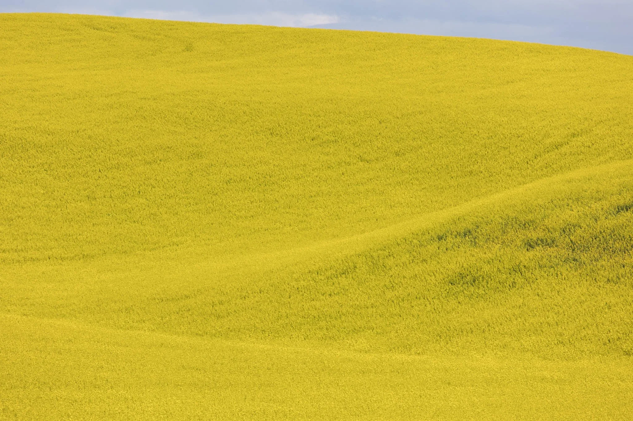
The Palouse region, located in southeastern Washington, extending into Idaho and Oregon was originally home to the Palus people. The area was transformed in the 1800s as settlers arrived under the Homestead Act.
Indigenous communities were displaced, and the land was reshaped by agriculture. The region’s deep loess soil and steep terrain led farmers to adopt contour plowing, giving the fields their signature flowing appearance.
Traveling through the Palouse region was an out of body experience. The word space takes on a new meaning as you meander through its rolling hills. The vibrant colors and different stages of tilling make each turn unique. The sheer amount of yellow extending in the areas growing the canola plant was mind-boggling.
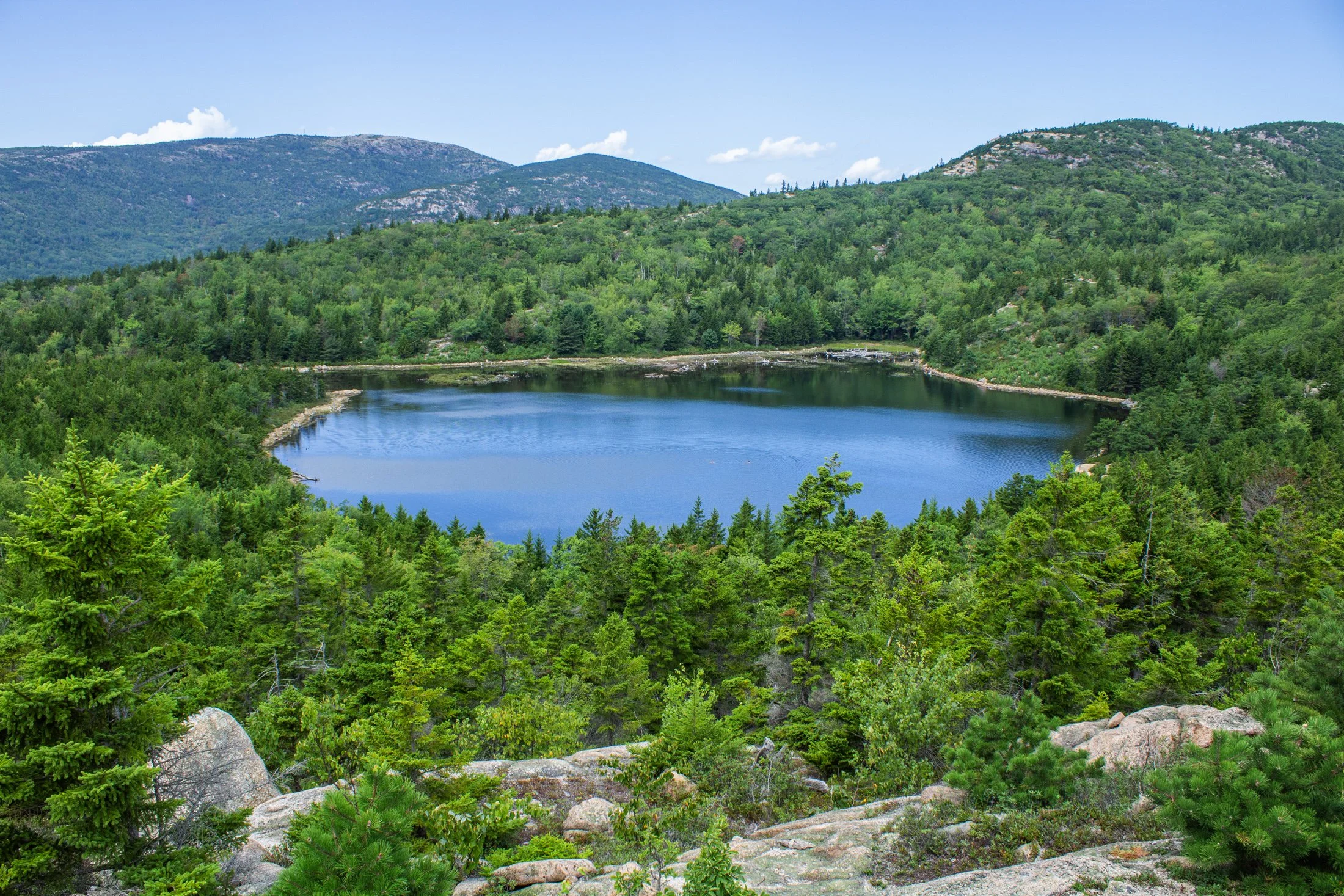
Acadia National Park, located southwest of Bar Harbor, is as picturesque as a national park can be. The varied terrain presents itself as one thing and then transforms into another. Known for its rugged coast and rocky cliffs, the national park offers a variety of hiking trails, loops, and climbs giving you a different perspective every direction you look.
This pond, known as The Bowl, was formed by glacial activity like many of the features in Acadia. This left a rounded, shallow basin surrounded by hills and rocky outcrops such as the one this photo was taken from.
Following a hike from our campsite a few miles away, we were able to avoid parking debacle Acadia is often known for. Climbing the precarious Beehive Trail, we were affording stunning views of the Atlantic Ocean on one side, and this picturesque lake on the other.
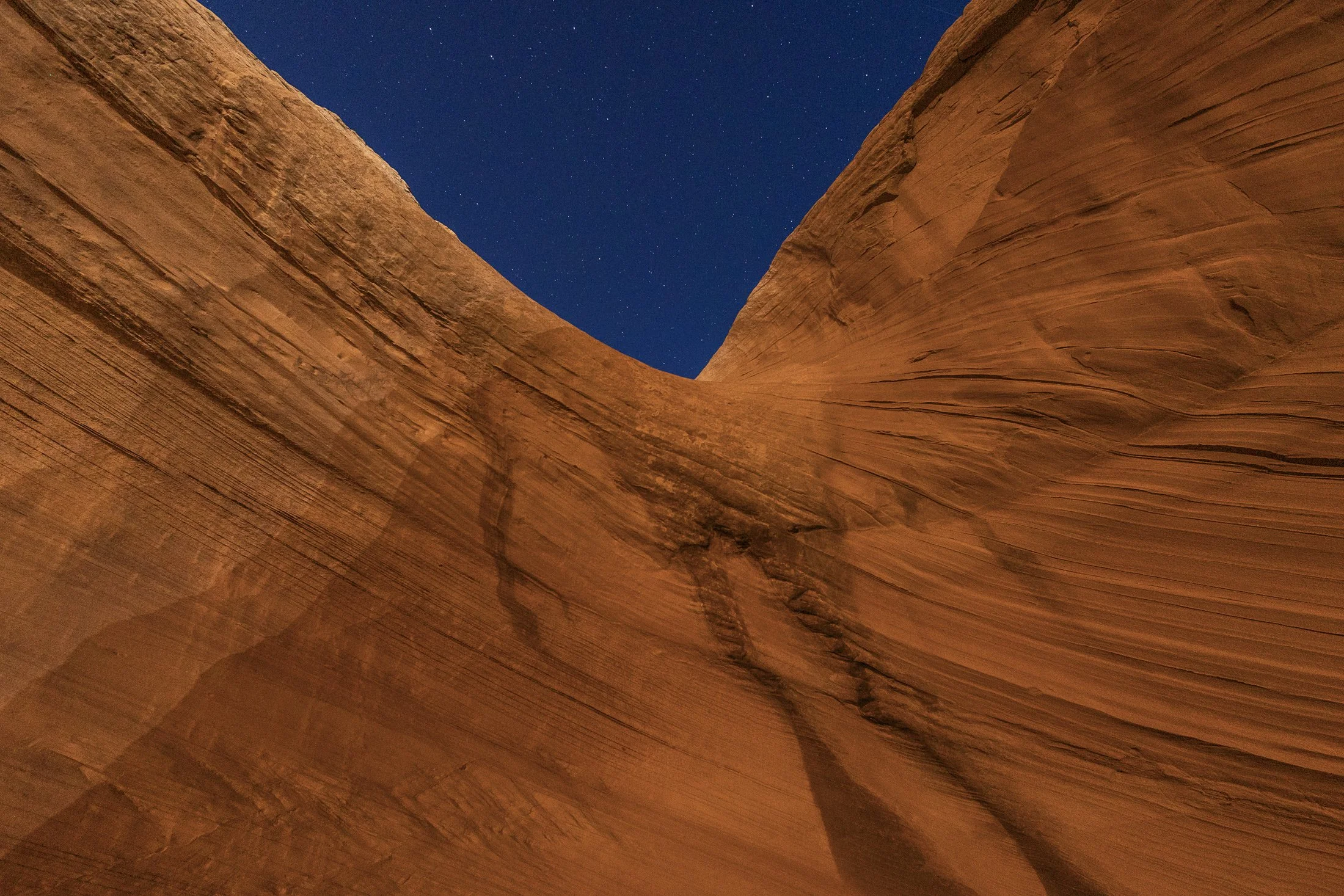
Page, Arizona, near Grand Staircase–Escalante National Monument, is one of my favorite towns in the Southwest. A crossroads between the Grand Canyon, Monument Valley, and Zion National Park, the area has become a vacation destination for desert residents and tourists alike, offering recreational water activities such as charting a boat through the flooded canyons of the man-made Lake Powell.
Lake Powell is a key part of the community which stores and regulates water from the Colorado River for the area as well as powering the Glen Canyon Dam which provides hydroelectric electricity to surrounding area and beyond. The red rock in this area is next to none, with every area offering beautiful trails and hidden views around each corner of the city.
This photo was taken in one such area which was behind a local gas station a mile outside of town. This is a well known sand cave that has gone viral on social media. The feeling of being in this cave is stunning, but I found the warped red rock a much more fascinating feature. Using a long exposure, I used my headlamp to paint the rock against the starry night.
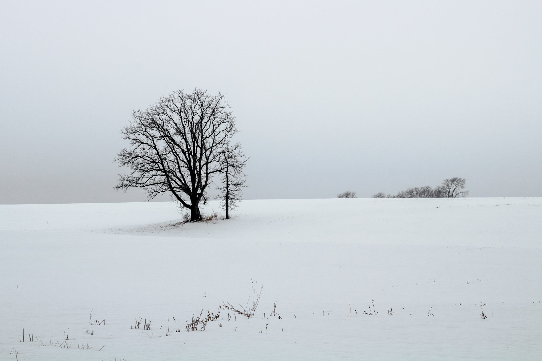
The cornfields near Polo, IL follow twists and turns as the land enters the Driftless Area. It is here where the sinuous and hilly terrain begin to take over. This area, and Illinois in general, is a very prominent agricultural hub for a variety of crops.
This particular area is one I have revisited often, and is part of an ongoing seasonal series yet to be published. This specific scene reminded me of something out of the film Fargo, with the delicate blanket of snow covering the fertile soil beneath.
The composition of this lone tree set against the distant row of trees in the background provided the proper depth for the open spaces these farmlands offer. Previously a historic route to Galena, this picturesque area was rift with natural prairie prior to its transformation for agricultural purposes, but the beauty still remains.
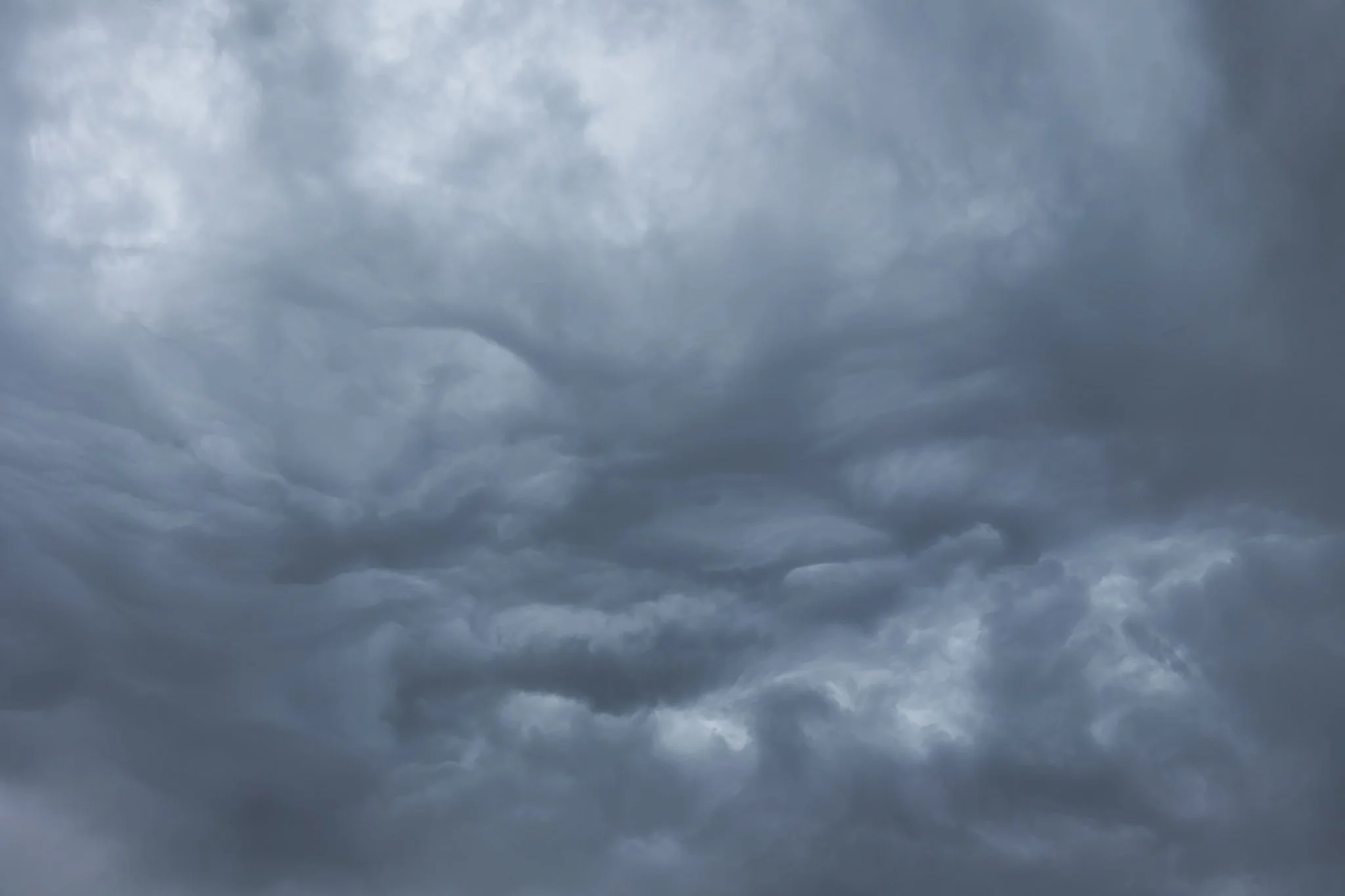
Chicago, and the Midwest in general, are known for having overcast skies half of the year and this day, taking off from Chicago at the tail end of a storm, was no different.
I now always make sure to grab a window seat when flying as I have encountered so many fascinating views flying through the clouds. There is a perspective that is missed on the ground when you are that high up and this beautiful abstraction of grey clouds swirling in strange formations was no exception.
I’m drawn to abstract photography for the reason most are. A lack of form allows the mind to explore itself. One can find meaning from an interior space rather than an exterior one, and it is something I often explore on my travels.
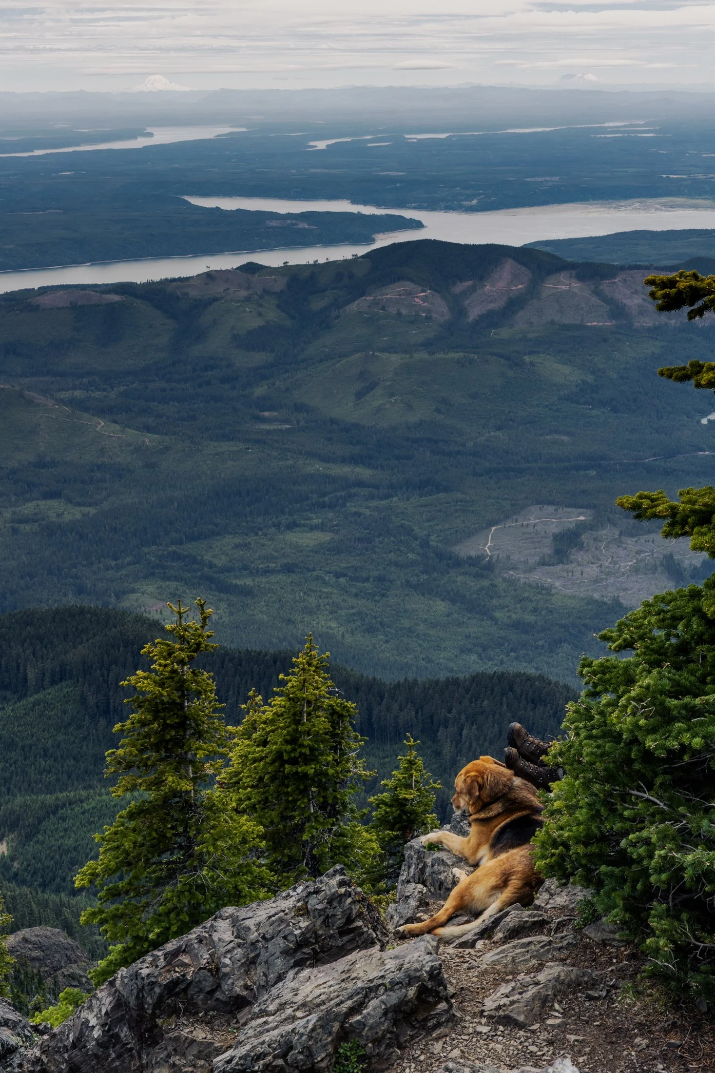
Mount Ellinor is part of the southeastern Olympic Mountains in western Washington state. The mountain is a beautiful one and shows clear signs of past glaciers.
During the ice ages, glaciers carved out the valleys and sharpened the ridges around the area. The views of Lake Cushman become even more amazing when you realize the whole area was shaped by ice and water
This particular photo was taken right after reaching the summit. On the way down I came across curious scene when turning a corner. The boots sticking out next to the owners dog felt like something out of a Dr. Seuss book. This quick snap reminded me dogs hike too.
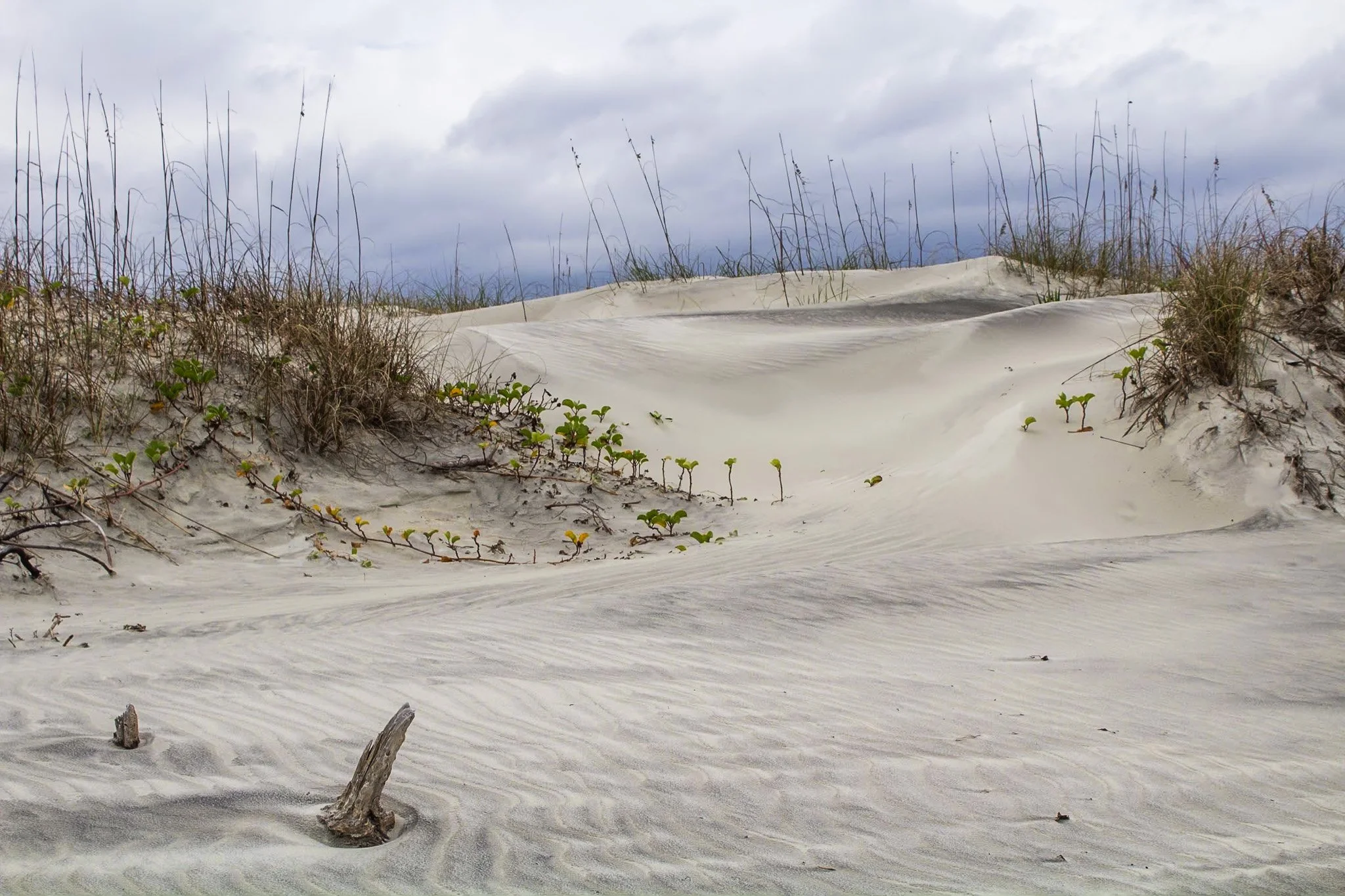
This photo was from my first visit to Cumberland Island National Seashore, located on the border of Georgia and Florida with access via a Ferry from St. Marys, Georgia. I would revisit this same island four years later, affording me the opportunity to finally explore all 18 miles of it.
The beach here is pristine, a stark comparison to the islands directly north and south of it which have been developed for residential and tourist activities. The island has faced various threats to its wilderness status and has been defended through the constant efforts of Carol Ruckdeschel, one of the few persons permitted to live on the island, and who I had the pleasure of meeting randomly on my second visit.
This photo was taken in the early morning on an overcast day following my sunrise shoot, and the feel of this specific patch of sprawling dunes system felt like something out of a painting.
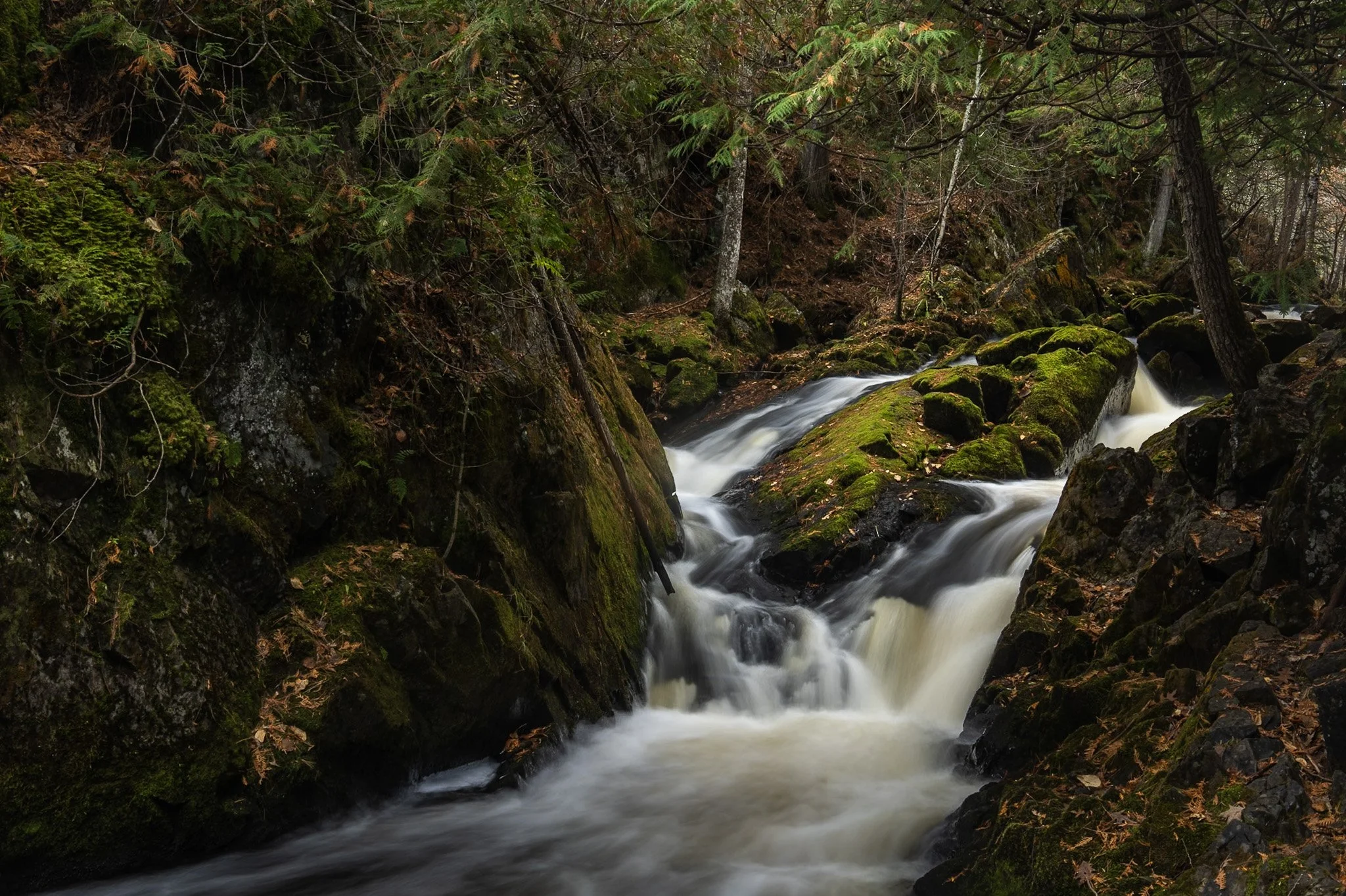
Smalley Falls, located in the Chequamegon National Forest of northern Wisconsin, is known for its serene and scenic beauty. Part of the Brule River, these falls are not as widely known as some of the others in the region, making it a particularly peaceful spot to visit.
The region is primarily composed of ancient Precambrian rock formations, some of the oldest on Earth, dating back about 1.6 to 2.6 billion years. Glacial till, which consists of a mixture of soil, clay, sand, and gravel, can be found in the area, deposited by the retreating glaciers that once covered much of Wisconsin. This sediment supports the lush vegetation and forest ecosystem surrounding Smalley Falls.
This particular composition required some scrambling and, again, careful positioning of my tripod legs on various levels of rocks to allow for the long exposure. This area immediately transported my mind to the lush forests of the Pacific Northwest, a site not often found in the Midwest landscape.
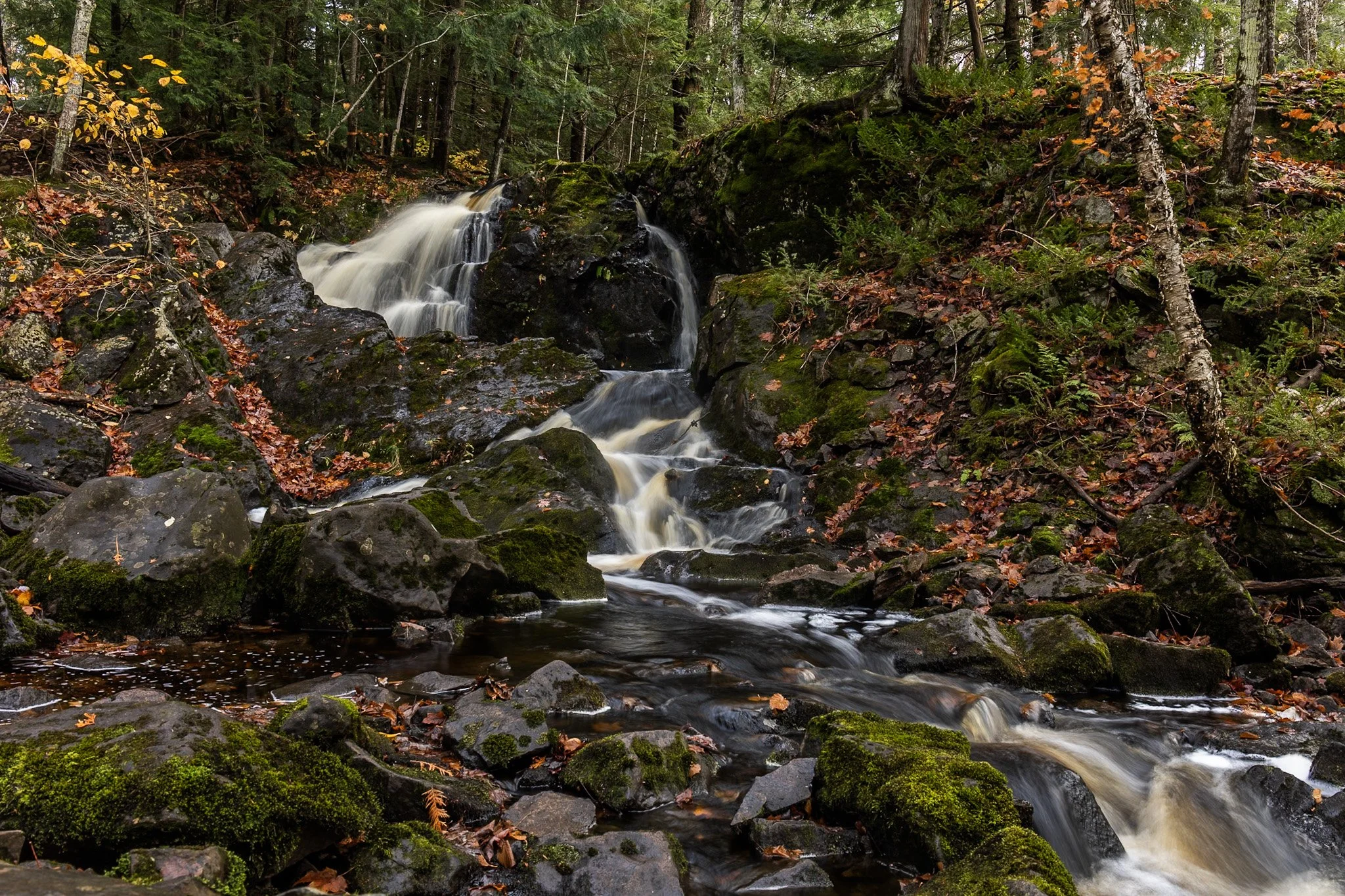
Located near Twin Lakes State Park, Wyandotte Falls finds its source from the Misery River in the Keweenaw Peninsula. The falls consist of a series of short cascades rocky ledges in a quiet, forested setting. The falls create an atmosphere that is reminiscent of a fairy tale forest.
This long exposure required the balancing of my tripod on the river rocks to get the composition that showed its varied pathways. Fall always adds something to a scene like this, and after chasing loud, roaring waterfalls all day, this was a serene end to the day.
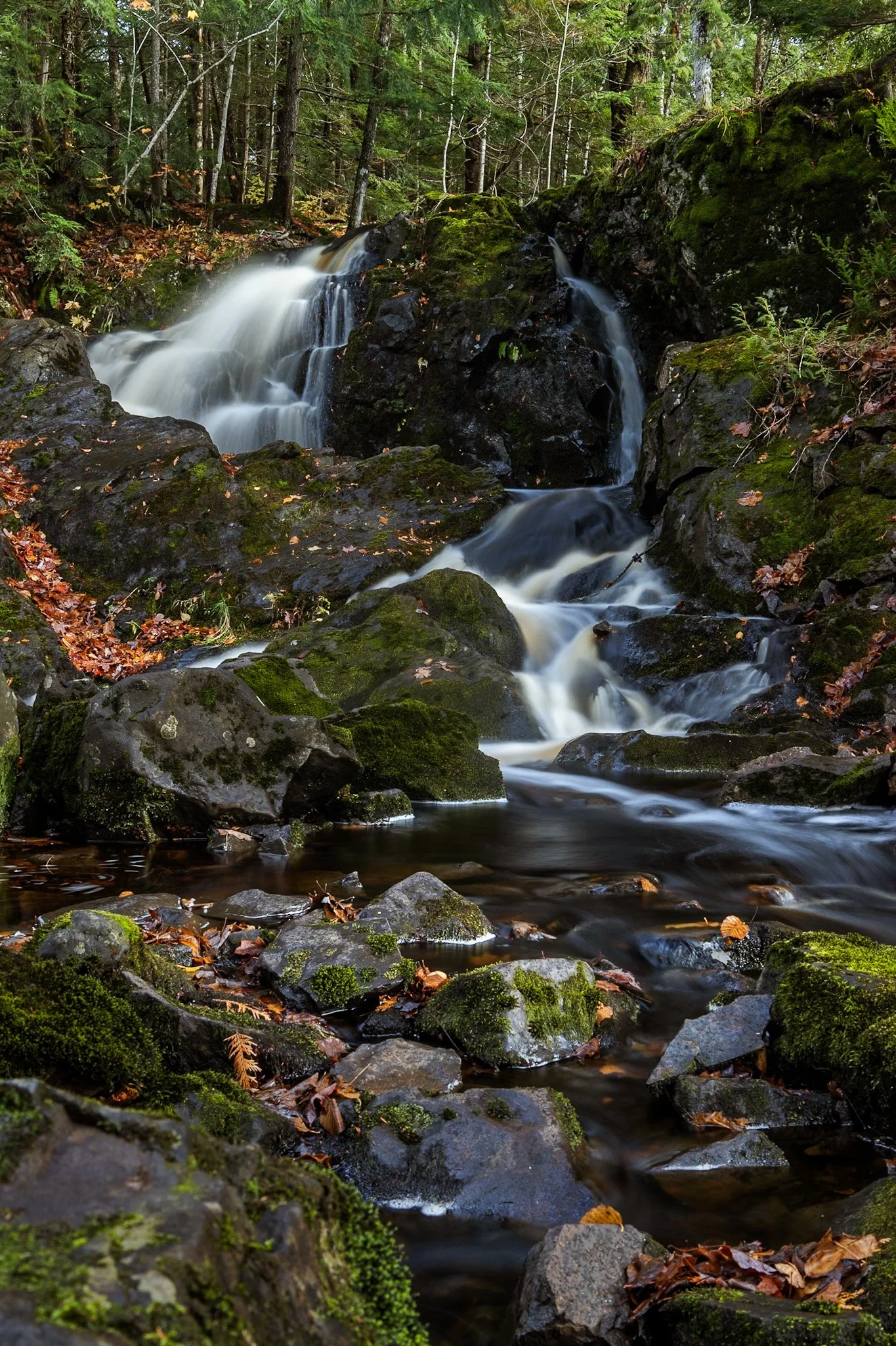
Located near Twin Lakes State Park, Wyandotte Falls finds its source from the Misery River in the Keweenaw Peninsula. The falls consist of a series of short cascades rocky ledges in a quiet, forested setting. The falls create an atmosphere that is reminiscent of a fairy tale forest.
This long exposure required the balancing of my tripod on the river rocks to get the composition that showed its varied pathways. Fall always adds something to a scene like this, and after chasing loud, roaring waterfalls all day, this was a serene end to the day.
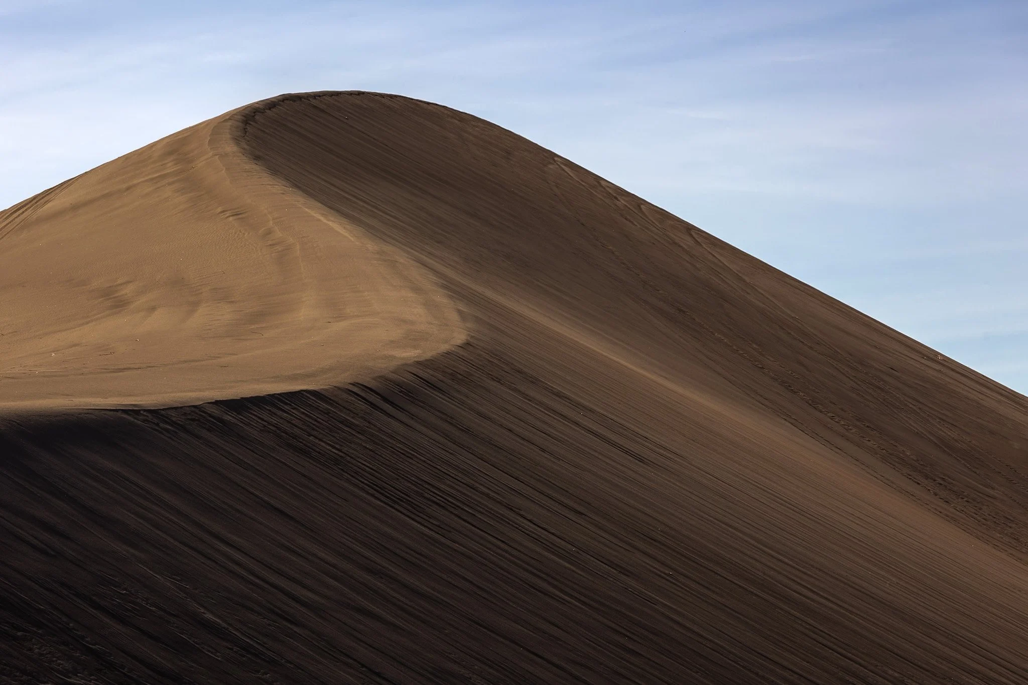
The dunes in and around Death Valley are primarily shaped by wind, which picks up and transports sand particles across the valley floor. Sediment from surrounding mountains supplies the sand forming these natural features.
The wind's constant movement reshape the dunes, causing them to shift across the valley, often forming barchan dunes which hold crescent shapes, such as the one seen here.
I found this specific dune formation completely deserted (excuse the pun) in the early morning. Walking to the base of it, it was tough not to be struck by the gigantic sense of time, space, and form the area offers up. This telephoto capture isolated its gentle untouched waves towering on the horizon from miles away.

The lone white pine on Chapel Rock, located in Pictured Rocks National Lakeshore, is estimated to be about 250 years old. There once was an archway connecting the rock to the mainland but it collapsed in the 1940s.
Chapel Beach and the mouth of Chapel River is adjacent to Chapel Rock, and is popular backcountry campground and hiking destination, offering a secluded beach as well as access to many waterfalls.
After a long day of backpacking, I set up camp and filtered water from Lake Superior while setting up this shot. The mouth of the Chapel River is pictured here, showing the diversity of this picturesque environment that has been a source of wonder for centuries.

These naturally occurring abstract patterns, created by the interplay of wind, water, and sediment, decorate the beaches of Manistee, Michigan. The fine-grained sand reminds one of marble, with its dramatic and delicate textures. They’re a quiet, fleeting reminder of nature’s handiwork.
This was my second visit to the Manistee Lighthouse, with both events being particularly cold days. This day just happened to be my birthday. Finding the right frame for these abstractions can take a bit, and on a cold day like this, it is a race against frostbite. This frame, out of all the ones I took, felt like the best representation of the abstract art in the natural world.

Art on the MART is a large-scale public art installation in Chicago that transforms the façade of the Merchandise Mart building into a digital canvas. Launched in 2018, it features nightly projections of contemporary art across 2.5 acres of the building’s river-facing side, making it the largest digital art projection in the world.
The installation showcases work from local, national, and international artists, often in collaboration with cultural institutions like the Art Institute of Chicago and the Chicago Symphony Orchestra. The projections are free and open to the public, and they typically run from spring through fall.
This offered me a secluded area to shoot, away from the hustle and bustle of the main viewing platform along the river, and provided the perfect vantage point to show off all that makes Chicago great, especially its world class architecture.

Starved Rock State Park in LaSalle County, Illinois transforms into a stunning winter landscape, with its waterfalls freezing into towering columns of ice. These frozen waterfalls are a major seasonal attraction, drawing hikers, photographers, and ice climbers to the park’s deep sandstone canyons.
Formed by melting snow and natural springs, the waterfalls normally flow through narrow cliff faces, but in winter, they become massive ice formations, sometimes reaching over 80 feet tall. The contrast between the icy formations and the ancient, rust-colored rock walls creates a dramatic and otherworldly scene.
This photo required some careful maneuvering to get to the right position as well as making sure my tripod stayed stable on the ice. This dead leaf stood out among a sea of white and grey and allowed me to capture a long exposure yet the leaf remained still. Taken earlier in my career, I had not come to appreciate the magic of crampons when navigating slick ice.

Carl G. Washburne Memorial State Park may be the one of the most scenic stretches of the entire Oregon Coast. Located about 15 miles north of Florence, and only a few miles past Heceta Head Lighthouse (a trail connects the two parks), the surrounding area offers a portal to another world.
The China Creek Trail weaves through coastal forests terminating on the beach, and the picturesque Hobbit Trail, known for its moss-draped trees and old-growth forest, make the hiking here magical.
This photograph was taken moments after sundown, following a chaotic two hours of trying to photography too many areas at once. I used the last remaining daylight to grab this abstract before retiring to my campsite across the main road. The park is a quiet place, unassuming, and it is here that shows Oregon’s true beauty.
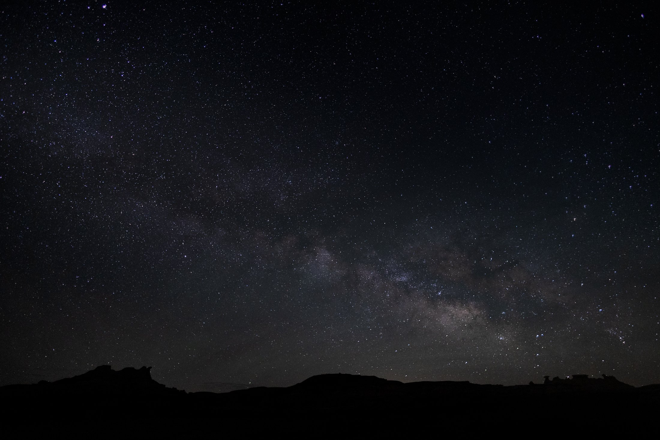
The Bisti Badlands are a remote and alien world in northwest New Mexico situated in the Bisti/De-Na-Zin Wilderness, an area protected by the Bureau of Land Management.
The name comes from the Dinë (Navajo) word “Bistahi” translating roughly to “among the adobe formations”. The wind-formed hoodoos in this region are numerous leading to bizarre formations, varied colors, and precariously balanced rocks. The area doubles as a designated dark sky territory providing an unpolluted night sky.
This was my second time visiting this desolate world, and this time I backpacked in at sunset and spent the entire night photographing around camp, using my headlamp to paint the rocks. Finally, late into the night, the Milky Way became visible with the naked eye, and this silhouette of the landscape perfectly framed our beautiful galaxy. It was a stunning sight.
The area around Starved Rock State Park near Utica, Illinois, is one of the most scenic Illinois has to offer. The Illinois River cuts through the area and was one of the few areas in Illinois not flattened by glacial drift.
This beautiful tree on the bank of the Illinois river is a Sycamore, known as the London Plane. Often planted in the Victorian area to help quell the London pollution caused by the Industrial Revolution, this tree has been a stable of urban development. It can incur a disease known as the Witches Broom, causing the shoots to bunch up which also offers a natural nest for nearby birds.
Camping on the edge of the Illinois after a trip to Starved Rock, I set up my tripod to capture the active birds at sunset, but then this Sycamore caught my eye. The composition of the eerie branches against the beautiful purple glow of the setting sun was mad even better by the birds passing through the area.